![]()
1
CHAPTER ONE
GIS overview
This chapter provides an overview of GIS for environmental applications. It introduces the history, the general framework and the functionality of GIS for environmental problem solving and decision making, discusses the roles of GIS in environmental research, management and planning, presents a brief introduction to several popular GIS software packages, and provides a guided tour of ArcGIS – the GIS software used in the examples throughout the book.
LEARNING OBJECTIVES
After studying this chapter, you should be able to:
• distinguish GIS from other types of computerised systems;
• understand the purposes for which GIS may be applicable;
• discuss the roles of GIS in environmental research, management and planning;
• describe the process of environmental problem solving with GIS;
• outline the key features of a range of proprietary and open source GIS software currently available for environmental studies;
• become familiar with the ArcGIS software environment.
1.1 INTRODUCTION TO GIS
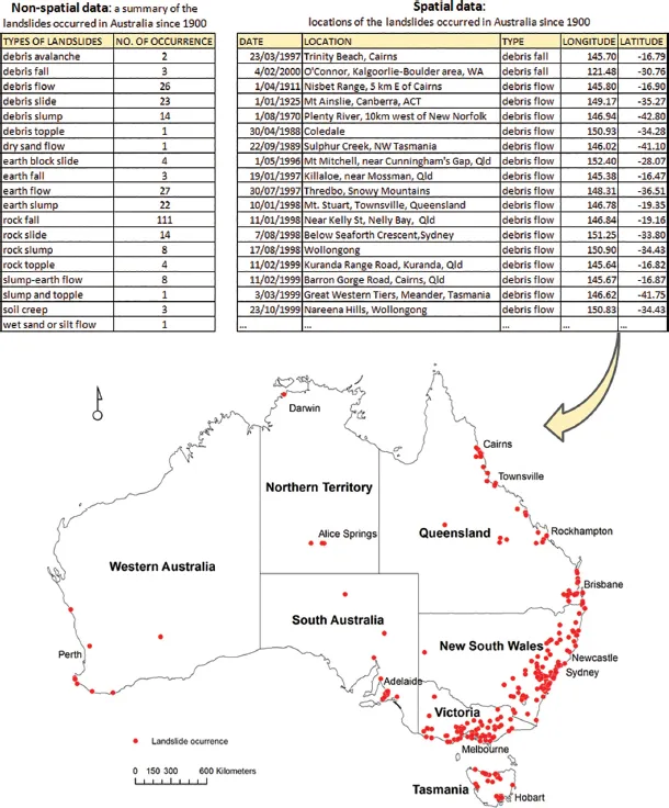
The fundamental goal of environmental research is to understand and solve environmental problems, focusing on how humans use natural resources and how human activities change the environment. For example, an ecologist might like to study the consequences of landscape fragmentation caused by agricultural intensification and habitat loss for wildlife. A wildlife biologist might want to analyse the movement patterns of migratory animals. A geographer might be interested in land use changes and their environmental impacts in a region. A climatologist might want to predict the responses of ecosystems to climate change in order to provide options for sustainable landscape management. A geologist might like to assess landslide susceptibility according to past history, slope steepness, bedrock and other physical factors and identify areas of differing landslide potential. A hydrologist might be interested in modelling hydrological responses to the urbanisation of areas where there are significant groundwater–surface water interactions and in understanding urban hydrology and contaminant flow pathways, which will inform water-sensitive urban design. All disciplines of environmental science work with data which are largely spatial in nature – data related to places on the Earth’s surface. Such data are called spatial data. They describe where things are or where they were or will be on the surface of the Earth. Box 1.1 shows a typical example of species distribution modelling relying on the use of spatial data. GIS provides a technology and suite of tools for collecting, organising, searching, analysing and visualising spatial data.
What is GIS?
The acronym GIS stands for geographical information system(s). Different from other types of computerised systems such as spreadsheets, word processors and database management systems, GIS processes and manages spatial data. While word processors and spreadsheets are computer tools for dealing with text and numbers respectively, GIS handles maps, images and other types of spatial data with specific references to locations on the Earth’s surface.
Box 1.1 Modelling the distribution of Sambar deer (Cervus unicolor) in Victoria, Australia
CASE STUDY
Species distribution modelling aims to understand where a species occurs or likely occurs, how the occurrence of a species is related to the environment, and how a species might respond to changes in its environment. It is based on the assumption that each species has its own environmental niche – living in areas within a range of environmental factors such as temperature, rainfall and vegetation type. Environmental scientists from the Arthur Rylah Institute (ARI) for Environmental Research in Melbourne combined field surveys with biophysical data to estimate the current and potential distributions of Sambar deer (Cervus unicolor) in Victoria. Sambar deer were introduced to Victoria in the nineteenth century from Sri Lanka, India and the Philippines. They have subsequently expanded their geographical range in southeastern Australia, and their continued expansion could have negative impacts on native biodiversity and water quality. Understanding the current and potential distributions of Sambar deer will allow wildlife managers to concentrate their management efforts more effectively.
The research team from ARI used faecal pellet counts to index Sambar deer abundances. They first collected the data on the presence of Sambar deer by counting the number of Sambar deer faecal pellets along 100 randomly located transects (150m long) in the field. The presence data are essentially a sample of locations with known presence of Sambar deer, which describe the total number of intact pellets counted on each transect (called the faecal-pellet index, or FPI) and the bearing and geographical locations of the transects. Then biophysical variables around each transect were estimated, including elevation, aspect, slope, proximity to water, vegetation type, solar radiation and proximity to roads. All these variables vary from transect to transect – in other words, they are location-specific. Based on the presence and biophysical data, several hypotheses about how the biophysical variables might affect the abundance of Sambar deer were formulated. Models were built to test the hypotheses, and finally the best model was selected to predict the spatial variations in Sambar deer abundance. The result was a habitat suitability model and a map of predicted Sambar deer abundance measured in FPI. This spatially explicit habitat model can help identify locations where Sambar deer might be found and predict how their geographical range might be expanded due to environmental change or other causes.
In this case study, the presence data for Sambar deer, the biophysical data and the predicted Sambar deer abundance data are all spatial data. These spatial data can be handled effectively in GIS. The ‘where’ and ‘what’ questions addressed in species distribution modelling – such as where a species occurs or likely occurs, where occupied or unoccupied habitats of a species are and what biophysical factors are associated with the occurrence of a species – are typical questions that a GIS is designed to help answer.
Source: Forsyth et al. (2007).
Generally speaking, spatial data describe a set of observations and measures of their attributes or properties in geographical space at a particular time or in a certain time period. A geographical space is a space in which the observations correspond to locations on the Earth’s surface defined with a spatial measurement framework that captures their spatial relationships (such as proximity, connectivity and direction) in the real world. Here a spatial measurement framework is a coordinate system which defines spherical or planimetric coordinates, height, orientation and other space measurement properties in ways that take the Earth’s complex shape into account. Observations in geographical space are made on spatially distributed features such as plants, wildlife animals, streams and rivers, which are also often referred to as geographical features, spatial objects or spatial entities (Gatrell 1991; Longley et al. 2011). They are defined as a set of locations in a geographical space together with a set of attributes characterising those locations. For example, a sighting of Sambar deer is an observation, which may be defined with a pair of latitude and longitude (spherical coordinates in the geographical coordinate system, discussed in Chapter 2) and a number of attributes attached to the location, including its election, aspect, slope, vegetation type and solar radiation. A map is a traditional means of representing a geographical space. Therefore, spatial data can be linked to a map or represented in map form (Figure 1.1). Spatial data are also called geographically referenced data, georeferenced data or geospatial data.
The concepts of the modern GIS were first articulated in the late 1970s. Dueker (1979) defined GIS as:
a special case of information systems where the database consists of observations on spatially distributed features, activities or events, which are definable in space as points, lines, or areas. A geographic information system manipulates data about these points, lines, and areas to retrieve data for ad hoc queries and analyses.
In the 1980s and 1990s, many new GIS definitions emerged. For example, Marble et al. (1984) defined GIS as ‘a set of tools for the input, storage and retrieval, manipulation and analysis, and output of spatial data’. Cowen (1988) contended that the ultimate goal of GIS is to support decision making processes, and therefore defined GIS ‘as a decision support system involving the integration of spatially referenced data in a problem solving environment’. Chrisman (1999) argued that GIS is not purely a technology, but a set of activities carried out by people within human organisations. He defined GIS as ‘organized activity by which people measure and represent geographic phenomena then transform these representations into other forms while interacting with social structures’.
GIS draws on concepts and ideas from many disciplines, including cartography, geography, computer science, surveying, photogrammetry, remote sensing and statistics, to name but a few. They gradually converged to form a new field of scientific study called geographical information science (GIScience). Goodchild (1992) defined GIScience as ‘the generic issues that surround the use of GIS technology, impede its successful implementation, or emerge from an understanding of its potential capabilities’. Therefore, it involves the scientific study of the fundamental issues arising from the creation, processing, management and use of spatial data and information, as well as the impacts of GIS on society and the influence of society on GIS. GIScience is the science behind GIS technology, not intended to replace GIS in terminology and in practice.
It should be noted that GIS is content-free expression. It means different things to different people. There is no universally accepted definition of GIS. To environmental researchers and practitioners, GIS is a computerised tool that assists them in managing, integrating, presenting and distributing environmental data and information; building, analysing and utilising environmental models; and facilitating and improving environmental problem solving and decision making processes. Hence, a working definition of GIS is provided in this book, which characterises GIS as a toolkit in terms of its capabilities:
A GIS is a computerised system for capturing, managing, manipulating, integrating, analysing, visualising and disseminating spatial data.
The chapters of this book are structured around this order of capabilities.
Components of GIS
A general view is that a GIS is primarily comprised of hardware, software, data, people and procedures (or methods) (Dueker and Kjerne 1989; Longley et al. 2011). Hardware is the device on which a GIS operates or is operated. Today, GIS runs on a wide range of devices, from centralised computer servers to desktop computers, laptops, tablets, in-vehicle devices and mobile phones. Software is a set of computer programs, algorithms and related data that drive GIS operations. Every GIS operation involves data. A GIS operation may take a map (a dataset) as an input and produce a new map (a new dataset) as an output. Data are prepared and entered into a GIS for specific problem solving or research purposes. People are users of GIS. They may be system developers who design and develop the GIS system, or system administrators who manage and maintain the system, or end users who use it as a tool to perform spatial analysis and interpret results. When a GIS is operated in an organisational context, procedures (including institutional arrangements, implementation pla...