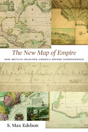
After the Treaty of Paris ended the Seven Years' War in 1763, British America stretched from Hudson Bay to the Florida Keys, from the Atlantic coast to the Mississippi River, and across new islands in the West Indies. To better rule these vast dominions, Britain set out to map its new territories with unprecedented rigor and precision. Max Edelson's The New Map of Empire pictures the contested geography of the British Atlantic world and offers new explanations of the causes and consequences of Britain's imperial ambitions in the generation before the American Revolution.
Under orders from King George III to reform the colonies, the Board of Trade dispatched surveyors to map far-flung frontiers, chart coastlines in the Gulf of St. Lawrence, sound Florida's rivers, parcel tropical islands into plantation tracts, and mark boundaries with indigenous nations across the continental interior. Scaled to military standards of resolution, the maps they produced sought to capture the essential attributes of colonial spaces—their natural capacities for agriculture, navigation, and commerce—and give British officials the knowledge they needed to take command over colonization from across the Atlantic.
Britain's vision of imperial control threatened to displace colonists as meaningful agents of empire and diminished what they viewed as their greatest historical accomplishment: settling the New World. As London's mapmakers published these images of order in breathtaking American atlases, Continental and British forces were already engaged in a violent contest over who would control the real spaces they represented.
Accompanying Edelson's innovative spatial history of British America are online visualizations of more than 250 original maps, plans, and charts.
- English
- ePUB (mobile friendly)
- Available on iOS & Android
eBook - ePub
About this book
Trusted by 375,005 students
Access to over 1 million titles for a fair monthly price.
Study more efficiently using our study tools.
Information

[ONE]
A Vision for American Empire
On June 8, 1763, the Lords Commissioners of Trade and Plantations drafted a bold new vision for western empire, illustrated it with a hand-colored map, and sent it to the king. The Board of Trade’s “Report on Acquisitions in America”—a master plan for colonial British America after the Seven Years’ War—imagined taking command of newly acquired lands, imposing limits on long-settled colonies, and forging far-flung territories into a tightly integrated commercial economy. As the commissioners annotated their copy of Emanuel Bowen’s An Accurate Map of North America (1763), they made visible an Atlantic system by which Britain’s diverse collection of New World settlements could work together for the benefit of the mother country. Above all, they sought to strengthen bonds of colonial dependence based on new characterizations of the environments, populations, and possibilities of American places. The “Report on Acquisitions in America” critiqued the history of colonization before 1763 and proposed an alternative for the future, in which carefully managed trade and centralized control of land could harmonize a cacophony of provincial interests. In this momentous year, the Board described a zone of settlement arrayed across the “Whole Coast” of North America and the islands of the Caribbean Sea.
In addition to imposing firm borders on the colonies, the commissioners narrated a reckless history of American expansion over the better part of two centuries, which featured heedless acquisition, fraud, and self-dealing at the expense of the nation’s security and prosperity. By dictating how the new territories would be settled, developed, and defended, the Board imagined channeling the expansive energies of migrating settlers to occupy the Florida colonies, the Gulf of St. Lawrence, and the southern islands of the Caribbees. Dedicated reformers affiliated with the Board of Trade attempted to reinvent colonization by establishing a regulated method for planting people on these new frontiers. Their aim was to reconstitute colonial British America from its contested edges inward, for which they sought unmediated views of American lands. They initiated the General Survey of North America and charged the Indian superintendents, the Commission for the Sale of Lands in the Ceded Islands, the Admiralty, and the army to contribute to a vast cartographic effort to represent these places comprehensively. To produce a record of place necessary to command the settlement and development of colonies from a distance, British reformers made mapmaking an imperial priority.
Representing American Spaces, 1660–1762
From its formal establishment in 1696 until its dissolution in 1782, the Board of Trade kept watch over the world with which England had entangled its interests through commerce and colonization. It remained a prescriptive body, charged to find facts and give advice, but by the early eighteenth century it did so with a wider purview, sharper analytical tools, and an expanded portfolio of places and trades to oversee. In 1622, the English state appointed the first of several councils, committees, and commissions to examine its American colonies. From 1660, however, precursors to the Board began a sustained quest to understand and critique American places. From the beginning, members of the Board of Trade fought a rearguard battle against the decentralized process of overseas settlement as they attempted to bring chartered colonies under the direct supervision of the Crown. Over decades, they articulated a consistent perspective on the problems of American colonization, one that pointed to a solution: a general plan for the administration of all the colonies, which hinged on direct control over the granting of American land. Only by holding each of these distinctive places to a common standard could Britain bring the riot of jurisdictions and provincial interests that had taken root since 1607 into an overarching system under its scrutiny.1
The Board of Trade’s history as a self-conscious body charged to bring order to the chaos of colonization began on July 4, 1660, when Charles II appointed a new Committee for Trade and Plantations, empowered to examine matters “concerning the plantations, as well in the Continent as Islands of America.” Staffed with a number of “understanding able persons,” including merchants, ship captains, and colonists, this early incarnation of the Board put a premium on direct experience with America, which these “knowing active men” had acquired firsthand. The idea of taking the “Severall Pieces” of England’s scattered dominions in America and drawing them together into a more “certain, civill, and uniform waie of Government” was part of its formal instructions, as was the idea of establishing a “continuall correspondencie” about the resources, commerce, wants, and governments of each colony, so that “all of them” could be “collected into one viewe.”2
From the beginning, this Committee for Trade and Plantations gathered information about America and synthesized it into new general representations on which policies for regulation could be based. New instructions issued in 1672 to a reconstituted Council for Foreign Plantations urged it to discover the colonies’ boundaries, climates, lands, and jurisdictions so that they might be reshaped to better serve the kingdom’s economic interests. Such a study would allow the Council’s members to examine the methods of cultivation that settlers had devised to adapt agriculture and husbandry to their distinctive environments and suggest more profitable commodities so that “Custome be not nourished to the pr[e]judice of Trade.” The Crown charged the Council in the late seventeenth century to reveal England’s American colonies as they were, estimate the value of what they could become, and bridge the distance between the two by devising new schemes of development and regulation. To record and transmit this information, it generated texts that made use of the languages of political economy and natural history; summarized the flow of manufactures, commodities, vessels, and revenue across the Atlantic with statistics; and collected maps to create authoritative, comprehensive, and densely inscribed representations of American places. “[By] all Way[s] and means,” ordered the king in 1672, the Council was to “procure exact Mapps, Platts or Charts of all and Every of our said Plantations abroad.” In particular, it was to obtain detailed “Mapps and Descriptions of their respective Ports, Harbours, Forts, Bayes, Rivers with the Depth of their respective Channells coming in or going up, and the Soundings all a long upon the said respective Coasts from place to place,” opening the riversides and coastlines around which colonial settlements clustered to maritime commerce. Moreover, it was “carefully to Register and Keepe” these maps, establishing an official cartographic archive of empire.3
The Council undertook to promote the “well governing of [the king’s] Forraine Plantations” in 1671, when it met at the Earl of Bristol’s London house in a “large room furnished with atlases, mapps, charts, [and] globes.” In 1675, the secretary of the reformed Committee of the Lords of Trade and Plantations, Robert Southwell, worked to gather together the Council’s scattered papers and assemble a permanent library of charters, maps, books, and documents, even questioning his predecessor, John Locke (who averred that “for globes and maps he never had any”), about lost materials that may have passed into private hands. In the early 1680s, Southwell’s successor, William Blathwayt, compiled fifty-four maps and charts in a leather-bound guard book fitted with paper stubs so that he could glue images in place as he acquired them. These were far from the only maps that England’s seventeenth-century colonial officials used to view America from London. Indeed, the Committee owned several published atlases and wall maps (including John Seller’s “large Chart in 16 sheets of the Maritime Coast of America”) and outfitted its offices in Scotland Yard with a number of large cabinets for “papers, books, and Maps,” suggesting a much larger collection of cartographic materials. However, because each image pasted into the guard book had to be individually selected, the forty-eight surviving sheets of Blathwayt’s atlas reveal which places the Committee deemed most worthy of inclusion as it pursued the king’s command to assemble a map archive.4
The paper label affixed to this volume’s spine reads: “Islands / Plantation / Mapps.” The atlas’s contents bore out this title’s suggestion that English America should be understood, first and foremost, as a collection of islands. An early chart of “Terra Nova,” or Newfoundland, showed the cod fishery’s stations inked in vivid color on vellum; Abraham Peyrounin’s Carte de lisle de Sainct Christophle traced the boundaries by which England and France divided the rising sugar island of St. Christopher (or St. Kitts, as it was commonly called) and sited the forts they had built to defend their portions of its fertile tropical acres; and an English copy of a Dutch sea chart of the “Caribe Islands,” or Lesser Antilles—colored to show the nations that claimed them—was intersected with rhumb lines to aid navigation into the Caribbean Sea. [1–3] Images of Bermuda, Tobago, Martinique, Long Island, Barbados, Guadeloupe, and Montserrat appeared in its sheets, along with four different maps of Jamaica, the most represented place in the atlas. As the sugar trade transformed England’s economy after mid-century, the Crown struggled to defend its vulnerable and valuable West Indian islands, exposed to the predation of imperial rivals.5
Islands were not only the most profitable, and thus the most interesting, part of these overseas dominions; they also offered an apt geographic metaphor for English America as a whole. Seventeenth-century colonies were outposts of settlement, perched on seacoasts and connected by water routes. The early mainland colonies thus “functioned, in their relationship to one another and to the Atlantic world at large, much like islands.” Following two world maps that opened the volume, Blathwayt pasted in Morden and Berry’s A New Map of the English Plantations in America, both Continent and Islands [1673], one of the first published maps to offer a comprehensive view of English America. [4] It pictured a space for settlement and seafaring, bisected by the Tropic of Cancer and evenly weighted between North America and the West Indies. The individual images of English colonies that follow focus, in roughly equal numbers, on continental as well as island colonies. Those steeped in geographic learning at the English universities would have recognized Blathwayt’s island-heavy volume as a later-day isolario—an illustrated encyclopedia of “maritime cosmography,” which was a hallmark of Renaissance publishing. It likewise fractured the world into numerous articulated pieces, presenting an array of exotic places, one after another, but forming no unified picture of a larger empire.6
“Plantation,” the second term in the volume’s title, introduced the atlas as a visual record of English colonization. A handful of images acknowledged the presence of Spanish, French, and Dutch colonies within the geographic frame Morden and Berry created to display “the English Plantations in America” (as well as a few—of Brazil, Paraguay, the Straits of Magellan, Africa, and Mumbai Harbour—that fell beyond it). For the most part, however, Blathwayt brought together images of places in which English colonists and their enslaved, indentured, and free dependents had improved wild wastes and established the rudiments of English society abroad. These maps presented high-resolution images of colonial territories, opening to inspection how settlers had taken up land within them. Francis Lamb’s Jamaicae Descriptio located the “most Eminent Settlements” that clustered in the island’s southern parishes, siting each noteworthy plantation and numbering it to correspond with a named proprietor. [5] Richard Ford’s A New Map of the Island of Barbadoes depicted every “Parish, Plantation, Watermill, Windmill, & Cattlemill” that vouched for this well-settled island’s capacity to grow and grind sugarcane. [6] Roanoke Island had once occupied the center of English colonizing activity, but on James Lancaster’s 1679 chart of Albemarle Sound, the island languished at the margin, apparently uninhabited. [7] To the west stretched a coastal landscape of river inlets interspersed with twenty-two house icons: red-roofed, two-story structures, each with a chimney that showed these remote settlements to be hearth-bearing English homes. As shown in Thomas Clarke’s map, Bermuda’s distinctive strips of land gave each tenant a cross-section of vital resources, from the ocean shore to scarce interior forests. [8] New England’s centrifugal town system had pushed outward to establish some five-dozen communities scattered across coastlines and riversides on an untitled manuscript map from 1678. [9] A dizzying bird’s-eye view of Montserrat sketched in 1673 offered chorographic profiles of its settled plains wrapped around its coastline. [10] An imagined grid of property lines showed how English colonists had taken up grants of arable coastal land for their slaves to clear. Stocked with these and many other images of improvements made by enterprising settlers, Blathwayt’s atlas was a pictorial record of English colonization in America.7
When they leafed through its pages to locate the places mentioned in incoming colonial letters, the Lords of Trade saw images of overseas territories produced at an assortment of scales and in a multitude of contrasting colors and styles. Hand-inked manuscripts followed printed copies produced by copperplate presses in London, Paris, and Amsterdam. The book itself—an album displaying images made by several mapmakers at different times and for different purposes—revealed how dependent official English geographic knowledge was on the output of more sophisticated cartographic cultures in Holland and France. Like those influential early compilers of travel narratives, Richard Hakluyt and Samuel Purchas, William Blathwayt knew the merchant adventurers that the Committee interviewed to obtain firsthand accounts of Atlantic trade, and it was through their hands that his atlas acquired some of its unique manuscript images. Spain’s Casa de Contratación oversaw official chart making from its establishment in 1503, and France’s Dépôt des cartes et plans de la Marine organized the navy’s hydrographic efforts to form a comprehensive surveying agency from 1720. Before Britain’s Admiralty established its own hydrographic service in 1795, the Board of Trade took the lead in compiling maps for the use of the government, generating new surveys, and working with commercial mapmakers to engrave and print new maps.
In 1696, William III reestablished this agency “for promoting the trade of our kingdom and for inspecting and improving our plantations in America and elsewhere” as the Lords Commissioners of Trade and Plantations. This new Board of Trade took its place within a rising administrative culture—exemplified by the office of the Inspector-General of Imports and Exports, also established in 1696—which valued systematic rigor in the gathering of information to characterize England’s subjects, territories, commerce, and wealth. At the turn of the eighteenth century, the Board joined other key government offices (including the Admiralty, Treasury, and Secretaries of State) in compiling increasingly large volumes of “useful knowledge” that administrators deemed indispensable to the task of identifying the kingdom’s interests and governing with them in mind. The Board’s charge to “inspect,” “examine,” “inquire,” and “take account of” English America meant setting up a new plantation office in Whitehall as a repository of information for the imperial state. With a new appreciation that the “strength and riches” of England in a “great measure depend[ed]” on its overseas trade, the king specifically empowered the Board to bring to light flaws in colonial agriculture, manufacturing, and legislation, and to envision schemes to improve colonial economy and administration. In particular, the commissioners were to investigate the natural capacities of the colonies, down to the level of how the “Limits of the Soyl” indicated the commodities that each should produce.8
The Board’s clerks rescued its archive of papers, books, and maps from the Whitehall Palace fire of 1698, which destroyed its quarters, and moved this growing archive into a series of cramped offices within England’s sprawling governmental center along the Thames. In 1746, the Board and its papers found a more permanent home in the new Treasury Building. Architect William Kent designed this neo-Palladian structure, completed in 1736, to instill Roman virtue at the center of Prime Minister Robert Walpole’s parliamentary state. Its purist conception of classical forms expressed the Board’s raison d’être: to promote the common good of the British nation as a whole over the narrow interests of the particular, private, and provincial. Its clean lines and absolute symmetry proclaimed the “virtue of the state” and projected British “cultural competence,” compared with the decadent palaces that housed the governments of European rivals.9
Within its chambers, four rooms (or sets of rooms) each played a role in managing the flow of information from the wider Atlantic world. In one, as many as a dozen clerks copied incoming correspondence, drafted letters, and annotated and archived the voluminous paper record of the overseas empire. Before leaving for the day, each clerk turned over his papers to the secretary, who kept the sensitive commercial and political intelligence they contained under lock and key. In the secretary’s room, the chief plantation administrator opened letters, transmitted accounts, scheduled the commissioners’ deliberations, drafted correspondence with colonial governors, and compiled reports. Although he was an...
Table of contents
- Cover
- Title Page
- Copyright
- Dedication
- Contents
- List of Maps
- A Note on the Maps
- Introduction
- 1. A Vision for American Empire
- 2. Commanding Space after the Seven Years’ War
- 3. Securing the Maritime Northeast
- 4. Marking the Indian Boundary
- 5. Charting Contested Caribbean Space
- 6. Defining East Florida
- 7. Atlases of Empire
- Conclusion
- Abbreviations
- Notes
- Map Bibliography
- Acknowledgments
- Index
Frequently asked questions
Yes, you can cancel anytime from the Subscription tab in your account settings on the Perlego website. Your subscription will stay active until the end of your current billing period. Learn how to cancel your subscription
No, books cannot be downloaded as external files, such as PDFs, for use outside of Perlego. However, you can download books within the Perlego app for offline reading on mobile or tablet. Learn how to download books offline
Perlego offers two plans: Essential and Complete
- Essential is ideal for learners and professionals who enjoy exploring a wide range of subjects. Access the Essential Library with 800,000+ trusted titles and best-sellers across business, personal growth, and the humanities. Includes unlimited reading time and Standard Read Aloud voice.
- Complete: Perfect for advanced learners and researchers needing full, unrestricted access. Unlock 1.4M+ books across hundreds of subjects, including academic and specialized titles. The Complete Plan also includes advanced features like Premium Read Aloud and Research Assistant.
We are an online textbook subscription service, where you can get access to an entire online library for less than the price of a single book per month. With over 1 million books across 990+ topics, we’ve got you covered! Learn about our mission
Look out for the read-aloud symbol on your next book to see if you can listen to it. The read-aloud tool reads text aloud for you, highlighting the text as it is being read. You can pause it, speed it up and slow it down. Learn more about Read Aloud
Yes! You can use the Perlego app on both iOS and Android devices to read anytime, anywhere — even offline. Perfect for commutes or when you’re on the go.
Please note we cannot support devices running on iOS 13 and Android 7 or earlier. Learn more about using the app
Please note we cannot support devices running on iOS 13 and Android 7 or earlier. Learn more about using the app
Yes, you can access The New Map of Empire by S. Max Edelson in PDF and/or ePUB format, as well as other popular books in History & British History. We have over one million books available in our catalogue for you to explore.