In 1817 a group of East Yorkshire gentry opened barrows in a large Iron Age cemetery on the Yorkshire Wolds at Arras, near Market Weighton, including a remarkable burial accompanied by a chariot with two horses, which became known as the King's Barrow. This was the third season of excavation undertaken there, producing spectacular finds including a further chariot burial and the so-called Queen's barrow, which contained a gold ring, many glass beads and other items. These and later discoveries would lead to the naming of the Arras Culture, and the suggestion of connections with the near European continent. Since then further remarkable finds have been made in the East Yorkshire region, including 23 chariot burials, most recently at Pocklington in 2017 and 2018, where both graves contained horses, and were featured on BBC 4's Digging for Britain series. This volume bring together papers presented by leading experts at the Royal Archaeological Institute Annual Conference, held at the Yorkshire Museum, York, in November 2017, to celebrate the bicentenary of the Arras discoveries. The remarkable Iron Age archaeology of eastern Yorkshire is set into wider context by views from Scotland, the south of England and Iron Age Western Europe. The book covers a wide variety of topics including migration, settlement and landscape, burials, experimental chariot building, finds of various kinds and reports on the major sites such as Wetwang/Garton Slack and Pocklington.
eBook - ePub
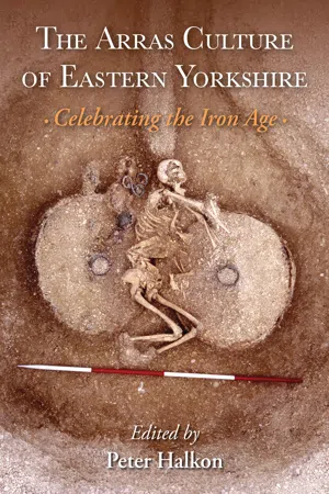
The Arras Culture of Eastern Yorkshire – Celebrating the Iron Age
Proceedings of "Arras 200 – celebrating the Iron Age." Royal Archaeological Institute Annual Conference, held at the Yorkshire Museum, York, November 2017, supported by the University of Hull, the Yorkshire Historical and Archaeological Society and East R
- 192 pages
- English
- ePUB (mobile friendly)
- Available on iOS & Android
eBook - ePub
The Arras Culture of Eastern Yorkshire – Celebrating the Iron Age
Proceedings of "Arras 200 – celebrating the Iron Age." Royal Archaeological Institute Annual Conference, held at the Yorkshire Museum, York, November 2017, supported by the University of Hull, the Yorkshire Historical and Archaeological Society and East R
About this book
Trusted by 375,005 students
Access to over 1.5 million titles for a fair monthly price.
Study more efficiently using our study tools.
Information
Topic
Scienze socialiSubtopic
Storia europea1
Setting the scene – landscape and settlement in Iron Age eastern Yorkshire
Peter Halkon
Introduction – The Iron Age cemetery at Arras
I saw in my journey to York many hundreds of tumuli, which I take to be Roman, at a place called Arras, on this side Wighton, not mentioned in any author, which I intend next summer to digg into and take a whole account and descriptions thereof and of all other Roman stations monuments, streets, places of battle, coins, or whatever is observable whereever I come.
January 1699 a letter to Dr Gale Dean of York by
Abraham De la Pryme (Jackson 1869, 200).
Abraham De la Pryme (Jackson 1869, 200).
There is no record that De la Pryme, curate of Holy Trinity Church, Hull, and antiquarian, actually carried out his intention to excavate the Arras burial mounds. His observation, however, shows that the barrows were upstanding at the end of the 17th century and had presumably escaped the ploughs of the now deserted medieval villages of Arras and Hessleskew. The first account of excavations at Arras is provided by George Oliver in his history of Beverley (Oliver 1829). This includes a letter from Dr Thomas Hull of Beverley to the noted antiquarian Thomas Hinderwell, describing discoveries made by the Rev. Edward Stillingfleet, the vicar of South Cave and Barnard Clarkson, a Gentleman landowner, banker and prominent Methodist of Holme-on-Spalding Moor, in May 1817. Stillingfleet’s own account is presented in another letter to Charles Newton, read at the February meeting of the Archaeological Institute (now the RAI) in London. Objects from the excavations had appeared in the ‘Museum’ formed for the institute’s annual meeting held in York in July 1846 (Stillingfleet 1848; Stead 1979). The discoveries made in 1815, 1816 and 1817 were indeed spectacular. These included a chariot burial complete with horses, which became known as the King’s barrow, a further chariot burial in what was known as the Charioteer’s barrow, and the grave of a richly furnished female containing a mirror, glass beads and a gold ring, which was named the Queen’s barrow. Fortunately, the Arras cemetery was mapped by William Watson, a leading cartographer in the region. The map itself was only rediscovered in the 1970s by Stephen Briggs, misplaced within the British Museum archives. It was subsequently realised that finds from the 1815 to 1817 excavations, which had been marked with a letter W, and a number, corresponded with the barrows mapped and numbered by Watson (Stead 1979) (Figure 1.1).

Figure 1.1. William Watson’s map of the Arras Cemetery dated August 5th 1816. © The Trustees of the British Museum.
No further work was done at Arras until the Yorkshire Antiquarian Club undertook excavations there in 1850, followed by Canon William Greenwell in 1876, who recorded a further chariot burial, discovered during the digging of a chalk pit (Greenwell 1906). In 1959, Ian Stead excavated here, accompanied by Martin Aitken of Oxford University, who conducted one of the first magnetometer surveys on an Iron Age site in Britain (Stead 1979).
A number of aerial photographic campaigns revealed what became known as square barrows, as the site was gradually flattened by agricultural activity and crop marks were subsequently mapped as part of the Royal Commission on Historical Monuments (England) National Mapping Programme (Stoertz 1997). This survey provided the opportunity for the first time to look at the Prehistoric and Roman landscape of the Yorkshire Wolds as a whole. As well as revealing the extent of the Arras cemetery, a settlement comprising rectilinear enclosures flanking a central drove way, thus resembling a ladder (hence ‘ladder settlement’) was recorded, which stretched northwards for well over a kilometre. This site was systematically field walked in the 1990s by the present author (Halkon 2008) and its ditches sectioned during the construction of the Teesside to Saltend Ethylene Pipeline (Parry 2000), an excavation that also provided evidence for both Iron Age and Roman activity there at least into the third century AD.
The square barrows also showed up clearly in Google Earth’s 2007 imagery to the north of the A1079, the main road between Hull and York, and in aerial photography undertaken by the author (Figure 1.2) and by the English Heritage (now Historic England) aerial survey team.
In autumn 2017, the first large-scale geophysical survey since Aitken’s was carried out by James Lyall and members of the East Riding Archaeological Society at the instigation of the writer (Halkon et al. 2019). The results of this survey closely matched the Google Earth imagery in some respects, but other features were invisible, including the large Bronze Age round barrows, the only Scheduled Ancient Monuments on the site. The magnetometer survey also detected parallel linear features running roughly north to south across the site, which are almost certainly geological in origin, making interpretation of the results somewhat difficult. In April and May 2018, Tony Hunt of Yorkshire Archaeological Aerial Mapping flew a drone over the cemetery, using a new technique by which the UAV is pre-programmed to fly at regular intervals, taking overlapping photographs (Figure 1.3). These are then transmitted to USA based DroneDeploy, who process the results, providing an output in various forms. As the northern field had been freshly ploughed, many barrows showed up clearly as soil marks, however the elevation view showed that no features were now standing above the general level of the ground surface. Having provided a brief summary of past and present research on the Arras type-site itself, what follows sets the cemetery into its wider landscape context.
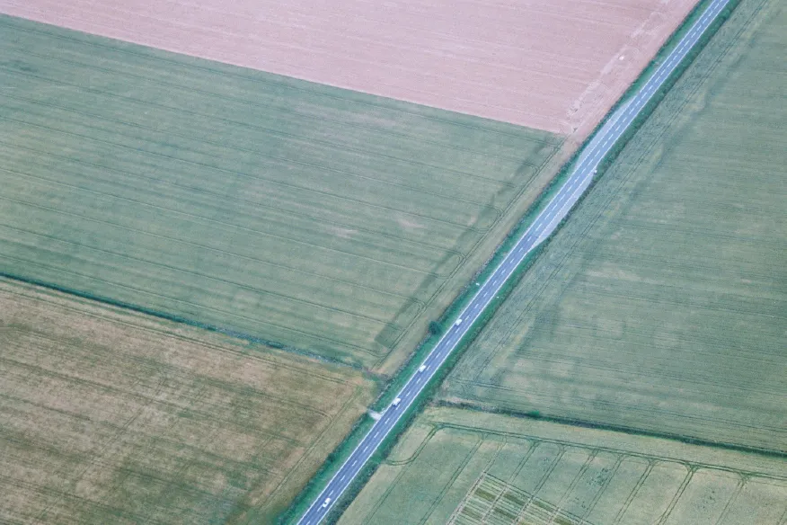
Figure 1.2. An aerial view of the eastern end of the Arras cemetery. Note that the majority of the square barrows have no central grave visible. (P. Halkon, 2005).
Landscape
In the letter referred to above, Stillingfleet provides a description of the setting of the Arras cemetery:
…the ground is very elevated on a kind of table land after a gradual rise of 2 miles; above the plain, which stretches from Humber to the Hambleton Hills and across the Vale of York to the Highlands of the West Riding, that vast plain it commands westerly. On the North, it looks over an extensive range of the Wolds; and towards the east and south-east nearly on the map of Holderness… Few situations could have been better chosen for observation or for security from surprises, or for advantages of pasturage, or for the pursuit of the chase (Stillingfleet 1848, 26).
Views to and from this plateau in the chalk Wolds are clearly significant. The cemetery also lies at the head of Sancton Dale, a sinuous dry valley, which provided a route between the low-lying terrain around the Humber estuary and the relative uplands of the Wolds. The Market Weighton Wold long barrow (Greenwell and Rolleston 1877), a Bronze Age round barrow cemetery (Halkon et al. 2009) and the Sancton Anglo-Saxon cremation cemetery (Timby 1993) at its southern entrance, demonstrate the continuing relevance of this location.
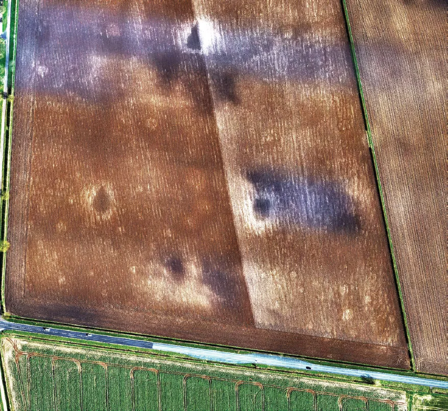
Figure 1.3. Photograph from a UAV of the Arras cemetery soon after ploughing in April 2018. The square barrows show clearly. The round barrows are also visible. The larger dark patches with a white ‘halo’ effect are recent chalk pits. (Tony Hunt, Yorkshire Archaeological Aerial Mapping).
Research has shown that during the Iron Age, the Humber lowlands had experienced radical changes, as a tidal surge and rising sea levels sometime between 800–300 BC created an inlet extending northwards for almost 12 km from the present Humber coastline, over 3 km across at its widest point, which eventually became Walling Fen (Halkon and Innes 2005). Although coring by Coles (2010, 35) suggested that rather than being continuous, it was constrained within creeks in its upper reaches, the penetration of this watercourse far inland opened up the hinterland of the Yorkshire Wolds to the Humber estuary and beyond.
The social implications of such climate and sea level change in the later Bronze Age and early Iron Age across Europe and the Mediterranean are a matter of much debate (Van Geel et al. 1996; Berglund 2003; Kaniewski et al. 2013; Tipping et al. 2008; Armit et al. 2014). Most scholars would now argue that such instabilities were multi-causal, including anthropogenic factors, however the tidal surges of 1953 and December 2013 (Spencer et al. 2015) demonstrate the catastrophe wrought by such natural disasters, with the potential to render arable land unusable for some time.
Linear earthworks
Most authorities would agree that the network of linear earthworks which runs across the Yorkshire Wolds has its origins in the later Bronze Age (Stoertz 1997; Fenton-Thomas 2003; Manby et al. 2003). Broadly paralleled in Wessex (Palmer 1984; Cunliffe 2005) and other parts of Britain, considerable effort would have been needed for their construction, for example the Great Wold Dyke that runs for over 15 km following the southern edge of the Great Wold Valley (Stoertz 1997, 77). Although their purpose is much debated, they may be partly the result of increasing competition for landscape control. The relationship of some stretches of linear earthworks with earlier round barrows and indeed pit alignments from earlier in the Bronze Age may represent the formalisation of pre-existing boundaries. In some places, the linear earthworks form considerable barriers; in others, they provide route ways through the landscape, some of which may be of some antiquity (Fenton-Thomas 2003). Analysis of linear earthworks within the wider region of Foulness Valley (Halkon 2008; 2013) provides good evidence that some systems are closely related to control of water supplies which are scarce on the Wolds, important for sustaining larger livestock such as cattle and horses. A good example of this is Huggate Dykes (Mortimer 1905; Fioccoprile 2015). Here a single linear earthwork runs southwards along the edge of the appropriately named Horse Dale, arriving at the narrowest point of a roughly figure of eight shaped plateau, where it joins a complex of five banks separated by six partially filled ditches. To the southeast is Frendal Dale, which leads down into Millington Dale and Millington Springs. In effect, this linear earthwork system controls access from the East to the many springs that feed Millington Beck. Fioccoprile (2015) identified three phases of construction, and three entrances, confirmed by geophysical survey, which resemble the monumental gateways of Wessex hillforts such as Maiden Castle in Dorset (Wheeler 1943; Sharples 1991).
Hillforts and other Wold top sites
Opinions differ as to who was responsible for the construction of the linear earthworks, with explanations ranging from the functional to the post-processual. Giles (2007) has viewed them as communal enterprises, others suggest construction carried out at the direction of some kind of authority or power base (Halkon 2008; 2013). Is it a coincidence that the hillfort at Grimthorpe overlooks a concentration of springs of which Huggate Dykes forms the eastern boundary (Halkon 2013)? The ring fort at Thwing (Manby 2007) lies close to the Great Wold Dyke and the valley of the Gypsy Race, a relationship mirrored elsewhere, both in eastern Yorkshire (Stoertz 1997) and beyond in the environs of Danebury (Palmer 1984). Due to centuries of ploughing, none of the larger eastern Yorkshire hillforts survive as well as those from Wessex and consequently have been rather overlooked. Only a few of the twenty or so examples have been fully excavated, the most important of these being Thwing (Manby 2007), Grimthorpe (Stead 1968), the promontory fort at Scarborough Castle (Smith 1928; Challis and Harding 1975; Pacitto 2004), and more recently Roulston Scar and Boltby (Powlesland 2011). Much smaller in scale, but also related to linear earthworks, are the ovoid hilltop enclosures of Staple Howe (Brewster 1963) and Devil’s Hill (Powlesland 1988) which lie on the northern edge of the Yorkshire Wolds overlooking the Vale of Pickering. Very similar ovoid enclosures have been found further south at Londesborough Moor (Halkon 2008) and Market Weighton Common (Ramm 1979; Halkon 2008) although these are yet to be investigated beyond aerial photography and, therefore, dating is problematic. The radiocarbon dates from Grimthorpe, Thwing, Staple Howe and Boltby Scar range from the fifteenth to the fourth century BC (Halkon 2013, 63).
In April 2017, a geophysical survey by James Lyall, accompanied by the writer, of a concentric enclosure 150 m in diameter near Kiplingcotes, plotted by Stoertz (1997), revealed unexpected and spectacular results. In the centre of the enclosure was a roundhouse 22 m in diameter. This was ‘ground-proved’ in an excavation directed by the writer, with James Lyall, in September...
Table of contents
- Cover
- Title
- Copyright
- Dedication
- Contents
- Acknowledgements
- List of contributors
- Introduction
- 1. Setting the scene – landscape and settlement in Iron Age eastern Yorkshire Peter Halkon
- 2. The Iron Age cemeteries at Pocklington and other excavations by MAP Mark Stephens and Paula Ware
- 3. Excavations in Garton Slack and Wetwang Slack 1963–1989 John Strickland Dent
- 4. Wide connections: women, mobility and power in Iron Age East YorkshireMelanie Giles, Victoria Green and Pedro Peixoto
- 5. New light on Iron Age warfare in Britain Yvonne Inall
- 6. Isotopes and chariots: diet, subsistence and origins of Iron Age people from Yorkshire Mandy Jay and Janet Montgomery
- 7. Reconstructing British chariots Robert Hurford
- 8. Perpetual motion: a reading of the artistic and cultural significance of Iron Age vehicle terrets Anna Lewis
- 9. Pattern and plainness in middle Iron Age East Yorkshire Helen Chittock
- 10. A northern view of Arras: or, we have chariots too Fraser Hunter
- 11. A view from the south Timothy Champion
- 12. Migrations in Iron Age Europe: a comparative view Manuel Fernández-Götz
Frequently asked questions
Yes, you can cancel anytime from the Subscription tab in your account settings on the Perlego website. Your subscription will stay active until the end of your current billing period. Learn how to cancel your subscription
No, books cannot be downloaded as external files, such as PDFs, for use outside of Perlego. However, you can download books within the Perlego app for offline reading on mobile or tablet. Learn how to download books offline
Perlego offers two plans: Essential and Complete
- Essential is ideal for learners and professionals who enjoy exploring a wide range of subjects. Access the Essential Library with 800,000+ trusted titles and best-sellers across business, personal growth, and the humanities. Includes unlimited reading time and Standard Read Aloud voice.
- Complete: Perfect for advanced learners and researchers needing full, unrestricted access. Unlock 1.5M+ books across hundreds of subjects, including academic and specialized titles. The Complete Plan also includes advanced features like Premium Read Aloud and Research Assistant.
We are an online textbook subscription service, where you can get access to an entire online library for less than the price of a single book per month. With over 1.5 million books across 990+ topics, we’ve got you covered! Learn about our mission
Look out for the read-aloud symbol on your next book to see if you can listen to it. The read-aloud tool reads text aloud for you, highlighting the text as it is being read. You can pause it, speed it up and slow it down. Learn more about Read Aloud
Yes! You can use the Perlego app on both iOS and Android devices to read anytime, anywhere — even offline. Perfect for commutes or when you’re on the go.
Please note we cannot support devices running on iOS 13 and Android 7 or earlier. Learn more about using the app
Please note we cannot support devices running on iOS 13 and Android 7 or earlier. Learn more about using the app
Yes, you can access The Arras Culture of Eastern Yorkshire – Celebrating the Iron Age by Peter Halkon in PDF and/or ePUB format, as well as other popular books in Scienze sociali & Storia europea. We have over 1.5 million books available in our catalogue for you to explore.