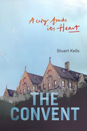
What was behind the wall and the wire? The local people knew... fine courtyards... an old swimming pool... dilapidated tennis courts and a remnant garden, now wild and sprawling. The Abbotsford Convent was this haunted place, left to languish for years after the last of the Sisters of the Good Shepherd had gone. In its prime it had been a school, a refuge, a retreat, a workhouse and a prison—the single largest charitable institution in the southern hemisphere.In the late 1990s a proposed high-density development threatened the idyllic riverside location, sparking outrage in the local community and further afield. Years of protesting, negotiating and fundraising followed and the convent, now on Australia's National Heritage List, has started a new life as a vibrant centre for art and culture. The Convent: A City Finds its Heart tells the story of the site's rich history and the efforts to preserve it. It is an uplifting tale of community activism—a tangible reminder that the magic of the past can endure and what people-power can achieve.
- English
- ePUB (mobile friendly)
- Available on iOS & Android
eBook - ePub
About this book
Trusted by 375,005 students
Access to over 1.5 million titles for a fair monthly price.
Study more efficiently using our study tools.
Information
1
A secret, magical place
WHAT WAS BEHIND the wall and the wire? The local people knew. A cluster of large and handsome buildings, most of them built in the Gothic style before World War I and all of them now resembling an abandoned medieval French village. There were fine courtyards, too, and an old swimming pool, and dilapidated tennis courts, and a remnant garden—once grand and kempt, now wild and sprawling. One of the largest trees was a venerable oak, planted almost 150 years ago. An arc of overgrown meadows connected the buildings and the garden to the banks of a sweeping bend in the Yarra River.
From time to time the locals ventured through cracks in the wall or gaps in the wire. They took cuttings from the garden’s unruly roses and seedlings of its rare tomatoes. They picnicked in the grounds and the riverside meadows, finding refuge in the remarkable quiet that was broken only by the uncanny ring of bellbirds. The most adventurous visitors invaded the old buildings or played clandestine games of twilight tennis on the derelict courts.
This mysterious site occupied a heart-shaped peninsula that was bounded by the Yarra to the south-west, the south-east and the northeast. The opposite bank was steep and heavily wooded, mostly with tall eucalypts, but also wattles and other native trees and shrubs: a striking semicircle of urban bushland just 4 kilometres from the centre of a large city.
Covered walkways, stained glass, a fine chapel, a solemn cloister. These and other features of the buildings and grounds gave away their former life. The site had once housed a busy religious community: the Convent of the Order of the Good Shepherd. Now, though, the nuns and their wards had gone and the site had been reduced to a kind of inner-urban land bank, suspended in time, lost in the too-hard basket.
Central Melbourne may have been nearby, but the peninsula felt a million miles from Collins and Bourke streets. Families and school groups visited the neighbouring Children’s Farm—formerly the convent’s larder—to meet goats and rabbits and peacocks. Cyclists and runners sped by on the recently opened riverside bike path. People from the neighbourhood walked dogs and took strolls. Otherwise, there was little passing traffic.
Margot Foster was one passer-by. A producer at ABC Radio National, she lived in William Street, a few blocks from the old convent site. In 1997 she was walking with her son and her dog along St Heliers Street on the site’s northern edge when a large sign stopped her in her tracks. Evidently the place was about to be transformed. A property developer had a new vision for the unique site’s 6.7 hectares.
From 1990, the developer had traded as ‘Australian Housing and Land’, or ‘Australand’ for short. That name was somewhat misleading. In its corporate communications, the company trumpeted its Australian heritage, which extended back to 1924 with the founding of TM Burke Pty Ltd. Now, though, the company was majority owned and controlled by a Singapore government body, CapitaLand; it would soon seek a dual listing on the Australian and Singaporean stock exchanges.
According to the Australand vision, a redeveloped ‘St Heliers Convent’ would be an exclusive, high-density residential enclave. By remaking the old structures and pulling other ones down, and by building large new ones in the gaps and around the edges, Australand would create 289 residential units. One of the proposed buildings, a six-storey tower, would overlook the Children’s Farm and the river. The other buildings included rows of three- and four-storey townhouses along the riverside path. Several existing buildings would retain just their facades. Vaunted features of the redevelopment proposal included a boat landing and a four-hole ‘chip-and-putt’ golf course, slated for the French Meadow.
This kind of closed-off, high-density residential development—in which repurposed heritage buildings were blended with modern and utilitarian ones—was altering neighbourhoods across Melbourne. Big developments were changing the shape and fabric of the inner city, Southbank, South Carlton, the inner east, the inner west and the bayside suburbs. But the Australand proposal was unusual for its scale and ambition.
Amanda Stone also saw the big sign on St Heliers Street: ‘Australand Is Coming’. So did Jo Kinross. Word spread about what Australand and the state government’s Urban Land Authority had in mind. People in the community were eager for more information. The residents of Abbotsford and nearby suburbs wanted to understand what was happening in their neighbourhood.
In 1997, the use of email wasn’t widespread and social media platforms were embryonic. The concerned residents shared information in low-tech ways, such as by letter and phone and in person. Thanks to these technologies, Abbotsford was home to a highly effective bush telegraph. With speed and efficiency, the residents swapped snippets of knowledge and the beginnings of ideas about what could and should be done. They also contacted others, in search of more information to share and act upon. Foster spoke to media colleagues. Her fellow residents put the word out among Melbourne’s architects, archaeologists and conservators.
The formal planning process involved some new players. Just three years earlier, the state government had created the City of Yarra by amalgamating the former inner-suburban municipalities of Collingwood, Fitzroy and Richmond, plus parts of Carlton North, Alphington and Fairfield. Now, the new council had the job of preparing a critical document that would pave the way for Australand’s redevelopment: Planning Amendment number L54.
The planning amendment process was enshrined in Victorian legislation. As part of the process, Australand’s representatives had to talk to affected residents. On 24 November 1997, the developer fulfilled this requirement in the most minimal way possible. By letter drop, it notified as few as six households and businesses immediately to the west of the old convent site about the amendment process and the opportunity to attend public information briefings.
Psychologist Sue Bannerman was one of the Clarke Street residents who received a letter from Australand. She lived at number 13, ‘Osborne House’, built in 1864. When the letter arrived, she was at her front gate chatting to a neighbour. Bannerman looked inside the envelope and some details jumped out at her, especially the proposed ten-storey tower on the convent car park. She then read the whole letter carefully and spoke to other neighbours.
On the Sunday after Bannerman received the letter, a few people were gathered around her kitchen table to talk about what was proposed and what they might do about it when they heard a knock at the door. It was Robyn Williams, the residents’ ward councillor. She didn’t know Bannerman, but had heard on the grapevine that Sue’s kitchen was the place to be.
Williams shared a critical piece of information. The proposed redevelopment wasn’t a fait accompli. The site could be used for housing only if it received approval from the local council. The nearby residents wouldn’t have to throw themselves in front of bulldozers—or at least not yet.
Williams emphasised the scale and significance of what was afoot. ‘This is really important,’ she said to the residents around the table. ‘You have to get organised.’ Then she gave them practical advice on how to do just that.
Thanks to Williams, and to the Australand briefings, the residents began to understand the gravity of the situation. The attendees at the briefings didn’t like what they heard: the scale of the proposal and its likely impact on the people of eastern Abbotsford were staggering. Using the bush telegraph, they alerted as many other people as they could.
By these means, Williams and the concerned residents called a public meeting to discuss the proposed development. Five days after the Australand briefings, more than 100 people gathered on the weedy, gravelly car park at the northern edge of the convent site, between St Heliers Street and Johnston Street.
The meeting was unanimous: Australand was in La La Land and the redevelopment had to be stopped. The gathered residents resolved to launch a public campaign. They would form the St Heliers Convent Action Group, and they would do what they could to save the precious, magical, secret place that was Melbourne’s green heart.
2
It began with lava
FOR MILLIONS OF years there were active volcanoes to the north and west of where Melbourne now stands. Molten lava flowed implacably outward from the volcano fields to form a basalt plain. At its south-eastern edge, the plain met ancient sandstone and mudstone and siltstone. This frontier defined the course of a river. The Yarra River.
In the last Ice Age, the Yarra was of much greater extent than it is today. Through what is now Port Phillip Bay and The Heads, it ran out to join the Barwon River and, in what would later become northern Tasmania, the Tamar. Ultimately the rising sea levels that made Tasmania also helped make the Yarra.
For the local Wurundjeri people—one of the five tribes of the Indigenous Kulin Nation—the river was of great cultural significance. The Wurundjeri tell of how two ancestral headmen, Bar-wool and Yan Yan, made the river by cutting through barriers with axes, thereby emptying a great mountain pool into the bay. Thereafter, the river was central to daily life. People drank from it and lived on its banks. When travelling, they carried Yarra water in possum-skin bags.
Over the span of tens of thousands of years, the Abbotsford peninsula was an important meeting place for the Indigenous people of south-eastern Australia. Set in a naturally enclosed amphitheatre, the peninsula was immediately downstream from an ancient crossing point near what is now Dights Falls. The region was home to many native vertebrates, including fish, platypuses, koalas, wombats, wallabies, kangaroos, echidnas, quolls, emus, blue-tongues and snakes—plus a great variety of plants. Seals and dolphins forayed upriver from the open ocean and the bay to catch fish and explore the fresher water.
Ideal for hunting and fishing and food collection, the rich river flats and deep water met many of the people’s needs. On land, the Wurundjeri caught kangaroos and possums. In the water, they caught eels and bream and perch. Nothing was wasted. The people sharpened mussel shells to scrape possum skins, and used echidna quills for sewing and to make necklaces. Riverside trees were sources of seeds and resins. Riverside vines were dried and twisted to make strong and versatile rope.
The first Europeans to venture into inland Victoria also used the river. In 1802, Governor Philip Gidley King ordered Charles Grimes, the newly appointed surveyor-general of New South Wales, to survey the countryside in the immediate vicinity of Port Phillip. The surveyor’s expedition was of the utmost importance as other countries besides Britain had eyes on this section of coast. The expedition would help forestall possible foreign interest in the Bass Strait area, especially from the French.
In February 1803, Grimes and James Fleming mapped vegetation and surveyed the Yarra. Fleming camped with the Wurundjeri people below the ancient crossing place and sowed seeds there. The expeditioners soon left the region, but over the following decades their countrymen would be back, and in large numbers.
The next European visitors would become household names and street names and school curriculum names: Hume and Hovell (1824), Charles Sturt (1830) and Edward Henty (1834). In 1835, fifteen citizens from Van Diemen’s Land formed the Port Phillip Association (originally the Geelong and Dutigalla Association) to acquire land from the Indigenous peoples of the mainland’s south-east coast. In May of that year, John Batman sailed from Launceston on the Rebecca. After entering Port Phillip and anchoring at Indented Head, he sailed to the mouth of the Yarra.
Soon after, the Wurundjeri headman Bebejern and seven other Indigenous leaders reportedly ‘signed’ Batman’s ‘deed of Melbourne’. The Indigenous Australian culture was a verbal one: the Indigenous signatures weren’t signatures at all, and the ‘deed’ was unconscionably one-sided. But by this means, more than 500,000 prime, verdant and culturally redolent acres (202,000 hectares) were ‘traded’ for a modest bounty of blankets, flour, tomahawks, knives, scissors, looking glasses, handkerchiefs and shirts.
That same year, a misunderstanding gave the Yarra its modern name. John Wedge was Batman’s surveyor. At the old falls near today’s Southbank, Wedge was with some Indigenous people when they said, ‘Yarra Yarra’ (‘Yarrow Yarrow’ is what he wrote in his notebook). Only later did Wedge and others realise that the people were referring to the movement of the water over the falls, not to the river as a whole—which the people actually called Birrarung or Brahrung, the ‘river of mists’.
In March 1837, Governor Sir Richard Bourke arrived at Port Phillip. Accompanying him was the surveyor Robert Hoddle. Bourke directed that a town be laid out, and appointed Hoddle as senior surveyor. By the end of April, Hoddle’s plan for the new town of ‘Melbourne’ was lodged at the government survey office in Sydney. The centrepiece of the plan—on land about 5 kilometres from the Abbotsford peninsula—was Hoddle’s iconic grid of wide streets and narrow lanes.
The following year, Hoddle and his staff surveyed both sides of the Yarra near Abbotsford and subdivided it into uniform allotments of 25 acres (10 hectares), except where natural features made uniformity impossible. In this way, Hoddle enabled the first land releases that expanded Melbourne beyond the grid-like urban centre. The allotments were sold as ‘rural retreats for gentlemen’ and were approved for subdivision.
Major Henry Smyth of Sydney purchased Crown portions 77 (23a) and 64 (12a), totalling 35 acres (14 hectares), on the Yarra at Abbotsford. In 1840, John Hodgson leased part of this riverside estate from Smyth. Two years later, the Hon. Isaac Erskine Murray bought Smyth’s whole estate and further divided it into riverside ‘farmlets’.
John Orr was a businessman, pastoral pioneer and politician. An alderman in the first Melbourne City Council of December 1842, he would also be a founding member of the Victorian parliament. In July 1842, he purchased ‘Abbotsford Estate’: seven picturesque acres on the Clarke Street edge of the peninsula’s subdivision.
In the same year, Edward Curr purchased the neighbouring property on the peninsula’s easternmost side. Curr, like Orr, was active in colonial politics. A member for the Port Phillip District in the New South Wales Legislative Council, he led the 1840s campaign to separate the district from New South Wales. Curr’s property consisted of around 16 acres that were divided into orchards, ornamental gardens and a large paddock. It was here that he built a fine home, ‘St Heliers’. His daughter Elizabeth, who was eight years old when she arrived in Melbourne, later wrote that St Heliers was a delightful property. She recalled that visitors from the Melbourne township ‘seemed to look at the garden as a sort of promised land’ and that her father acquired two roan horses and a carriage from London, which he used to travel to town for his business and political activities.
In 1843, Orr built the equally fine ‘Abbotsford House’. The name harked back to the home of the Scottish novelist and poet Sir Walter Scott. In 1811, Scott had bought ‘Newarthaugh’, a mountain farm that sat ‘on a bare haugh and bleak bank by the side of the Tweed’. The local people called the property ‘Cartleyhole’ or ‘Clarty Hole’, but Scott renamed it ‘Abbotsford’, ‘after the ford across the Tweed below the house used in former times by the monks of Melrose Abbey’. He planted trees and extended the farmhouse, which became a ‘whimsical and picturesque’ building that featured a study, dining room, armoury, conservatory and library. The armoury would later serve as the author’s ‘boudoir’. Though less extensive and picturesque than Scott’s home, Orr’s ‘Abbotsford’ was a large house with high ceilings and a wide veranda. The grounds featured pleasant shrubberies, orchards and flower gardens.
On 11 November 1850, news reached Melbourne that the separation campaign had succeeded: Britain’s parliament had passed legislation to separate the Port Phillip District from New South Wales. Just five days later, Curr died. Obituarists credited him as the Father of Separation.
In December, Curr’s trustees let out St Heliers in two parts. Robert Cole took the lower garden and paddock, while William F Lord took the house and its adjoining garden. Later in the 1850s, George Young would lease St Heliers, and Samuel Moss—an American hotelier, restaurateur and sometime playwright—would lease part of Abbotsford Estate.
Subsequent notable lessees would reportedly include Hugh Childers (Commissioner of Customs, Steam Navigation Board chairman and vice-chancellor of the University of Melbourne) and Charles W Ligar (Victoria’s surveyor general). With Robert Patterson and John Mackenzie, Orr would eventually subdivide the northern part of the estate into town lots and advertise them for sale. In the early 1860s, Mr Frederick Cooke, manager of the Melbourne Banking Company, would own and occupy Abbotsford House.
3
Sue’s kitchen
FOR A BRIEF period in the 1850s—‘the golden fifties’—this Abbotsford neighbourhood between Hoddle Street and the Yarra was an exclusive one. ...
Table of contents
- Cover
- Title
- Copyright
- Contents
- Acknowledgements
- 1. A secret, magical place
- 2. It began with lava
- 3. Sue’s kitchen
- 4. Neither pot nor pan
- 5. A positive alternative
- 6. Growth
- 7. A social enterprise
- 8. A noble cause
- 9. Basket weavers
- 10. Flooded
- 11. The Great and the Good
- 12. Life at the convent
- 13. The legacy
- 14. Coming and going
- 15. Implacable
- 16. The end of an era
- 17. A gem
- 18. Everything you wanted
- 19. Saved
- 20. Open
- Timeline
- Notes
- Index
Frequently asked questions
Yes, you can cancel anytime from the Subscription tab in your account settings on the Perlego website. Your subscription will stay active until the end of your current billing period. Learn how to cancel your subscription
No, books cannot be downloaded as external files, such as PDFs, for use outside of Perlego. However, you can download books within the Perlego app for offline reading on mobile or tablet. Learn how to download books offline
Perlego offers two plans: Essential and Complete
- Essential is ideal for learners and professionals who enjoy exploring a wide range of subjects. Access the Essential Library with 800,000+ trusted titles and best-sellers across business, personal growth, and the humanities. Includes unlimited reading time and Standard Read Aloud voice.
- Complete: Perfect for advanced learners and researchers needing full, unrestricted access. Unlock 1.5M+ books across hundreds of subjects, including academic and specialized titles. The Complete Plan also includes advanced features like Premium Read Aloud and Research Assistant.
We are an online textbook subscription service, where you can get access to an entire online library for less than the price of a single book per month. With over 1.5 million books across 990+ topics, we’ve got you covered! Learn about our mission
Look out for the read-aloud symbol on your next book to see if you can listen to it. The read-aloud tool reads text aloud for you, highlighting the text as it is being read. You can pause it, speed it up and slow it down. Learn more about Read Aloud
Yes! You can use the Perlego app on both iOS and Android devices to read anytime, anywhere — even offline. Perfect for commutes or when you’re on the go.
Please note we cannot support devices running on iOS 13 and Android 7 or earlier. Learn more about using the app
Please note we cannot support devices running on iOS 13 and Android 7 or earlier. Learn more about using the app
Yes, you can access The Convent by Stuart Kells in PDF and/or ePUB format, as well as other popular books in History & World History. We have over 1.5 million books available in our catalogue for you to explore.