- 204 pages
- English
- ePUB (mobile friendly)
- Available on iOS & Android
eBook - ePub
About this book
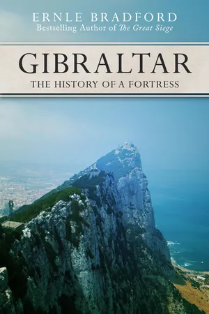
Since ships first set sail in the Mediterranean, The Rock has been the gate of Fortress Europe. In ancient times, it was known as one of the Pillars of Hercules, and a glance at its formidable mass suggests that it may well have been created by the gods. Sought after by every nation with territorial ambitions in Europe, Asia, and Africa, Gibraltar was possessed by the Arabs, the Spanish, and ultimately the British, who captured it in the early 1700s and held onto it in a siege of more than three years late in the eighteenth century. The fact that that was one of more than a dozen sieges exemplifies Gibraltar's quintessential value as a prize and the desperation of governments to fly their flag above its forbidding ramparts. Bradford uses his matchless skill and knowledge to take the reader through the history of this great and unique fortress. From its geological creation to its two-thousand-year influence on politics and war, he crafts the compelling tale of how these few square miles played a major part in history.
Trusted by 375,005 students
Access to over 1.5 million titles for a fair monthly price.
Study more efficiently using our study tools.
Information
1
Rock and Sea
The strange and formidable Rock of Gibraltar has long been a symbol of all that is permanent and enduring. It is, indeed, a ‘Rock of Ages’.
To Mediterranean mariners of antiquity it stood as a warning mark, to tell them that they were at the close of the known world. Beyond it all civilization ended—and possibly even the earth itself. Many centuries later, it was seen as the sally-port into Europe, the bridge across which the Moors stormed into Spain and the Christian continent out of Moslem Africa. Lastly, after the opening-up of the oceanic trade routes, it became the point where all of them converged to enter the Mediterranean. It is hardly surprising, then, that the Rock, and the whole area surrounding it, became imbued first with myth and legend, and then with history. Many battles have been fought beneath its shadow.
A four-faced Janus, Gibraltar looks out westward to the Atlantic, southward to Africa, and eastward into the Mediterranean. To the north it gazes towards Spain and Europe. This is, indeed, one of the great crossroads of the earth.
Less than three miles long by three quarters of a mile wide, the Rock is one of those natural phenomena which have acquired an importance out of all proportion to their actual size. Two accidents of nature account for this: firstly its geological structure, and secondly its geographical position. This immense ‘rock’, for such it is, rising to a maximum height of 1400 feet, is a jagged mass of Jurassic limestone which was formed on the bed of an immense ocean, during that phase of the world’s history which has been called ‘The Age of Reptiles’. The ocean, which covered a large part of modern Europe and the Mediterranean basin, was stocked by innumerable turtles, vast icthyosaurs and plesiosaurs, as well as by countless fish that were beginning to approach to their modern forms. Crustaceans and long-tailed lobster-like creatures; the catfish; and the ancestors of the sturgeon; all these formed part of the life of Tethys, as the ocean has been called after the Greek sea-goddess who was reputed to be the daughter of Earth and Sky. Molluscs and Cephalopods, sponges and corals, all contributed over the millennia to form out of their bony skeletons and frames a deep deposit on the ocean floor.
Looking at the Rock today, it is difficult to imagine that it represents the death of billions of creatures, all once vivid with life. But the time came when the earth’s surface shrank, and the Atlas mountains of North Africa and the Sierra Nevada of Spain were driven towards one another. When this occurred, the former seabed, at the junction of what is now the straits, was thrust up into the sunlight. More millennia of sun and rain, wind and ice, tempered this marine deposit until it became the limestone that is so typical of the Mediterranean region as man knows it today. Geologically, perhaps, there is nothing especially remarkable about Gibraltar, but geographically there is—for it is separated from the main body of Spain and, therefore, of Europe. It is basically an island—probably indeed it once was—for the sandy isthmus that connects it with the continent is, in geological terms, an ‘innovation’. In other parts of the Mediterranean, similar siltings have occurred. Monte Circeo, for instance, a little north of Naples and now united to the west coast of Italy by alluvial deposits washed down from the Tiber, was once, too, an offshore island. Its structure is very similar to Gibraltar’s.
Gibraltar is what is known as a ‘bill’; that is to say, the exact opposite to an inlet, where an arm of sea thrusts into the land. The bill, or rock of Gibraltar, is an arm of land thrust out into the sea. If this, and its geological structure, were all, then there would be nothing more to say about Gibraltar except that it is an interesting—but not unique—natural phenomenon. The Rock, however, is situated at the narrow entrance-mouth of the Mediterranean, and has thus acquired its unusual importance. It runs almost due North and South, terminating at Europa Point, and facing across the straits that bear its name towards Mount Ceuta on the Moroccan coast. At this point, less than fourteen miles of sea divide Europe from Africa.
In classical times Gibraltar was known as Calpe, and Ceuta as Abyla. (Both names seem to stem from Phoenician roots, the exact meaning of which has long provided a battlefield for Semitic scholars.) They were the famous Pillars of Hercules beyond which, as the dramatist Euripides wrote in the fifth century BC, there ‘lies the end of voyaging and the Ruler of Ocean no longer permits mariners to travel on the purple sea’.
This was poetic exaggeration, of course (or perhaps no more than geographical and historical ignorance). The Phoenicians, for certain, had long been penetrating into the Atlantic beyond the Pillars of Hercules, and possibly even the Minoans and Myceneans before them. It is likely, though, that it was the Phoenicians who first named Gibraltar and Ceuta the Pillars of Hercules, or rather of Melquart. He was their principal male deity and it was the Greeks and the Romans who later equated him with Heracles, or Hercules. It has been suggested also that these two great rocks at the mouth of the sea reminded them of the twin pillars in the temple of Melquart at Tyre. Tyre was the most important city in the Phoenician world and, since it was the Tyrians who were among the foremost navigators of antiquity, it is probable that it was a Tyrian who first, lifting his eyes at dawn as the mist peeled off the strait, cried out ‘The Pillars of Melquart, Lord of the City!’
The appearance and geography of Gibraltar have been best described in the Journal of the Geological Society (London 1878):
‘The extreme length of the Rock from the base of the cliff at the north front to Europa Point is only a little over and the promontory tapers somewhat gradually away from a breadth of 1,550 yards between Gibraltar and Catalan Bay to a width of 550 yards at Europa. The Rock shoots abruptly upwards from the low flat land at the north front in a fine mural precipice, the basal portion of which is partly concealed by a sloping curtain of debris and breccia. This precipitous wall culminates….at the Rock Gun (1,349 ft.) from which point the dividing ridge or backbone of the promontory extends southward in a sharp jagged arch, the dominant points of which are Middle hill (1,195 ft.), Signal station (1,294 ft.), heights above Monkey’s Alameda (1,396 ft.), and O’Hara’s tower (1,370 ft.). At the latter the ridge is sharply truncated, and succeeded to the south by the well-marked plateau of Windmill hill and Europa. From the Rock Gun to O’Hara’s tower the dividing ridge presents to the east a bold escarpment, which is for the most part inaccessible, and in places almost vertical, the cliffs where they are lowest having a drop of not less than 300 or 400 ft., and of more than 1,000 ft. where they approach the sea on the north. From their base the ground falls rapidly away to the coastline at angles that vary from 300 to 40 The opposite slopes of the dividing ridge are not so abrupt, the only really precipitous portion that faces the west being the line of cliff that overlooks Gardiner’s road and Engineer’s road between the Moorish wall and the Mount. A low sandy plain, that does not average more than 10 ft. in height above the sea, connects the Rock with the mainland.’
It is the precipitous eastern face that gives rise to one of the more unusual phenomena associated with the Rock—the Levanter Cloud. The Levanter, or East Wind, which blows out of the warm Mediterranean, is the prevailing wind in the strait. In an average year it may blow for as many as one hundred and fifty days. Compared with this, the other two principal winds, the west and north-west, average about one hundred and twenty days between them. Since the east wind is most prevalent between June and September, it arrives across a thousand miles of summer Mediterranean, having absorbed on its way a very high humidity. The wind strikes the sheer, eastern, cliff-face, and spins upwards to close on fifteen hundred feet, where it condenses to form a cloud (somewhat similar to the vapour-trail of an aircraft). All the heights now become beaded with moisture, and the cloud trails away westerly over the whole area of Gibraltar and the bay beyond it. Sometimes it stretches right across the bay, five miles to where the Spanish town of Algeciras lies. While all the rest of the sky may be clear and blue, Gibraltar wears its grey hat. This obscures the sun on the western slopes, raises the humidity, and accounts for an irritability among the inhabitants somewhat similar to that engendered in Malta, Sicily and Southern Italy by the equally humid, but southerly, Sirocco.
When the Levanter cloud is particularly thick and heavy, life on the Rock has been accurately compared to living in a Turkish bath. T. J. Bickford writing in the Royal Naval Sailing Association Journal also describes how ‘sailing in the harbour (on the western side) can be very tricky, for the cold air under the cloud rushes down the slope now and again…and then stops while the cloud reforms to a different shape. In addition, the vacuum created by the loss of volume due to the cooling and formation of the cloud has to be filled by air rushing in from either side. These rotating miniature whirlwinds—for they do pick up a plume of water 1 o ft. high—progress across the harbour… The terror winds are those that come down in gusts at 45 degrees and drive the boat over.’
The narrow strait of Gibraltar is also one of the few areas in the Mediterranean where a strong surface current is experienced. (The others are the strait of Messina, and the narrows of the Bosporus.) Since the Mediterranean only receives from the rivers that drain into it about a third of the amount of water that it loses annually by evaporation, it follows that this deficiency must be made good by an inflow from the Atlantic. There is, in fact, a small inflow from the Black Sea and the Sea of Marmara through the Bosporus and the Dardanelles, but most of the water replacement pours in through the strait of Gibraltar. The result is that there is a strong surface current in the strait, flowing easterly into the inland sea and usually making at about two knots—although on occasions even greater rates have been experienced. The Admiralty Pilot for the area states that: ‘Within about 20 miles eastward of Gibraltar the current is extremely variable, and special caution is necessary when making the strait from eastward. Thus, in 1936, HMS Nelson reported that south-east going currents, with rates up to 3 knots, were frequently experienced during the latter half of February and the first week in March in the area southward of the parallel of Europa point, whereas northward of that parallel very little current was experienced; the wind during the period was mainly between south-west and north-west. Between the eastern end of the Strait of Gibraltar and the meridian of Malaga, the main current has sometimes been found to have a rate of 5 knots…’
But if the Atlantic waters flow into the Mediterranean to replenish what is lost by evaporation during the long dry summers, there is also an outflow from the land-embraced sea into the vast Atlantic. The reason for this is that the Mediterranean, due to its high rate of evaporation, is a very saline sea, as any swimmer can testify who has contrasted its buoyancy with other seas and oceans of the world. A higher salinity means a greater density, so the surface waters of the sea are constantly sinking, to add to the dense water in the hidden depths. The excess of this saline water now flows out through the strait of Gibraltar—well below the surface. It has been calculated that up to a depth of 68 fathoms (408 ft.) the water is flowing into the Mediterranean, but below this depth the ‘old water is flowing out into the Atlantic. The whole of the Mediterranean basin, therefore, is constantly renewed every few years.
While the inflow averages a rate of about 2 knots, below the surface the water is flowing out at about knots, lifting gently over the sill that forms the comparatively shallow strait between Gibraltar and Ceuta, Europe and Africa. Another phenomenon of which the sailor in this area soon becomes aware is that at certain points along the adjacent coastlines, particularly on the African side, west-going eddy currents occur which are at complete variance with the main surface stream. Furthermore, when the Levanter blows strongly, the incoming waters are checked and the rate of the stream drops considerably. Conversely, strong westerly winds out of the Atlantic can double its speed. In all respects, then, Gibraltar and its strait are an area of unusual meteorological and oceanographic interest. It is not surprising that the ancients felt that this was a place of magic and mystery.
2
The Pillars of Heracles
In 1848, one year before Charles Darwin published his Origin of Species, a discovery was made at Gibraltar which occasioned little comment at the time. In a cave on the north face of the rock, ‘an old skull’—in the words of the Gibraltar Society—was brought to light. It was the skull of a woman. Nine years later, at Neanderthal in the valley of the Düssel, a tributary of the Rhine, a similar skull, together with thigh and other bones, was found. Similar remains have subsequently come to light in Belgium, France, Jersey, Czechoslovakia and Palestine. They represent practically all that we know about what has subsequently been called ‘Neanderthal’ man—who should, more accurately, have been termed ‘Gibraltar Woman’, since it was here that the very first specimen was uncovered.
This forerunner of the human race had massive brow ridges, a short bull-like neck, teeth and palate that seem to indicate a vegetable diet, and thigh bones (to judge from the German specimen) that indicate a character more simian than the roots from which we ourselves spring. Nevertheless, the skull, although long and low, was capacious, and there can be little doubt that the type deserves to be called ‘man’ rather than ‘simian’. Remains of Neanderthal man have also been unearthed in South Africa, Tangier just across the strait from Gibraltar, and as far north as Denmark. Anthropologists, although often as at variance with one another as archaeologists, seem to agree that this particular species of the human race originated in Africa. It is very possible that it was in the narrow strait between Ceuta and Gibraltar that this ancient forerunner of mankind crossed from Africa into Europe. He (or she) was to be succeeded by what seems to be our real ancestor, Cromagnon man—a more efficient killer, who most probably exterminated his predecessor. The English novelist William Golding in The Inheritors has brilliantly imagined and recreated the world in which gentle, fruit-eating Neanderthal met his doom at the hands of violent Cromagnon.
The first people in recorded history to have regularly passed through the strait were the Phoenicians. They were bound not only for the tin mines of Spain, but for those farther north in the rain- and wind-swept isles of Britain, There is no evidence that the rock of Gibraltar meant anything more to these master-mariners of antiquity than a landmark. Natural fortress it certainly was, but the Phoenicians and their descendants, the Carthaginians, picked the sites for their settlements almost entirely on the basis of trade. Sheltered bays, or offshore islands, with easy access to the hinterland of whatever country it might be—these were the places that they chose for the repair and slipping of their ships. They sought trading posts which, if the natives proved unfriendly, could be defended easily, and from which their seapower could always enable them to escape. It was for this reason that they founded a trading settlement north of Gibraltar at the head of the gulf, where they were protected from the Levanter by the towering rock, and on the west by the headland that is now called Punta Secreta.
Further west at Gades (modern Cadiz) the Phoenicians had one of their most important trading sites off the mouth of the Guadelete river, on an island which has subsequently become the silted-in peninsula protecting the modern bay of the city. It was here, at the southern tip of the island, that they erected a famous temple to Melquart. According to the Greek historian Stabo, the ‘Pillars of Heracles’ were not at Gibraltar at all, but were named after two bronze pillars erected at the temple of the god Melquart at Gades. Both Carteia and Gades, as well as a number of other trading sites on the south-western coast of modern Spain and Portugal were founded by the Phoenicians in their quest for tin. This was, of course, the essential addition to copper that could transform it into bronze. Tin to the ancient world (for copper itself was not so difficult to come by) was somewhat equivalent to oil in the twentieth century. The tin routes, like the oil routes of today, were the vulnerable Achilles’ Heel of a nation’s industry.
The Phoenicians, although they play little part in the history of Gibraltar itself, are essential to any understanding of the strait and of the place that Gibraltar has occupied in the history of the Mediterranean. Herodotus writes that they regularly traded ‘beyond the Pillars of Heracles’ with the natives of Africa, with whom they bartered their manufactured wares. They would leave the goods on the beach and make a fire so that the local inhabitants would know of their presence. They would then retire to their ships, and wait for the natives to bring down gold in return. It was now the part of the locals to withdraw, while the Phoenicians inspected the amount of gold. If they considered it sufficient, they would take it and sail off, but if not they would go back again to their ships and wait. This coming and going went on until both parties were satisfied. ‘Neither side,’ Herodotus remarks, ‘ever cheats. The Carthaginians do not touch the gold until they are satisfied, neither do the natives touch the goods until the others have accepted the gold.’
It was possibly due to the fact that so much of their trading was carried on with primitive peoples that the Phoenicians, able business men though they were, were so late in developing a coinage of their own. Although coins were regularly in use in Greece by the early sixth century BC, the earliest Phoenician coinage (struck at Tyre) did not appear until about the middle of the fifth century BC.
The ships with which they will have passed through the strait on their way to Gades or down the west coast of Africa were of two basic types. One, the round ship, called a Gaulos (literally ‘a tub’) was the principal cargo carrier of the time. Although it had two banks of oars to cope with the long calms of the summer Mediterranean, it was primarily a sailing vessel, having a large square sail set on a central mast, for use whenever the wind blew fair. The other type of vessel was a ‘long ship’, essentially a warship. Again, it had two banks of oars, but was much narrower in the beam and had a long beak or ram projecting out ahead of the stem. It, too, had a mast with a squaresail but it was primarily an oared vessel, designed for swift bursts of speed when running in to attack an enemy. Since, in the early days of Phoenician trading ventures in the western Mediterranean, they were unchallenged by any other seagoing power, it is more than likely that the Rock will have seen numbers of ‘round ships’ coming and going, but few war galleys passing through the strait. It was not until the Greek challenge to Phoenician maritime supremacy, followed later by the long conflict between Carthage and Rome, that this end of the Mediterranean became the scene of naval warfare.
Since the im...
Table of contents
- Dedication
- Epigraph
- Chapter 1 – Rock and Sea
- Chapter 2 – The Pillars of Heracles
- Chapter 3 – Gateway and Stepping Stone
- Chapter 4 – Embattled Fortress
- Chapter 5 – Rooke’s Rock
- Chapter 6 – Free Port
- Chapter 7 – A Pawn in Politics
- Chapter 8 – Preparations for Defence
- Chapter 9 – The Siege Begins
- Chapter 10 – Relief, Blockade and Fire
- Chapter 11 – The Second Year
- Chapter 12 – Sortie
- Chapter 13 – The Great Assault
- Chapter 14 – ‘As Solid as the Rock…’
- Chapter 15 – A Station for the Navy
- Chapter 16 – The Years of Change
- Chapter 17 – Imperial Gibraltar
- Chapter 18 – An American on the Rock
- Chapter 19 – Politics and People
- Chapter 20 – War and Peace
- Chapter 21 – Fulfilment
- Chapter 22 – Present and Future
Frequently asked questions
Yes, you can cancel anytime from the Subscription tab in your account settings on the Perlego website. Your subscription will stay active until the end of your current billing period. Learn how to cancel your subscription
No, books cannot be downloaded as external files, such as PDFs, for use outside of Perlego. However, you can download books within the Perlego app for offline reading on mobile or tablet. Learn how to download books offline
Perlego offers two plans: Essential and Complete
- Essential is ideal for learners and professionals who enjoy exploring a wide range of subjects. Access the Essential Library with 800,000+ trusted titles and best-sellers across business, personal growth, and the humanities. Includes unlimited reading time and Standard Read Aloud voice.
- Complete: Perfect for advanced learners and researchers needing full, unrestricted access. Unlock 1.5M+ books across hundreds of subjects, including academic and specialized titles. The Complete Plan also includes advanced features like Premium Read Aloud and Research Assistant.
We are an online textbook subscription service, where you can get access to an entire online library for less than the price of a single book per month. With over 1.5 million books across 990+ topics, we’ve got you covered! Learn about our mission
Look out for the read-aloud symbol on your next book to see if you can listen to it. The read-aloud tool reads text aloud for you, highlighting the text as it is being read. You can pause it, speed it up and slow it down. Learn more about Read Aloud
Yes! You can use the Perlego app on both iOS and Android devices to read anytime, anywhere — even offline. Perfect for commutes or when you’re on the go.
Please note we cannot support devices running on iOS 13 and Android 7 or earlier. Learn more about using the app
Please note we cannot support devices running on iOS 13 and Android 7 or earlier. Learn more about using the app
Yes, you can access Gibraltar by Ernle Bradford in PDF and/or ePUB format, as well as other popular books in History & British History. We have over 1.5 million books available in our catalogue for you to explore.