![]()
INDIAN REMOVAL IN THE 19TH CENTURY:
As Europeans continued flooding into America in the 19th century, our federal government began displacing Native Americans from their homelands by moving them to reservations west of the Mississippi River. This section retraces the paths followed by one of those tribes, the Cherokee, along what came to be known as The Trail of Tears, because of the resulting deaths and hardships.
![]()
THE CHEROKEE TRAIL OF TEARS
Missionary Daniel Butrick kept a journal of his travels with the Cherokee People as they were force-marched to Indian Territory during the winter of 1838-39. It is one of the saddest episodes in American history, with the depths of despair grippingly described by him in this entry: “… the government might more mercifully have put to death everyone under a year or over sixty; rather it had chosen a more expensive and painful way of exterminating these poor people.”
BREAKING AWAY FROM THE BELTWAY
In pre-Columbian times, the Cherokee People’s land stretched from the Ohio River to present-day Kentucky, Tennessee, North Carolina, South Carolina, Georgia, and Alabama. But by the early 1800s, various treaties had reduced Cherokee land to a fraction of their former size. At the same time, European diseases devastated much of the Cherokee Nation. Those who survived adopted many aspects of European culture and enterprise, including farming, a written language, a court system, a printed newspaper, and even Christianity. Cherokee settlements looked and functioned much the same as white settlements of the day. However, in 1828, gold was discovered on Cherokee land in North Georgia, and white settlers began ignoring legal Cherokee boundaries. By 1830, the Cherokee had lost any legal claim to their lands. That year, Congress passed the Indian Removal Act, and President Andrew Jackson signed it into law; he had long advocated Indian removal to lands west of the Mississippi River.
Bob Brown and I start our journey at the US Capitol in Washington, DC, on a hot, humid day in early September. After touring the National Museum of the American Indian, it’s time to motor south and explore the Cherokee Trail of Tears. Bob (my intrepid travel companion on this long-distance adventure) and I spend the next three days enjoying the stunning scenery of the Blue Ridge Parkway on our way to Cherokee, NC.
INSUFFICIENTLY CELEBRATED GENIUS
Cherokee, NC, is the present-day home base for the Eastern Band of Cherokee Indians, descendants of some 800 who remained after the other 15,000 members of the tribe were forced to resettle in Indian Territory (present-day Oklahoma). Today, Cherokee, NC is a small but vibrant resort town. Gaming establishments are available for adults, and a host of outdoor activities and shopping venues abound. But Bob and I are focused on learning more about the Cherokee People themselves. There’s no better place to start than the Museum of the Cherokee Indian in downtown Cherokee. We spend several hours perusing numerous artifacts, exhibits, sculptures, dioramas, and other artwork recounting Cherokee culture and seminal events in Cherokee history. It’s easy to see why some referred to them as one of the “Five Civilized Tribes,” virtually all of which were removed from the southeastern states. By late morning we’re back on the pavement following some of the region’s most iconic roads. My goal in designing this route was to enjoy interesting roads between the various Trail of Tears historical sites. First up is the Tail of the Dragon. Although it’s a relatively short distance, the 318 curves make it seem much longer—it can be an exhausting experience to navigate.
DESTINATION:
MUSEUM OF THE CHEROKEE INDIAN
The museum’s stated mission is “to perpetuate the history, culture, and stories of the Cherokee People.” Cherokee artifacts show continual occupation in the southern Appalachian Mountains for more than 13,000 years. The Museum of the Cherokee Indian tells their story, dating from the Paleo, Archaic Woodland, and Mississippian periods through present-day. Approximately 800 to 1,000 Cherokee people stayed in this area, their original homeland, when most of the tribe was forcibly removed to Indian Territory (present-day Oklahoma) in 1838. This group is now known as the Eastern Band of Cherokee Indians. Today, they number approximately 13,000, with about 9,000 living on tribal land.
The “Emissaries of Peace: The 1762 Cherokee & British Delegations” exhibit focuses on when Cherokee leaders traveled to London to meet with King George III. Henry Timberlake, who accompanied the tribal leaders, kept a memoir, which the exhibit brings to life with artifacts, archaeological treasures, period artwork, music, and life-size figures. Because of the exhibit’s excellence in telling this story, it has previously been on display at the National Museum of American History in Washington, DC.
I found the sculpture of a Cherokee man celebrating the Green Corn Festival to be particularly evocative. The figure’s sculptor is Jerry Wolfe, who participated in the Normandy Beach landing on D-Day in World War II, was also a part-time tribal storyteller at the museum. He holds the esteemed title of Beloved Man of the Eastern Band of Cherokee Indians. (Sadly, Jerry passed away in 2018 at the age of 93.) Find it at 589 Tsali Blvd, Cherokee, NC, (828) 497-3481, www.cherokeemuseum.org.
Continuing farther west, to an island in Tennessee’s Tellico Lake, we find reconstructed Fort Loudon. The British colony of South Carolina built the original fort here during the French and Indian War (1754-1763). This helped to ally the Overhill Cherokee Nation in the fight with the French and preserve trade with the Cherokee. But relations broke down in the 19th century, and the Cherokee captured Fort Loudon in August 1860.
A mile farther down the road we find the Sequoyah Birthplace Museum. Sequoyah (1776-1843) was a soldier, statesman, silversmith, blacksmith, and, most importantly, creator of the written Cherokee language. His development of the Cherokee syllabary marked one of the few times in history that a member of a preliterate people independently created an effective writing system. The Cherokee Nation officially adopted Sequoyah’s syllabary, and their literacy rate soon surpassed that of surrounding European-American settlers.
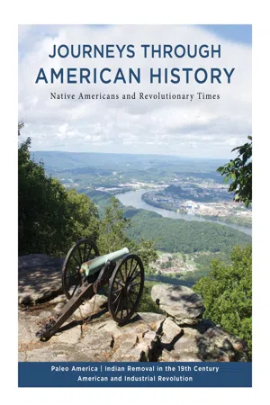
We cap off our day of discovery with an exhilarating excursion back into North Carolina on the gloriously scenic Cherohala Skyway. The majestic, tree-lined mountains and stunning panoramas take our breath away as the road carves through the landscape.
RAINY ROADS TO ROME
Today, we’ll test the theory that all roads do, in fact, lead to Rome—after all, our destination is Rome … Georgia. We begin our circuitous route with a leaden sky and a light fog, all harbingers of the day’s weather conditions to come. State Routes 2 and 52, taking us west from historic Ellijay, GA, turn out to be really curvy. The narrow, two-lane tarmac writhes back and forth as we gain altitude. This might be fun except for one thing: Rain is coming down in torrents, diminishing visibility to several yards. We pull off at the visitor center in Fort Mountain State Park to wait out the deluge; better safe than sorry.
By the time we reach the Chief Vann House State Historic Site in Chatsworth, sunlight is filtering through high clouds. Construction of this two-and-a-half-story Colonial-style brick home was completed in 1804. James Vann established the largest and most prosperous plantation in the Cherokee Nation. His well-to-do life, however, was cut short in 1809—and eventually his family’s holdings were later also lost when the Cherokee were forcibly removed from their homeland.
We travel to nearby Calhoun, which was once New Echota, GA, the capital of the Cherokee Nation and official starting point of the Trail of Tears. At the New Echota Historic Site, the original town layout has been re-plotted, and a number of buildings, including a council house, courthouse, print shop, residences, and general store, have been reconstructed. New reconstructions proceed as funds permit. All of the original buildings here were laid to waste, and the Cherokee lands redistributed to non-native settlers by lottery, once the Cherokee had been forced out.
In its day, New Echota represented the apex of Cherokee culture and government. But, unfortunately, Cherokee also committed acts of treachery against their fellow tribesmen here. A small minority of unofficial representatives of the Cherokee Nation signed the Treaty of New Echota with the US government on December 29, 1835. The treaty ceded all Cherokee territory in the southeast and formed the legal basis for their removal to Indian Territory. This act set in motion the Trail of Tears and bitter resentments toward the illegitimate group of signers, known as the Treaty Party. As we arrive at our hotel in Rome, I recall that violent revenge would be exacted on the Treaty Party in years to come.
We motor west along rural country lanes into Northern Alabama. Prior to removal, this area was also part of the Cherokee Nation. Signage periodically confirms that our route follows the historic Trail of Tears. At this point, however, it’s important to note that there was not a single trail, and the removal took place in two stages: the roundup and then the transport to Indian Territory. Soldiers arrived at Cherokee settlements and gave inhabitants little time to gather what few belongings they could carry. Then they marched them to makeshift holding forts, which offered little to no protection from the elements. Many died of exposure and diseases before ever starting the long trek to Indian Territory.
CHUGGING INTO CHATTANOOGA
The Trail of Tears transport phase actually occurred over several different routes, some of which involved conveyance by river for part of the distance and walking for the remainder. But most of the Cherokee walked or rode in wagons to their new homeland. The northern overland route, which is probably the most infamous, and the one most Cherokee followed, required them to walk around 1,200 miles with inadequate clothing, shelter, and food during one of the coldest winters on record.
Arriving in Fort Payne, AL, we turn north. There’s little reminder here today that the original Fort Payne was constructed by the Alabama militia in 1838 as one of the many internment camps for holding Cherokee during the roundup phase of Indian removal. After departure of the last group ...