- 128 pages
- English
- ePUB (mobile friendly)
- Available on iOS & Android
eBook - ePub
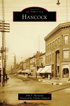
Hancock
About this book
Hancock is a 19th-century mining boomtown in the heart of Michigan's Copper Country.
Situated on the northern shore of Portage Lake, it grew into a regional center of shipping and commerce. Hancock's early residents were predominantly emigrants from Prussia, Ireland, and England (largely Cornwall) who came to work in area mines. Germans and French Canadians were also part of the diverse ethnic mix, and they were later joined by Finns, Scandinavians, and Italians. The harsh winter climate and geographic isolation, with limited means of transportation for roughly half the year, required a hardy citizenry. The pioneer inhabitants were resolute achievers, forging a community that with each generation grew less dependent on mining and its ancillary industries. Hancock became the Copper Country's first city in 1903 and remains Michigan's northernmost city to this day. It is also home to the only private university in Michigan's Upper Peninsula.
Information
One
EARLY MAPS

This portion of a November 1859 diagram by Quincy Mining Company agent Samuel W. Hill shows the village of Hancock as laid out by Hill earlier that year. Ravine, Tezcuco, and Reservation Streets run north and south. Water, Hancock, Quincy, and Franklin Streets run east and west. Reservation Street is so named because Quincy reserved all land east of it for its own use. (Library of Congress, HAER MICH, 31-HANC,1--1.)

This section of an 1873 American Oleograph Company print shows the core of a rebuilt Hancock following the devastating 1869 fire that claimed roughly three quarters of the town’s structures. Prominent in the foreground is the Quincy Mining Company’s stamp mill (labeled “7”), serviced by a tramway running from the mining operations on Quincy Hill. Arriving by boat and disembarking at Tezcuco Street was the common means of reaching the village. Notable buildings include the First Congregational Church (“A”), at the southwest corner of Hancock and Tezcuco Streets; the Methodist Episcopal Church (“B”), at the northeast corner of Hancock and Ravine Streets; St. Anne’s Catholic Church (“C”), at the northeast corner of Quincy and Ravine Streets; and the public school, near the east end of Franklin Street. St. Anne’s Catholic School (“10”) is at the southeast corner of Franklin and Ravine Streets, directly behind the church. (Library of Congress, HAER MICH,31-HANC,1--141.)

This segment of an 1881 lithograph by Beck and Pauli of Milwaukee, Wisconsin, details a bustling community and accurately represents the slope of the land moving north from Portage Lake. A wooden swing bridge connects Hancock to Houghton on the southern side of the waterway. The Mineral Range Railroad runs primarily between Hancock and Calumet to the north, as rail lines had not yet been added to the bridge. Mineral Range has several structures, including a depot and machine shop, at the base of Tezcuco Street. Hancock’s first fire hall (labeled “13”) sits at the end of Quincy Street, just east of Reservation Street. The public school (“E”), built in 1875, towers over Quincy Street near the upper left of the image. The newly erected St. Peter and St. Paul’s Evangelical Lutheran Church (“B”) is at the corner of Hancock and Montezuma Streets, and the former church, adjacent to the east, is used as a school. (Library of Congress, HAER MICH,31-HANC,1--142.)

This 1890 bird’s-eye view was published by B.H. Pierce & Company of Hancock. The bridge now includes tracks on the lower level, connecting Hancock to the south by rail. The Catholic parish, formerly known as St. Anne’s, has divided into two, with the Irish occupying St. Patrick’s Church (labeled “3”) in the center of town while the Germans constructed St. Joseph’s Church (“2”) a couple of blocks down the street, just west of the public high school. Parish schools are adjacent to each church. The Finnish Evangelical Lutheran Church (“6”) is on Reservation Street, just to the west of the Quincy tramway. At this time, Quincy was in the process of moving their copper-stamping operation to a new mill on Torch Lake, six miles to the east, in response to concerns over the amount of stamp sand being dumped into Portage Lake. (Library of Congress, HAER MICH,31-HANC,1--143.)
Two
THE FIRE OF 1869

This mid-1860s view looking north across Portage Lake shows a densely built Hancock prior to the 1869 fire. From left to right are Tezcuco Street, Reservation Street, and Quincy’s tramway running downhill to their stamp mill on the waterfront. (Houghton County Historical Society.)

Early in the morning of Sunday, April 11, 1869, a fire began in a saloon following an all-night dance. The saloon was in the northwest quarter of town adjacent to St. Anne’s Catholic Church (far right). The fire spread southeast, destroying roughly three-fourths of the community. Directly behind the church are the St. Anne’s rectory and school. (Michigan Technological University Archives and Copper Country Historical Collections.)

Taken from a similar vantage point to that above, this photograph shows a rebuilt Hancock around 1870, including the First Congregational Church, facing north at the corner of Hancock and Tezcuco Streets. (Michigan Technological University Archives and Copper Country Historical Collections.)

This image depicts the east side of Hancock shortly after the fire. The building standing alone to the left is the public school on Franklin Street. The village’s fire equipment and water supply were woefully inadequate to contain the blaze, which lasted about six hours and consumed some 150 structures. (Michigan Technological University Archives and Copper Country Historical Collections.)

The Franklin Street School is in the foreground of this view. The long building on the waterfront is Quincy’s stamp mill. Firefighters from Houghton attempted to cross the frozen lake and lend aid, but many turned back, fearing that burning embers carried by the wind might spread the fire to their community. (Michigan Technological University Archives and Copper Country Historical Collections.)

This view looks south down Tezcuco Street following the fire. The L-shaped boardinghouse to the left of the utility pole stood behind the First Congregational Church, which was destroyed. A newspaper account stated, “It was the most awful spectacle we ever witnessed. The flames roared like an approaching tornado, and crackled like the discharge of straggling volleys of small arms.” (Houghton County Historical Society.)

Later in 1869, Tezcuco Street and the rest of Hancock were busy with new construction. A large firefighting unit was soon formed, and the first dedicated fire hall was erected in 1875. (Houghton County Historical Society.)
Three
TEZCUCO STREET

Tezcuco Street was known as “Puffing Hill,” and this view from Quincy Street shows the vigorous climb from Portage Lake. On the far left is Joseph Wertin & Sons general store, which is part of a community arts center today. On the far right is Baer Bros. meat market, which burned down in 1923. Jacob Baer served as village president from 1893 to 1897. (Author’s collection.)

Opened at the corner of Hancock and Tez...
Table of contents
- Cover Page
- Title Page
- Copyright Page
- Dedication
- Table of Contents
- Foreword
- Acknowledgments
- Introduction
- 1. Early Maps
- 2. The Fire of 1869
- 3. Tezcuco Street
- 4. Quincy Street
- 5. Churches and Schools
- 6. Bridges and Portage Lake
- 7. Mining Activity
- 8. Suomi College and Finnish American Publishing
- 9. Around Town
- Suggested Readings
- Local Historical Organizations
Frequently asked questions
Yes, you can cancel anytime from the Subscription tab in your account settings on the Perlego website. Your subscription will stay active until the end of your current billing period. Learn how to cancel your subscription
No, books cannot be downloaded as external files, such as PDFs, for use outside of Perlego. However, you can download books within the Perlego app for offline reading on mobile or tablet. Learn how to download books offline
Perlego offers two plans: Essential and Complete
- Essential is ideal for learners and professionals who enjoy exploring a wide range of subjects. Access the Essential Library with 800,000+ trusted titles and best-sellers across business, personal growth, and the humanities. Includes unlimited reading time and Standard Read Aloud voice.
- Complete: Perfect for advanced learners and researchers needing full, unrestricted access. Unlock 1.4M+ books across hundreds of subjects, including academic and specialized titles. The Complete Plan also includes advanced features like Premium Read Aloud and Research Assistant.
We are an online textbook subscription service, where you can get access to an entire online library for less than the price of a single book per month. With over 1 million books across 990+ topics, we’ve got you covered! Learn about our mission
Look out for the read-aloud symbol on your next book to see if you can listen to it. The read-aloud tool reads text aloud for you, highlighting the text as it is being read. You can pause it, speed it up and slow it down. Learn more about Read Aloud
Yes! You can use the Perlego app on both iOS and Android devices to read anytime, anywhere — even offline. Perfect for commutes or when you’re on the go.
Please note we cannot support devices running on iOS 13 and Android 7 or earlier. Learn more about using the app
Please note we cannot support devices running on iOS 13 and Android 7 or earlier. Learn more about using the app
Yes, you can access Hancock by John S. Haeussler in PDF and/or ePUB format, as well as other popular books in History & North American History. We have over one million books available in our catalogue for you to explore.