- 192 pages
- English
- ePUB (mobile friendly)
- Available on iOS & Android
eBook - ePub
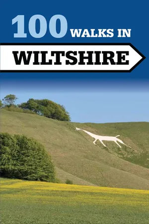
100 Walks in Wiltshire
About this book
Wiltshire is a walker's paradise with many unexpected delights. With half the county designated as an Area of Outstanding Natural Beauty, this new collection of 100 walks of up to 12 miles will help you explore the best of this beautiful, mystical and timeless landscape. The Crowood Walking Guides give detailed and accurate route descriptions of the walks, with full-colour mapping sourced from the Ordnance Survey. Details of where to park and where to eat and drink are included and also places of interest to see along the way. Easy-to-follow directions are given along with clear and detailed route maps. Illustrated with 87 route maps.
Tools to learn more effectively

Saving Books

Keyword Search

Annotating Text

Listen to it instead
Information
WALK
1 |
Malmesbury |
START Station Yard (long stay car park), Malmesbury SN16 9JT, GR ST931875
DISTANCE 2¼ miles (3.5km)
SUMMARY Urban walk
MAPS OS Landranger 173 Swindon & Devizes; OS Explorer 168 Stroud, Tetbury & Malmesbury
WHERE TO EAT AND DRINK Numerous places in Malmesbury
A gentle stroll along the picturesque streets and water meadows of England’s oldest borough.
1 Cross the river by the bridge at the end of the car park and go up the steps in front of you, bearing left as soon as you begin to climb. The steps lead to the remarkable Abbey House Gardens and Malmesbury Abbey, which you will want to explore in detail. Equally interesting is the picturesque wisteria-clad hotel called The Old Bell beside the Abbey. Leave the Abbey through the south door and go towards the Tolsey, or gatehouse, directly in front of you. Halfway along to the left of the path you may wish to search for the intriguing gravestone to the memory of Hannah Twynnoy. Go through the Tolsey and, passing the old Market Cross, cross Oxford St and head down the High St, bearing left downhill into Lower High St, from where a fine view of the Almshouses can be appreciated.
2 Join the pavement on the right of the road and just before St John’s Bridge go through a gateway on the right and then turn left over a footbridge above the Avon. As you cross the footbridge, you will see the town’s silk mills, now converted into flats, to your left. Walk a few yards along the road before turning right through a gate into the watermeadow. Keeping the river on your right, proceed along the path for about half a mile, then cross a stone footbridge over a small stream. Turn to the right and go through a squeeze stile and along an embankment, then over a second and larger footbridge to the left.

3 Go along the path between two stone walls then turn right up the sloping path marked ‘Burnivale’. Turn left up the stone steps and follow the path to reach Gloucester St. Turn right to return to the Market Cross, then go straight on along Oxford St and turn right into Market La to reach Cross Hayes. Take the road in the opposite corner of the square. This is Silver St, so called because it once contained Malmesbury’s mint. After a few yards the road gives way to gentle steps, until you reach the bottom of the hill, whereupon you turn left over the bridge and past the bowling green. At the edge of the green, turn left again, down a gravel footpath. This will take you first over a sluice-cum-footbridge and then over a stile into watermeadows.
4 After a further hundred yards or so, by an old derelict railway line, you will come to another stile. Go over this, keeping between the two courses of the River Avon (the Tetbury branch is alternatively known as the River Ingleburn). Eventually you reach a stile by a road going over a bridge.
5 Cross the road and take the path immediately in front of the pub car park. Continue along this path, with the river on your left, through the Conygre Mead Nature Reserve to return to the car park.
Points of interest

Abbey House: This fine building was erected in the sixteenth century after William Stumpe had bought the Abbey and its lands after the Dissolution of the Monasteries in the time of Henry VIII. He paid only £1,516 for the entire Abbey property. William Stumpe was a wealthy local clothier who set up his factory inside the Abbey itself, though two years later he gave the nave to the town for use as a church. Abbey House Gardens have been developed since 1994 and are open 11am–5.30pm daily 21 Mar–end Oct.
Malmesbury Abbey: The first abbey was founded by St Aldhelm in the seventh century, though what we now see was mainly built in the twelfth century. Restoration work was carried out in the fourteenth century when a mighty tower was added, standing some 445ft high. This collapsed in the fifteenth century, destroying much of the eastern end of the church, but nevertheless the abbey is still one of the finest examples of Norman ecclesiastical architecture anywhere in the country. Notice particularly the magnificent twelfth-century carved porch, the tomb of King Ethelstan, the first Saxon king to rule the whole of England, who died in 940, and the mysterious little watching loft on the south wall. When the Parvise is open, some fascinating manuscripts, coins and documents are on view. In the eleventh century a monk at the Abbey, one Elmer, jumped off the tower wearing home-made wings in the vain belief that he had discovered the secret of man-powered flight. One story has him gliding over 200yds before he crashed. He broke both his legs and was crippled for the rest of his life. Elmer’s flight is today commemorated in a stained-glass window.
The Old Bell: It is believed that the inn may well have once been part of a Saxon castle which is known to have been demolished in 1216. Since the site was then used for the Abbey guesthouse, part of the inn’s walls are thought to be from that building.
Tolsey: This gatehouse guards the entrance to the Abbey grounds and was possibly the town lock-up. The Apostle’s Spoon, on the left as you leave the Abbey, is the oldest private house in the town.
Market Cross: Nearly 500 years old, the market cross was built, it is recorded, for poor market folks to stand dry when rain cometh!
High Street: The street once contained many public houses, almost all of which have now changed their use. The exception is the King’s Arms Hotel, reached via an archway into a courtyard. On the opposite side, The George Veterinary Hospital was once an eighteenth-century coaching inn.
Almshouses: A hospital was first founded on this site in the late thirteenth century by the Order of St John of Jerusalem. At the Dissolution of the Monasteries, the Order was banished and the buildings were later bought by the Capital Burgesses, who donated £10 a year for the provision of almshouses on the site. The old archway is all that remains from the original hospital building. The inscription above it records the Burgesses’ gift of £10.
Cross Hayes: The word Hayes means ‘common’ and this area was the market place for the town from Saxon times until quite recently. At Queen Victoria’s Jubilee the area was turned into an outdoor dining room for the whole town.
WALK
2 | Near the River Avon |
START Lower Woodford (north end), SP4 6NH, GR SU126353
DISTANCE 3 miles (5km)
SUMMARY Easy
MAPS OS Landranger 184 Salisbury & The Plain; OS Explorer 130 Salisbury & Stonehenge
WHERE TO EAT AND DRINK The Wheatsheaf Inn, Lower Woodford, T01722-782203
An easy walk through rich water meadows with fine views over Salisbury Plain.
START At the northern end of the village turn up the side road opposite a long thatched wall. Just before you reach the farm buildings, turn left along a footpath and follow it between fields and past a wood on the left. Continue across the next field to the road.
1 Follow the road to the junction with Wilton Rd, where you turn left down a private, gated road through the estate of Little Durnford Manor. You will eventually emerge through a door in a wall. Cross the road and continue up the lane by a wood.
2 Turn left at the crossroads by Keeper’s Cottage and continue along the bridleway to a copse. Go ahead through the trees and turn left just before a gate. Follow the footpath down the hill, keeping the fence on your right. The path ends beside a farmyard and emerges onto the road.
3 Turn left and then immediately right down a lane, marked as a bridleway, by the post box. This crosses three bridges on the way back to Lower Woodford and the starting ...
Table of contents
- Cover Page
- Title Page
- Copyright Page
- Contents
- How to Use this Book
- Walks Locator
- Walk 1 Malmesbury
- Walk 2 Near the River Avon
- Walk 3 Oare & Martinsell Hill
- Walk 4 Drew’s Pond & Potterne Woods
- Walk 5 Wardour Castle & Woods
- Walk 6 Easton Grey to Pinkney
- Walk 7 Highworth to Sevenhampton
- Walk 8 The Winterbournes
- Walk 9 Great Bedwyn & the Brails
- Walk 10 Ramsbury & Littlecote
- Walk 11 Around Wilton
- Walks 12/13/14 Coate Water
- Walks 15/16 Cherhill Down
- Walk 17 Mildenhall & the River Kennet
- Walk 18 Westwood & Farleigh Hungerford
- Walk 19 Bremhill & Maud Heath’s Highway
- Walk 20 Bradford-on-Avon to Avoncliff
- Walk 21 A Flight of Locks Near Devizes
- Walk 22 Boyton Down & Sherrington
- Walk 23 Buttermere & Inkpen Hill
- Walk 24 Around Tollard Royal
- Walk 25 Luckington
- Walk 26 Holt & Great Chalfield
- Walk 27 Around Dundas Aqueduct
- Walk 28 Hilperton & Whaddon
- Walk 29 South Wraxall & Monkton Farleigh
- Walk 30 Chute Causeway
- Walks 31/32 Cherhill to Compton Bassett
- Walk 33 Ludgershall Castle & Collingbourne Wood
- Walk 34 Gasper Mill
- Walk 35 Salisbury Plain & the Lavingtons
- Walk 36 Around Winterbourne Bassett
- Walk 37 Pigs Hill & Marridge Hill
- Walk 38 Wootton Bassett to Greenhill
- Walk 39 Whiteshard Bottom
- Walk 40 Middle Hill
- Walk 41 Roundway & Heddington
- Walk 42 Stanton Fitzwarren to Castle Hill
- Walk 43 Wroughton & Clouts Wood
- Walk 44 Sugar Hill & Liddington
- Walk 45 Windmill Hill
- Walk 46 Around Broad Hinton
- Walk 47 Lacock & Bowden Park
- Walk 48 Somerford Common & Braydon Wood
- Walk 49 Castle Combe & Long Dean
- Walk 50 Foxholes
- Walk 51 Bishops Cannings & Wansdyke
- Walk 52 Old Sarum & Lower Woodford
- Walks 53/54 Rockley
- Walk 55 Biddestone & Slaughterford
- Walk 56 Around Brinkworth
- Walk 57 Wootton Bassett & Lydiard Tregoze
- Walks 58/59 Swindon Old Town
- Walk 60 Clyffe Pypard & Broadtown Hill
- Walk 61 Around Milton Lilbourne
- Walk 62 Wootton Bassett to Bushey Vowley
- Walk 63 Whitesheet Hill
- Walk 64 Bidcombe Down
- Walks 65/66 Bishopstone
- Walk 67 Shaston Drove
- Walk 68 Bradford-on-Avon & Iford
- Walk 69 North Bradley & West Ashton
- Walk 70 Bratton & Edington
- Walk 71 Barbury Castle, Burderop Down & Smeathe’s Ridge
- Walk 72 All Cannings & Stanton St Bernard
- Walk 73 Bradenstoke & Great Wood
- Walk 74 Ancient Wiltshire
- Walk 75 Around Crofton
- Walk 76 Broad Chalke & the Ebble Valley
- Walk 77 Great Wishford
- Walk 78 Purton & Ringsbury Camp
- Walk 79 Aldbourne to Hilldrop
- Walks 80/81 Lockeridge
- Walk 82 Upavon & North Newnton
- Walks 83/84/85 Hackpen Hill
- Walk 86 Dauntsey & Great Somerford
- Walk 87 Around Bishops Cannings
- Walk 88 Kingston Deverill
- Walk 89 Devizes, Seend & Poulshot
- Walk 90 Around Ashton Keynes
- Walks 91/92 Barbury Castle
- Walks 93/94 Chiseldon
- Walk 95 Pewsey Wharf to Knap Hill
- Walks 96/97 Aldbourne
- Walks 98/99 Bishops Cannings & Wansdyke
- Walk 100 Around Sutton Veny
Frequently asked questions
Yes, you can cancel anytime from the Subscription tab in your account settings on the Perlego website. Your subscription will stay active until the end of your current billing period. Learn how to cancel your subscription
No, books cannot be downloaded as external files, such as PDFs, for use outside of Perlego. However, you can download books within the Perlego app for offline reading on mobile or tablet. Learn how to download books offline
Perlego offers two plans: Essential and Complete
- Essential is ideal for learners and professionals who enjoy exploring a wide range of subjects. Access the Essential Library with 800,000+ trusted titles and best-sellers across business, personal growth, and the humanities. Includes unlimited reading time and Standard Read Aloud voice.
- Complete: Perfect for advanced learners and researchers needing full, unrestricted access. Unlock 1.4M+ books across hundreds of subjects, including academic and specialized titles. The Complete Plan also includes advanced features like Premium Read Aloud and Research Assistant.
We are an online textbook subscription service, where you can get access to an entire online library for less than the price of a single book per month. With over 1 million books across 990+ topics, we’ve got you covered! Learn about our mission
Look out for the read-aloud symbol on your next book to see if you can listen to it. The read-aloud tool reads text aloud for you, highlighting the text as it is being read. You can pause it, speed it up and slow it down. Learn more about Read Aloud
Yes! You can use the Perlego app on both iOS and Android devices to read anytime, anywhere — even offline. Perfect for commutes or when you’re on the go.
Please note we cannot support devices running on iOS 13 and Android 7 or earlier. Learn more about using the app
Please note we cannot support devices running on iOS 13 and Android 7 or earlier. Learn more about using the app
Yes, you can access 100 Walks in Wiltshire by Tim Jollands in PDF and/or ePUB format, as well as other popular books in Personal Development & Travel. We have over one million books available in our catalogue for you to explore.