This book leads the modern traveller along seven medieval pilgrim routes of Britain (those with historic origins, rather than modern constructs), taking in world-famous sites such as Canterbury and Lindisfarne in addition to out-of-the-way locations along paths not so widely travelled. Each route guides pilgrims on a journey of discovery. Illustratedthroughoutwith photographs and colour maps, and written by a renowned expert on pilgrimage, Pilgrim Routes of the British Islesprovides clear maps and informative commentary on the history of the most significant landscapes, shrines, art and architecture. Although it offers some fresh walking ideas, primary consideration is given to understanding the history, significance and practices surrounding the pilgrim routes and sites of Britain, helping you to follow in the footsteps of our forebears and gain invaluable insights into their medieval world. Itwill be of great interest to walkers and historians alike. Illustrated with 80 colour photos and 12 maps.
- 300 pages
- English
- ePUB (mobile friendly)
- Available on iOS & Android
eBook - ePub
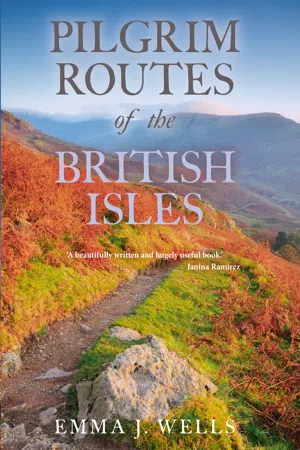
Pilgrim Routes of the British Isles
About this book
Trusted by 375,005 students
Access to over 1.5 million titles for a fair monthly price.
Study more efficiently using our study tools.
Information
Topic
Theology & ReligionSubtopic
Christian Rituals & PracticeCHAPTER ONE
St Andrew’s Way
This Scottish pilgrimage commemorating the patron saint of Scotland, and the town in which his relics were contained, can very much be classified as a revived version of a 1,000-year-old route. Recent campaigns have sought to revive interest in the Christian origins and tradition of the town of St Andrews in an attempt to turn it back into a major centre of pilgrimage rivalling that of Santiago in Spain. With the support of Fife Council and its museum, the Cathedral Project began a series of exhibitions and walks which sought to stimulate knowledge and promote the embedded history of their town. This began in September 2000 with a four-day pilgrimage from St Andrews to Edinburgh, following, as much as was possible, the medieval route to North Queensferry but going in the reverse direction. This walk revived great interest in the authenticity and history of the route, and led to Fife Council reopening and officially waymarking the main medieval pathways across the region so modern-day pilgrims could walk in the footsteps of their forebears.

Map of St Andrew’s Way. JIM BRIGHTMAN
The Way of St Andrew was officially launched in July 2012, and is perhaps one of the most ‘authentic’ routes included in this book. In order to fully experience the route, an official badge may be purchased to show your pilgrim status, on your knapsack, or on your clothes. The current design features the scallop shell emblem upon the Scottish flag.
The History of St Andrew
The route is 71 miles (115km) in distance, and follows a modern restoration of a medieval pilgrimage walk from central Edinburgh across the Forth Road Bridge to St Andrews. The desire to revive the historical pilgrim links at St Andrews is not surprising given that the majority of the town’s development derived from its religious associations. Firstly, the cathedral of St Andrews was built to house the relics of the saint as the town became the focus of pilgrimage, and therefore a site that was fitting for his growing popularity was demanded. As such, the original name of the town was changed from Kilrymont (or ‘Church on the King’s Hill’) – named after St Kenneth, who was thought to have established a site for the church in c.570CE – to St Andrews, after the relics were brought to the town in the Middle Ages.
According to legend, in 345CE St Regulus or Rule had a vision whereby he was told to bring the relics of St Andrew (of which he was the guardian) from Patras in Greece and move them to Constantinople, to the outer limits of the Empire; it is said he was shipwrecked at Kilrymont. Another legend states that Bishop Acca came north from Northumbria in around 746CE bearing the relics of the apostle Andrew. The more likely story is that the relics were brought to the town by the Northumbrians in an effort to promote St Andrew over St Columba and, in doing so, lessening the influence of the Gaels.
Although the current cathedral of St Andrews dates from the medieval period, there were previous churches built on this site. The relics – an arm bone, three fingers, a tooth and a kneecap – were first kept in a shrine in the Romanesque St Rule’s church of which the tower and choir are still extant. However, a more ancient Christian site lies to the east, outside the cathedral precinct wall, between it and the sea. Known as St Mary on the Rock, the cruciform church’s foundations can still be made out in the ground. The earthworks that remain date back to the twelfth century, and were only uncovered in 1860 after being lost for centuries – yet the site and church date back to the eighth century. Fragments of crosses discovered there, now in St Andrews Museum, suggest the church may have been built for the Culdee community, who were a group of Celtic monks ousted by Augustinian canons who took residence there when St Andrews Cathedral was built.
The cathedral, now ruined, was founded in 1162, completed in 1318, and consecrated in the presence of King Robert the Bruce. Forty feet (12m) longer than any other cathedral in Western Europe of great pilgrimage status, it was also the largest building in medieval Scotland, providing more accommodation than was afforded by the older church of St Rule. As such, it dictated the layout of the town in various ways. When the Picts and Gaels united to form the Kingdom of Scotland under Kenneth MacAlpin in the ninth century, St Andrews Cathedral became the focus of pilgrim routes from Scotland and abroad. This was aided by Queen Margaret in the eleventh century, who developed the route of pilgrimage from South Scotland to St Andrews when she established the ferry from South to North Queensferry, giving her name to the settlement and establishing various pilgrim hospices there.
It is important to note here that in the medieval period there was no distinction between a hostel, a hospice and a hospital. This arose from the monastic hospitium or, more generally, the hospitalis domus – a place for guests – being shortened to hospitale, hence the modern term. They were ultimately based on the duty to support travellers and the sick. Thus, their role was to provide care and assistance to pilgrims, which was not necessarily medical. It was not until much later that the limited medical meaning was given to the term we use today.
When Queen Margaret died in 1093 her body was laid to rest in Dunfermline Abbey and her tomb became a site of pilgrimage itself – in fact, upon her canonization in 1251, the Pope declared that the Queen’s shrine should be determined as a station along the route. This declaration was specifically designed, however, to carry the increasing number of pilgrims from the south to St Andrews. Those journeying from the west took a ferry across the River Tay, while those coming from the north had to cross the Tay estuary via Dundee and Tayport. The latter two routes had to converge where the modern village of Guardbridge is now sited (the clue is in the name, as many translations note the location origins as the last hospice station where pilgrims would assemble before travelling to St Andrews in procession) in order to cross the River Eden, which lies 5 miles (8km) north of St Andrews.
The pilgrim population of St Andrews had become so enormous by the fifteenth century that, upon arrival, pilgrims had to be taken to a holding station on the outskirts of the town. They then made their way towards the cathedral down South Street. After venerating at the relics, they would finally proceed in a one-way system up North Street. The layout of the town centre thus derives from the need to contain these grand pilgrim processions along the streets to the shrine, and a major part of the centre was used to serve the needs of the pilgrim trade – along Market Street, between North Street and South Street, traders and shops sold badges, souvenirs and provisions.
The main digression from this original route arises when considering how one journeys from A to B. While the modern route is fairly close to one of the initial tracks, the revised version accounts for large and busy roads, and has to find alternative routes for safety purposes. The Great North Road is joined near Keltybridge but the medieval routes are either followed via their modern counterparts or simply in the general direction of where they were originally located. In addition, the Forth Bridges are part of the current route to Queensferry, but medieval pilgrims would have had to cross the river by boat. They would have taken one of two ferries: an eastern crossing from North Berwick to Earlsferry, or a western route from Queensferry to North Queensferry, as established by Queen Margaret. The ferries lasted until 1964 when the bridge was opened.
An Overview of the Route
Starting at either St Mary’s Roman Catholic Cathedral or the twelfth-century High Kirk of St Giles, the route descends down through Edinburgh to the sixteenth-century Cramond Brig. It then follows the shore of the Forth estuary to reach South Queensferry and across to North Queensferry.
However, there are two possible routes for this pilgrimage: one takes you from North Queensferry, across country towards Loch Leven and then east, and the second, modern route, heads straight towards Kirkcaldy and up to St Andrews. The latter route is covered in this chapter, as it is the current way authorized and most recently created (partly due to safety); however, a summary of the inland route is provided below as it is an interesting alternative, providing stops at many important historic sites.
INLAND ROUTE
After crossing the Forth Road Bridge into North Queensferry, the route heads out into the country and across several hills, including Muckle Hill. Rosyth is the next place to be encountered, then on to Dunfermline by the banks of Towere Byrn, and up past the ruins of Queen Margaret and King Malcolm Canmore’s house. From there, the route passes through Kingseathill, and then over wooded Town Hill to Kingseat. The hamlet of Lassodie begins the next section of the route, which carries on round the east end of Loch Fitty before ending in the village of Keltybridge – the bridge here originally carried the main road north for the route, now the B996, but previously the former Great North Road, the line of which can be seen a few fields beyond.
Harren Hill is then traversed, followed by Benarty Hill, and a descent down to the top of Vane Hill: here you can overlook Loch Leven, where Mary, Queen of Scots was imprisoned on Castle Island in the 1560s – the island may be visited by a short detour.
The route follows the road, bypassing Loch Leven Sluice House, and on to Scotlandwell. It makes a long ascent towards Munduff Hill and across the plateau of the Lomond Hills, and then, between West Lomond and East Lomond, it drops down Maspie Den towards Falkland and its palace.
The next section begins on a flat level, along the River Eden until past Kingskettle; then from Balmalcolm, it ascends again to the slopes of Down Law and Cults Hill. Heading up to Coaltown of Burnturk the landscape is punctuated with mining history, and the views look out over the Eden Valley as you head out on the road to Chance Inn, Craigrothis. This section culminates at Ceres and its war memorial marking the Battle of Bannockburn.
The final section of the route passes over the old packhorse bridge in Ceres, and up towards and over Kininmouth Hill. It passes Arnsheen then Denhead, and on through Craigton Country Park by way of Lumbo Den, finally feeding down into the Lade Braes Walk and town.
This brings you into St Andrews. The town is entered via the ancient West Port from Lade Braes Walk, which follows the route of the Kinness Burn and up South Street towards the cathedral, where it ends.
THE MODERN COASTAL ROUTE
After crossing the Forth Road Bridge, the Way descends into North Queensferry where, directly underneath the railway bridge, it joins Fife Coastal Path. The signposted path hugs the Path and national bike route, continuing along this until the island of Inchcolm comes into sight. It then passes St Bridget’s church, carries along into the pretty fishing village of Aberdour, and down to the harbour. It then continues along the Fife Coastal Path and woodland tracts to the town of Burntisland.
Leaving Burntisland, the Way passes Kinghorn and carries on to Kirkcaldy. It then descends abruptly to the beach, and follows the signposted Fife Coastal Path to Lundin Links and Leven. Take the beach or the path to the village of Largo, and on to Largo Bay through dunes to Earlsferry.
After Earlsferry, the Way strikes north off the Fife Coastal Path, continues along quiet roads and tracks until Largo Ward, then to Radernie, where it is signposted to Cameron Reservoir. After the reservoir it passes through Denhead and the golf clubhouse at Craigtoun, before descending along the picturesque burn and forest track of Lumbo to St Andrews. It enters the town bypassing Lade Braes Walk to the east, following the route of the Kinness Burn and up South Street towards the cathedral, where it ends.
Addendum: Additional Routes
In addition to the primary Way, in 2013 two new popular routes were established. These were named St Columba’s Way, which runs from Iona to St Andrews, and St Duthac’s Way, from Aberdeen to St Andrews. These sit alongside additional startpoint locations including the Ladywell Way (from Motherwell), St Wilfrid’s Way from Hexham, St Duthac’s Way from Aberdeen, and St Margaret’s Way from Edinburgh. Further smaller extensions within the main route to St Andrews have also been created and subsequently revised, such as St Margaret’s Loop (North Queensferry to Dunfermline), Rosslyn Chapel Way (via Rosslyn Chapel), and St Margaret’s Elbow (Earlsferry via Crail).
Start of the Route: Edinburgh
The route begins at Eduardo Paolozzi’s giant foot of bronze at the top of Leith Walk by St Mary’s Roman Catholic Cathedral. The Manuscript of Monte Cassino, aka the ‘Big Foot’, is a three-piece sculpture outside St Mary’s. The sculpture is an allegory of a pilgrimage – the foot that travels, and the connecting ankle and hand receiving alms or hospitality.
ST MARY’S ROMAN CATHOLIC CATHEDRAL
St Mary’s is the Cathedral Church of the Archdiocese of St Andrews and Edinburgh. Bishop Hay, Vicar Apostolic for the Lowland District, chose the site in 1801. After his Chapel in Blackfriars’ Wynd was burnt down by a mob, he hoped the new site would b...
Table of contents
- Cover Page
- Title Page
- Contents
- Acknowledgements
- Dedication
- Preface
- Timeline of Architectural Styles and Periods
- Introduction: A History of Pilgrimage
- Chapter One St Andrew’s Way
- Chapter Two St Cuthbert’s Way
- Chapter Three The North Wales Pilgrim’s Way (Holywell to Bardsey Island)
- Chapter Four Our Lady of Caversham Pilgrimage Walk
- Chapter Five The Pilgrims’ Way (beginning as St Swithun’s Way)
- Chapter Six The Saints’ Way, or Forth An Syns
- Chapter Seven The Pilgrims’ Trail (Hampshire to Normandy)
- Postscript
- Further Reading
- Cartographic Information for Routes
- Appendix: Travel Information for Overseas Routes
- Index
Frequently asked questions
Yes, you can cancel anytime from the Subscription tab in your account settings on the Perlego website. Your subscription will stay active until the end of your current billing period. Learn how to cancel your subscription
No, books cannot be downloaded as external files, such as PDFs, for use outside of Perlego. However, you can download books within the Perlego app for offline reading on mobile or tablet. Learn how to download books offline
Perlego offers two plans: Essential and Complete
- Essential is ideal for learners and professionals who enjoy exploring a wide range of subjects. Access the Essential Library with 800,000+ trusted titles and best-sellers across business, personal growth, and the humanities. Includes unlimited reading time and Standard Read Aloud voice.
- Complete: Perfect for advanced learners and researchers needing full, unrestricted access. Unlock 1.5M+ books across hundreds of subjects, including academic and specialized titles. The Complete Plan also includes advanced features like Premium Read Aloud and Research Assistant.
We are an online textbook subscription service, where you can get access to an entire online library for less than the price of a single book per month. With over 1.5 million books across 990+ topics, we’ve got you covered! Learn about our mission
Look out for the read-aloud symbol on your next book to see if you can listen to it. The read-aloud tool reads text aloud for you, highlighting the text as it is being read. You can pause it, speed it up and slow it down. Learn more about Read Aloud
Yes! You can use the Perlego app on both iOS and Android devices to read anytime, anywhere — even offline. Perfect for commutes or when you’re on the go.
Please note we cannot support devices running on iOS 13 and Android 7 or earlier. Learn more about using the app
Please note we cannot support devices running on iOS 13 and Android 7 or earlier. Learn more about using the app
Yes, you can access Pilgrim Routes of the British Isles by Emma J Wells in PDF and/or ePUB format, as well as other popular books in Theology & Religion & Christian Rituals & Practice. We have over 1.5 million books available in our catalogue for you to explore.