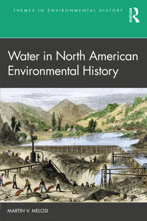
Water in North American Environmental History offers 25 cases studies that explore the range of uses and perceptions of water throughout Canadian, Mexican, and United States history.
Water has served a myriad of purposes historically as human sustenance, agricultural irrigation, sanitation, fire protection, military defense, power generation, transportation, and much more. Water and its uses provide an excellent entrée into the study of humans and the environment, not only because water is a vital resource for life, but also because water as a medium is so intimately woven into the everyday experiences of humans and into society's economic, political, and social fabric. A North American perspective is not representative of the world's water use, but it is an area with a linked history and many overlapping human and environmental features and concerns. With a continental perspective, the book explores many disparate topics without being confined to the history and experiences of just one country. The chapters are short, but descriptive, and departure points for what they tell us about the human experience in dealing with water and the environmental implications of water use. The text leads students to consider water in relation to society, and to the past.
The book will be of interest to students of environmental history, geography, and the environmental sciences.
Trusted by 375,005 students
Access to over 1.5 million titles for a fair monthly price.
In October 2021, sci-fi fans were ecstatic when Warner Bros. Pictures and HBO released the latest iteration of Dune. The film was based on the 1965 science fiction novel written by Frank Herbert. The cult classic focuses on Arrakis, the desert planet, which holds the only source of the life-prolonging drug mélange—or spice—and controlling it becomes the central cause for galactic conflict. More importance for our purposes is that water is the most important resource to make life possible on the planet. The native population, the Fremen, have learned how to survive on Arrakis, and as we learn, will ultimately thrive there despite attempts by hostile forces to subjugate them. The Fremen's knowledge and respect for water become their secret weapon.
Indigenous peoples in North America going back thousands of years demonstrated remarkable abilities to survive in a variety of settings and environments, not as inhospitable as Arrakis, but unhospitable enough. Water proved to be key to that survival, especially in the creative ways that they relied on and utilized water. Obviously, fresh water was necessary for life. But the versatility of fresh and salt water to serve other purposes was graphically demonstrated by the three cultures under study: the Hohokam of the American Southwest, the Aztecs of the Valley of Mexico, and the Inuit of the Arctic Zone.
The Hohokam constructed a vast irrigation system—the first large-scale system in the United States—beginning in about 850 CE along the convergence of the Gila, Verde, and Salt rivers in modern-day Arizona covering about 100,000 acres. Their elaborate technical system was the basis for an enduring society that shaped its environment on a scale unknown before. While some details of how the Hohokam culture collapsed are not known, some of their creative technical legacy was passed along to others and material remnants of their system imprinted in Arizona soil.
The Aztecs founded their capital city of Tenochtitlan on an island near the western swamps of Lake Texcoco in the Valley of Mexico in 1345 CE. Building their capital city on watery swampland may have seemed unrealistic, but the water barrier that it provided protected the Aztec from their enemies, and helped the city become a central base for regional power as well as for trade and farming. Without drayage animals or wheeled vehicles, the Aztecs utilized canoes and rafts to move people and goods within the city and out into the periphery. They irrigated and employed chinampa (a raised field or garden) agricultural techniques to grow crops. We know about the conquest of the Aztecs by the Spanish, who employed tools and weapons not known or anticipated by the Aztecs when they built their defenses. Yet Tenochtitlan was a testament to a multi-faceted understanding of the value of water.
The Inuit carved out a successful lifestyle for about 4,000 years or more in the desolate and hostile Arctic Climate Zone in Greenland and in the northernmost parts of the Eurasian and North American continents. Like the Hohokam and the Aztec, water was an essential element of Inuit culture. In their case, however, they learned how to deal with water in a solid form as ice and snow. Their knowledge of sea ice, weather conditions, ice-covered terrain, and the habits of fish and wildlife led to successful adaptation to an environment that white explorers found too threatening. It remains to be seen to what degree the impacts of climate change will undermine Inuit adaptation to the evolving Arctic, or to what degree the Inuit can help us find sustainable ways to live in a world facing threatening environmental conditions. Inuit Tapiriit Kanatami'S (the national representative organization for the 65,000 Inuit in Canada) National Inuit Climate Change Strategy (2019) provides information on the vision of Inuit leaders for combatting climate change. See also Zoltan Grossman and Alan Parker's edited volume, Asserting Native Resilience: Pacific Rim Indigenous Natives Face the Climate Crisis (2012) for examples of how other indigenous peoples are confronting the climate crisis.
Each story is fascinating. Each story is unique. The common element is the way these cultures adapted to their surroundings—desert, high plains, and arctic—utilizing water as a central component in their growth and survival. The stories also are suggestive of a variety of themes for further exploration. How do societies respond to aridity and drought, and with what tools or actions? Georgina Endfield takes on that issue in Climate and Society in Colonial Mexico (2008). In all the water episodes in the book, the relationship between water and culture is vastly important. A good start is Terje Tvedt's nine volume A History of Water (2006–2016). Of course, looking at how other indigenous people acquired their water and how they used it makes for excellent comparisons among peoples. And, as colonialism came to the Americas, questions of indigenous water rights are critical.
1 The Hohokam: “The Canal Builders” of the American Southwest
DOI: 10.4324/9781003041627-3
Water meant survival for the Hohokam, and survival rested upon the establishment of an agricultural society dependent on irrigation on a large scale. Their canal system mainly in the Gila and Salt River Valleys covered more than 100,000 acres of mostly desert land in what is now primarily southern Arizona. The Hohokam set a standard for constructing large and complex irrigation networks using preindustrial technology with future implications for farming in the arid American West.
The sprawling city of Phoenix in Arizona's Valley of the Sun sits atop numerous sites of the Hohokam civilization that appeared along the convergence of the Gila, Verde, and Salt rivers from about 200 CE to 1450 CE. The name Hohokam likely came from the Pima meaning “those who vanished” given their ambiguous disappearance after 1450. Archeologists usually divide Hohokam history into four periods: Pioneer (200–775), Colonial (775–975), Sedentary (975–1150), and Classic (1150–1450). According to Marc Reisner in Cadillac Desert: The American West and Its Disappearing Water, the Hohokam established a civilization that “rivaled the Aztec, Inca, and Maya farther south” (Reisner, 1993, 256).
Figure1.1 Map of the Hohokam Area ca. 1350. Unknown author. Creative Commons Attribution-Share Alike 3.0. Wikimedia.
At first, the early desert cultivators planted crops on the fertile floodplain, and later descendants began diverting water into their fields through short and shallow canals. We now know that the Hohokam built a vast canal network and irrigated as much as 110,000 acres of desert land serving as many as 50,000 people. A Phoenix city engineer who mapped the irrigation system in the 1920s estimated that it was the largest tract of irrigated land in prehistoric North and South America. In addition, the Salt River Valley was the most populous and possibly the most agriculturally productive area in the American Southwest before 1500.
For our purposes, the story of the Hohokam is a tale of determined and talented people prevailing in an extremely hostile environment through its innovative capture of water. A difficult question to answer is whether they were attempting to subdue the natural world for survival, or trying to find a way to adapt to it?
Hohokam society existed within the Phoenix Basin in the extraordinarily hot and dry Sonoran Desert, which extends from southwestern Arizona to southeastern California, and into northwestern Mexico. It is over 192,625 square miles in size. In the area in which the Hohokam's villages grew, the mean annual precipitation ranged between 6 and 15 inches—most often favoring the lower end of the scale. There were two distinct rainy seasons, one in the winter due to storms from the Pacific Ocean, and another in the summer with thunderstorms driven by subtropical forces from the south. Winter rains contributed extensive runoff and destructive flooding along the Salt River. Summer flooding tended to be smaller and less destructive. Temperatures in the summer could exceed 105 degrees Fahrenheit. The topography of this region consisted mainly of low-level slopes. At the basin floor the elevation is less than 985 feet, and about 3,937 feet at the summit of the McDowell Mountains to the northeast of the basin floor.
The Hohokam canal system was adapted to the weather conditions and to the desert terrain. In that area the Gila and Salt rivers received their water from highland watersheds. The Sonora Desert, however, provided many resources to sustain life. Hohokam communities could accumulate surpluses of storable food such as fruit from cacti and seeds from trees and shrubs. Although they were not a hunter culture, the Hohokam had access to deer, bighorn sheep, small game such as rabbits, fish, and mussels. Less abundant was wood for fires and building purposes, but ironwood, paloverde, mesquite, and cottonwood could be found along drainage areas. Ultimately, the Hohokam not only emerged as premier agriculturalists but supplemented farm production with foraging and short- and long-distance trade.
Over time, many Hohokam farming communities grew along the rivers. What archeologists call “sedentary villages” (places where subsistence economies were established) predate the Hohokam, as did farming along the desert rivers going back as early as 1200 BCE. But the scale of the Hohokam's village development and its farming was much greater. Early settlements in the Pioneer period concentrated along the major rivers but were scattered with individually built structures made of wood, clay, and brush and sat atop shallow pits. In the Colonial period, settlements were established on a more regional scale. They could be in upland areas to the south and west of current-day Tucson and Phoenix, and between Phoenix and Flagstaff. Villages in general varied greatly in size with some covering 15 square miles and containing more than 2,500 irrigated acres.
Snaketown, which was excavated in 1934–1935, was located about 30 miles southeast of Phoenix and may have had as many as 2,000 inhabitants. Snaketown apparently got its name because the heaps of garbage collected by the Hohokam became nesting places for rodents, which attracted rattlesnakes and other serpents looking for a meal. Snaketown was considered the cultural capital of the Hohokam and a production center. It is significant because it provided evidence of broad Mesoamerican (a cultural area including modern-day Mexico, Guatemala, Honduras, Belize, El Salvador, Nicaragua, and Costa Rica) influence in the region, such as the cultivation of maize and squash, the use of ballcourts for playing a Mesoamerican ballgame, and the presence of some common trade items, such as copper bells, pyrite mirrors, obsidian, and turquoise. Evidence of artifacts, such as red-on-buff pottery made in Snaketown have been found in surrounding communities. Indeed, the Hohokam may have originated in Mesoamerica and migrated northward into the American Southwest.
The central feature of the Hohokam's contributions to modernity was its hydraulic system, which was an engineering marvel matching that of the ancient Roman aqueducts. In the New World, it was the most massive irrigation system north of Peru. Complementing the Hohokam engineering prowess was their farming skills, including domesticating one or more varieties of maize (new to the Southwest), as well as growing cotton, beans, and squash.
Canals were constructed between 850 and 1450, reaching their greatest extent in the Classic period. About 150 miles of canals in all were in the Salt River Valley. The decision to irrigate the desert environment may have been one of necessity, especially when the Hohokam shifted to a sedentary, agricultural life with a larger population requiring more water to produce more crops. The Hohokam, however, practiced both canal irrigation expanding within the core communities and dry farming in some areas along the periphery of those communities.
In the spring, the Hohokam concentrated on maintaining and repairing their irrigation systems, while in the summer they spent time gathering wild plants and developing thousands of acres of farming fields. The canals often extended 16–22 miles in length. One canal unearthed in Mesa was 15 feet deep and 45 feet wide.
Overall, the Gila and Salt River valleys were ideal settings for a massive irrigation system because of their relatively flat topography. The main canals operated by gravity, achieving a gradient (drop) of only a few feet per mile. They were tapered to allow the water to flow at a constant rate. Such an approach lessened channel erosion from fast-moving water and from silting that occurred when water slows down. The canals transported water laterally as well as downstream for miles beyond the source, which increased coverage dramatically. The builders faced different problems on different rivers. Patterns of water discharge and the form of the channels depended on the amount of water available, sediment load, and the kind of streambed they encountered. In the Salt River Valley, for example, the topography allowed for the extending of canals as far as 8 miles from the river and in a variety of directions; along the Gila's main channel the canals had to parallel the river in most cases.
The canals themselves consisted of a variety of components. In places where the canal met the river, a weir was likely constructed. (A weir is a dam that reaches into part of a river). It raised the level of the water in the river and directed it into the canal. Inside the canal proper there was a headgate (water control gate) to regulate the amount of water entering the canal. The main canals were large at the juncture with the river, reduced in size as the water traveled to the fields. Distribution canals carried water from the main canal to the fields and were a way of controlling the water level in the canal by utilizing a variety of control features, such as diversion gates or control gates. Water control gates (tapons) were often located inside the main and distribution canals. The control mechanisms allowed the Hohokam to create a highly complex irrigation system.
Rather than relying on some sort of mechanized construction technology, the Hohokam depended on vast numbers of workers to build the canals—and without wheeled vehicles. The soil was loosened by hand with “stone hoes” (large wedge-shaped pieces of stone) and wooden digging sticks and removed in large baskets. Reconstruction of some of the canals suggests that more than 28 million cubic feet of dirt may have been removed to produce a major canal. “Leveling frames”—used in various preindustrial agrarian cultures—were used to establish gradients of the canals. Water may have been carried along the canal during construction to loosen the soil.
Figure1.2 A Restored Hohokam Canal in Arizona. MWyattB. Creative Commons Attribution-Share Alike 4.0. Wikimedia.
Canals and their component parts could not last forever once constructed. Flooding in particular, but regular usage, in general, could damage or destroy the canals, requiring repairs or rebuilding. One estimate suggested that individual canals seldom exceeded 50–100 years in life span, which was significant given the duration of Hohokam society in the Sonoran Desert. Also...
Table of contents
Cover
Half Title
Series Page
Title Page
Copyright Page
Dedication
Contents
Acknowledgments
Introduction
PART I: Indigenous Peoples Before Contact
PART II: Colonialization and Early-Industrial Growth
PART III: Expansionism and Western Settlement
PART IV: Commerce, Industry, and Urban Growth
PART V: The Mid-Twentieth Century
PART VI: The Postwar Years
PART VII: The New Ecology
PART VIII: Social Crises/Environmental Injustices
Postscript: Climate and Water
Index
Frequently asked questions
Yes, you can cancel anytime from the Subscription tab in your account settings on the Perlego website. Your subscription will stay active until the end of your current billing period. Learn how to cancel your subscription
No, books cannot be downloaded as external files, such as PDFs, for use outside of Perlego. However, you can download books within the Perlego app for offline reading on mobile or tablet. Learn how to download books offline
Perlego offers two plans: Essential and Complete
Essential is ideal for learners and professionals who enjoy exploring a wide range of subjects. Access the Essential Library with 800,000+ trusted titles and best-sellers across business, personal growth, and the humanities. Includes unlimited reading time and Standard Read Aloud voice.
Complete: Perfect for advanced learners and researchers needing full, unrestricted access. Unlock 1.5M+ books across hundreds of subjects, including academic and specialized titles. The Complete Plan also includes advanced features like Premium Read Aloud and Research Assistant.
Both plans are available with monthly, semester, or annual billing cycles.
We are an online textbook subscription service, where you can get access to an entire online library for less than the price of a single book per month. With over 1.5 million books across 990+ topics, we’ve got you covered! Learn about our mission
Look out for the read-aloud symbol on your next book to see if you can listen to it. The read-aloud tool reads text aloud for you, highlighting the text as it is being read. You can pause it, speed it up and slow it down. Learn more about Read Aloud
Yes! You can use the Perlego app on both iOS and Android devices to read anytime, anywhere — even offline. Perfect for commutes or when you’re on the go. Please note we cannot support devices running on iOS 13 and Android 7 or earlier. Learn more about using the app
Yes, you can access Water in North American Environmental History by Martin V. Melosi in PDF and/or ePUB format, as well as other popular books in History & Historical Geography. We have over 1.5 million books available in our catalogue for you to explore.