Bradley M. Gottfried’s The Maps of First Bull Run: An Atlas of the First Bull Run (Manassas) Campaign, including the Battle of Ball’s Bluff, June - October 1861 is the eagerly awaited companion volume to his bestselling The Maps of Gettysburg (2007, two editions, four printings), part of the ongoing Savas Beatie Atlas Series.The Maps of First Bull Run breaks down the entire operation (and related actions) into numerous map sets or “action-sections” enriched with more than fifty full-color original full-page maps. These cartographic originals bore down to the regimental and battery level and include the march to and from the battlefield and virtually every significant event in between. At least two—and as many as seventeen—maps accompany each “action-section.” Keyed to each piece of cartography is a full facing page of detailed text describing the units, personalities, movements, and combat (including quotes from eyewitnesses) depicted on the accompanying map, all of which make the story of First Bull Run come alive.This original presentation makes it easy for readers to quickly locate a map and text on virtually any portion of the campaign. Readers will maneuver with Confederate and Union armies in the Shenandoah Valley, march with General McDowell’s Federals to the plains of Manassas, and fight blow-by-blow through the battle up to its stunning climax on Henry House Hill and the final retreat from the battlefield all the way to Washington. The smaller but important Battle of Ball’s Bluff is also covered in the same fashion, as is the skirmish at Lewinsville. Serious students will appreciate the extensive and authoritative endnotes, bibliography, and complete orders of battle. They will also want to bring the book along on their trips to the battlefields.Perfect for the easy chair or for walking hallowed ground, The Maps of First Bull Run is a seminal work that, like his earlier Gettysburg study, belongs on the bookshelf of every serious and casual student of the Civil War.About the Author: Bradley M. Gottfried, Ph.D., is the President of the College of Southern Maryland. An avid Civil War historian, Dr. Gottfried is the author of five books, including Brigades of Gettysburg: The Union and Confederate Brigades at the Battle of Gettysburg (2002) and The Maps of Gettysburg (2007). He is currently working with co-editor Theodore P. Savas on a Gettysburg Campaign encyclopedia.
eBook - ePub
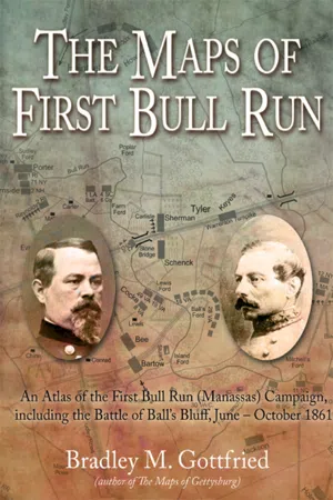
The Maps of First Bull Run
An Atlas of the First Bull Run (Manassas) Campaign, including the Battle of Ball's Bluff, June - October 1861
- 144 pages
- English
- ePUB (mobile friendly)
- Available on iOS & Android
eBook - ePub
The Maps of First Bull Run
An Atlas of the First Bull Run (Manassas) Campaign, including the Battle of Ball's Bluff, June - October 1861
About this book
Trusted by 375,005 students
Access to over 1.5 million titles for a fair monthly price.
Study more efficiently using our study tools.
Information
Subtopic
American Civil War HistoryIndex
HistoryTable of contents
- Cover Page
- Title Page
- Copyright Page
- Dedication Page
- Contents
- Introduction
- Acknowledgments
- Part 1: Maps of First Bull Run/Manassas
- Part 2: August—September 1861
- Part 3: Ball’s Bluff
- Appendix 1: First Bull Run (First Manassas) Order of Battle and Losses
- Appendix 2: Ball’s Bluff Order of Battle and Losses
- Notes
- Bibliography
Frequently asked questions
Yes, you can cancel anytime from the Subscription tab in your account settings on the Perlego website. Your subscription will stay active until the end of your current billing period. Learn how to cancel your subscription
No, books cannot be downloaded as external files, such as PDFs, for use outside of Perlego. However, you can download books within the Perlego app for offline reading on mobile or tablet. Learn how to download books offline
Perlego offers two plans: Essential and Complete
- Essential is ideal for learners and professionals who enjoy exploring a wide range of subjects. Access the Essential Library with 800,000+ trusted titles and best-sellers across business, personal growth, and the humanities. Includes unlimited reading time and Standard Read Aloud voice.
- Complete: Perfect for advanced learners and researchers needing full, unrestricted access. Unlock 1.5M+ books across hundreds of subjects, including academic and specialized titles. The Complete Plan also includes advanced features like Premium Read Aloud and Research Assistant.
We are an online textbook subscription service, where you can get access to an entire online library for less than the price of a single book per month. With over 1.5 million books across 990+ topics, we’ve got you covered! Learn about our mission
Look out for the read-aloud symbol on your next book to see if you can listen to it. The read-aloud tool reads text aloud for you, highlighting the text as it is being read. You can pause it, speed it up and slow it down. Learn more about Read Aloud
Yes! You can use the Perlego app on both iOS and Android devices to read anytime, anywhere — even offline. Perfect for commutes or when you’re on the go.
Please note we cannot support devices running on iOS 13 and Android 7 or earlier. Learn more about using the app
Please note we cannot support devices running on iOS 13 and Android 7 or earlier. Learn more about using the app
Yes, you can access The Maps of First Bull Run by Bradley M. Gottfried in PDF and/or ePUB format, as well as other popular books in History & American Civil War History. We have over 1.5 million books available in our catalogue for you to explore.