- 208 pages
- English
- ePUB (mobile friendly)
- Available on iOS & Android
eBook - ePub
About this book
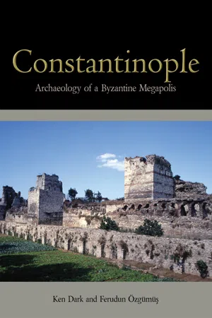
Istanbul, Europe's largest city, became an urban centre of exceptional size when it was chosen by Constantine the Great as a new Roman capital city. Named 'Constantinople' after him, the city has been studied through its rich textual sources and surviving buildings, but its archaeology remains relatively little known compared to other great urban centres of the ancient and medieval worlds. Constantinople: Archaeology of a Byzantine Megapolis is a major archaeological assessment of a key period in the development of this historic city. It uses material evidence, contemporary developments in urban archaeology and archaeological theory to explore over a thousand years of the city's development. Moving away from the scholarly emphasis on the monumental core or city defences, the volume investigates the inter-mural area between the fifth-century land walls and the Constantinian city wall – a zone which encompasses half of the walled area but which has received little archaeological attention. Utilizing data from a variety of sources, including the 'Istanbul Rescue Archaeology Project' created to record material threatened with destruction, the analysis proposes a new model of Byzantine Constantinople. A range of themes are explored including the social, economic and cognitive development, Byzantine perceptions of the city, the consequences of imperial ideology and the impact of 'self-organization' brought about by many minor decisions. Constantinople casts new light on the transformation of an ancient Roman capital to an Orthodox Christian holy city and will be of great importance to archaeologists and historians.
Information
Subtopic
Ancient HistoryIndex
Social SciencesCHAPTER 1
INTRODUCTION: CONSTANTINOPLE AND ISTANBUL
Constantinople (Figure 1), modern Istanbul, was from its inauguration on 11th May AD 330, central in almost every respect to the Eastern Roman, or Byzantine, Empire and its culture (for example, Berger 2005, 2009, 2010, 2011b). As Paul Magdalino has recently re-stated, the city was ‘the very essence of the state’ (Madgalino 2007, IV, 24), and it was ‘the status of Constantinople as the New Rome which made it legitimate for Byzantines to call themselves Romaioi and their state Romania’ (Magdalino 2007, XI, 151. See also Beck 1964). Moreover, both to the Byzantines themselves, and archaeologically compared with any contemporary urban centre, the city was a ‘megapolis’ (J. Harris 2007, 5; Sodini 2011), an urban centre of outstanding size and significance. Without doubt, this was the political, administrative and economic core of the entire empire (Kaplan 2006).
The city’s status as Rome’s political and religious successor was declared first in the Church Council of 381 (Magdalino 2007 X, 181). However, Constantinople was held by the Byzantines not only to be the ‘New Rome’, but also the ‘New Jerusalem’. From the seventh century it gained a further religious epithet, the ‘city of the Mother of God’, and was considered to be under the protection of the Virgin Mary (Limberis 1994; Mango 1996, 2000a; Vasilaki 2000, 2004). This sacral dimension of the city’s identity was enhanced by its many churches and unequalled collection of religious relics (Speck 1973, 1995, 2003; Berger 2009; Kalavrezou 1997; Nicholson 2005; Klein 2006, Ousterhout 2006). Even the sea surrounding the city could be seen by the Byzantines as having a liturgical meaning (Mayer 1998). This was, therefore, more than a capital, but perceived to be a Christian ‘holy city’, perhaps surpassed in this respect only in Byzantine thought by Jerusalem itself. As there seems to have been a close equivalence in the Byzantine mentality (see Magdalino 2007, XI, 151) between the secular and religious identities of the city and state, the archaeological study of Byzantine Constantinople is, in a sense, the study of the cognitive archaeology of the Byzantine Empire as a whole, as much as of its urban, social or economic archaeology (on these terms, see Dark 1995).
The international importance of the city endures, in part, today. At the start of the twenty-first century, Istanbul is still the largest city in Europe, with over 15 million (by some accounts, 20 million) inhabitants spread over 5712 square kilometres. It lies at the junction of the continents of Europe and Asia, on the Bosphorus. To the south of the city, is the Sea of Marmara, the north-eastern ‘corner’ of the Mediterranean, which the Bosphorus links with the Black Sea to the North (on the importance of this unique geographical position: Stichel 2000). On its eastern shore lies Chalcedon, once a suburb of Constantinople (Akürek 2002, 2004) and today again part of its urban sprawl. Among the notable features of the Marmara is a picturesque archipelago of nine small islands, the Princes’ Islands (or ‘Princely Isles’), long used as a retreat from the city’s heat and bustle (for archaeological work on the Princes’ Islands: Gregory 1991; Akürek and Ousterhout 2001; Özbayoğlu 1999, 2000, 2001a, b; Ousterhout and Akyürek 2002).
The shores of the Bosphorus – occupied by both monks and villagers in the Byzantine period (Eyice 1976; Ousterhout 1991; Batur 1996a) – are built-up with the suburbs and outlying districts of the modern city, but were still largely open until after World War II, when Istanbul began to expand rapidly. Even today there is much open land just west of Istanbul, where a large area of woodland (the ‘Belgrad Forest’) is located to the northwest of the built-up urban area. This so-called ‘Green Heart of the City’ feeds the city’s water supply, as it did in the Byzantine and Ottoman periods, when water was carried by a series of long-distance aqueducts (Çeçen 1996; Crow et al. 2008), supplementing the limited supplies from wells in and around the city and from the River Lycus, which ran diagonally across the western part of the Byzantine walled area. Cyril Mango (2001, 20) has noted that the river – called Bayrampaşa Deresi in Turkish – is even shown on a 1934 map of the city. Today, it is barely visible inside the city walls.
Beyond these were the towns and villages of Thrace (Glück 1920; Demangel 1945; Mansel 1951; Eyice 1969b, 1971, 1977–8; Kleiss 1974; Ötüken and Ousterhout 1989, 1995; Ousterhout 1985a, 1989, 1999; Bakirtzis 1989, 1994; Madzharov 1989; Bakirtzis and Triantaphylos 1988; Pralong 1988; Madzharov 1989, Rodley 1994, 291; Pekak 1996; Kountoura 1997; Fiat 2001; Crow 2002, 2009; Bauer and Klein 2006; Dinchev 2007; Külzer 2008, 2009; Crow et al. 2008; Crow and Turner 2009; Bakirtzis et al. 2011), such as the walled harbourside towns of Selymbria – perched high above the sea – and Heraclea (Perinthos). Although ongoing fieldwork (notably by Jim Crow) is beginning to rectify this, none of these is well known archaeologically, although work by Nuşin Asgari (1994) has clarified something of Heraclea (Perinthos), where there was an impressive (probably sixth-century) basilican church, other church buildings, a palace and an aqueduct.

Fig. 1: Byzantine Constantinople. The probable line of the Constantinian city wall is shown as a dashed line. B = the Blachernae palace; C = the gate of Charisius; AE = the Cistern of Aetius; AS = the Cistern of Aspar; MA = the Forum of Marcian; MO = the Cistern of Mocius; P = the Pege gate; X = the Xylokerkos gate; G = the Theodosian Golden Gate; S = the approximate location of the Sigma (C-shaped portico); CG = the approximate location of the Constantinian Golden Gate. Within the probable line of the Constantinian wall: M = the Mese (the main street of the city), with along it a series of public spaces: A = the Forum of Arcadius; B = the Forum Bovis; AM = the Amastrianon;T = the Forum Tauri/Forum of Theodosius I; C = the Forum of Constantine; A = the Augustaion (around which Hagia Sophia, the Patriarchal palace, the Great Palace and the Hippodrome were all located). The principal, textually-attested, streets discussed are shown here as straight lines projected (for purposes of discussion in chapters 3 and 4) from the gateways in the Theodosian walls to Isa Kapı Mescidi. Their actual routes are unknown. (Based on Bardill 2004, fig. 2 with many alterations based on the discussion in the text and Mango 2004 for the Sigma and Constantinian Golden Gate).
A key factor in the expansion of post-World War II Istanbul into its Byzantine hinterland was the influx of economic migrants from Anatolian Turkey, who also transformed the character of the city. This expansion was matched by the city’s rapid growth into the leading economic centre in its region, bolstering rapid expansion both outward and – in terms of skyscrapers – upwards from what is today usually termed ‘the New City’, focussed on Taksim Square in Beyoğlü rather than the earlier focus of Galata, across the Golden Horn. The ‘New City’ reflects in many respects the Westernising and secularist tendencies of Turkey since the 1920s (on the development of Istanbul in the Ottoman period and Turkish Republic: Incicyan 1956; Mantran 1962, 1996, 2000; Eyice 1969a; Duranay et al. 1972; Goodwin 1977; Yerasimos 1990, 1994, 2000, 2005; Çelik 1993, 1998; Yenen, Merey-Enlil and Unal 1993; Yerasimos and Vatin 1994; Yerasimos and Pinon 1996; Ortayalı 1996; Yücel 1996a, b; Enlil 1999; Freely 2000a; Yenen 2001; Kanipak 2006; Gül 2009; Tekeli 2010.
The centre of the ‘New City’ is separated from both the sprawling estates of apartments in the vast European suburbs, and from the historic core of the city by a narrow river-like strait, the Golden Horn (Haliç in Turkish) – the deep inundated valley of a glacial creek with very mild currents forming an excellent commercial waterway. With the Bosphorus to its north and the Sea of Marmara to its south, the European side of Istanbul has an encircling ‘garland [of water] around the city’ (Procopius De Aedeficiis 1.5.10), an image evoking also the impressive sunsets often seen over these waterways. However, much of the cultural life of the city, and its crucial tourist trade, focus on its historic centre on the southern shore of the Golden Horn (Cramer 1978; Tekeli 1994; Balamir 1996; Tapan 1996; Nasir 2004. On local government in Istanbul: Heper 1989. For an excellent bibliography of urban planning and related issues in late twentieth-century Istanbul: Pérouse 2000).
The focal area of the European part of the city (‘the Old City’) is a roughly triangular penisula with seven prominent hills, most of which have major Ottoman mosques on their summits, about 23 sq km in total area. The ‘Old City’ is divided into two large boroughs: Eminönü, in the east, and Fatih, in the west. Byzantine land- and sea-walls surround the ‘Old City, most impressively on the landward side, where the c. 5,650 m long, Theodosian Wall (probably completed in AD 413) continues to be an important physical and cognitive barrier in the urban fabric (Foss and Winfield 1986, 47. For the land walls: Meyer-Plath and Schneider 1943; Perbellini 2004; Asutay-Effenberger 2007. For the sea walls: Dirimtekin 1953a, b). Kennedy Cad., the late twentieth-century coastal highway, built on reclaimed land, runs along the present Marmara coast on the south, giving the ‘Old City’ a clear-cut boundary on this side.
The city within these limits has several natural problems: it is prone to flash floods, contains an insufficient natural water supply to support a large urban population, and is at high risk of a major earthquake. Although estimates vary, its situation only a few kilometres north of the line of the North Anatolian Fault has led to suggestions from seismologists that there is a 77% likelihood of at least a 7.0 magnitude earthquake within a few decades. During the period of the project reported here there was a relatively minor earthquake in September 1999, but even this caused structural damage to major buildings. This adds another dimension of risk to both the urban population and the city’s archaeological heritage (on the risks to Istanbul’s heritage posed by earthquakes: Ahunbay 2000).
The archaeological study of Byzantine Constantinople
The Byzantine city of Constantinople was undoubtedly very impressive in physical terms. As mentioned earlier, the city was eventually enclosed by two successive land walls, replacing that of earlier Roman-period Byzantium (Foss and Winfield 1986, 41–77; Bassett 2004, 18–25; Müller-Wiener 1977, 286–300; Başgelen 1993, 2011; Asutay-Effenberger 2007). The existing sea walls are not closely dated, but another fifth-century wall – the ‘Anastasian’ (or ‘Long’) wall – was built during the late fifth century to protect the city’s European hinterland. This outermost defence has been the subject of an important study directed by Jim Crow (Crow 1995; Crow and Ricci 1997; Bayliss and Crow 2001).
Within the Theodosian land walls, in addition to many churches, large and small, texts mention imperial and public structures, including two imperial palaces – the Great Palace in the southeast of the city, and the Blachernae Palace in its northwest. There was a series of Roman-style fora: the Forum of Constantine (built c. 328, and referred to as ‘the Forum’ by the sixth century), the Forum of Arcadius (403), the Forum of Theodosius (built in 423, and said to be a copy of the Forum of Trajan at Rome), the Forum of Marcian (450–452) and the Forum of Leo (471) (on these in their broader context: Bauer 2001; Lavan 2004, 2006, 2007). Most of these lay along the main street (the Mese), a porticoed parade of shops, perhaps in part of two storeys, running from the Chalke, the ceremonial gateway of the Great Palace, via what seems to have been a small square, the Augustaion, to the Forum of Constantine. From there, the Mese proceeded to the Golden Gate in the fourth-century Constantinian city wall (Mango 1959, 78–9, 1978, 32–3, 1993, III, IV, X and XI, 2004, 28 and 43–5; Müller-Wiener 1977, 248–67; Berger 1988, 4, 7–8, 60–2; Restle 1990; Sodini 1992; Faedo 1982, 1997; Barsanti 1995; Bauer 2001; Bassett 2004, 60–1, 94–6, 187–8, 212; Dark 2004b; Freely and Çakmak 2004; Ricci 2005; Lavan 2007; Schreiner 2007; Crow et al. 2008; Girgin 2008; Hennessy 2008; Kalkan 2010. For the eastern Mediterranean context: Lavan 2006).
The Mese formed a venue for imperial display and the visual assertion of the Roman identity of the city and empire. It had monumental columns in its fora and at the Augustaion (where the most notable was the Column of Justinian I, built in 543), and at least one triumphal arch (the Arch of Theodosius, commemorating Theodosius I’s victory in the 380s over the Goths), along it route. These monuments, and a series of statue-groups (such as the Philadelphion, showing embracing tetrarchs) highlighted the city’s links with Rome, a message exemplified by the Kapitolion (‘Capitol’), based on the Capitol at Rome (Croke 2005, 65–6; Bauer 1996, 187–215; Mango 1993, III and IV; Mango 2004, 28–9).
The monumental city-centre contained many large structures, some – such as the church of Hagia Sophia, the Hippodrome and the Basilica Cistern (Yerebatan Sarayı) – still partly visible today. Others, such as the Palace of Lausos – famous for its collection of ancient sculpture – are long lost. However, it is texts rather than archaeology that provide most detailed information about the monumental core of the Byzantine capital, especially the area around the Augustaion and within the confines of the Great Palace. In these areas, written evidence even enables one to reconstruct the appearance and function of some structures in detail and, in a few cases, to trace how these differed over time. Even outside the city-centre, texts attest institutions important to the life of the city, such as baths and monasteries, but they offer a far from detailed picture of what the majority of the city was like at any time in the Byzantine period (Mango 2004; Tonguç 1988; Magdalino 1990; Pitarakis 2010; Dagron 2011).
The combination in the Ottoman period of timber structures (Figure 2) and relatively slight foundations served to preserve the buried archaeology of the Byzantine capital extremely well across large tracts of the city within the Theodosian Walls. Even today, as this project and recent Turkish excavations have made apparent, much survives both above and below ground of the archaeological heritage of Byzantine Constantinople. Despite major disturbance in limited areas, such as along the line of the railway that brought the famous Orient Express (constructed 1874), large parts of the city remained undeveloped through the Ottoman period into the start of the twentieth century. While massive Ottoman complexes, such as the sixteenth-century Süleymaniye were built on Byzantine terraces, a surprising amount of the walled area in the west of the city remained open land (Müller-Wiener 1977, 324–31, 368–491; Glück 1921; Sauermost and von der Mülbe 1981; Müller-Wiener and Cramer 1982; Ireland and Beckhoefer 1998).

Fig. 2. Typical Ottoman-period wooden houses in the Yedikule area.
This brings us to the history of the archaeological study of Byzantine Constantinople. Here, it is only possible to give a brief outline, in order to demonstrate both the achievements and limitations of archaeological work in Istanbul.
Archaeological research on Byzantine Constantinople prior to 1919
Today, archaeological interest in Byzantine Constantinople is worldwide, increasingly attracting scholars from fields and countries that have previously been little involved with its study (e.g. Kompa 2011). However, the origins of the archaeological study of the Byzantine capital go back to the work of Pierre Gilles (Gyllius) in the sixteenth century in his book De topographia Constantinopoleos (Musto 1988; Boyd 2002). Gilles established the distinctive topographical, and text-led, method of investigation that has dominated the city’s archaeological study ever since. In ma...
Table of contents
- Cover
- Title
- Copyright
- Contents
- List of figures
- List of colour plates
- Note on authorship
- Terminology and conventions
- Acknowledgments
- Preface
- Chapter 1: Introduction: Constantinople and Istanbul
- Chapter 2: The Istanbul Rescue Archaeology Project 1998–2004: history, organisation and methods
- Chapter 3: The southern part of the study area
- Chapter 4: The northern part of the study area
- Chapter 5: The Blachernae Palace
- Chapter 6: The Church of the Holy Apostles
- Chapter 7: Conclusion: archaeology of a Byzantine megapolis
- Appendix 1: The first phase of construction at Fatih Camii
- Appendix 2: The church of Zoodochos Pege
- Appendix 3: The 2000 ‘Fener-Ayakapı-Cibali-Unkapanı’ Survey
- Catalogue of material of Roman or Byzantine date recorded in the study area during the project’s work in 1998–99 and 2001–4, followed by distribution maps showing the material recorded in the catalogue with a key to these maps
- Maps
- Bibliography
- Plates Section
Trusted by 375,005 students
Access to over 1.5 million titles for a fair monthly price.
Study more efficiently using our study tools.
Frequently asked questions
Yes, you can cancel anytime from the Subscription tab in your account settings on the Perlego website. Your subscription will stay active until the end of your current billing period. Learn how to cancel your subscription
No, books cannot be downloaded as external files, such as PDFs, for use outside of Perlego. However, you can download books within the Perlego app for offline reading on mobile or tablet. Learn how to download books offline
Perlego offers two plans: Essential and Complete
- Essential is ideal for learners and professionals who enjoy exploring a wide range of subjects. Access the Essential Library with 800,000+ trusted titles and best-sellers across business, personal growth, and the humanities. Includes unlimited reading time and Standard Read Aloud voice.
- Complete: Perfect for advanced learners and researchers needing full, unrestricted access. Unlock 1.5M+ books across hundreds of subjects, including academic and specialized titles. The Complete Plan also includes advanced features like Premium Read Aloud and Research Assistant.
We are an online textbook subscription service, where you can get access to an entire online library for less than the price of a single book per month. With over 1.5 million books across 990+ topics, we’ve got you covered! Learn about our mission
Look out for the read-aloud symbol on your next book to see if you can listen to it. The read-aloud tool reads text aloud for you, highlighting the text as it is being read. You can pause it, speed it up and slow it down. Learn more about Read Aloud
Yes! You can use the Perlego app on both iOS and Android devices to read anytime, anywhere — even offline. Perfect for commutes or when you’re on the go.
Please note we cannot support devices running on iOS 13 and Android 7 or earlier. Learn more about using the app
Please note we cannot support devices running on iOS 13 and Android 7 or earlier. Learn more about using the app
Yes, you can access Constantinople by Ken Dark,Ferudun Özgümüş in PDF and/or ePUB format, as well as other popular books in Social Sciences & Ancient History. We have over 1.5 million books available in our catalogue for you to explore.