eBook - ePub
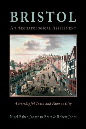
Bristol: A Worshipful Town and Famous City
An Archaeological Assessment from Prehistory to 1900
- 450 pages
- English
- ePUB (mobile friendly)
- Available on iOS & Android
eBook - ePub
Bristol: A Worshipful Town and Famous City
An Archaeological Assessment from Prehistory to 1900
About this book
Bristol is a major city and port in the south-west of England. In medieval times, it became the third largest city in the kingdom, behind London and York. Bristol was founded in the late Saxon period and grew rapidly in the 12th and 13th centuries. Initially, seaborne trading links with Ireland and France were particularly significant; later, from the 16th century onwards, the city became a focus for trade with Iberia, Africa and the New World. This led to the growth of new industries such as brass manufacture, glass production and sugar refining, producing items for export and processing imported raw materials. Bristol also derived wealth from the slave trade between Africa and the New World. The city has a long history of antiquarian and archaeological investigation. This volume provides, for the first time, a comprehensive overview of the historical development of Bristol, based on archaeological and architectural evidence. Part 1 describes the geological and topographical context of Bristol and discusses evidence for the environment prior to the foundation of the city. The history of archaeological work in Bristol is discussed in detail, as is the pictorial record and the cartographic evidence for the city. In Part 2, a series of period-based chapters considers the historical background and archaeological evidence for Bristol's development from the prehistoric, Roman and post-Roman eras, through the establishment and growth of Bristol between about 950 and 1200 AD; the medieval city; early modern period; and the period from 1700 to 1900 AD, when Bristol was particularly important for its role in transatlantic trade. Each chapter discusses the major civic, military and religious monuments of the time, and the complex topographical evolution of the city. Part 3 assesses the significance of Bristol's archaeology, and presents a range of research themes for future research. ?
Information
Subtopic
Economic HistoryIndex
Social SciencesIntroduction
Location and setting
Bristol is the largest city in the south-west of England and is one of the eight core cities in England. Close to the river Severn and to Wales, the city’s historic centre stands on a finger of land (at grid reference ST 590 730) between the river Avon and its tributary, the river Frome, with hills rising steeply on its north side and the floodplain of the rivers on the south. Its landscape is distinctive with the valleys of the Avon and Frome in particular having an historic and continuing influence upon the city’s topography. The Avon Gorge especially is world-renowned and is nationally important for its rare flora and fauna as well as being probably the most impressive entry to a modern city (Fig 0.1).
Bristol is a unitary local authority with more than 430,000 inhabitants and has a broad-based economy, ranging from manufacturing companies to cultural production. It is an important national location for banking and insurance services but also has a significant proportion of public sector employment. It is home to two major universities, the University of Bristol and the University of the West of England, both of which are experiencing significant increases in student numbers, with over 50,000 students attending both universities. Both make significant contributions to the fields of historical and archaeological research. The city is a major node in the modern road and rail network but in the past the Avon formed Bristol’s major highway, winding westward for approximately 13km through the Avon gorge to the Severn estuary. From there its ships reached Europe and the Atlantic. The archaeology of Bristol strongly reflects this maritime history and the wealth and influence that its commerce generated.
The Urban Strategies Programme and the origins of the project
The publication of Archaeology and Planning in 1990, a government planning policy guidance note usually known as PPG16, changed the conduct of English archaeology (Department of the Environment 1990). The document emphasised the role of local authorities in the curation of archaeology, recommending inclusion of policies for archaeology in local development plans, and indicating a practical means of archaeological management through the exercise of their development control and other functions. As a result the need became clear for strategies tailored to the specific local circumstances of the larger towns and cities where development pressure is often greatest. To develop these strategies English Heritage launched its Urban Archaeological Strategies programme in 1992 with the publication of Managing the Urban Archaeological Resource (English Heritage 1992). Smaller urban settlements would be subject to a rapid survey (the Extensive Urban Survey) covering, in the Bristol administrative area, places later absorbed into the urban conurbation: Bedminster, and Clifton and Hotwells. These documents have now been largely superseded as a result of a more inclusive approach to the production of Conservation Area Character Appraisals. For the larger urban settlements, including central Bristol, a more intensive approach was envisaged, with three main stages. The first stage, the creation of Urban Archaeological Databases of the available archaeological information, would be followed in the second stage by an assessment of that information. The third stage would be the formulation of management strategies for use by curatorial archaeologists (English Heritage 1992, 8–9); these strategies, based on the judgements made during the assessment, would then be incorporated into local policy. Subsequently, PPG16 was replaced by Planning Policy Statement (PPS) 5 and then in 2012 by the National Planning Policy Framework (NPPF).

Figure 0.1 Plan of the Bristol region

Figure 0.2 Plan of the UAD and UAA study area
The Bristol Urban Archaeology Database
The first step towards an archaeological strategy for Bristol was the compilation of the Bristol Urban Archaeology Database (UAD), which began in early 1996. Two researchers worked full time for 64 weeks, focusing on an area of roughly 5 square kilometres in the centre of the city which extended from the New Cut in the south to Kingsdown and St Paul’s in the north, and Old Market in the east to Brandon Hill in the west. This area covered the Saxon burh and the subsequent medieval and early modern expansion. A finger extended west to Cumberland Basin to bring the whole of the Floating Harbour, the most important post-medieval monument in the city, within the study area (Fig 0.2).
The approach developed for the Cirencester UAD (Darvill and Gerrard 1994, 7–13) and adopted for the other urban database projects, was also followed in Bristol. This distinguishes between archaeological recognition events, the excavation, survey, photograph or other record which holds information about the archaeological resource, and monuments, the monastery, factory or other cultural artefact, which are an interpretation and distillation of the relevant recognition events.
The first task of the Bristol project was to compile a comprehensive list of archaeological events from published and unpublished sources (see Appendix 1). Other historic and visual sources were then searched selectively, including historic maps, the Braikenridge collection of early 19th-century watercolours held by the Bristol Museum and Art Gallery, photographs published by the Reece Winstone archive, and historic documents, to extract the archaeological information they contained (Brett and Bryant 1997). The second element of the project was the identification of monuments within the landscape. Geographical Information Systems (GIS) software was used to map, where possible, the spatial extent of the events, features and monuments which were identified during the data gathering.
The Bristol Urban Archaeological Assessment
Today the urban conurbation of Bristol covers many square kilometres. Most of this area has been developed since the end of the 19th century but in the medieval period the core of the settlement was focused on a small area at the confluence of the river Avon and the Frome. The study area defined for the Bristol UAD and this assessment (Fig 0.2) encloses this historic core but also seeks to examine the subsequent post-medieval expansion. Consequently the defences built to the north of the city during the civil wars of the 1640s (parts of which have the status of Scheduled Ancient Monuments), the whole of the Floating Harbour (on which much of the economic life of the settlement depended) to the west, and part of the early industrial area of St Philip’s Marsh to the east have all been included. Bedminster to the south and Clifton and Hotwells to the north-west have, however, been omitted since they were the subject of separate studies in the Extensive Urban Survey programme.
The first draft of the Assessment was produced in 2002 and submitted to English Heritage for review (Brett et al 2002). Following detailed comment, it was decided to produce a second draft, involving significant rewriting, especially of the medieval section of the document. A second draft was then submitted in 2005 (Brett et al 2005). Detailed comments and criticisms were made by Professor Derek Keene in 2006, following which a start was made on a significant redraft of the document by the principal author. However, following the untimely death of the author in 2007, the project was put on hold since there were no resources within Bristol City Council to continue at that time.
In 2008, initial discussions were held with English Heritage to re-start the project and Dr Nigel Baker, formerly of Herefordshire Archaeology, was approached to undertake the rewriting of the existing draft. Following an initial project proposal, a detailed Project Design was agreed in 2010. This set out a detailed methodology for a major redrafting of the earlier work, commencing with the production of a sample chapter (chapter 6 of this volume), to explore and solve any problems that might have arisen with the new structure for the volume that was being proposed. A subsequent Project Design was agreed in early 2012 to complete the remainder of the volume.
Approach
The structure of the Bristol Urban Archaeological Assessment was devised at the outset through dialogue with English Heritage. It aimed to retain a common structure with similar assessments carried out elsewhere while allowing for the particular local circumstances of Bristol. Earlier drafts were biased towards the assessment of the archaeological potential and importance of defined geographical units within the city. While the importance of the component geographical elements is still recognised (see below), the chronological narrative is now concerned with the exploration of the city’s development on a thematic basis. The study considers the archaeological research carried out in the city up to the year 2014 with the aim of presenting an overview of our current understanding of the evolution of the city. This will form the basis for the development of the management strategy discussed above. The focus is on the core of Bristol, but the impossibility of dividing an urban settlement from its hinterland and, particularly in the case of Bristol, its overseas connections means that in places the text does range more widely.
Document structure
The assessment is divided into three parts, each divided into a number of chapters. The first part puts the study of the archaeology of the city into an overall context. Chapter 1 starts with a summary history of Bristol from the first manifestations of human activity up to 1900. In chapter 2 there is a brief summary of the geology of the city and the changes to its topography and geomorphology, illustrated by the results of a study into the distribution and significance of waterlogged deposits in the city, commissioned in 2012 by English Heritage (Wilkinson et al 2013b). Chapter 3 looks at the history of archaeological study in Bristol, from the Itinerary of William Worcestre in the 15th century through the works of antiquarians in the 18th and 19th centuries and finally to the establishment of archaeology as an integral part of local planning policy and strategy. This chapter goes on to look at the remarkable range of visual and cartographic sources available to the archaeologist, much of which is now available on line.
Part 2 sets out the development of Bristol from the prehistoric period until the cut-off date of 1900. This is arranged in five chapters dealing with each chronological period and explores the changes in Bristol’s urban landscape and assesses the quality of the archaeological resource. The chronological divisions were chosen to reflect the major phases of Bristol’s development as follows:
Bristol before AD 950
Evidence for prehistoric, Roman and Early to Middle Saxon occupation in central Bristol (if not in the surrounding landscape) is very limited although the possibilities afforded by detailed analysis of deeper deposits by geoarchaeological prospection are examined. The hypothesis that has been put forward for an early foundation for Bristol, perhaps as early as the 8th century, is briefly examined, while all of the data for the period before AD 950, the earliest date for the founding of the town, is dealt within a single section.
Bristol c 950–c 1200
This chapter discusses the evolution of the town from the earliest date for its foundation which can be demonstrated archaeologically up to the end of the 12th century. This was the period which saw the Late Saxon town plan become formalised, the town become a major port, weathering both the Norman Conquest and 12th-century civil wars, and undergoing initial suburban development before the expansion of the high Middle Ages.
Bristol c 1200–c 1540
The chapter explores the period of Bristol’s emergence as a major European port between the 13th and 16th centuries. The period saw the diversion of the river Frome to increase the capacity of the docks, enabling further suburban development, and culminated with the religious controversy preceding the Reformation.
Bristol c 1540–c 1700
The chapter discusses the radical changes in landholding and topography which followed from the disappearance of the monasteries at the beginning of the period. During the 17th century Bristol merchants became involved in a lucrative trade with the new colonies along the eastern seaboard of America and in the Caribbean, stimulating the emergence of new industries in the city at the end of the 17th century.
Bristol c 1700–c 1900
The final period to be discussed saw both Bristol’s peak as an economic power and its gradual decline to regional city in the era of the Second Industrial Revolution.
For the purposes of illustrating the physical growth of the city over a 1000-year period, and to emphasise the distinctive development pattern of the city during this period, a number of geographical areas have been defined. They have distinctive attributes that separate them from other areas in the immediate vicinity, by reason of their topography, their development pattern or the particular historic circumstances that resulted in their development (Fig 0.3).
Old City: the extent of the original settlement within the inner circuit of the town walls and the area of the royal castle and its associated land in and beyond Castle Park.
Old Market: the boundaries of the area known as Old Market are defined by the roads to the north and south of Old Market Street, Redcross Street and Unity Street. It also includes the main street, West Street and the back lanes.
Broadmead: the suburb to the north of the castle, its boundaries are defined by Penn Street to the east, the course of the river Frome on the south and west sides and Horsefair on the north.
Redcliffe and Temple: the 12th-century suburbs of Redcliffe and Temple on the south side of the Avon, bounded by the river Avon and the New Cut.
Lewin’s Mead: the area of a rock outcrop to the north of the Frome on which the majority of the religious houses were sited, stretching from Park Street to St James Barton.
College Green: including the precinct of St Augustine’s Abbey, Canon’s Marsh and Brandon Hill.
The Marsh: the area between the circuit of the inner town walls north of Baldwin Street and the land to the south of Queen Square. The northern half of this area was starting to be settled from the 12th century a...
Table of contents
- Front Cover
- Half-Title Page
- Title Page
- Copyright Page
- Contents
- Foreword
- List of contributors
- List of illustrations
- List of tables
- Acknowledgements
- Picture credits
- Summary
- Resumé
- Zusammenfassung
- Glossary of terms
- Part 1: A Background to the Archaeological Study of the City
- Part 2: the Development of Bristol
- Part 3: the Archaeology of Bristol: An Assessment
- Appendix 1: Gazetteer of selected archaeological events in Bristol
- Bibliography
- Back Cover
Trusted by 375,005 students
Access to over 1.5 million titles for a fair monthly price.
Study more efficiently using our study tools.
Frequently asked questions
Yes, you can cancel anytime from the Subscription tab in your account settings on the Perlego website. Your subscription will stay active until the end of your current billing period. Learn how to cancel your subscription
No, books cannot be downloaded as external files, such as PDFs, for use outside of Perlego. However, you can download books within the Perlego app for offline reading on mobile or tablet. Learn how to download books offline
Perlego offers two plans: Essential and Complete
- Essential is ideal for learners and professionals who enjoy exploring a wide range of subjects. Access the Essential Library with 800,000+ trusted titles and best-sellers across business, personal growth, and the humanities. Includes unlimited reading time and Standard Read Aloud voice.
- Complete: Perfect for advanced learners and researchers needing full, unrestricted access. Unlock 1.5M+ books across hundreds of subjects, including academic and specialized titles. The Complete Plan also includes advanced features like Premium Read Aloud and Research Assistant.
We are an online textbook subscription service, where you can get access to an entire online library for less than the price of a single book per month. With over 1.5 million books across 990+ topics, we’ve got you covered! Learn about our mission
Look out for the read-aloud symbol on your next book to see if you can listen to it. The read-aloud tool reads text aloud for you, highlighting the text as it is being read. You can pause it, speed it up and slow it down. Learn more about Read Aloud
Yes! You can use the Perlego app on both iOS and Android devices to read anytime, anywhere — even offline. Perfect for commutes or when you’re on the go.
Please note we cannot support devices running on iOS 13 and Android 7 or earlier. Learn more about using the app
Please note we cannot support devices running on iOS 13 and Android 7 or earlier. Learn more about using the app
Yes, you can access Bristol: A Worshipful Town and Famous City by Nigel Baker,Jonathan Brett,Robert Jones in PDF and/or ePUB format, as well as other popular books in Social Sciences & Economic History. We have over 1.5 million books available in our catalogue for you to explore.