![]()
Part I
Basic Topics and 2D Interpretation
![]()
Chapter 1
Introduction and Overview
(Anstey, 1982)
1.1 Exploration Geophysics in Petroleum Exploration
Four geophysical survey techniques are commonly used in the exploration for petroleum: gravity surveys, aeromagnetic surveys, electromagnetic surveys and seismic surveys.
The first two are reconnaissance techniques designed to answer such questions as:
- Where are the sedimentary basins in an area?
- How deep are they (to ≈10 per cent accuracy)?
- What are the controlling structural features?
They provide low resolution data over a wide area comparatively cheaply.
Electromagnetic surveys have had a long history of application in the mining industries, but they have only recently been applied to petroleum exploration with the aim of directly detecting the presence of hydrocarbons in the subsurface.
Seismic surveys have a long history of use in petroleum exploration and are the primary tool for delineating subsurface structure and detecting the presence of hydrocarbons prior to drilling.
Seismic surveys can be of two types – refraction and reflection – depending on the mode of transmission of the seismic energy. The refraction technique is little used, because it again gives results of a reconnaissance nature. The main effort and expenditure is put into the reflection technique because it provides much more information, resolving structural detail down to scales of approximately 10 m and yielding full three-dimensional images of the subsurface. Where data quality is good, lithological and petrophysical data on subsurface rocks can also be derived from the seismic reflection data when this is integrated with information from wells.
In exploring a sedimentary basin, seismic reflection surveys are applied immediately after surface geological surveys and reconnaissance geophysical surveys have been made. The initial aim is to map out subsurface structure along two-dimensional cross-sections (2D surveys) in sufficient detail to map out the broad structure and stratigraphy of the basin and allow the siting of the first exploration wells. As promising leads are identified, intensive 3D surveys will be carried out to optimize the placement of wells and guide drilling. Finally, in the course of a field's history, repeated 3D surveys (‘4D’ surveys) may be undertaken to monitor the flushing of hydrocarbons from the reservoir.
1.2 The Principle of Seismic Reflection Surveying
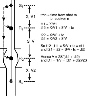
The principle is very simple: it is a form of echo-sounding. A sound pulse (compressional or P-wave) generated by a powerful source at the surface (for example, an explosion) penetrates the rocks to depths of several kilometres and is reflected back as an echo from the interfaces between different rock types (Figure 1.1). The echoes are recorded at the surface on an array of sensitive receivers – geophones on land, hydrophones at sea. After initial processing of the data, one may regard the sound as having travelled down to and back from the interface along the same travel path (raypath) to a receiver located beside the shot (Figure 1.1). The raypath is at right angles to the interface, and for this reason it is called a normal-incidence reflection (‘normal’ in the sense of ‘at right angles to’). The reflective interfaces are usually bedding planes within a sedimentary sequence, but they may be low-angle faults or the sediment-basement interface.
The echoes are recorded at the surface as separate pulses of sound, and successive pulses may well overlap so that the final recording from a single receiver takes the form of an extended wave train several seconds in length. It is recorded digitally but can be displayed as an oscillographic trace – a seismogram or graph of receiver output versus time. The time is that taken for the sound to travel down to the reflector and back to the surface, so it is called the two-way time (TWT) or reflection time.
Many such seismograms are recorded from successive points along a survey line and displayed side-by-side on a large sheet of paper or on a computer screen with the TWT shown as increasing downwards (Figure 1.1). The zero of time is the time of firing the explosive shot, and this is measured to an accuracy of better than one thousandth of a second, i.e. 1 millisecond (1 ms). The reflected pulse from any one horizon may be readily followed by eye from trace to trace across the display. The whole bears a striking resemblance to a geological cross-section through the strata, as if it were a gigantic cliff face several kilometres high and tens of kilometres long, on which the strata were laid out for our inspection.
Possible oil-bearing structures may be recognized on such a display and their depth and amount of closure calculated from the observed reflection times, provided the velocity of propagation of seismic energy in the rocks above can be measured. Since the display so strongly resembles a geological section, but has a vertical dimension scaled in TWT, it is called a time-section.
In addition to the compressional wave (P-wave), two other types of seismic wave disturbance are produced by the source: shear waves and surface waves. Surface waves are a considerable source of interference in data acquired on land and will be considered in Chapter 3. Shear waves will be considered in the context of reservoir geophysics, where they have increasing application.
1.3 Overview of the Seismic Reflection Industry
The seismic reflection industry can be divided into three main sections: data acquisition, data processing and data interpretation. These incorporate not only areas of technique, but also of business activity and of employment:
- Data acquisition is a difficult operation on both land and sea. It requires a lot of skill and experience on the part of operating personnel and so, like much of the technically difficult operations in the oil business, is placed in the hands of specialist contractors. Firms such as Schlumberger Geco-Prakla, Western Geophysical, Petroleum Geo-Services (PGS) and Compagnie Generale de Geophysique (CGG) provide data acquisition and processing services and may also provide specialist interpretation of the results. However, most interpretation is handled by the client oil companies or specialist consultancies. The contractors may undertake to survey specific areas exclusively for oil-company clients – so-called proprietary surveys. They may also initiate non-proprietary or speculative surveys in areas which they think will be of interest, make interpretations of them and attempt to sell them to oil companies. Contractors are at the forefront of the research and development of new techniques in both acquisition and processing. They employ mostly physicists, geophysicists, engineers, computer scientists and mathematicians, with some geologists.
- Data processing is normally handled by the same contractors who carry out acquisition, with the addition of some smaller firms who may focus on particular advanced processing techniques. They all employ a similar mix of people.
- Data interpretation is mostly handled by the client oil companies, who employ both geophysicists and geologists as seismic interpreters. Most companies have moved away from workgroups based on skills (‘Geology Department’) to groups based on projects (‘Tertiary Sand Plays’) or based on assets such as individual fields (‘Schiehallion team’). As a result, there is much more emphasis on the integration of geological/geophysical data with other data sets, such as those of the reservoir engineer, and all geoscientists have to know quite a lot about what the others in the group are doing.
The petroleum industry is by far the biggest spender on geophysical surveying, spending about five times the total spent on all other applications such as minerals, engineering and research. Most of the expenditure goes on seismic reflection surveys and the total length of profile surveyed in a year is well over one million miles. About a third of that is on land and two-thirds at sea.
1.4 A Brief History of Seismic Surveyin...