- 780 pages
- English
- ePUB (mobile friendly)
- Available on iOS & Android
eBook - ePub
History of Seattle, Volume 1
About this book
The preparation of a "History of Seattle" has been the exploration of a new field and the amount of patient research and careful investigation involved has been a task of colossal proportions. The printed and written records of the first twenty years of Seattle's existence are scanty almost beyond belief. Not until 1863 was a newspaper established there and, for many years, more space in it was devoted to eastern and foreign politics than to the record of local passing events. Few, if any, pioneers kept diaries and none of these, except that of the writer, has been accessible. And yet has this work become one of the most detailed and accurate narratives of the history of this beautiful town on the West coast. A must read - and not only for Seattle citizens. This is volume one out of two.
Trusted by 375,005 students
Access to over 1.5 million titles for a fair monthly price.
Study more efficiently using our study tools.
Information
Subtopic
North American HistoryIndex
HistoryCHAPTER I. IN THE BEGINNING
It is the intention of the writer of this work to bring into it only facts and accounts that belong to a history of Seattle. However, the history of the City of Seattle and of the Sound country are so closely interwoven that it will be necessary to go far anterior to the arrival of the pioneers in Elliott Bay to present a clear understanding of the later years. It is believed the readers of its pages will be more pleased with this plan than to consume much space in describing remote incidents about which they are, perhaps, better informed than the writer.
For more than a century preceding the settlement at Alki Point maritime expeditions into the North Pacific had been made by the Spanish, British, Russian and American navigators, and a brief account of these is proper as a prelude to the later events which made the rise of the City of Seattle possible.
In April, 1596, Michael Lok, an Englishman, met an old Greek navigator called Juan de Fuca, at Venice, and in the course of their conversation, de Fuca opened up to him certain of his voyages. On one of these, in 1592, while in the service of the Viceroy of Mexico, he sailed up the coast of North America until he came to latitude forty-seven degrees where he found a broad inlet between the forty-seventh and forty-eighth, and entering it sailed for more than twenty days, passing many islands. The viceroy promised him a great reward for his discovery, but the reward never came, and de Fuca said that he then left the service of the viceroy, and intimated to Lok that he would like to enter the service of the English if for no other reason than to get revenge on the Spanish for their vile treatment of him. Lok tried to get the old man employment, but never succeeded, and the old man died. It has since been proved that Juan de Fuca or Apostolos Valerianos, as he was known in the Greek language, is a myth and that Lok had been imposed upon by a clever seaman. However, the story became widely known and was published in the leading geographies of the day. It is a remarkable coincidence that his story should be so nearly in keeping with the facts.
The Spanish had been pushing northward from Mexico and, witnessing the efforts of all the other civilized nations in the Pacific Northwest, began to send explorers into these waters. On May 21, 1775, the Spanish sent out from San Blas, Mexico, the Santiago, in command of Bruno Heceta, accompanied by the schooner Sonora, in command of Bodega y Quadra. This expedition sailed northward as far as Alaska, and on its return narrowly missed the discovery of the Columbia River. But they failed to sight the entrance to the Strait of Juan de Fuca.
On Sunday, March 22, 1778, Capt. James Cook, of the British navy, sailing on his third voyage, made his way along the northwest coast of North America and sighted a prominent cape which he called Cape Flattery. He had in mind the supposed strait or inlet advertised by Juan de Fuca and Lok, but after considerable search was unable to find it. It appears that a heavy wind arose during the night and when morning came he had passed the entrance.
Cook remained at Nootka Sound, on what is now Vancouver Island, for over a month, engaged in scientific work.
To Capt. John Meares belongs the honor of sighting the Strait of Juan de Fuca. In May, 1788, while sailing under the British flag, but in reality under double colors, having a Portuguese partner, Meares in the Felice arrived at Nootka, and purchased for two pistols some land from the Indian chief, Maquinna. He erected a fort here and built a little vessel called the North West America. In the latter part of June Meares set out to explore the surrounding country, and on Sunday, June 29, 1788, he sighted the great inlet which he called after its real discoverer John de Fuca. Of course Meares believed implicitly in the story of Juan de Fuca. He made for the southern coast and landed upon the shores of what is now the State of Washington, probably at Neah Bay, and there was received by a chief called Tatoosh. He saw the large mountain to the southward and called it Mount Olympus. He then went southward and entered Willapa Harbor which he called Shoalwater Bay, but was unable to find a river where the Columbia empties into the Pacific and so dubbed the site where he had labored in vain Cape Disappointment and Deception Bay. Returning to Nootka, Meares dispatched one of his officers and thirteen men in a boat to examine the shores of the Strait of Juan de Fuca.
Meares then left with a cargo of lumber for the Chinese markets and made arrangements for his aids to winter in the Sandwich Islands. Later he organized a joint stock company for trading purposes under a license from the East India Company and proceeded to build up a colony at Nootka of Chinese men and Hawaiian wives. In April, 1789, two captains of Meares, Douglas and Funter, arrived at Nootka.
In the meantime, the Spanish, alarmed at the fact that the Russians were extending their colonies and forts north of California, sent Estevan Jose Martinez northward to examine the Russian settlements. He secured information that the Russians intended to send four frigates from Siberia to Nootka, whereupon he was directed to repair to Nootka and take possession of the place in the name of the Spanish king and build a fortress there. By so doing he would out-general the Russians. When he arrived at Nootka, however, he found the English ships instead of the Russian, and proceeded to take possession of the place and to seize the ships and men, taking them to Mexico. The Spanish then occupied the fort erected by Meares and established a garrison, first under Martinez and later under Francisco Eliza. This was almost an act of war and for a while it looked as if Spain and England would leap at each other's throats.
The Spanish began to compromise by releasing the ships and men and promising indemnities to the owners of the vessels for delays, etc. But Meares had now arrived in England and he set the matter before the English government on April 30, 1790. England demanded not only a payment of damages for the individual losses of ships and stores, but demanded also that the lands be restored to the sovereignty of the English crown. England was able to secure the promise of aid from Holland and Prussia, but as Spain's chief ally, France, was now in the midst of a revolution, Spain was forced to meet the British demands, and signed a treaty dated October 28, 1790, which provided for an indemnity ultimately amounting to $210,000 to be paid by Spain, and the transfer of the lands at Nootka to England. Subjects of both powers were left free to visit the port. The entire matter was patched up at Nootka in March, 1795.
It was during these years that the Spanish became quite intimately acquainted with the Strait of Juan de Fuca, and made fairly accurate surveys of the coasts as far east as Bellingham and as far south as Admiralty Inlet. In 1790, Francisco Eliza, who was in command at Nootka, sent Manuel Quimper to explore the Strait of Juan de Fuca. He placed Spanish names on most of the bays, points, and islands, few of which have survived. In 1792, two scientific men, Dionisio Galliano and Cayetano Valdes, were added to the expedition, and they made further surveys. The principal names added to the nomenclature of the Sound were San Juan Archipelago, Sucia Islands, Matia Islands, Canal de Haro, Port Angeles, Guemes Island, and Fidalgo Bay. Most of the others have long since disappeared, although subsequent explorers have honored the Spanish commanders by naming several places for them.
On the two principal maps left as a heritage by the Spaniards, that portion of the Sound now known as Admiralty Inlet, which connects Puget Sound proper with the Strait of Juan de Fuca, is called Boca de Caamano. Quimper says in his journal, that from his station (now called Port Discovery) he saw other inlets and openings to the east, which he called Boca de Fidalgo and Boca de Flon. He had, however, no time to explore them. Don Francisco Eliza, who advanced in 1791 to the eastern end of de Fuca Strait, recognized for the first time this inlet, and called it Bocas de Caamano, probably in honor of the Spanish navigator, Caamano. Eliza, however, did not further explore the interior of this inlet, because he understood from the Indians that, though it was very long, still, from the end of it, one could not advance further unless with canoes. Eliza's object was not to explore shut-up inlets, but to find a passage to other waters.
Following closely upon the voyages of Cook and Meares was the expedition of George Vancouver who was the first recorded white man to enter Puget Sound above the entrance to Admiralty Inlet. Vancouver's expedition was partly scientific, partly commercial, and partly diplomatic, for he was detailed to meet the Spanish at Nootka Sound and arrange terms of settlement. He sailed from England April 1, 1791, with the sloop-of-war Discovery and the armed tender Chatham, and after rounding the Cape of Good Hope visited the South Seas and the Hawaiian Islands, and then made his way to what was then known as New Albion, but which is today called Oregon and Washington.
He examined the region about Cape Disappointment, but came to the conclusion that there was only an inlet there, and then proceeded northward naming Point Grenville and passing Cape Flattery and entering the Strait of Juan de Fuca. Here he met Capt. Robert Gray of the ship Columbia who told him that he had discovered a large river at Cape Disappointment, but Vancouver would not believe him, and only later did he come to the same conclusion.
Vancouver named the mountain which appeared to the eastward Mount Baker after his third lieutenant, Joseph Baker; New Dungeness after its resemblance to old Dungeness in England; Port Discovery after his vessel, the Discovery, and the little island at the entrance to the harbor, Protection Island, because it served as a protection to the harbor both from contrary winds and armed attacks from an enemy if the island were fortified. He now came in sight of a large mountain to the south-eastward which he called Mount Rainier in honor of Rear Admiral Peter Rainier, his friend. Port Townsend he named after the Marquis of Townshend. [About 1850 the “h” was dropped as the word, so spelled, proved difficult for the Americans. He sailed into Hood's Canal which he so called after the Right Honorable Lord Hood, and Marrowstone Point because it was here that he found deposits of marrowstone.
He then quickly sailed southward into the main port of the Sound and established his party in headquarters on what is now Restoration Point on Bainbridge Island. This point he first called Village Point, probably because it was here that he found an Indian village, but he changed the name to Restoration Point in honor of the fact that the day was the anniversary of the restoration of the Stuart monarch, Charles 11, to the throne, after the long rule of Oliver Cromwell. From his headquarters at Restoration Point Vancouver sent out small boat parties to make surveys. His lieutenant, Peter Puget, went up the Sound, through the narrows and made a fairly good survey of the waterways and inlets. This portion of the Sound was called by Vancouver Puget Sound, and the name is probably as euphonious a one as has ever been given to any portion of the earth's surface. It must be remembered that Vancouver intended that only that portion of all these northwest waters should be called Puget Sound, but it is interesting to note the development of this word Puget Sound as a generic term for all these Northwest waters. Vancouver designated these waters by five names, viz.: Strait of Juan de Fuca, Canal de Arro, Gulf of Georgia, Admiralty Inlet, and Puget Sound, but at the present time all save two, Puget Sound and Strait of Juan de Fuca, have ceased to be terms of popular parlance. Only the United States Coast and Geodetic Survey Charts officially recognize them. Nor is the term Strait of Juan de Fuca safe from ultimate extinction. In 1859 no less a person than Governor Douglas of British Columbia spoke of Vancouver Island as being in Puget Sound, and in a recent decision of the Superior Court of Clallam County, Judge Ralston held that for the purposes of the fishing laws, the Strait of Juan de Fuca was a part of Puget Sound.
Vancouver, himself, surveyed the land to the southward of Restoration Point, and found and named the large island Vashon Island, in honor of a friend, James Vashon. This brings up an interesting relationship of names.
Rainier's sister, Sarah, married Admiral James Vashon, and Joseph Baker married Vashon's niece, so that in a way Mount Baker, and Mount Rainier are related.
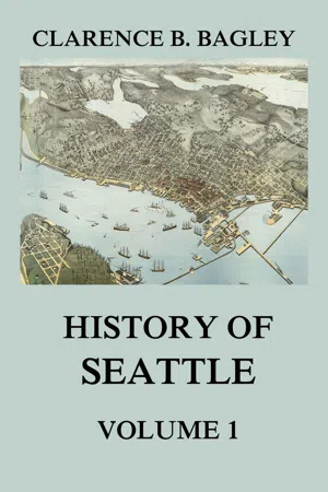
The survey of the waterways to the westward of Restoration Point Vancouver intrusted to his clerk, H. M. Orchard, and that is how we get the name Port Orchard. Not wishing to be forgetful of the honors which the board of admiralty in England had bestowed upon him in selecting him as leader of the expedition, Vancouver named the watercourse which extends from the narrows to the Strait of Juan de Fuca, Admiralty Inlet, which name is still officially used upon all Government charts, but which is not very generally used by the public at large. On Vancouver's chart a fairly good representation of the harbor which is now known as Elliott Bay is set down, but there is no evidence to show that Vancouver's surveyors did any more than sketch it in the rough from small boats perhaps a half a mile from mainland.
His expedition now repaired to the inlet or watercourse to the eastward of Whidby Island and landed somewhere on the mainland within the present limits of the City of Everett. Here he prepared to celebrate the king's [George III] birthday, it being June 4, 1792. As this region is so near to the present limits of the City of Seattle I take leave to quote a few words from Vancouver's Journal. “Sunday, the 3rd, all hands were employed in fishing with tolerably good success, or in taking a little recreation on shore; and on Monday, the 4th, they were served as good a dinner as we were able to provide for them, with double allowance of grog to drink the king's health, it being the anniversary of his majesty's birth; on which auspicious day, I had long since designed to take formal possession of all the countries we had lately been employed in exploring, in the name of, and for his Britannic majesty, his heirs and successors.
“To execute this purpose, accompanied by Mr. Broughton and some of the officers, I went on shore about one o'clock, pursuing the usual formalities which are generally observed on such occasions, and under the discharge of a royal salute from the vessels, took possession accordingly of the coast, from that part of New Albion, in the latitude of 39° 20' north, and longitude 236° 26'
east, to the entrance of this inlet of the sea, said to be the supposed Straits of Juan de Fuca ; as likewise all the coasts, islands, etc., within the said straits, as well on the northern as on the southern shores; together with those situated in the interior sea we had discovered, extending from the said straits, in various directions, between the northwest, north, east and southern quarters; which interior sea I have honored with the name of The Gulf of Georgia, and the continent binding the said gulf, and extending southward to the forty-fifth degree of north latitude, with that of New Georgia; in honor of his present majesty. This branch of Admiralty Inlet obtained the name of Possession Sound; its western arm, after Vice Admiral Sir Alan Gardner, I distinguished by the name of Port Gardner, and its smaller eastern one by that of Port Susan.”
Recently the Daughters of the American Revolution erected a monument, in commemoration of this event, within the present limits of the City of Everett.
A bronze tablet upon the monument reads: “On The Beach Near This Spot Vancouver Landed June 4, 1792. Erected by the Marcus Whitman Chapter Daughters of the American Revolution, June 4, 1915.”
Port Susan has almost disappeared as a name; Possession Sound is still used for Everett Harbor; Port Gardner has been replaced by Saratoga Passage; while Alan Point is still the southern cape of Camano Island; and the term Possession is further used as the name of the south cape of Whidby Island.
It is a matter of regret that his celebration could not have taken place nearer the City of Seattle. It is, however, interesting to note that all the land once taken possession of by the English and later transferred to the United States of America, is connected in some way with the name of George III. It was this king who was reigning when the American Revolutionary war was fought; while this country, called by Vancouver, New Georgia, later known as Oregon and Washington, was definitely ceded to the United States in 1846.
Other names which Vancouver gave were: Whidbey Island, in honor of the master of his ship Discovery, Joseph Whidbey, who had made extensive surveys in this region, and who proved this to be an island. Vancouver never determined that Camano Island was an island but has it set down on his chart as a part of the mainland. Point Partridge was named in honor of the family into which Vancouver's brother John had married. Other names are: Cypress Island, Strawberry Bay, Deception Pass, Bellingham Bay, Point Hudson, Birch Bay and Point Roberts. This latter name is of some interest. Vancouver was not the first choice of the admiralty as leader of the expedition.
Another person, Capt. Henry Roberts, had been selected, and Vancouver was to go along in the capacity of lieutenant, but just as the expedition was on the point of sailing, a war with Spain was imminent, and Roberts was sent in command of a ship of war to fight the Spanish, if war were declared, in the West Indies. Bu...
Table of contents
- PREFACE
- CHAPTER I. IN THE BEGINNING
- CHAPTER 11. THE PIONEER PERIOD
- CHAPTER III. THE INDIAN WAR PERIOD
- CHAPTER IV. THE INDIAN TRIBES AND CHIEF SEATTLE
- CHAPTER V. SEATTLE'S MOSQUITO FLEET
- CHAPTER VI. COAL MINES AND COAL MINING
- CHAPTER VII. WASHINGTON STATE UNIVERSITY
- CHAPTER VIII. EDUCATIONAL ACTIVITIES
- CHAPTER IX. THE CHURCH
- CHAPTER X. THE PRESS
- CHAPTER XI. THE SNOQUALMIE PASS
- CHAPTER XII. SAWMILLS, LUMBER AND LUMBER PRODUCTS
- CHAPTER XIII. RAILROADS
- CHAPTER XV. MUNICIPAL PARKS
- CHAPTER XVI. THE PUBLIC LIBRARY
- CHAPTER XVII. BENCH AND BAR
Frequently asked questions
Yes, you can cancel anytime from the Subscription tab in your account settings on the Perlego website. Your subscription will stay active until the end of your current billing period. Learn how to cancel your subscription
No, books cannot be downloaded as external files, such as PDFs, for use outside of Perlego. However, you can download books within the Perlego app for offline reading on mobile or tablet. Learn how to download books offline
Perlego offers two plans: Essential and Complete
- Essential is ideal for learners and professionals who enjoy exploring a wide range of subjects. Access the Essential Library with 800,000+ trusted titles and best-sellers across business, personal growth, and the humanities. Includes unlimited reading time and Standard Read Aloud voice.
- Complete: Perfect for advanced learners and researchers needing full, unrestricted access. Unlock 1.5M+ books across hundreds of subjects, including academic and specialized titles. The Complete Plan also includes advanced features like Premium Read Aloud and Research Assistant.
We are an online textbook subscription service, where you can get access to an entire online library for less than the price of a single book per month. With over 1.5 million books across 990+ topics, we’ve got you covered! Learn about our mission
Look out for the read-aloud symbol on your next book to see if you can listen to it. The read-aloud tool reads text aloud for you, highlighting the text as it is being read. You can pause it, speed it up and slow it down. Learn more about Read Aloud
Yes! You can use the Perlego app on both iOS and Android devices to read anytime, anywhere — even offline. Perfect for commutes or when you’re on the go.
Please note we cannot support devices running on iOS 13 and Android 7 or earlier. Learn more about using the app
Please note we cannot support devices running on iOS 13 and Android 7 or earlier. Learn more about using the app
Yes, you can access History of Seattle, Volume 1 by Clarence B. Bagley in PDF and/or ePUB format, as well as other popular books in History & North American History. We have over 1.5 million books available in our catalogue for you to explore.