- 176 pages
- English
- ePUB (mobile friendly)
- Available on iOS & Android
Manhattan in Maps 1527-2014
About this book
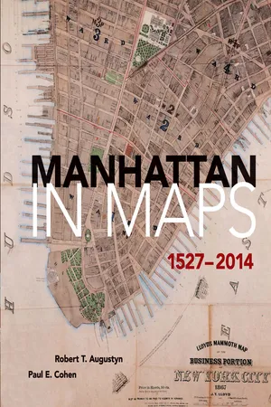
More than 400 years of history unfold in the pages of this lavishly illustrated volume, which presents sixty-five full-color maps of America's oldest major city. This is Manhattan's first atlas of historical maps, gathered from private collections and libraries throughout the world. From Giovanni da Verrazzano's first glimpse of New York Harbor in the sixteenth century to a modern aerial survey of the island, these rare and beautiful maps recount the city's urban and social history.
Each map is accompanied by a fascinating essay that explores its portrait of New York's changing physical and social contours. Examples from the Dutch colonial period reflect the findings of Manhattan's earliest European settlers. New York was the command center for British forces during the Revolution, and wartime maps painstakingly delineate the battleground's streams, swamps, hills, and shoreline. Frederick Law Olmsted and Calvert Vaux's original plan for Central Park appears here, along with charts that reveal the development of the Manhattan grid as well as the expansion of ethnic neighborhoods, midtown vice, and the subway system. Each entry cites the map's title, date of creation and publication, cartographer, medium, and the institution or private collection where the map is archived. There is a Foreword by Tony Hiss, a bibliography, and complete index, as well as a new Introduction by Marguerite Holloway, author of The Measure of Manhattan (2013), and an essay by landscape ecologist Eric W. Sanderson, which includes a map by Mr. Sanderson and cartographer Markley Boyer providing a view of Manhattan Island as Henry Hudson might have seen it in 1609.
"Here then is the story of Manhattan as it was, as it is, and even as it might have been. Maps tell the story. All the output of all the journalists who have written about Manhattan does not succeed half as well."—Ted Koppel, former managing editor and anchor, Nightline
"Manhattan in Maps enables us all to look through layers of time and concrete to the ground of life in this city through over three centuries. . . . an invaluable visual guide to New York City history."—Alice C. Hudson, Chief, Map Division, Center for Humanities, The New York Public Library
Frequently asked questions
- Essential is ideal for learners and professionals who enjoy exploring a wide range of subjects. Access the Essential Library with 800,000+ trusted titles and best-sellers across business, personal growth, and the humanities. Includes unlimited reading time and Standard Read Aloud voice.
- Complete: Perfect for advanced learners and researchers needing full, unrestricted access. Unlock 1.4M+ books across hundreds of subjects, including academic and specialized titles. The Complete Plan also includes advanced features like Premium Read Aloud and Research Assistant.
Please note we cannot support devices running on iOS 13 and Android 7 or earlier. Learn more about using the app.
Information
INDEX
Table of contents
- Cover
- Title Page
- Dedication
- Copyright Page
- Contents
- Acknowledgments
- Preface
- Foreword
- Introduction To The Dover Edition
- The Lost First Map
- Manhattan Found And Lost
- Hudson Rediscovers Manhattan
- The Invention of New Netherlands
- Early Reconnaissance
- Spreading The News Of New Amsterdam
- Metropolis In Embryo
- The Colony In Crisis
- New Lisbon
- New Amsterdamers In New Jersey
- The Brave Place
- The Fall of New Amsterdam
- The English Survey Their Prize
- Dutch Again
- The English Domain
- Cartographic Illusion: Fortress New York
- Expansion Under English Rule
- From Town To City
- All But Lost
- A Citizen’s Map
- Mapping From Memory
- Early Planned Growth
- Charting The Harbor
- Clandestine Cartography
- A Military Survey Becomes A Masterpiece
- Victory in Retreat
- Conflagration
- Manhattan’s Original Topography Preserved On Paper
- Diminished By War
- Capital Recovery
- A Preliminary Plan for Growth
- Fanciful Projection of The Future
- The Modern City Grid
- A Better Comprehensive Plan
- The Randel Survey
- Surveying The Waterfront
- Postwar Growth
- Fire Amid Prosperity
- Croton Water Reaches The City
- The Old Juxtaposed With The New
- Charting The Bay And Harbor With Advanced Methods
- Real-Estate Interests Drive Cartography
- Insurance Company Surveys
- Central Park
- Watery Foundations To Growth
- The Nation’s Business Center
- Uniting Brooklyn And Manhattan
- The Promise of Greater New York City
- Rapid Transit Under Ground
- The “Red Scare”
- City of Skyscrapers
- Times Square Cleanup
- Aviation In The Service of Cartography
- Selected Bibliography
- Index
- Illustration Credits
- About The Authors