- 360 pages
- English
- ePUB (mobile friendly)
- Available on iOS & Android
eBook - ePub
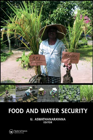
Food and Water Security
About this book
This book deals with ways and means of managing food and water security in various agroclimatic environments through the integration of R & D, training, people participation, agronomic practices, economic instruments, and administrative policies. It includes contributions by global experts in the field, who elaborate on the governance of f
Trusted by 375,005 students
Access to over 1.5 million titles for a fair monthly price.
Study more efficiently using our study tools.
Information
Section 1
Biophysical Dimensions of Food Security
Chapter 1
Remote sensing methodologies for ecosystem management
R. Nemani1, P. Votava2,A. Michaelis2,M. White3, F. Melton2, C. Milesi2, L. Pierce2, K. Golden4, H. Hashimoto2, K. Ichii5, L. Johnson2,M. Jolly6, R. Myneni7, C. Tague8, J. Coughlan1, & S. Running9
1.1 Introduction
The latest generation of NASA Earth Observing System (EOS) satellites has brought a new dimension to monitoring the living part of the Earth system – the biosphere. EOS data can now measure weekly global productivity of plants and ocean chlorophyll and related biophysical factors, such as changes to land cover and to the rate of snowmelt. However, a greater economic benefit would be realized by forecasting biospheric conditions (Clark et al., 2001). Such predictive ability would provide an advanced decision-making tool to be used in the mitigation of natural hazards or in the exploitation of economically advantageous trends. Imagine if it were possible to accurately predict shortfalls or bumper crops, epidemics of vector-borne diseases such as malaria and West Nile virus, or wildfire danger as much as 3 to 6 months in advance. Such a predictive tool would allow improved preparation and logistical efficiencies. Forecasting provides decision-makers with insight into the future status of ecosystems and allows for the evaluation of the status quo as well as alternatives or preparatory actions that could be taken in anticipation of future conditions. Whether preparing for the summer fire season or for spring floods, knowledge of the magnitude and direction of future conditions can save time, money, and valuable resources. Space and ground-based observations have significantly improved the ability to monitor natural resources and to identify potential changes, but these observations can describe current conditions only. This information is useful, but many resource managers often need to make decisions months in advance for the coming season. Recent advances in climate forecasting have elicited strong interest in a variety of economic sectors: agriculture (Cane et al., 1994), health (Thomson et al., 2005) and water resources (Wood et al., 2001). The climate forecasting capabilities of coupled ocean-atmosphere global circulation models (GCMs) have steadily improved over the past decade (Zebiak, 2003).
Given observed anomalies in sea-surface temperatures (SSTs) from satellite data, GCMs are now able to forecast general climatic conditions, including temperature and precipitation trends, 6 to 12 months into the future with reasonable accuracy (Goddard et al., 2001; Robertson et al., 2004).
While such climatic forecasts alone are useful, the advances in ecosystem modeling allow specific exploration of the direct impacts of these future climate trends on the ecosystem. One day predictions made in March might accurately forecast whether Montana’s July winter wheat harvest will be greater or less than normal, and whether the growing season will be early or late.
One of the key problems in adapting climate forecasts to natural ecosystems is the “memory’’ that these systems carry from one season to the next. For example, soil moisture levels, plant seed banks, and fire fuel build-up are all affected by cumulative ecosystem processes that occur over many seasons or years. Simulation models are often the best tools to carry forward information about this spatio-temporal memory. The ability of models to describe and to predict ecosystem behavior has advanced dramatically over the last two decades, driven by major improvements in process-level understanding, climate mapping, computing technology, and the availability of a wide range of satellite- and ground-based sensors (Waring and Running, 1998). In this chapter, we summarize the efforts of the Ecological Forecasting Group at NASA Ames Research Center over the past six years to integrate advances in these areas and develop an operational ecological forecasting system.
1.2 Background of ecological forecasting
Ecological Forecasting (EF) predicts the effects of changes in the physical, chemical, and biological environments on ecosystem state and activity (Clark et al., 2001). EF is pursued with a variety of tools and techniques in different communities. For example, for community ecologists EF commonly includes methods for describing or predicting the ecological niche for various species. Much of invasive species forecasting falls in this area, where a set of conditions associated with the presence/absence of a species is derived and then these empirical relations are used to predict the occurrence or potential for occurrence of that species within a landscape. Similarly, bio-geographers use EF to predict species/community compositions in response to changes in long-term climate or geo-chemical conditions. Climate change and carbon cycling research falls in this category of predicting the state and/or functioning of ecosystems over long-lead times of decades to centuries. In contrast, the eco-hydrological community uses EF as a way of extending weather/climate predictions, with lead times ranging from days to months, for use in operational decision-making. Examples include forecasts of frost damage, flood/streamflow, crop yield, and pest/disease outbreaks. Though such forecasts are age-old among practitioners of various trades, there has been much subjectivity in the decision-making process that is hard to quantify and pass on to later generations. Providing an operational forecasting capability brings a new level of complexity to creating, verifying, and distributing information that is worth acting upon.
1.3 Components of ecological forecasting for eco-hydrological applications
Increasing interest in ecological forecasting is evident from several recent applications ranging from streamflows (Wood et al., 2001), crop yields (Can et al., 1994) and human health (Thompson et al., 2006) These attempts tend to focus on specific watersheds or a geographic location with a very specific application; therefore they do not deal with EF as a broad theme associated with certain tools and technologies. Our past heritage in eco-hydrology and NASA’s strengths in global observations and technology led us to focus on the development of a general data and modeling system that allows producing operational nowcasts and forecasts relevant for many in the ecohydrological community. Here we briefly review the important components that make our approach to EF possible, extensible, and economically viable.
Ecosystem Models: As in numerical weather prediction, models form the basis for EF. These models range in complexity, computational requirements, and in the representation of the spatio-temporal details of a given process or system. For example, biogeochemical cycling models are often complex and versatile in the sense that the basic ingredients that they simulate (carbon, water, nutrient cycling) form the core information for a variety of biospheric activities of economic value. For example, changes in carbon cycling expressed as net primary production (NPP) can be a key indicator of crop yields, forage production or production of board feet of wood. These models use the Soil-Plant-Atmosphere continuum concept to estimate various water (evaporation, transpiration, stream flows, and soil water), carbon (net photosynthesis, plant growth) and nutrient flux (uptake and mineralization) processes. They are adapted for all major biomes exploiting their unique eco-physiological principles such as drought resistance, cold tolerance, etc. (e.g. BIOME-BGC, Waring and Running, 1998; CASA, Potter et al., 2003). The models are initialized with ground-based soil physical properties and satellitebased vegetation information (type and density of plants).
Following the initialization process, daily weather conditions (max/min temperatures, solar radiation, humidity, and rainfall) are used to drive various ecosystem processes (e.g., soil moisture, transpiration, evaporation, photosynthesis, and snowmelt) that can be translated into drought, crop yields, NPP, and water yield estimates. We currently use a diagnostic (with satellite data input) version of BGC to produce nowcasts and a prognostic (without satellite data inputs) version of BIOME-BGC to produce forecasts of carbon and water related fluxes.
Extensive discussion on types of ecosystem models and their relevant applications can be found in Waring and Running (1998) and Canham et al. (1997).
Microclimate mapping from surface weather observations: Access to reliable weather data is a pre-requisite for ecosystem modeling. The availability of weather observations has been a key obstacle in the development of real-time EF systems. Historically, weather data was made available on tapes or CDs months after it was collected and corrected for errors. This time lag precluded real-time simulations, a precursor to developing forecasting capability. Through the World Wide Web, however, there are now thousands of on-line weather stations providing real-time weather data. These real-time data include ground-based observations of max/min/dew temperature and wind speed, satellite-based solar radiation, and spatially continuous rainfall fields produced by weather agencies. Another important advancement for EF is the ability to grid point observations onto the landscape at various spatial resolutions, as observations are rarely sufficient to represent the spatial variability. Models such as PRISM, DAYMET, and SOGS (Daly et al., 1994; Thornton et al., 1997; Jolly et al., 2004) ingest point surface observations, and use topography and other ancillary information to compute spatially continuous meteorological fields (temperature, humidity, solar radiation, and rainfall) that can be directly used in ecosystem modeling.
Weather/Climate Forecasts: There is considerable optimism among the climate community about our ability to forecast climate into the future (Trenberth, 1996). This optimism stems from several recent advancements in climate modeling, such as improvements in GCMs that have allowed realistic reproduction of observed global climate (Roads et al., 1999), adaptation of new forecasting strategies, demonstration of the links between El Niño/Southern Oscillation (ENSO) and short-term climate, and the ability to forecast ENSO 12–18 months in advance. Barnett et al. (1994) showed that with the above improvements, GCMs could be used successfully to predict air temperature, precipitation, and solar radiation at extended lead times over many parts of the world. Research as well as operational agencies that currently produce and disseminate climate forecasts includes the NOAA’s National Center for Environmental Prediction, Columbia University’s International Research Institute, the Scripps Institute of Oceanography’s Experimental Climate Prediction Center, and others.
Satellite remote sensing: A number of studies over the past two decades have shown the utility of satellite data for monitoring vegetation (type, density, and production), extent of flood damage, wildland fire detection, and monitoring snow and drought conditions. However, many of the products generated from satellite data have been experimental, and did not have a wide distribution among natural resource managers. Over the past five years, through NASA’s EOS program, there have been substantial improvements in the way satellite data is acquired, processed, converted to products, and delivered (Table1.1). For example, weekly maps of leaf area index (LAI, area of leaves per unit ground area) and vegetation indices, key inputs for many ecosystem models, are being generated and distributed from the NASA/MODIS sensor. A number of other key land products such as NPP, fire occurrence, snow cover, and surface temperature are available globally at 1-km resolution every 8 days (Justice et al., 1998; Myneni et al., 2002). Without this near realtime observing capacity, systems such as TOPS would never have materialized.
Integrated modeling: Numerous studies over the past two decades addressed the logical steps for modeling land surface processes over various spatial scales, by integrating ecosystem models with satellite, climate data, and other ancillary information (Waring and Running, 1998). One such attempt that many of us have been part of was the development of the Regional Hydro-Ecological Simulation System [RHESSys, Band et al., 1993; Nemani et al., 1993; Tague and Band, 2004). RHESSys has been used i...
Table of contents
- Cover Page
- Title Page
- Copyright Page
- Preface
- Foreword
- List of Figures
- List of Tables
- List of Plates
- Section 1: Biophysical Dimensions of Food Security
- Section 2: Socioeconomic Dimensions of Food Security
- Section 3: Governance of Food Security In Different Agroclimatic and Socioeconomic Settings
Frequently asked questions
Yes, you can cancel anytime from the Subscription tab in your account settings on the Perlego website. Your subscription will stay active until the end of your current billing period. Learn how to cancel your subscription
No, books cannot be downloaded as external files, such as PDFs, for use outside of Perlego. However, you can download books within the Perlego app for offline reading on mobile or tablet. Learn how to download books offline
Perlego offers two plans: Essential and Complete
- Essential is ideal for learners and professionals who enjoy exploring a wide range of subjects. Access the Essential Library with 800,000+ trusted titles and best-sellers across business, personal growth, and the humanities. Includes unlimited reading time and Standard Read Aloud voice.
- Complete: Perfect for advanced learners and researchers needing full, unrestricted access. Unlock 1.5M+ books across hundreds of subjects, including academic and specialized titles. The Complete Plan also includes advanced features like Premium Read Aloud and Research Assistant.
We are an online textbook subscription service, where you can get access to an entire online library for less than the price of a single book per month. With over 1.5 million books across 990+ topics, we’ve got you covered! Learn about our mission
Look out for the read-aloud symbol on your next book to see if you can listen to it. The read-aloud tool reads text aloud for you, highlighting the text as it is being read. You can pause it, speed it up and slow it down. Learn more about Read Aloud
Yes! You can use the Perlego app on both iOS and Android devices to read anytime, anywhere — even offline. Perfect for commutes or when you’re on the go.
Please note we cannot support devices running on iOS 13 and Android 7 or earlier. Learn more about using the app
Please note we cannot support devices running on iOS 13 and Android 7 or earlier. Learn more about using the app
Yes, you can access Food and Water Security by U. Aswathanarayana in PDF and/or ePUB format, as well as other popular books in Social Sciences & Sociology. We have over 1.5 million books available in our catalogue for you to explore.