- 330 pages
- English
- ePUB (mobile friendly)
- Available on iOS & Android
eBook - ePub
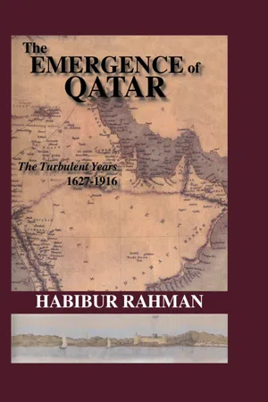
The Emergence Of Qatar
About this book
First published in 2006. The history of Qatar from the Portuguese bombardment of 1627 to the conclusion of the Treaty of 1916 is a hitherto untold story of destructions, wars, battles, conflicts, intrigues, conspiracy and strategic contests originating in the ashes of the north-west coast of the peninsula and brought to a conclusion at al-Bida (later Doha). The present work examines the years of frustration and upheaval that led to the emergence of Qatar
Trusted by 375,005 students
Access to over 1.5 million titles for a fair monthly price.
Study more efficiently using our study tools.
Information
Chapter One
Historical and Geo-Political Setting
‘Katara’ or ‘Guttur’ or ‘El-Katr’ and now Qatar is a peninsula, which juts into the southern Arabian Gulf almost midway between the mouth of the Shatt al-Arab waterway to the north-west and the strait of Hormuz (to the north of Oman at the Gulf’s eastern end). The breadth of the Gulf between Ras Rakkan, at the tip of the Qatar peninsula and the Persian coast at Ras Mustaf was estimated at 100 miles in the first edition of the Persian Gulf Pilot.(1) Qatar, with its arid desert climate, extends the length of the peninsula, which is about 120 miles long and 60 miles wide and covers a total area of 7110 square miles. In medieval times the name ‘Bahrayn’ was applied to the whole Arabian littoral from the vicinity of Kuwait to Qatar including the islands of Bahrain. Qatar lay on the border of the two major geographical divisions into which eastern Arabia had been split, Bahrain and Oman.
Qatar in Ancient and Medieval Times
Qatar played a vital role in the development of maritime trade and commerce even in the Stone Age and Neolithic period. Archaeological discoveries of pottery, flint, flint scraper tools and the rim of a painted ceramic vessel with part of the flange from al-Ubaid, Mesopotamia, at Bir Zekrit and Ras Abaruk, situated on the western coast of Qatar, indicates Ras Abaruk’s trade and commercial links with the Mesopotamian civilization, which flourished in the land between the Tigris and the Euphrates (in present-day Iraq) during the 5th - 4th millennium BC. Ras Abaruk continued to grow in importance and it became a fishing station where foreign vessels used to land to dry fish in 140 BC. Further settlements and a trading point developed in and around Umm al-Ma, situated to the north-west of Ras Abaruk, during the reign of the Sasanids in Persia (3rd century AD - 6th century AD). Ras Abaruk and Umm al-Ma, played a conspicuous role in the Sasanid commerce, particularly in the shipment of precious pearls and purple dye.(2)
Islam spread throughout the entire Arabian Gulf region in the seventh century. During the Islamic period settlements continued to grow and a system of administration developed on the west coast of Qatar peninsula. In the year 628, Al Mundhir bin Sawa al-Tamimi, the ruler of Qatar at the time, along with his subjects, embraced Islam when the Prophet Mohammad’s (Peace be upon Him) emissary al Ala al-Hadrami visited al-Tamimi.(3) Eventually, trade and commercial links were established between Qatar and Arabia. Historians have failed to identify al-Tamimi’s seat of administration, but it may have been at either Umm al-Ma or Murwab in the Joghbi area. This theory is lent supported by the archaeological discovery of about 100 small stone-built houses and the fortified palaces of a tribal leader at Murwab, which date to the early Islamic period. The Murwab palace or fort was built on the ruins of an earlier fort destroyed by fire. Furthermore, an early Islamic village site with rectangular wall lines similar to those at Murwab was unearthed one kilometer north of al-Nama, southwest of Zubara.(4)
During the reign of the Umayyads (661-750 AD), and the Abbasids (750-1258 AD) in Damascus and Baghdad respectively, trade and commerce grew in Qatar. It became a famous camel and horse breeding centre during the Umayyad period, while the Abbasid period witnessed the development of the pearling industry in the rich waters around Qatar. The demand for Qatari pearl also increased in the East, as far away as China. As mercantile activities intensified on the western coast of Qatar, settlements began to spring up there, particularly at Murwab, between Zubara and Umm al-Ma, where, as mentioned above, 100 or more small stone-built houses were constructed.(5)
Towns and Topograpy in Modern Times
The development of modern settlements is best understood in the historical and geographical context. It is interesting to note that Carsten Niebuhr’s map of the Persian Gulf, published in 1765, failed to show Qatar as a peninsula. Niebuhr’s map is confusing and not accurate. Although he visited Arabia in 1764, he prepared his map without visiting Qatar personally and relied on local Arab informants as well as English sea captains. Niebuhr’s Qatar included ‘Guttur’ [al-Bida], ‘Adsjar’ (probably al-Khor), al-Huwailah, Yusufiyah and Furaiha. (6) In 1809, more than four decades after the publication of Niebuhr’s map, Captain John Wainwright referred to the Qatar coast as ‘the coast of danger’ because of its inaccessibility from the sea, an opinion based on his voyage to the Gulf.(7) Major Colebrook’s report on the Persian Gulf littoral of 10 September 1820, gives the first description of the major towns of Qatar:
Zobarah [Zubara] .… protected by a tower and occupied at present merely for the security of fishermen that frequent it. It has a Khoor with three fathoms water which Buggalahs may enter.
Khoor Hassam - Before the seat of Aula Yelaina [Jalahima] has a Khoor admitting Buggulahs drawing 2½ fathoms. It has no inhabitant at present.
Limel [Jumail] .… at one time could furnish 1,000 men (5,000 of the tribe Maheude [al-Maadhid] and 500 Bokuara [Bu Kawara] a branch of the Beni Tamem) defended by a square Ghurry on the seaside. Fresh water abundant.
Foreihel [Furaiha] - Deserted formerly occupied by the Bu Sumaitt.
Ul Yusvee [al Yusufiyah] and Roes [Ruwais]-Are two villages to the west of Ras Rekkan [Rakkan], the inhabitants of which had latterly removed to Bahrein. Limel, Yusvee and Roes, have Khoors or back waters, which are shallow. Batils can enter at high tide, but at low water they are quite dry, and the sea coast very shallow. Yusvee has a square Ghurry and fresh water.
Phoerol [Fuwairet] - To the East of Ras (cape) Reckan, the inhabitants removed to Bahrein, has no Khoor the coast on this side the cape, is bolder and may be approached by vessels within gunshot.
Howeleh [al-Huwailah] - Is defended by a square Ghurry, containing good water, and is frequented by fishermen in the season. It was inhabited by a remnant of the once powerful tribe of Musellim [al-Musallam], now incorporated with the Utubis. The tranquillity restored to the Gulf, will probably cause all these places to be reoccupied, the coast being well watered, which is not the cases in Bahrein.
Guttur- Or Ul Buddee [al-Bida] once a considerable town, is protected by two square Ghurries, near the sea shore; but containing no fresh water they are incapable of defence except against sudden incursions of Bedouins, another Ghurry is situated two miles inland and has fresh water with it. This could contain 200 men. There are remaining at Ul Buddee about 250 men, but the original inhabitants, who may be expected to return from Bahrein, will augment them to 900 or 1,000 men, and if the Doasir tribe, who frequent the place as divers, again settle in it, from 600 to 800 men.(8)
The major tribes living in north-west Qatar at that time were: al-Bu Kuwara, al-Maadhid, al-Bu Sumait and al-Musallam, the last of which were ‘incorporated with the Utubis’, as Colebrook mentioned. All these coastal towns and villages were situated near the Arabian Gulf pearl banks and the inhabitants had been practising pearl fishing since time immemorial.
The British Survey of Qatar
The first systematic survey of the topography of the Gulf was carried out between 1820 and 1829 by the Officers of the East India Company’s Bombay Marine. In 1821 Lieutenant J. N. Guy surveyed from the Trucial Coast to the tip of the Qatar peninsula at Ras Rakkan; Captain George Barnes Brucks then continued up to the Shaft al-Arab. The task was completed in 1825 and the results were published in 1829. Describing briefly the topography of Khor al-Odaid channel, Brucks mentioned Wakra, which was composed of coral and small rocks and situated about ten miles east of al-Bida. Although Brucks’ report made no reference to any settlement at Wakra, he examined al-Bida in detail:
Al Bidder Town is in lat. 25° 16’ 50” N., long. 51° 33’ E. It is situated at the bottom of a harbour, formed by the reefs before mentioned. The entrance is only half a mile wide, having three and four fathoms water in it in mid channel, and rather less towards the northern reef, and towards the southern two fathoms. As the shoals show themselves distinctly, to enter the harbour you must be guided by them, keeping rather nearer to the northern one. The narrow part is not more than half a mile in length. When through, steer for the town, and anchor abreast the eastern tower, in three and a half fathoms, about half a mile off shore. This place contains about four hundred Arabs of the Nahune [Nairn]; Dooasir [Dawasir], and Abookara [al Bu Kawarah] Tribes, and is frequented by the Monasir and other wandering tribes. In the pearl season the inhabitants are augmented to about twelve hundred, it being convenient to the banks, and so completely sheltered. The people are mostly fishermen; they have one or two trading boats, and, like all other inhabitants of this coast, take a large share in the pearl fishery. (9)
The total population of al-Bida was therefore four hundred, consisting of the Nairn, al Bu Kuwara, Dawasir tribes. There were also two or three towns and a ‘Ghuree’ in al-Bida for defensive purposes. (10)
Therefore, by the 1820s a township had developed with an impressive population, containing several tribes and featuring growing commerce. Al-Huwailah, another major town, to the north of the peninsula, also drew Brucks’ attention. This coastal town, older than al-Bida, was defended by a small Ghuree and was inhabited by about four hundred and fifty of the al Bu Kuwara tribe. The people were engaged in maritime trade and during the pearl fishing season al-Huwailah was one of the principal trade centres. In addition to these towns, Brucks surveyed almost all the coastal towns and villages on the coast of Qatar including al Khor, Fuwairet, Ruwais, Ras Rakkan, Abu Dhaluf, Jumail, Yusufiyah, Khor Hassan, Furaiha and Zubara as well as Rubaiya. The total population of these places varied from fifty to one hundred. In the absence of any central authority these coastal towns and villages were governed by the local Shaikhs. Brucks’ last point of survey on the Qatar coast was the Warden islands (later Hawar islands), situated about one mile off the coast of Qatar. Two fishing villages owned by the migratory Dawasir tribe were found on the main island.(11)
The successful completion of the survey was a remarkable achievement by Brucks. The survey included comprehensive information regarding the tribes, towns, villages and resources of the Arabian shores. However, as incorrect longitudinal information appeared in the survey, Lieutenant C. G. Constable and A. W. Stiffe were employed in 1857 to correct it; the revised text was published by the Admiralty as the first edition of the Persian Gulf Pilot in 1864. The Persian Gulf Pilot was a significant improvement on the reports of Colebrook and Bracks’ on the geographical location of the towns of Qatar. It referred to some new places, namely, Ras Abu Aboud and Doha. While the former was a natural harbour with no settlement, the latter was a well-developed town. The Persian Gulf Pilot described the town of Doha as well as al-Bida:
DOHEE [Doha] is a town partly walled round, with several towers, half a mile S. W. by W. from Ras Nesseh; it extends about 800 yards along the beach. The Sheikh’s house is at a large round tower (with the flagstaff) on the beach, about the centre of the town; to the west of this tower is a small bight, where boats are hauled up to repair. The reef dries off a quarter of a mile from the shore opposite this place. Between this town and Al Bida’, and almost connected with Doheh, is a distinct town, recently built, called Doheh el Saghireh (Little Doha), which has a new square fort at the south-west corner, built on the rising ground at the back of the town. AL BIDA- There is only 400 yards open space between this town and Little Doheh; the three towns together extend one mile along the coast. Bida’ is built up the side of the rising ground; there is a fort in the town, where the Sheikh’s flag is shown, and two towers on the highest part of the land behind the town, one of which is the first thing seen from the sea. One mile and a half to south-eastwards of the town is a tower near the wells, with a little cultivation; with this exception the whole country is desert.(12)
The total population of the above three towns was approximately 5,000; most of whom were employed in pearl fishery. The Persian Gulf Pilot also estimated the inhabitants of Wakra as 1,000.(13) Finally in 1905, John Gordon Lorimer, the eminent British civil servant and gazetteer writer estimated the total population of Qatar as 27,000 souls consisting of different tribes, namely, al-Maadhid, al Bu Ainain, al Bin Ali, al Bu Kuwara, al-Mohannedi, al-Kubaisat, al-Dawasir, al-Manai, al-Sulaithi, the Persians, etc.(14) Lorimer also described the economic activities of Qatar at the time:
Occupations, resources and trade- The principal and almost the exclusive source of livelihood in Qatar is pearl-fishing, supplemented in some places by the breeding of camels. Agriculture hardly exists. The only date palm...
Table of contents
- Cover
- Title
- Copyright
- Contents
- List of Plates
- Glossary
- Abbreviations
- Preface
- Acknowledgements
- 1 Historical and Geo-Political Setting
- 2 The Shifting Balance from Zubara to Al-Bida
- 3 The Struggle for Power in Bahrain and the Fall of Bin Tarif
- 4 Bin Thani and the Unification of Qatar
- 5 The Ottomans in al-Bida and the Ascendancy of Shaikh Jasim
- 6 The 1895 Zubara Tragedy and the Aftermath
- 7 Struggle for British Protection
- 8 The Last Phase of Shaikh Jasim’s Rulership and the Zakhnuniyah Crisis
- 9 The Baghdad Railway and the Status of Qatar
- 10 Summary and Concluding Remarks
- Appendix I Report on the Battle of Fuwairet, 1847
- Bibliography
- Index
Frequently asked questions
Yes, you can cancel anytime from the Subscription tab in your account settings on the Perlego website. Your subscription will stay active until the end of your current billing period. Learn how to cancel your subscription
No, books cannot be downloaded as external files, such as PDFs, for use outside of Perlego. However, you can download books within the Perlego app for offline reading on mobile or tablet. Learn how to download books offline
Perlego offers two plans: Essential and Complete
- Essential is ideal for learners and professionals who enjoy exploring a wide range of subjects. Access the Essential Library with 800,000+ trusted titles and best-sellers across business, personal growth, and the humanities. Includes unlimited reading time and Standard Read Aloud voice.
- Complete: Perfect for advanced learners and researchers needing full, unrestricted access. Unlock 1.5M+ books across hundreds of subjects, including academic and specialized titles. The Complete Plan also includes advanced features like Premium Read Aloud and Research Assistant.
We are an online textbook subscription service, where you can get access to an entire online library for less than the price of a single book per month. With over 1.5 million books across 990+ topics, we’ve got you covered! Learn about our mission
Look out for the read-aloud symbol on your next book to see if you can listen to it. The read-aloud tool reads text aloud for you, highlighting the text as it is being read. You can pause it, speed it up and slow it down. Learn more about Read Aloud
Yes! You can use the Perlego app on both iOS and Android devices to read anytime, anywhere — even offline. Perfect for commutes or when you’re on the go.
Please note we cannot support devices running on iOS 13 and Android 7 or earlier. Learn more about using the app
Please note we cannot support devices running on iOS 13 and Android 7 or earlier. Learn more about using the app
Yes, you can access The Emergence Of Qatar by Rahman,Habibur Rahman in PDF and/or ePUB format, as well as other popular books in Social Sciences & Anthropology. We have over 1.5 million books available in our catalogue for you to explore.