Chapter 1
Introduction
1.1Introduction
In 1985, a failure took place during the construction of a UK motorway cutting (Arrowsmith et al., 1985), which was shown to be due to lenses of laminated clay embedded in the glacial till. The slope had been cut to a standard angle specified by the road authority, a typical angle for stiff clays. The laminated clay lenses proved to be nearly parallel to the slope. Ground investigations did indicate that the lenses were there but they were interpreted as pockets of laminated clay or horizontal layers of laminated clays, not unusual and not considered a risk. In 1993, a land fill design was based on the assumption that the underlying glacial till was impermeable. The arguments that a till can contain lenses of more permeable materials led to the proposal being rejected at a public inquiry (Gray, l993). A dredging contractor claim that they did not expect boulders because the borehole logs did not indicate their presence was rejected on the grounds that glacial till can contain boulders. A piling contractor took as read that they would be constructing bored piles in stiff clay because that was the description given in the borehole logs. They chose to use smaller diameter piles than those considered at the design stage, which meant that they were longer and, importantly, extended below the depth of most of the boreholes. This proved to be an expensive mistake as the pile holes had to be cased to full depth to prevent water ingress and collapse of the sides of the boring when they encountered a layer of water-bearing sand. Hand excavation was proposed for a tunnelling scheme on the basis of the soil descriptions; the contractor ended up using explosives because the till was much stronger in situ. Bell and Culshaw (1991) consider the glacial till to be a problematic soil together with collapsible soils, quick sands, peat, expansive clays and frozen soils because of the variability in the composition. These examples highlight issues of misinterpreting borehole logs, the failure to appreciate the fabric and structure of glacial soils and poorly planned ground investigations.
A truly useful ground investigation would be staged to include preliminary boreholes to identify the ground profile and secondary boreholes to collect representative samples for geotechnical characterisation. Those samples are likely to be driven U100 samples or rotary cored samples. However, as pointed out by Taylor et al. (2011), neither of these sampling methods produces undisturbed samples; that is, it is often impossible to obtain quality representative samples of many glacial soils, which means that it is difficult to determine their characteristic stiffness and strength. Consequently, foundations are often overdesigned and inappropriate construction techniques may be used.
These examples highlight some of the challenges that glacial tills present and why conventional practice is often lacking, possibly inappropriate. This is because boulders, lenses and layers of water-bearing sands and gravels and laminated clays should be expected in glacial tills and glacial tills can be softer/stiffer than laboratory tests indicate. Other glacial soils such as glaciolacustrine, glaciofluvial and glaciomarine soils also have distinguishing features, which can be difficult to deal with. These include their anisotropic nature due to summer/winter deposition, variation in composition with distance from source, variation in composition associated with their source and speed of deposition and, possibly, very sensitive structure. Glacial soils are eroded by ice, transported by ice/water and deposited by ice/water, which leads to spatially variable soils in terms of their composition, fabric and structure. Failure to recognise this in glacial tills can have economic and, possibly, catastrophic consequences.
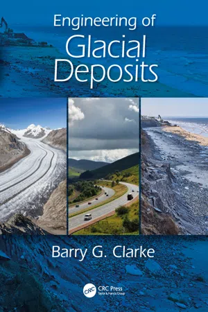
1.2Glaciation
It is estimated that at some time 30% of the world’s land mass was covered by glaciers or ice sheets (Benn and Evans, 2010); a quarter of North America, one-third of Europe, and 60% of the United Kingdom were covered in glacial materials (Flint, 1971). A glacier is a slow moving mass or ‘river’ of ice formed by accumulation and compaction of snow falling on the upper reaches of a valley glacier or near the centre of ice sheets. About 22% of the Earth’s land surface was covered by glaciers at the last ice age; currently, glaciers and ice sheets cover 9.6% of the terrestrial surface. Glacial ice is an important dynamic element of the earth system; for example, 25.7 × 10⁶ km3 of ice is found in the Antarctic Ice Sheet, equivalent to a rise of 61 m sea level; mountain glaciers are an important water resource. As glacial ice advances, it deforms and erodes the bedrock and underlying soil, including remnants of previous glaciations, and transports, homogenises and deposits glacial soils beneath the glacier, at the ice margins or remote from the ice margins. Most of the terrestrial glacial soils are remnants of the last glacial advance leaving extensive deposits of glacial drift (Table 1.1). Since the last glacial period, the ice has receded leaving ice sheets confined to Greenland and Antarctica and valley glaciers in the Alps, Himalayas, Andes and North Alaska (Table 1.2), with the ice sheets representing 96.6% of the current glaciated area.
Table 1.1Possible thicknesses of g...