eBook - ePub
King's Lynn and the Fens: Medieval Art, Architecture and Archaeology
Volume 30
- 246 pages
- English
- ePUB (mobile friendly)
- Available on iOS & Android
eBook - ePub
About this book
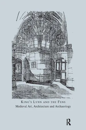
The fourteen papers collected in this volume explore the medieval art, architecture and archaeology of King's Lynn and the Fens. They arise out of the Association's 2005 conference, and reflect its concern to engage with a broad range of monuments and themes, rather than focusing on a single major building. Within King's Lynn contributors consider the superb 14th-century enamelled drinking vessel popularly known as 'King John's Cup', the former Hanseatic 'Steelyard', the Red Mount Chapel, and the oak furnishings of the chapel of St Nicholas, while the pine standard chest from St Margaret's church is assessed in terms of the importation and distribution of similar chest across England as a whole.Outside King's Lynn there are articles on the historical manipulation of landscapes and buildings at Kirkstead, the 13th-century architecture and sculpture of Croyland Abbey, the 14th-century parish church of St Mary at Snettisham, the tomb of Sir Humphrey de Littlebury at All Saints, Holbeach, the overlooked medieval wall paintings in the Prior's Chapel at Castle Acre, and the late medieval stained glass at Wiggenhall St Mary Magdalen. Finally, there are three papers that look at particular aspects of the ways in which parish churches were financed, embellished and used across the region - in terms of late-12th and early-13th-century patronage, their 12th-century deployment of architectural sculpture, and the types and arrangements of choir stalls that appeared at a parochial level during the later Middle Ages.
Information
Masters of Kirkstead: Hunting for Salvation
This is a paper about interrelationships between buildings and landscapes. It explores the ways that both were moulded by successive lords — religious and secular — in order to make political, social and religious points. In particular, we seek to explore the relationship between two well-known groups of buildings, Kirkstead Abbey and Tattershall Castle, both with each other, and with the distinctive landscape maintained for hunting, in which they were set. We shall use as a focus for our study the beautiful (if somewhat mysterious) surviving chapel of St Leonard, whose raison d’être can be understood more clearly if seen against the backdrop of its surrounding landscape.
INTRODUCTION
BOTH Kirkstead and Tattershall lie towards the southern end of a tongue of land created by the rivers Witham and Bain in Lincolnshire, which has a markedly different character from the surrounding landscape (Fig. 1). To the west lie the Witham fens, an extension of the great fen to the south with the medieval river flowing along its eastern boundary. To the north-east and east, beyond the Bain valley, lie the foothills of the Lincolnshire Wolds; from the 10th century a landscape of nucleated settlements, each with its parochial church. Except along the more fertile alluvial margins, the ridge between the two rivers is poor sandy land, still relatively well covered with a mixture of woodland and heathland. This is the southern end of a continuous belt of such country, five miles wide, that once extended southwards from Market Rasen and was known as ‘Linwood’.
Tattershall has always been one of the two gateways to Lindsey — that region of Lincolnshire, north of the Witham and east of the Trent, whose separateness was periodically made explicit by separate administration.1 The other is Lincoln itself. No doubt this gateway role accounts for the recurrent aspiration amongst great men to hold the lordship of Tattershall and, to some extent, for the architectural ambition displayed by successive buildings here.
ORIGINS OF A HUNTING LANDSCAPE
KIRKSTEAD is that type of place-name formation which scholars of place-names call ‘appellative’ (i.e. common nouns describing function or status within an estate network, which become used as place-names). It is striking that there are many place-names of this appellative form in close proximity, indeed all the main names within the area under scrutiny seem to be appellatives (Fig. 2). Coningsby, ‘the king’s farm’ for example, is probably a scandinavianization of an earlier OE ‘king’s tun’.2 Kirkby, ‘the settlement with a church’, is likely to refer to a pre-Viking church and perhaps to be an earlier ‘churchton’.3 Tumby, as ‘the settlement related to a — perhaps abandoned or deserted — enclosure’, too, might have been earlier ‘tun-stead’.4 Fulsby was ‘the foals’ farm’, or stud farm, analogous to the OE versions of the same place-name at Foulridge in Lancs, Fowberry in Northumberland, or Statfold/Stotfold in Staffordshire, Bedfordshire and the West Riding of Yorkshire, whilst the minor name of Langworth, ‘the long ford or river crossing’, is an appellative; and Armtree, also recorded in Coningsby, is too, if it meant ‘outlaws’ tree’ (that is ‘gallows’) as its elements suggest.5


Even the simplex Thorpe, if it replaced an earlier OE &rop (equivalent to Latin fundus ‘farm, estate’6) rather than representing a minor, secondary Scandinavian settlement, can be understood as a further and key component of an early estate. Indeed, this is strongly suggested by the way that Domesday Book records land-holding here. No holding is recorded against Tattershall, but all the components that later formed the local elements of the barony are returned against the name ‘Thorpe’. Even more significantly, there were intimate tenurial connections between ‘Thorpe’ and Kirkby-on-Bain, its next neighbour to the north, and with Kirkby’s constituents on the east side of the Bain at Tumby and Fulsby.
The place-names strongly suggest, then, a single entity: a territory or estate.7 In Domesday Book recurrent references to ‘woodland throughout the territory’ confirm its unity. Economically, this territory was characterized by rather low population and settlement density, and small amounts of arable; but there was plentiful meadow, presumably on the river flood plains, and numerous mills and fisheries. But most distinctive were the very large areas of woodland for pannage, and therefore suitable for hunting. It contained specialized features that presumably relate to this specific function: the king’s house at Coningsby (providing accommodation for riding parties from the royal administrative centre at Horncastle), the apparent stud-farm, and the gallows tree, where offenders against the ‘vert’ might be punished. The estate was evidently already established at Domesday, but it may have been considerably more ancient, as it has been proposed that the remarkable later 7th-century so-called ‘smith’s burial’ at Tattershall Thorpe owes its presence to the existence locally of a royal estate.8 The earlier focus of the territory may have been the late prehistoric enclosure at ‘Tattershall Thorpe’ across from Tumby; and we might compare its geographical separation from the putative royal tun at Coningsby with that of the late prehistoric enclosure at Crow Hill (where reoccupation in the early Anglo-Saxon period has also been demonstrated) and its associated, documented, 8th-century royal vill at Irthlingborough (both in Northamptonshire).9
Three generations after Domesday, the Cistercian abbey of Kirkstead was established in this landscape, some 2.5 miles upstream from Tattershall. This was not the site of its original foundation, however, as Kirkstead was one of those monasteries — including Barlings and Haverholme locally, and nearly half of all Cistercian foundations further afield10 — which, after establishment at one location, is reported to have moved site. In Kirkstead’s case, the final location was a site which the place-name shows had previously been marked by an ecclesiastical foundation of some kind. But additionally, we wish to propose that the original location was also called ‘Kirkstead’.
We have argued elsewhere that the location where the Kirkstead community first settled was near modern Tattershall.11 Here, we wish to suggest, an early church had already been established that was the fore-runner of the chapel whose documented 13th-century dedication was to St Mary. We suggest, furthermore, that when the Cistercian house of Kirkstead was founded (as a daughter of Fountains in 1139 by Hugh Brito, son of Eudo fitzSpirewic, lord of Tattershall — whose family eventually adopted the name de Tateshale), it was as the successor to this pre-existing chapel. This was also certainly a ‘kirkstead’ — that is an isolated church site as distinct from a settlement with a church — and the new foundation, we suggest, took this as its name. The foundation charter spells it out: the location was generically a ‘kirkstead’ (as the locals called it), ‘id est locus ecclesiae’.12
In the late Anglo-Saxon period, both Kirksteads were distinguished through their place-names from the other sorts of ecclesiastical provision serving this territory, which we might guess was originally based at the settlement called ‘Kirkby’. The two Kirksteads — one at the east end of the Martin-Woodhall cross-Witham causeway; the other at the east end of the Billinghay-Tattershall cross-valley causeway — were not only both Christian guardians of their respective causeways,13 but they also lay at the entrances from the west onto this distinctive wooded heathland plateau. We shall see that, although both Kirksteads developed into substantial building complexes, both also remained intimately connected with this hunting territory, regardless of whether they were held in religious or secular hands.
KIRKSTEAD AT TATTERSHALL, AND ITS RELOCATION
THE parallels for custodial churches at the ends of causeways, combined with the place-name Kirkstead, then establish the probable presence of an Anglo-Scandinavian church at the southernmost of our two sites: a place which was also called Tattershall, ‘a nook of land’ — OE halh — associated with a man with a dithematic, aristocratic name of early type.14 The detailed topography is precisely ‘a nook’, a narrow low promontory as defined by the 5 m contour poking out into the peat lands (Fig. 3 upper left) and lying, furthermore, at the tip of the well-wooded estate we have already identified. Here, if we wish to match the abbey’s foundation documentation literally, is a location ‘horroris et vastae solitudinis … containing a limited level area but surrounded by brambles and marshes’, as the foundation account has it.
This putatively early chapel that stood on the promontory where Tattershall Castle now stands was first securely documented in 1160.15 But one ‘Ralph the priest of Tattershall’, who was connected to the de Tateshale family and to the newly founded Kirkstead Abbey, gave land to the abbey in c. 1140 and it seems likely that he was also associated with this chapel.16 In 1243 and 1250 institutions were made to a rectory at Tattershall and E. M. Sympson thought that this represented the creation of the parish church here.17 Certainly, the church of Tattershall is listed routinely in the taxation surveys of 1254 and c. 1291, in the latter case with the high value of £21 6s. 8d.18 The relationship between the later parochial church and the earlier chapel is unclear, but the major change preceding the apparent foundation of the rectory was the establishment of the castle somewhere in the same vicinity. The ecclesiastical situation here remained complicated, however, and the church itself had a rector and a staff of four or five priests in the later 14th century.19 The complexity of the institution had not been resolved by the time of the death of Ralph Lord Cromwell’s grandmother Matilda in 1419, when she — like Joan de Driby in 1323 before her — held the advowsons (plural) of the church of St Peter at Tattershall and those of the chapels in the same church20 According to Dorothy Owen one of these separately endowed chapels was dedicated to St Mary, and, given its dedication, may represent the earlier chapel on the promontory around which the monastic community first settled. Owen thought it lay in the churchyard of Holy Trinity College, and Douglas Simpson presumed it lay ‘more or less on the site of the present building’ (Fig. 3).21 Simpson was probably referring to the same discovery of foundations ‘beneath the south transept floor’ that had been reported before the First World War.22 In the early 16th century, the dedication to St Mary was linked with St Nicholas ‘within the castle’.23

Table of contents
- Cover
- Half Title
- Title Page
- Copyright Page
- Table of Contents
- List of Abbreviations
- Preface
- ‘King John’s Cup’
- The Red Mount Chapel, King’s Lynn
- The Former Nave and Choir Oak Furnishings, and the West End and South Porch Doors, at the Chapel of St Nicholas, King’s Lynn
- The Pine Standard Chest in St Margaret’s Church, King’s Lynn, and the Social and Economic Significance of the Type
- Trading Places: Counting Houses and the Hanseatic ‘Steelyard’ in King’s Lynn
- Masters of Kirkstead: Hunting for Salvation
- ‘Sadly mangled by the insulting claws of time’: Thirteenth-Century Work at Croyland Abbey Church
- Snettisham Church
- The Tomb of Sir Humphrey de Littlebury at All Saints, Holbeach
- The Fourteenth-Century Wall-Paintings at Castle Acre Priory and Greyfriars, Great Yarmouth
- The Stained Glass of Wiggenhall St Mary Magdalen, Norfolk
- Romanesque Sculpture in Parish Churches of the Lincolnshire Fens
- Investment in Local Church Fabric in the Lincolnshire Fenlands c. 1150–c. 1210: Moulton and Whaplode
- Medieval Choir Stalls in Parish Churches
- Colour Plates
Trusted by 375,005 students
Access to over 1.5 million titles for a fair monthly price.
Study more efficiently using our study tools.
Frequently asked questions
Yes, you can cancel anytime from the Subscription tab in your account settings on the Perlego website. Your subscription will stay active until the end of your current billing period. Learn how to cancel your subscription
No, books cannot be downloaded as external files, such as PDFs, for use outside of Perlego. However, you can download books within the Perlego app for offline reading on mobile or tablet. Learn how to download books offline
Perlego offers two plans: Essential and Complete
- Essential is ideal for learners and professionals who enjoy exploring a wide range of subjects. Access the Essential Library with 800,000+ trusted titles and best-sellers across business, personal growth, and the humanities. Includes unlimited reading time and Standard Read Aloud voice.
- Complete: Perfect for advanced learners and researchers needing full, unrestricted access. Unlock 1.5M+ books across hundreds of subjects, including academic and specialized titles. The Complete Plan also includes advanced features like Premium Read Aloud and Research Assistant.
We are an online textbook subscription service, where you can get access to an entire online library for less than the price of a single book per month. With over 1.5 million books across 990+ topics, we’ve got you covered! Learn about our mission
Look out for the read-aloud symbol on your next book to see if you can listen to it. The read-aloud tool reads text aloud for you, highlighting the text as it is being read. You can pause it, speed it up and slow it down. Learn more about Read Aloud
Yes! You can use the Perlego app on both iOS and Android devices to read anytime, anywhere — even offline. Perfect for commutes or when you’re on the go.
Please note we cannot support devices running on iOS 13 and Android 7 or earlier. Learn more about using the app
Please note we cannot support devices running on iOS 13 and Android 7 or earlier. Learn more about using the app
Yes, you can access King's Lynn and the Fens: Medieval Art, Architecture and Archaeology by John McNeill in PDF and/or ePUB format, as well as other popular books in Art & History of Architecture. We have over 1.5 million books available in our catalogue for you to explore.