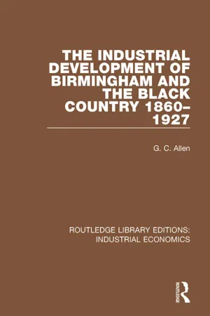
This book, first published in 1929, analyses the changes to Birmingham and the Black Country in the nineteenth century. The area underwent quite a transformation: many of the older trades were decaying, while at the same time a number of new manufactures were making a remarkable rapid advance. As a result of this, the industrial structure of the area in the early twentieth century was made up of very different constituents from those of which is was composed sixty years previously. This is an invaluable study of a remarkable industrial transformation that was carried out in a very short space of time.
- 502 pages
- English
- ePUB (mobile friendly)
- Available on iOS & Android
eBook - ePub
The Industrial Development of Birmingham and the Black Country, 1860-1927
PART I
INTRODUCTORY
CHAPTER I
THE AREA DEFINED
THE area with which we are concerned in this survey can be defined with some accuracy and detail, for it has possessed throughout the last sixty years of its history clearly marked characteristics which separate it from the neighbouring districts. This is rather surprising because the area does not form an administrative unit, and its limits are not fixed by physical features of any kind. Neither rivers, hills nor any peculiarities of surface configuration coincide with the line of its boundaries; and while it is true that the rocks lying beneath its surface have had an important influence on its economic development, its geological structure is not by any means homogeneous. The area is, in fact, to be regarded as a unit solely from an industrial point of view, and the characteristics which enable it to be distinguished are economic rather than physical or administrative. It might be expected that the boundary of a district which is essentially industrial should have changed profoundly between 1860 and 1927. During the course of nearly seven decades, indeed, the larger towns have spread over the surrounding countryside, and the industries of the district have extended to neighbouring centres of population which, at the beginning of this period, were either predominantly agricultural or concerned with manufactures which were in no way connected with those of the area. Yet, although it will be important to notice such modifications as have occurred from time to time with the extension of the industries of the district, or with changes in its economic character, no marked deviations from the boundary line which will now be described have occurred.
Roughly, the area may be said to consist of the City of Birmingham, according to its present limits, and of that part of South Staffordshire and of North Worcestershire which is known as the Black Country. A more accurate conception is arrived at by considering the country enclosed by a line drawn from the north-eastern boundary of Birmingham, near Short Heath, north-west to Walsall and Bloxwich, from there to the north-western outskirts of Wolverhampton, then south through Kingswinford to the western limits of Wordsley and Stourbridge, and from there eastwards through Hales Owen to the western edge of Birmingham. The present boundary of Birmingham forms the south-western and western limits, except where our boundary line takes in Sutton Coldfield, and so parts of the three counties of Stafford, Warwick and Worcester will be dealt with in this survey.
The area thus defined is at the present time concerned almost entirely with industry and commerce, and it is only in the southern section of the City of Birmingham, and on the edges of the district as a whole, that there is a fringe of agriculture. In 1860, the industrialization was not, of course, so complete; but even in parts which were then predominantly agricultural, such as the parishes of Northfield and King’s Norton, certain domestic industries typical of the area were extensively carried on, and consequently they and other parishes with similar characteristics may be regarded as forming part of our industrial district then as now. Further, there are certain towns and villages which, though isolated geographically, belong to the area on account of their economic character, and these also fall within the scope of the survey. The most important of these industrial centres at the present time is the City of Coventry; but, for reasons which will be considered later, Coventry is not held to form part of our area in 1860, and it is not until the eighties that it begins to be linked up. On the other hand, the manufactures of Redditch and of the neighbouring villages, such as Alcester and Studley, have borne from early times such a close relationship to those of Birmingham and District that they have been included from the beginning of the survey. These form the most substantial additions to our territory. Several important industries, however, though centred within our boundary line, have been carried on at different periods in outlying agricultural districts, and these will be considered in so far as their manufactures can be regarded as offshoots of those associated with our area. To this limited extent, then, such places as Bromsgrove, Bellbroughton, Brewood and Pelsall will fall within the scope of this history.
When these outlying districts—which may be regarded, from an industrial point of view, as offshoots of the compact area falling within our boundary line—are included, the area coincides so nearly with that defined in the Industry Tables of the Census of 1921 as “Birmingham and District” that this description is worth quoting; for it will afford an indication of the cities, towns and villages to which our attention will be directed throughout the course of this survey. Birmingham and District, according to this authority, consists of the following:—
part of Staffordshire—viz. the county boroughs of Smethwick, Walsall, West Bromwich and Wolverhampton; the municipal borough of Wednesbury; the urban districts of Amblecote, Bilston, Brierley Hill, Brownhills, Coseley, Darlaston, Heath-town or Wednesfield Heath, Perry Barr, Quarry Bank, Rowley Regis, Sedgeley, Short Heath, Tettenhall, Tipton, Wednesfield and Willenhall; the rural districts of Dudley and Walsall;
part of Warwickshire—viz. the county boroughs of Birmingham and Coventry; the municipal borough of Sutton Coldfield; the rural districts of Coventry, Foleshill, Meriden and Solihull;
part of Worcestershire—viz. the county borough of Dudley; the urban districts of Bromsgrove, Lye, and Wollescote, North Bromsgrove, Oldbury, Redditch and Stourbridge; the rural districts of Bromsgrove and Hales Owen.
Although attention will be concentrated on the area previously described, we shall be concerned incidentally, when not directly, with all these places, with the exception of the rural districts lying to the east of Birmingham.
The district within the boundary line has a total area of about 200 square miles. Its length from north to south ranges from 17 miles between Bloxwich and Rednal to 12 miles between Wolverhampton and Old Swinford; while in width it is about 8 miles in the north between Walsall and Wolverhampton, and 16 miles at its widest point between Kingswinford and the extreme edge of the western boundary of Birmingham. A part of the main watershed of England, which here separates the basins of the Severn and the Trent, runs through this district, and the heights of which it is formed give to the area its main topographical features.1 In South Staffordshire and North Worcestershire this watershed appears as a series of hills running diagonally to the south-east, and is composed of the heights of Sedgeley, Wren’s Nest, Dudley Castle and Rowley. It is continued in the rounded points of Warley and Frankley, and leaves the district in the high and bold ridge of Clent and Lickey, which lies just beyond the boundary line. Within our area the watershed nowhere attains a height of more than 900 feet above sea-level; but it suffices to provide the dominant feature of the landscape and to divide the district into two main surface areas. To the north there is a gently undulating plateau of from 400 to 500 feet above sea-level. This rises sharply in the east at Barr Beacon, and it is divided in the extreme west by a secondary watershed which runs by Wednesfield to Bushbury, and separates the basin of the Penk from that of the Tame. The City of Birmingham stands on a transitional belt of country, where the uplands of South Staffordshire break down irregularly into the central Warwickshire lowlands, and its surface consists of an alternation of low, rounded hills and shallow stream valleys. It is drained by the River Rea, which runs through the south-east of the city and, by its affluents, into the Tame. This latter river, which rises in the centre of the Black Country and flows through the Hamstead Gap in the Barr Ridge, just north of Aston, to join the Trent ten miles beyond Tamworth, thus drains the whole of our district (including Birmingham) north of the main watershed. To the south of the divide the country is more varied in its surface configuration, and it contains at Lye and Hales Owen curious hollows which have been washed out of the South Staffordshire plateau. This part of the area is drained by the River Stour into the Severn, while the isolated industrial district of which Redditch is the centre is drained by the Arrow into the Avon.
Physically the streams flowing into the Trent are in marked contrast to those entering the Severn; for while the former have the appearance of maturity, and occupy broad valleys with gentle gradients, the Stour and the Arrow are confined in their upper reaches to ravine-like valleys. This contrast is of importance to the economic historian, for the steeper gradients and the greater and more constant supply of water in the Severn rivers have given them a marked advantage over the others in the provision of water-power.1
Over the greater part of Birmingham and the Black Country the original surface features have been so entirely destroyed by industrial activity and urban development that little attention need be paid to topography; but the geological structure invites a more detailed consideration because of its influence on the economic development of the area as a whole and on the sites of the chief towns. The rocks which floor that part of South Staffordshire and North Worcestershire which is known as the Black Country have been bent into a long, low, anticlinal arch, from which the originally overlying Permian and Triassic rocks have been denuded, so as to lay bare the coal-measures. These form the “visible” coal-field, and within that part of it which is bounded by Smethwick, Oldbury, Walsall, Dudley and Bilston, thirteen or fourteen seams coalesce to form the “thick,” or “ten yard,” coal for which the district was long famous. To the south, near Hales Owen, where the measures thin out, the seams become mixed with shale; and they terminate against the red sandstones (or so-called Permian strata) of the Clent Hills. As they pass to the north, the seams become separated by intermediate sandstones and shales; so that at Pelsall and Essington the “thick” coal is represented by fourteen distinct seams resting in a mass of barren rock. Thus there is an important distinction between the southern and the northern sections of the South Staffordshire coal-field. The line of division between the two is determined by the Great Bentley Fault, which runs east and west just north of Walsall. To the south of this is the Black Country coal-field, to which our survey is confined. To the north lies the Cannock district.
The main anticlinal, which is the dominant feature of the Black Country’s geological structure, is broken up by three minor anticlinals, and rocks of the underlying Palæozoic systems protrude through the sheet which forms the “visible” coal-field. These outcrops must be briefly referred to, because they have proved of value to the industries of the locality. To the north-east of our district, in the neighbourhood of Walsall and Barr, there is an outcrop of Silurian limestone and shale with a surface area of about two square miles. In the heart of the Black Country the hills of Sedgeley, Wren’s Nest and Dudley Castle are similarly formed; and the Netherton anticlinal, in the south-west, exposes Silurian rocks at Lye. In contrast to these are the Rowley Hills, which are composed of basalt. From an economic point of view the anticlinals of South Staffordshire are of great importance. The hills and plains are all related to them—the former marking the outcrops of the uplifted harder rocks (the limestones), the latter the softer rocks (the shales and clay); and the arches have brought within working distance of the surface the coal, ironstone, brick-clay, fire-clay and limestone which have formed the raw materials for most of the local industries.
It has been shown that the boundary of our district coincides with the Great Bentley Fault in the north and with the limits of the “visible” coal-measures in the south-west. Our western boundary, moreover, extends only a short distance beyond the Western Boundary Fault, where the coal-measures are faulted against a narrow band of Permian (so-called) strata. The greater part of Wolverhampton rests on sandstones of that age; but its suburb, Tettenhall, and Kingswinford and Stourbridge are floored by rocks of the Triassic series. In spite of a few exceptions, then, the limits of the “visible” coal-measures deviate to a surprisingly small extent in the north, south and west from the boundary which has been assigned to the area on economic grounds alone, and this coincidence is an indication of how strongly the geological structure of the district has influenced its industrial development. In the east, however, the matter is more complicated. The Eastern Boundary Fault, against which the coal-measures terminate, runs north from California and Quinton through Oldbury and Swan Village to the north-east of Walsall. East of this fault the coal is overlaid by a broad outcrop of red sandstone of the (so-called) Permian series, on which parts of Oldbury, West Bromwich and Smethwick rest. Beyond this belt of Permian strata there occurs that formation which is “the Birmingham system par excellence"— viz. the Triassic formation.1 Part of Smethwick, Harborne, Handsworth and part of Aston all stand on Bunter Beds of the Triassic series; but the greater part of Birmingham, including its older and more thickly populated quarters in the east, rests on a wide outcrop of Keuper sandstone, or “waterstone.” This “sweeps through the centre of the city, forming all the higher ground supporting the main streets and the chief public buildings, and is continued through Aston and Erdington to Sutton.”2 The significance of this structure deserves emphasis. However great the economic value of the Carboniferous and Silurian rocks of South Stafford-shire, the influence of the Triassic formations in attracting a dense population can scarcely have been less powerful. The Bunter Beds of the Birmingham neighbourhood, besides being responsible for the excellent casting sand of Hockley and elsewhere...
Table of contents
- Cover
- Half Title
- Title Page
- Copyright Page
- Table of Contents
- PREFACE
- INTRODUCTION, by Professor J. F. Rees
- PART I: INTRODUCTORY
- PART II: BIRMINGHAM AND DISTRICT IN 1860
- PART III: PROSPERITY AND DECLINE, 1860–1886
- PART IV: THE NEW ERA, 1887–1914
- PART V: WAR AND POST-WAR, 1914–1927
- APPENDICES
- INDEX
Trusted by 375,005 students
Access to over 1.5 million titles for a fair monthly price.
Study more efficiently using our study tools.
Frequently asked questions
Yes, you can cancel anytime from the Subscription tab in your account settings on the Perlego website. Your subscription will stay active until the end of your current billing period. Learn how to cancel your subscription
No, books cannot be downloaded as external files, such as PDFs, for use outside of Perlego. However, you can download books within the Perlego app for offline reading on mobile or tablet. Learn how to download books offline
Perlego offers two plans: Essential and Complete
- Essential is ideal for learners and professionals who enjoy exploring a wide range of subjects. Access the Essential Library with 800,000+ trusted titles and best-sellers across business, personal growth, and the humanities. Includes unlimited reading time and Standard Read Aloud voice.
- Complete: Perfect for advanced learners and researchers needing full, unrestricted access. Unlock 1.5M+ books across hundreds of subjects, including academic and specialized titles. The Complete Plan also includes advanced features like Premium Read Aloud and Research Assistant.
We are an online textbook subscription service, where you can get access to an entire online library for less than the price of a single book per month. With over 1.5 million books across 990+ topics, we’ve got you covered! Learn about our mission
Look out for the read-aloud symbol on your next book to see if you can listen to it. The read-aloud tool reads text aloud for you, highlighting the text as it is being read. You can pause it, speed it up and slow it down. Learn more about Read Aloud
Yes! You can use the Perlego app on both iOS and Android devices to read anytime, anywhere — even offline. Perfect for commutes or when you’re on the go.
Please note we cannot support devices running on iOS 13 and Android 7 or earlier. Learn more about using the app
Please note we cannot support devices running on iOS 13 and Android 7 or earlier. Learn more about using the app
Yes, you can access The Industrial Development of Birmingham and the Black Country, 1860-1927 by G.C. Allen in PDF and/or ePUB format, as well as other popular books in Business & Business General. We have over 1.5 million books available in our catalogue for you to explore.