- 188 pages
- English
- ePUB (mobile friendly)
- Available on iOS & Android
eBook - ePub
About this book
Chad, the fifth largest country in Africa, has experienced great difficulties politically, economically, and socially. During the 1980s and early 1990s, Chad briefly held international attention because of its warring with Libya. This situation underlines Chad's potential for drawing its neighbors-Libya, Sudan, Cameroon, and Nigeria in particular-a
Trusted by 375,005 students
Access to over 1.5 million titles for a fair monthly price.
Study more efficiently using our study tools.
Information
1
Chad: Geographical Setting
The Republic of Chad is landlocked at the crossroads of Central Africa. Chad (whose total area is 495,755 square miles; 1,284,000 sq km) is bordered on the north by Libya, on the south by the Central African Republic, on the east by Sudan, and on the west and south by Niger, Nigeria, and Cameroon. The country's fragile ecosystem and harsh terrain make for a difficult environment; nevertheless, there are reasonable prospects of economic growth and development. Over the past century, natural phenomena and human activity have combined to transform the environment, population distribution, social structure, economic conditions, and future prospects of this sparsely populated country.
Physical and Human Geography
Two seasons are clearly distinguishable in Chad: a rainy season that extends from June to October (peaking in August) and a dry season that begins in November and ends in May. The two seasons result from the convergence of trade winds that establish an intertropical front. As Figure 1.2 shows, Chad has four major rainfallbased climate zones, which extend south to north: (1) the Humid Tropical Zone, also called the Wet Zone; (2) the Tropical, or Sudanese, Zone; (3) the Sahelian Zone; and (4) the Desert, or Saharan, Zone.
The southernmost climatic area, the Humid Tropical Zone, has the most rainfall, between 900 and 1,200 mm annually. At the border with eastern Cameroon and the northwestern part of the Central African Republic, a small portion of Chad's southern tip falls into the Humid Tropical Zone, which has a rainy season lasting six to nine months and high temperatures year-round. This zone, encompassing some areas of the Mayo-Kebbi, Logone, and Moyen-Chari, is a transitional climate between the equatorial and tropical zones.
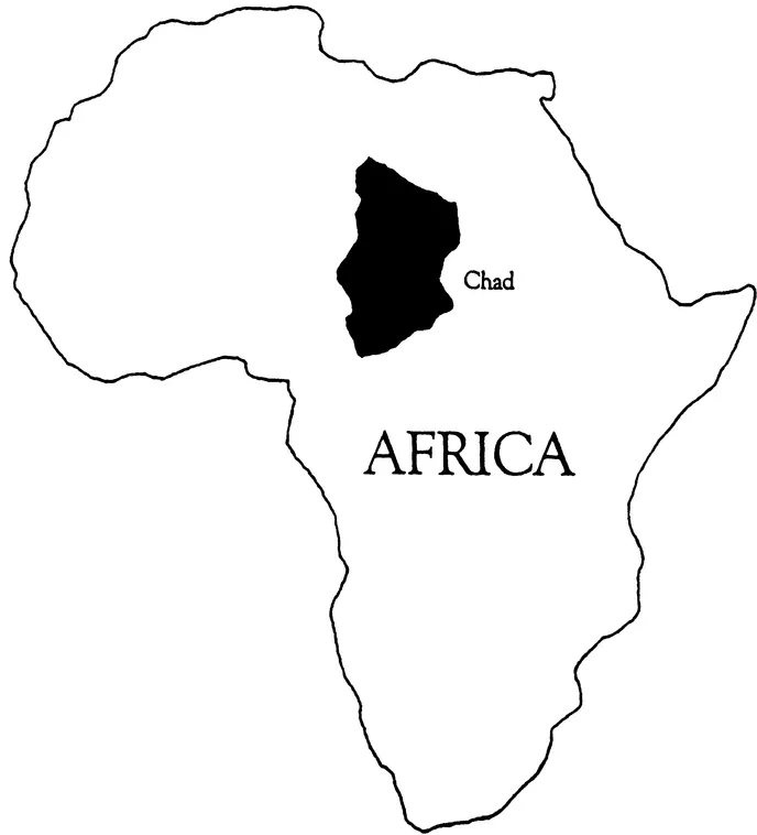
FIGURE 1.1 The Republic of Chad in Africa
The Sudanese, or Tropical, Zone covers a substantial portion of Chad. It has a long dry season, the length of which (six to nine months) increases from south to north, and an annual average rainfall of 500 to 900 mm.
Immediately north of the Sudanese Zone is the Sahelian Zone, which covers the middle portion of Chad. This typically subdesert zone forms the transition between the tropical and desert climates. Here, rainfall is less than in the tropical zones (200 to 500 mm per year) and uneven from year to year, and average temperatures are higher.
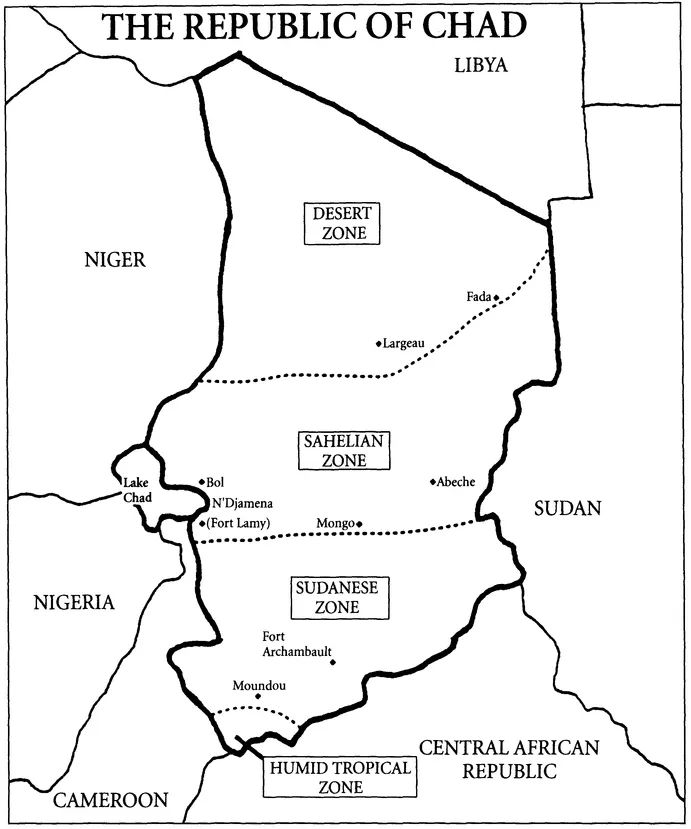
FIGURE 1.2 Climatic and Vegetational Zones in Chad
The northernmost zone, the Saharan, has a desert climate with less than 200 mm of annual rainfall. The extremes in temperature and the dry air combine to create significant temperature fluctuations between night and day. Because this region suffers from such low rainfall, it is unsuitable for human habitation.1
The irregularity, shortage, or absence of rainfall and the frequent dry spells interspersed with rainy years have a considerable impact on Chad's rain-fed crop production and animal husbandry. Areas of low rainfall support little or no agriculture.
Rainfall-Based Vegetational Regions
Chad has three main rainfall-based vegetational regions. From south to north, they are (1) the tropical wet-and-dry region, (2) the tropical semiarid (Sahel) region, and (3) the hot, arid desert region. The tropical wet-and-dry region is characterized by savanna with scattered trees or bushes. Wild animals thrive in this region, since it has grassland vegetation interspersed with trees. The Sahel region, found in the Sahelian Zone, is a savanna that gradually gives way to thornbushes and open grassland in the North. This is also a subdesert region with a discontinuous grassy carpet. There are, however, hot arid segments made up of dunes and plateaus where vegetation is scarce except for occasional oases. The third and northernmost region is desert steppe and arid barren land interspersed with oases and oasis vegetation.
Chad's vegetational regions are almost evenly divided between the two tropical regions and the desert region. In the desert areas, there is hardly any vegetation except in the oases, where grains and dates are grown and market garden production is practiced. Vegetation in the oases adapts to extended periods of dryness.2 In the desertland, no farming is undertaken; rather, pastoral nomadism in which sheep, goats, and camels are reared predominates. Agricultural production in the savannas consists of mixed cropping of sorghum, peanuts, and manioc as well as commercial crops such as cotton and rice. The main livestock are cattle, sheep, goats, and horses. The savanna grassland products are millet, sorghum, and peanuts. Improved polders (reclaimed low or underwater land) support the production of wheat around the Lake Chad area, where fishing also occurs.
Chad experienced large annual rainfall variations, extended periods of drought interspersed with periods of good weather, and a prolonged downward trend in rainfall from the 1950s to the 1970s. These adverse climatic conditions have been exacerbated by human activities. For example, the growth and development of plant and animal life have suffered not only because of reduced rainfall and desertification, in this case a southward shift of the Sahara, but also because of overuse of the drylands. As F. Kenneth Hare and others argue, recent desertification involves the interaction of natural and temporary desiccation with the increase in population and extension of agricultural activities. Although desertification is reversible, the process renders the ecosystem more vulnerable to adverse climatic factors, leading to deteriorating health conditions for the growing population. Decreased productivity cannot support a growing population; thus migration ensues.3
In Chad's rain-fed agricultural production system, droughts and desert encroachment have caused crop failure. The adverse climatic conditions contribute to the gradual depletion of Lake Chad, a vital source of fish for many Chadians, and cause serious loss of livestock and reduction in agricultural output such as cotton. In addition, the recurrent drought has caused massive southward migration of herders, acceleration of deforestation, reinforcement of desertification (eolian regeneration), and disruption of harvests.
Topography
Chad's topography includes both flat and undulated-relief terrain. The plains that constitute the flat topography in the central area give way to plateaus in the South and other undulations in the territorial fringes. Chad is also a mountainous country: In northernmost Chad stands the volcanic Tibesti Massif, in the Northeast is the Ennedi Plateau, in the East are the crystalline rock mountains of the Wadai region, and in the South is the Oubangui Plateau.4 The Tibesti Massif has peaks attaining heights of 11,152 feet (3,400 meters) and several interlocking craters characterized by large deposits of ash, basalt, and lava. In the central basin are the oases of Borkou. The Wadai highlands are located on the eastern boundary with Sudan. In central Chad stands its highest point, the Guera Massif, rising 4,900 feet (1,500 meters). In southwestern Chad, at the border with Cameroon, are the Mandara Mountains.
Soils
Most of the soil in Chad is either sandy (desert areas) or rocky (mountainous regions) and therefore unsuitable for farming.5 The area surrounding Lake Chad (the polder) is mainly clay, however, and the seasonally flooded areas around the Chari and Logone Rivers and the Salamat Wadi have wet soils. The upland slopes of the Wadai region consist of tropical soils. To the north of Lake Chad, in the Kanem region, however, the soil is mainly subarid, although wet land in which salinization occurs is sometimes present.6 Whereas a large portion of Chad is desert soil, other soils can be found in the North, such as the reddish-brown, brown, and grayish-brown soils of the subdesert areas. The reddish-brown soil of the dry tropical areas exists mostly in the South. Alluvial soil and reddish-brown bottomland are found southwest of N'Djamena in a southeasterly direction, that is, from the Lake Chad area toward the valleys of the Chari and Logone Rivers. These are areas with agricultural value where multiple cropping can occur in one year. Thus the main agricultural soils are found in the center and in the South.
Hydrographic Features
Perhaps Chad's most important hydrographic feature is the shallow lake from which it derives its name. The lake's size varies from 3,861 to 9,653 square miles.7 It is progressively drying, however, as some rivers, such as the Bahr-el Ghazal, disappear under pressure from human activity and environmental change. The main rivers that feed the lake are the Chari and the Logone. The Chari and Logone flow north into Lake Chad from the Sudanese Zone, where rainfall is up to 36 inches (900 mm) yearly.
In south-central Chad, 25 miles (40 kilometers) southwest of Ati, is the shallow, reed-filled Lake Fittri (1,352 square kilometers). On the northeast and west of Lake Fittri are soils of the Quaternary geological period and important water tables: Batha, Kanem, and Chari-Baguirmi. East from the center of Lake Fittri are several underwater pockets that are restricted and localized in the valleys and interrupt the granitic massifs. The region to the west has neither notable relief nor underground water, and the eastern region comprising Wadai in the east and Guera in the center has a meager water supply.8 The eastern region is characterized by high relief, granitic soil, and the absence of water tables. The southern half of the country is submerged under water during the rainy season; the northern half has hardly any surface running water except during certain periods of heavy rainfall.
Human Geography
Chad's regional geographical variations create differences in economic activities among its rapidly growing population. The North is populated by herders, the central area by farmers and semisedentary herders, and the South by sedentary farmers with some livestock. Population estimates vary due to lack of reliable demographic data:9 Estimates for 1990 ranged from 5 to 6 million.10 The population grew at an average rate of 2.1 percent in the years 1975 to 1980, 2.3 percent in 1980 to 1985, and 2.5 percent in 1986 to 1990.11
Figure 1.3 shows that Chad's population, which more than doubled between 1950 and 1990, reached 6,000,000 in 1994 and will reach 13,250,000 by 2025. As expected, the Desert Zone is the least populated with a density of 0.5 per square kilometer, or 2 percent of the population, followed by the Sahelian Zone with seven people per square kilometer. The Sudanese Zone has the highest population density with about 13 people per square kilometer.12 Approximately one-half of the population lives in an area of this zone that composes 10 percent of the country.13 Thus Chad's population density varies from 2 percent in the prefecture of Borkou-Ennedi-Tibesti (BET) to 42 percent in the Western Logone Prefect...
Table of contents
- Cover
- Half Title
- Series Page
- Title
- Copyright
- Dedication
- Contents
- List of Tables and Figures
- Acknowledgments
- Selected Acronyms
- INTRODUCTION
- 1 CHAD: GEOGRAPHICAL SETTING
- 2 CHAD'S HISTORY
- 3 POLITICAL EVOLUTION AND THE CIVIL WAR IN CHAD
- 4 THE ECONOMY
- 5 SOCIETY AND CULTURE
- 6 INTERNATIONAL RELATIONS
- 7 CHAD: FACING THE FUTURE
- Expanded Chronology
- Selected Bibliography
- About the Book and Authors
- Index
Frequently asked questions
Yes, you can cancel anytime from the Subscription tab in your account settings on the Perlego website. Your subscription will stay active until the end of your current billing period. Learn how to cancel your subscription
No, books cannot be downloaded as external files, such as PDFs, for use outside of Perlego. However, you can download books within the Perlego app for offline reading on mobile or tablet. Learn how to download books offline
Perlego offers two plans: Essential and Complete
- Essential is ideal for learners and professionals who enjoy exploring a wide range of subjects. Access the Essential Library with 800,000+ trusted titles and best-sellers across business, personal growth, and the humanities. Includes unlimited reading time and Standard Read Aloud voice.
- Complete: Perfect for advanced learners and researchers needing full, unrestricted access. Unlock 1.5M+ books across hundreds of subjects, including academic and specialized titles. The Complete Plan also includes advanced features like Premium Read Aloud and Research Assistant.
We are an online textbook subscription service, where you can get access to an entire online library for less than the price of a single book per month. With over 1.5 million books across 990+ topics, we’ve got you covered! Learn about our mission
Look out for the read-aloud symbol on your next book to see if you can listen to it. The read-aloud tool reads text aloud for you, highlighting the text as it is being read. You can pause it, speed it up and slow it down. Learn more about Read Aloud
Yes! You can use the Perlego app on both iOS and Android devices to read anytime, anywhere — even offline. Perfect for commutes or when you’re on the go.
Please note we cannot support devices running on iOS 13 and Android 7 or earlier. Learn more about using the app
Please note we cannot support devices running on iOS 13 and Android 7 or earlier. Learn more about using the app
Yes, you can access Chad by Mario Azevedo in PDF and/or ePUB format, as well as other popular books in Politics & International Relations & African Politics. We have over 1.5 million books available in our catalogue for you to explore.