- 256 pages
- English
- ePUB (mobile friendly)
- Available on iOS & Android
eBook - ePub
Early Mapping Of Hawaii
About this book
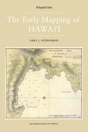
First published in 1987. The cartographic history of Hawaii began with the arrival of explorer and chartmaker Captain James Cook in 1778. Between then and the mid-19th century, visitors to Hawaii produced a rich assortment of charts amid maps depicting the shores, harbors, towns, and volcanoes of the various islands. This volume traces the story of the mapping of Hawaii during the pivotal years in which the indigenous society was radically transformed by the peoples and ideas imported from the West. A major segment of The Early Mapping of Hawaii it examines the contribution of American missionaries in mapping Hawaii. Mostly produced at the seminary school at Lahainaluna, Maui, these maps introduced geographical education into the Hawaiian school system. Lahainaluna graduate S. P. Kalama produced a landmark map of the islands in 1838, one of the most significant maps in Hawaiian history. Nearly one hundred maps, views, portraits, and illustrations are reproduced here. Included are many charts and harbor plans produced by James Cook, William Bligh, George Vancouver, Otto von Kotzebue, Urey Lisiansky, Jean Francois de la Pérouse, Louis Duperrey, and Charles Wilkes. These charts document the early geography of Honolulu, Lahaina, Hilo, and Kailua, as well as many bays and harbors in the islands.
Trusted by 375,005 students
Access to over 1.5 million titles for a fair monthly price.
Study more efficiently using our study tools.
Information
Subtopic
AnthropologyIndex
Social Sciences1
Captain James Cook and the First Map of Hawai‘i

1 Captain James Cook, 1728–1779
In three voyages, from 1768 to 1779, Cook traversed vast expanses of the Pacific Ocean and made many important discoveries, including Hawai‘i in January 1778, which he named the Sandwich Islands after John Montagu, fourth earl of Sandwich and First Lord of the Admiralty. His accomplishments as a surveyor and chartmaker in Canada earned Cook his commission as a lieutenant in the British navy. As the most famous explorer of the Pacific, Cook trained many notable officers in the techniques of hydrographic surveying.
THE EUROPEAN discovery of Hawai‘i occurred on January 18, 1778, when English ships under the command of Captain James Cook sighted the islands of O‘ahu and Kaua‘i. No ordinary seaman, Cook was conducting one of the great exploratory voyages of history, and mapmaking was an integral part of his work. Discovering new islands was of little consequence if he did not map their locations accurately enough for others to find them later.
In the Hawaiian language the word haole originally referred to something that was foreign or strange. It later assumed an ethnic connotation, being used to identify the European strangers who had come to the islands. In both senses, the word haole can be applied to mapmaking in Hawai‘i. Native Hawaiians did not make maps. The concept of drawing an image of the land was foreign to them even though they carried very detailed knowledge of the land and adjacent waters in their heads. Europeans not only introduced mapmaking to Hawai‘i, they were the only practitioners of the art for several decades. In fact, until the arrival of missionaries in the 1820s, Europeans made maps of Hawai‘i for their own use, not for the Hawaiians.
When we examine the early mapping of Hawai‘i, therefore, we are studying the introduction of a European practice. James Cook is the man responsible for that introduction. Recognized in his day as an outstanding mapmaker, Cook produced maps on his voyages of discovery that were vastly superior to ones made by previous explorers in the Pacific. As a prelude to the discussion of the earliest mapping of Hawai‘i, it is necessary to briefly review the state of Pacific exploration and the nature of mapmaking in that era. The attributes and flaws of the first maps of Hawai‘i are best appreciated when viewed in that broader context.
Two ideas were central to the activities of virtually all the men who made the initial maps of Hawai‘i. First, they were more concerned with events elsewhere in the Pacific than in Hawai‘i. This was true for Captain Cook, and it was basically true for the famous as well as obscure mapmakers who came to Hawai‘i for approximately the next forty years. Second, time was essential to these men; it was something to be utilized with discretion. In spite of voyages which lasted for years, these men often had very little time to actually perform the tasks assigned them. In hindsight it seems the great exploratory voyages operated at a leisurely pace, but concern with getting to specific destinations at opportune times imparted a sense of urgency. The making of maps was important work to these early oceanic explorers, but time could not be wasted embellishing a map—only the information most essential to navigation was charted.
The coastlines and islands of the northern Pacific were mostly unexplored in the late 18th century.1 North of lower California, the coastline of North America was largely unknown. The Russians had crossed from their settlements in Kamchatka to establish outposts and trading stations along the Alaskan coast, but their knowledge of the region was still sketchy and imprecise. The Spanish controlled the entire eastern rim of the Pacific from Cape Horn to California, and some of their officials began to think of pushing northward with settlements to cement their claim to what we now call the Pacific Northwest. The Spanish had been sailing galleons across the North Pacific from the Philippines to Mexico since the mid-16th century, but their ships had adhered to a well-defined course—delivering the rich cargo of the Orient was more important than exploration—and geographical knowledge of the islands garnered from these voyages was unknown to the rest of the world.
The British were the first to send a major expedition to the North Pacific. For his third Pacific voyage, Captain James Cook was given the assignment of conducting a thorough investigation of the western coast of North America. It was the government’s hope that he would discover the Northwest Passage, the long-sought-for northern connection between the Atlantic and Pacific oceans. Although the fabled sea route eluded them, Cook and his men provided another incentive for others to follow their path to the northern Pacific. They discovered that furs bought from the natives of North America commanded high prices in China. Hawai‘i was strategically located for those involved in the fur trade that developed after Cook’s voyage. The islands were perfect ports of call for food, water, wood, and recreation. For those who stayed several seasons in the North Pacific, Hawai‘i provided a hospitable respite from harsh winter weather.
James Cook rose to be a commander in the British navy largely because of his accomplishments as a surveyor and cartographer. As a ship’s master he was involved in the British campaign in North America that resulted in the acquisition of Canada. His major contribution to this operation was a careful, detailed survey in 1759 of the St. Lawrence River, from which the French had removed all navigational aids. His work allowed British ships to sail up the river and participate in the siege and capture of Quebec in 1759. After demonstrating his cartographic skills—all of which were learned on the job or were self-taught—by mapping the reaches of the St. Lawrence River, Cook then spent the years 1763 to 1767 conducting a comprehensive survey of the coasts of Newfoundland.
The quality of Cook’s chartmaking, his demonstrated competence in practical mathematics and astronomy—two disciplines which are crucial to navigation as well as cartography—and his character and leadership impressed influential officers of the British navy. His accomplishments in Newfoundland behind him, Cook was placed in command of the Endeavor to carry prominent scientists into the Pacific Ocean where they were to make astronomical observations on the recently discovered island of Tahiti.
Between August 1768 and July 1771 Cook conducted the first of his three great Pacific expeditions. After the stay in Tahiti, he sailed west and investigated the islands of New Zealand, previously sighted by the Dutch explorer Abel Janzoon Tasman in 1642. Six months were spent circumnavigating the two major islands before Cook went west again and sighted the unknown eastern shore of Australia. Sailing north along this coast, which he called New South Wales, Cook guided the Endeavor through a perilous journey along the Great Barrier Reef. This first voyage added significantly to scientific geographical knowledge. In keeping with his training, Cook compiled numerous maps of a quality that had never been achieved by previous explorers. Although Europeans had touched at Tahiti earlier, he was the first to produce a good map of the island, and his maps of New Zealand and eastern Australia are classics among explorers’ maps.
The first voyage was such a success that Cook was quickly given command of two ships, the Resolution and Adventure, with the goal of proving or disproving the existence of a massive southern continent known as Terra Australis. From July 1772 to July 1775 Cook ranged over wide portions of the southern oceans, proving beyond a doubt that no continent existed in low enough latitudes as to be habitable. Pushing as far south as feasible during the austral summer, Cook spent the winters exploring other portions of the South Pacific. As in the previous voyage, he compiled numerous charts to document his discoveries and explorations.
This takes us to Cook’s third voyage, the one in which Hawai‘i was discovered and the voyage that shifted Europe’s interest toward the North Pacific rather than the South Pacific. Before getting into the story of the third voyage, however, two aspects of Cook’s earlier voyages are critical to understanding what he accomplished in the initial mapping of Hawai‘i. Those are his use of lunar tables and his role in proving the reliability of Harrison’s chronometer. Cook was the first circumnavigator to have precise knowledge of his geographic position at all times. Prior to him, mariners had difficulty gauging their longitude, or their location in terms of east-west directions. Cook was fortunate in living at a time when science and technology combined to produce not one but two reasonably reliable methods of determining longitude, a problem which had plagued man since the days of the Greeks.
Longitude is directly related to the concept of time, for in a twenty-four-hour day the earth rotates 360 degrees in an eastward direction. Simple division yields a result of fifteen degrees of rotation per hour. If two places are thirty degrees apart in longitude, then they differ by two hours on the clock. Conversely, if they are two hours apart in time, then they are thirty degrees apart in longitude. As simple as this is in theory, the best minds of the world wrestled with this problem for centuries before finding two practical ways to measure the difference in time between two points, which then permitted the navigator to calculate the longitudinal difference.
The English devised the two methods of determining longitude that were practical for use at sea. The first of these involved the use of “lunar tables.” Using an octant, or later the improved version of the instrument known as the sextant, a navigator measured the angular distances between the moon and prominent stars. The observatory at Greenwich, England, issued tables which indicated the precise time at Greenwich when specific angular distances, termed lunar distances, between the moon and those prominent stars would be observed. The difference between the local time when a navigator observed a specific lunar distance and the time when that event was supposed to occur at Greenwich represented the difference in time between the two places. By extension, that told the navigator how far east or west he was from Greenwich. In 1763, with the publication of the first nautical almanac, astronomical data was regularly available by which mariners could determine their longitude from lunar observations.
Here is where Cook enters the picture. The lunar method required two things of a navigator: the ability to make accurate readings with his instruments and the ability to perform some complex mathematical computations. From his training in surveying, Cook possessed the necessary skills to do both. The method had been proven on trials at sea, but the tests had been conducted by skilled astronomers. Cook successfully used the lunar tables on his first voyage and showed that the technique was suitable for use by any competent navigator.
Cook was even more directly involved in the second method of determining longitude, the use of the chronometer. In this approach, the chronometer—essentially an extremely reliable and accurate clock—provided the time at a fixed locale, or prime meridian. The navigator took readings of the sun or stars to determine the local time, then used the difference between local time and the time shown on the chronometer to arrive at the correct longitude. Such a chronometer was first developed by an Englishman, John Harrison, and the significance of the achievement was such that he won a twenty-thousand-pound award from the Board of Longitude, a committee Parliament had established in 1714 to promote and judge solutions to the problem of determining longitude.
Cook was the first non-astronomer, non-clockmaker to give the chronometer a true test at sea. On his second voyage he had several based on Harrison’s design. Cook found that the chronometer was quite reliable and yielded excellent results. It had the advantage of being usable during the day and did not require as accurate or as difficult observations as did the lunar method.
What does all this have to do with the mapping of Hawai‘i? As simple as it may seem, the fact that Cook was able to determine his longitude meant that he was able to place new discoveries on the map with a high degree of accuracy. Consequently, when Hawai‘i was first sighted by Cook’s ships, his men were able to place the islands in their correct geographic position. The ability to determine longitude also meant that Cook could chart courses through parts of the ocean that he wanted to explore and know for certain that he had indeed traversed those areas. Prior to Cook, plotting the location of a newly discovered island was no small feat; after Cook it was taken for granted that explorers and cartographers could plot any location with accuracy. Compared to the mapping of many earlier discoveries in the Pacific, the early maps of Hawai‘i reflect vastly improved levels of navigational and cartographic skills. When we examine the first map of Hawai‘i, we are looking at a map that is correct in virtually all important aspects, and that is largely because Cook had mastered the latest in navigational techniques of his era.
The First Printed Map of Hawai‘i
To designate any map as the first one of Hawai‘i is to engage in a debate of semantics. Is primacy awarded to the first printed map on which Hawai‘i is shown? If so, then the title may belong to a relatively simple world map—one which will be discussed in the later chapter “Hawai‘i in the World.” Or is it to be the first manuscript map, one drawn on the spot, to show the entire c...
Table of contents
- Cover
- Half Title
- Title Page
- Copyright Page
- Contents
- Dedication Page
- Preface
- Acknowledgments
- Chapter 1 Captain James Cook and the First Map of Hawai‘i
- Chapter 2 The Explorers
- Chapter 3 Harbor Charts
- Chapter 4 Mapping Hawaiian Volcanoes
- Chapter 5 Missionaries and Maps
- Chapter 6 Hawai‘i in the World
- Chapter 7 Hawai‘i Nei
- Notes
- Citations of Illustrations
- Bibliography
- Index
Frequently asked questions
Yes, you can cancel anytime from the Subscription tab in your account settings on the Perlego website. Your subscription will stay active until the end of your current billing period. Learn how to cancel your subscription
No, books cannot be downloaded as external files, such as PDFs, for use outside of Perlego. However, you can download books within the Perlego app for offline reading on mobile or tablet. Learn how to download books offline
Perlego offers two plans: Essential and Complete
- Essential is ideal for learners and professionals who enjoy exploring a wide range of subjects. Access the Essential Library with 800,000+ trusted titles and best-sellers across business, personal growth, and the humanities. Includes unlimited reading time and Standard Read Aloud voice.
- Complete: Perfect for advanced learners and researchers needing full, unrestricted access. Unlock 1.5M+ books across hundreds of subjects, including academic and specialized titles. The Complete Plan also includes advanced features like Premium Read Aloud and Research Assistant.
We are an online textbook subscription service, where you can get access to an entire online library for less than the price of a single book per month. With over 1.5 million books across 990+ topics, we’ve got you covered! Learn about our mission
Look out for the read-aloud symbol on your next book to see if you can listen to it. The read-aloud tool reads text aloud for you, highlighting the text as it is being read. You can pause it, speed it up and slow it down. Learn more about Read Aloud
Yes! You can use the Perlego app on both iOS and Android devices to read anytime, anywhere — even offline. Perfect for commutes or when you’re on the go.
Please note we cannot support devices running on iOS 13 and Android 7 or earlier. Learn more about using the app
Please note we cannot support devices running on iOS 13 and Android 7 or earlier. Learn more about using the app
Yes, you can access Early Mapping Of Hawaii by Gary L. Fitzpatrick,Fitzpatrick in PDF and/or ePUB format, as well as other popular books in Social Sciences & Anthropology. We have over 1.5 million books available in our catalogue for you to explore.