Many estuaries are located in urbanized, highly engineered environments. Cohesive sediment plays an important role due to its link with estuarine health and ecology. An important ecological parameter is the suspended sediment concentration (SSC) translated into turbidity levels and sediment budget.
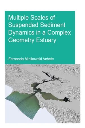
This study contributes to investigate and forecast turbidity levels and sediment budget variability at San Francisco Bay-Delta system at a variety of spatial and temporal scales applying a flexible mesh process-based model (Delft3D FM). It is possible to have a robust sediment model, which reproduces 90% of the yearly data derived sediment budget, with simple model settings, like applying one mud fraction and a simple bottom sediment distribution. This finding opens the horizon for modeling less monitored estuaries.
Comparing two case studies, i.e. the Sacramento-San Joaquin Delta and Alviso Slough, a classification for estuaries regarding the main sediment dynamic forcing is proposed: event-driven estuary (Delta) and tide-driven estuary (Alviso Slough). In the event-driven estuaries, the rivers are the main sediment source and the tides have minor impact in the net sediment transport. In the tide-driven estuaries, the main sediment source is the bottom sediment and the tide asymmetry defines the net sediment transport.
This research also makes advances in connecting different scientific fields and developing a managerial tool to support decision making. It provides the basis to a chain of models, which goes from the hydrodynamics, to suspended sediment, to phytoplankton, to fish, clams and marshes.
eBook - ePub
Multiple Scales of Suspended Sediment Dynamics in a Complex Geometry Estuary
- 138 pages
- English
- ePUB (mobile friendly)
- Available on iOS & Android
eBook - ePub
Multiple Scales of Suspended Sediment Dynamics in a Complex Geometry Estuary
About this book
Information
1
GENERAL INTRODUCTION
1.1 Background
Estuaries are valuable ecosystems for flora, fauna, and human beings. Society, as we know today, has a part of its history related to these environments where prosperous civilization developed (Day et al., 2007). Estuaries, more specifically deltas and flood plains, provide rich soil for agriculture, due to fine sediments deposited on the banks and fishery stocks. They provide a sheltered area which is favorable to host port facilities, to link coastal to inland navigation, and consequently industry settlement. Industry, in most cases, exploits natural resources and may contribute to the contamination of water and soil (mostly fine sediment).
Estuaries provide a complex system of barotropic and baroclinic currents and sediment transport due to tidal incursion and freshwater discharge that can present highly seasonal variation (Dyer, 1986). Considering abiotic characteristics, mixing of fresh and salt water occurs in estuaries generating a salinity gradient zone. This gradient creates a wide range of habitat conditions promoting rich flora and fauna, as well as biodiversity including endemic species.
As for many estuarine systems, cohesive sediment plays an important role. It is important not only because of its physical behavior but also due to the link with estuarine health and ecology. A number of reasons can be mentioned:
a) Fine sediment is the most accountable for vegetation colonization since it stabilizes the substrate and retains nutrients. It plays an important role in colonization of sub-aquatic vegetation and marsh maintenance as well as the ability of this vegetation to cope with sea level rise (Morris et al., 2002).
b) It regulates phytoplankton productivity that is the aquatic food web base (Burkholder, 1992). On one hand, it increases the water turbidity, decreasing the optic depth. On the other hand, carries nutrients essential for phytoplankton development so enhancing the production;
c) Cohesive sediments are responsible for river bank fertilization. During flood conditions the fine sediment overtops the banks and deposits on the riverside; due to associated high organic matter concentration the sediment works as a fertilizer;
d) Organic (e.g. PCB’s) and inorganic (e.g. heavy metal) contaminants can easily adhere to fine sediment increasing the contaminants’ residence time in the system so facilitating the entrance in the food web (Winterwerp and Van Kesteren, 2004);
e) Fine sediment tends to accumulate in still water such as bays and inside harbors, increasing maintenance dredging costs to ensure port accessibility.
Taking into account the aforementioned factors it is important to understand estuarine systems and to develop the capacity of forecasting sediment path, system turbidity (which is proportional to turbidity) and sediment budget.
1.1.1 Hydrodynamics
There are many factors that influence sediment dynamic and availability as tides, river discharge, wind, waves, dredging, and superficial flow in adjacent land. In this section, we are going introduce the main hydrodynamic processes that govern the sediment dynamics
1.1.1.1 Tides
In a simplistic way, tides are periodic sea surface variation forced by the Earth-Moon-Sun gravitational attraction. Tides can be seen as long waves propagating in the ocean basin and if we consider no friction, no rotation, no inertia and no obstacles we have a rising and falling cycle every 12 hours. However, this is not the case, especially considering propagation inside estuaries.
The tidal wave excursion landwards defines the estuary extension. The tides while penetrating in estuaries suffer distortion, attenuation or amplification (Friedrichs and Aubrey, 1988; Savenije, 2001). These processes modify the duration of ebb and flood tides creating asymmetries, in estuaries worldwide both ebb or flood asymmetries can be observed.
This means that there is an inequality between ebb and flood current, this difference will create a residual sediment transport defining whether there is an import or export of sediment. The freshwater discharge also influences in this duration (Ridderinkhof et al., 2000; Talke and Stacey, 2003).
Tides also transport salt landwards what creates an environment with salinity gradient and so a density gradient zone that is going to be described afterward. This brackish environment is important to many aquatic species that nurse and feed in such a system.
1.1.1.2 Freshwater flow
This work considers freshwater input exclusively by the rivers to simplify the analysis and it is the source which there is available data. The fresh water flow is the landward boundary of an estuary, which provides fresh water and is the main source of sediment to estuaries. The watershed drainage carries sediment from upstream that later is going to feed estuary and coastal region.
In many estuaries, the freshwater discharge accounts for a big portion of the system variability. It is usual to observe an annual cycle of dry and wet season. Freshwater discharge is going to modulate the salinity gradient, the estuarine circulation, water quality (including turbidity), productivity and abundance of species.
1.1.1.3 Wind and wind-waves
The wind is an important energy source for the system. In estuaries, the wind may generate waves that stir sediment from the bottom. The stirring process is due to waves orbital velocities that can feel the bottom in shallow water. Orbital velocity is proportional to the wave height, so the wind and wind-wave impacts can be better seen in shallow regions since in estuaries the fetch is limited and so the wave heights. In some cases, it is possible to observe the penetration of ocean waves inside the estuaries. In these cases, the stirring process can be felt in deeper waters (Talke and Stacey, 2003).
The importance of stirring sediment from mud-flats and shoals can be enhanced by the tidal excursion, so the waves stir the sediment while the tidal currents transport it. This process will be further discussed below in the sediment dynamics section.
1.1.2 Sediment dynamics
In estuaries, most of the sediment input are delivered in suspension by rivers, resulting in an hourly sediment load that is dependent on the river discharge. River discharge and consequently SSC may vary on weekly to yearly time scales. When considering sea level rise, the time scale is increased to centuries.
The sediment dynamics is closely linked to the hydrodynamic processes described above. However, first is important to identify if the sediment is cohesive or not. Cohesive sediment (mud) has completely different dynamics than non-cohesive sediment (sand). Cohesive sediment dynamics, for example, are affected by flocculation, lower fall velocity, and consolidation and higher stress for erosion (Winterwerp and Van Kesteren, 2004).
The difference arises from the electrochemical interactions between clay particles, so the cohesiveness of sediment depends on the clay content. Laboratory experiments show that sediment becomes cohesive when the clay content is over 3-5% (Van Ledden et al., 2004). Though, the clay percentage necessary to make the sediment cohesive may increase with larger sand grains (Le Hir et al., 2011).
Currents and waves loose energy in the bottom boundary layer, this energy dissipation is translated in shear stress at the bed (Grant and Madsen, 1979). Sedimentation takes place while the shear stress is below a critical value; above the critical value, erosion takes place. The critical shear stress depends on the bottom composition; cohesiveness can increase the critical erosion shear stress in 2-5 times (Van Ledden et al., 2004). This means that the velocities to erode the sediment layer should be higher even though the sediment is finer.
During flood tide, one observes a peak of sediment concentration that it is advected landward. During the slack water, the sediment has time enough to settle and partially consolidate and is not re-suspended during ebb tide (Postma, 1961). This is the main sediment transport forcing for tide-driven estuaries. This transport scenario changes in stormy periods becoming ebb dominated. For event-driven estuaries, during wet periods the peak river events with high SSC dominate the sediment transport in the estuary (Coco et al., 2007; Dyer et al., 2000; Ralston and Stacey, 2007), overcoming the tidal sediment transport.
1.1.2.1 Sediment Budget
In this section, we are going to discuss the sediment origin (source) and destination (sink). Looking from a broader perspective the highland is the source of sediment, the rivers transport it, the estuaries is the interface between the land and the sea, and the ocean is the final destination. Nevertheless, many processes may enhance or decrease sediment supply, disrupting the sediment budget.
Starting from a worldwide perspective,(Syvitski and Kettner, 2011), state that the human impact on sediment production dates from 3000 years ago accelerating in the last 1000 due to engineering developments. In the literature, there is no consensus in the budget of sediment delivered to the coastal zone varying from 9.3 Gt yr−1 to more than 58 Gt yr−1 (Milliman and Syvitski, 1992). Estimating the world sediment budget, it is still a challenge either due to lack of data or studies in this field (Vörösmarty et al., 2003). Adding to that, there is a highly variability in sediment supply due to the human and climate change impact.
Changes in the landscape as deforestation, land cover and hydraulic mining are the main factors of increasing sediment supply. On the contrary, channel diversion and dam construction trap sediment decreasing the supply. Estimations show that dammed rivers have 50% of trapping efficiency and the numbers of interventions to control river flow have been increasing (Vörösmarty et al., 2003; Wright and Schoellhamer, 2004).
Sediment supply reduction results in greater sediment transport capacity than supply, this imbalance leads to depletion of sediment pool downstream and thus incision in the channels and later clearing of the estuary (Schoellhamer, 2011; Curtis et al. 2010).
1.1.3 Sediment and ecology
The sediment budget and SSC defines the estuary habitat. Salt marshes are mud flats colonized by macrophytes vegetation located in the intertidal zone of an estuary. They are important to the maintenance of a healthy environment as nursery habitat, coastal stabilization, runoff filtration, trophic support and trapping of sediment (Whitcraft and Levin, 2007). Despite their ecological importance, over time, more than 90% of the original marshes in the San Francisco Bay area were leveed and removed from the intertidal area, in order to give space to agriculture and urban land.
In the last decade, the importance of keeping and restoring these habitats has been discussed again. Several projects of marshes/wetlands restoration are being planned and implemented. However, there is a lack of knowledge about how and if these marshes are going to be able to develop and cope with sea level rise. Kirwan et al. (2010) show that marshes can keep up with conservative projections for sea level rise once the sediment concentration is above 20 mg L−1. The results show that the amount of sediment available determines marshes survival. In an environment with a high concentration of sediment in suspension (30-100 mg L−1), such as in the Sacramento-San Joaquin Delta, the marshes are able to survive and cope with a sea level rise up to 10 mm yr−1 (Reed, 2002). This adaptability can be maintained since the relative sea level rise does not exceed 1.2 cm yr−1 (Morris, 2002).
SSC also defines habitat for phytoplankton, fishes, and small invertebrates. SSC attenuates light penetration in the water, for the phytoplankton the fine sediment carries nutrients but at the same time decrease the photic zone. In the fishes and small invertebrates, it increases survival chance by hiding from predators.
1.1.4 Spatial-temporal scale
Estuarine systems, as San Francisco Bay-Delta (Fig 1-1), present several processes in various spatial/time scales. This means that the overall behavior of system responds to processes on the order of centimeter that happen in seconds at the same time as processes order of kilometers that take decades or even centuries to conclude. This is called the spatial/temporal scale (De Vriend, 1991). Each spatial scale is linked to a certain temporal scale, and they are grouped in levels. There is a hierarchical arrangement of levels, in which the lower levels contain the high-frequency processes and the higher levels, the lower frequency processes.

The system is forced mainly by tides, river discharge, and the wind and we are interested in variability in the order of days, months, years and multi-year. We focus on 3 main processes timescales to study SSC (turbidity) patterns and sediment budget for tide- (Alviso Slough, South Bay) and event-driven estuary (Sacramento-San Joaquin Delta):
- Days to weeks - tidal asymmetry, peak river discharge.
- Months - reverine seasonal cycle. The rivers that discharge in the Delta present a strong seasonal cycle. Each water year presents a cycle, on average, of 3 wet months and 9 dry months.
- Intra-annual -the dry and wet cycle varies in duration and magnitude from year...
Table of contents
- Cover
- Half Title
- Title Page
- Copyright Page
- Dedication
- Acknowledgments
- Summary
- Samenvatting
- Resumo
- Table of Contents
- 1 General introduction
- 2 A 2D Process-Based Model for Suspended Sediment Dynamics: a first Step towards Ecological Modeling
- 3 Suspended Sediment Dynamics in a tidal channel network under Peak River Flow
- 4 Impact of a sudden tidal prism increase in estuarine sediment flux: implications to remobilization of Hg-contaminated sediment
- 5 How important are climate change and foreseen engineering measures on the sediment dynamics in the San Francisco Bay-Delta system?
- 6 Conclusions
- 7 References
- Exposure
- Biography
- Sense Diploma
Trusted by 375,005 students
Access to over 1.5 million titles for a fair monthly price.
Study more efficiently using our study tools.
Frequently asked questions
Yes, you can cancel anytime from the Subscription tab in your account settings on the Perlego website. Your subscription will stay active until the end of your current billing period. Learn how to cancel your subscription
No, books cannot be downloaded as external files, such as PDFs, for use outside of Perlego. However, you can download books within the Perlego app for offline reading on mobile or tablet. Learn how to download books offline
Perlego offers two plans: Essential and Complete
- Essential is ideal for learners and professionals who enjoy exploring a wide range of subjects. Access the Essential Library with 800,000+ trusted titles and best-sellers across business, personal growth, and the humanities. Includes unlimited reading time and Standard Read Aloud voice.
- Complete: Perfect for advanced learners and researchers needing full, unrestricted access. Unlock 1.5M+ books across hundreds of subjects, including academic and specialized titles. The Complete Plan also includes advanced features like Premium Read Aloud and Research Assistant.
We are an online textbook subscription service, where you can get access to an entire online library for less than the price of a single book per month. With over 1.5 million books across 990+ topics, we’ve got you covered! Learn about our mission
Look out for the read-aloud symbol on your next book to see if you can listen to it. The read-aloud tool reads text aloud for you, highlighting the text as it is being read. You can pause it, speed it up and slow it down. Learn more about Read Aloud
Yes! You can use the Perlego app on both iOS and Android devices to read anytime, anywhere — even offline. Perfect for commutes or when you’re on the go.
Please note we cannot support devices running on iOS 13 and Android 7 or earlier. Learn more about using the app
Please note we cannot support devices running on iOS 13 and Android 7 or earlier. Learn more about using the app
Yes, you can access Multiple Scales of Suspended Sediment Dynamics in a Complex Geometry Estuary by Fernanda Achete in PDF and/or ePUB format, as well as other popular books in Physical Sciences & Geology & Earth Sciences. We have over 1.5 million books available in our catalogue for you to explore.