This book provides an understanding of desert environments, their climatic conditions, and unique physical beauty - using the five American deserts of the southwestern United States as an example. Through considerable research, sensitivity, and practical experience, the author provides insight into how built environments are designed and installed in order to cope with the harsh, unforgiving physiographic area. Bridging the gap between professional jargon and common sense, Desert Landscape Architecture displays detailed information for every facet of landscape design, environmental concerns, water issues, cultural issues, and plant material use.
This unique, thorough book:

- 656 pages
- English
- ePUB (mobile friendly)
- Available on iOS & Android
eBook - ePub
Desert Landscape Architecture
About this book
Trusted by 375,005 students
Access to over 1.5 million titles for a fair monthly price.
Study more efficiently using our study tools.
Information
Topic
ArchitectureSubtopic
EcologyChapter 1
North American Deserts
Introduction
There are 23 major deserts in the world, 5 of which are in North America. Worldwide, deserts occupy 12% of the Earth’s land area and 3% of the North American continent. Deserts occur on a consistent basis north and south of the equator loosely aligning themselves with the Tropic of Cancer and the 30°N parallel and the Tropic of Capricorn and the 30°S parallel. This is not a coincidental phenomenon. We know (since the days of Columbus) that the earth is round and rotates around the sun on an oval track. A complete rotation takes one year and the distance closer to or farther away from the sun on the oval track is what causes seasons. In addition, the earth spins on its axis as it revolves around the sun. One complete spin takes 24 hours and is evidenced by night and day. Imagine that this axis is a north/south stake driven directly through the center of the earth. If you are having a hard time visualizing the earth’s axis, look at a globe mounted on a metal stand. The stand grips the globe (Earth) at the North and South Poles which are the exit points of the imaginary axis.
Generally, it is warmest at the equator because this represents the widest part of the earth as it faces, and is therefore closest to, the sun. The Arctic and Antarctic are so cold because they are the farthest away from the sun. The earth rotates in an easterly direction and this spinning causes turbulence which gives rise to intercontinental winds (the tradewinds) and cold ocean currents. These two physiological events, in conjunction with mountain ranges, account for the majority of deserts on earth.
First, the tradewinds or, more specifically, the clouds they carry: clouds are most intense at the equator. Because the equatorial band is the widest latitudinal point on earth, it must spin the fastest in order to keep up. This is why footballs spiral. These wind-driven clouds rise, and as they do, they drop their moisture in prodigious amounts. This accounts for the tropical rainforests. Now lighter and higher in the atmosphere, the clouds fan out and literally float towards the tropics of Cancer and Capricorn. Gravity, being what it is, eventually pulls these clouds down. This creates high atmospheric pressure which, in and of itself, creates dryness.
The cold oceanic currents, for whatever reasons, travel along the western continental shelves of the continents. This, for geological reasons, is where the majority of the Earth’s great mountain ranges also occur. When the clouds pass over those parts of the oceans carrying the cold currents, they drop their moisture in response to cooler air temperatures. Continuing east along their way, they now abut the coastal mountain ranges and once again have to drop most of their remaining moisture in order to lighten themselves and rise up over the peaks. The wet westerly side of these ranges is called the “windward side” while the dry easterly slopes are referred to as the “leeward side.” In any event, the lands which lie immediately to the east at the base of these ranges is unlikely to receive any significant amount of moisture and are said to exist in a rain shadow. This gives rise to the deserts of the world.
All or parts of the five main North American deserts occur within the territorial boundaries of the U.S. The five American deserts are located predominately between two major mountain ranges. Furthest west representing barrier ranges, are the Sierra Nevadas of California and the Cascades of Oregon and Washington. To the east lie the Great Rocky Mountains. The northernmost of the deserts is the Great Basin Desert. Immediately below the Great Basin is the Mohave Desert. East of the Mohave lies the Painted Desert. Directly south of the Mohave and southwest of the Painted Desert is the Sonoran Desert so named after the Mexican state of Sonora. Situated east of the Sonoran Desert, is the Chihuahuan Desert, again named after the Mexican state of Chihuahua. Diagrams of geographic locations are provided at the end of this chapter.
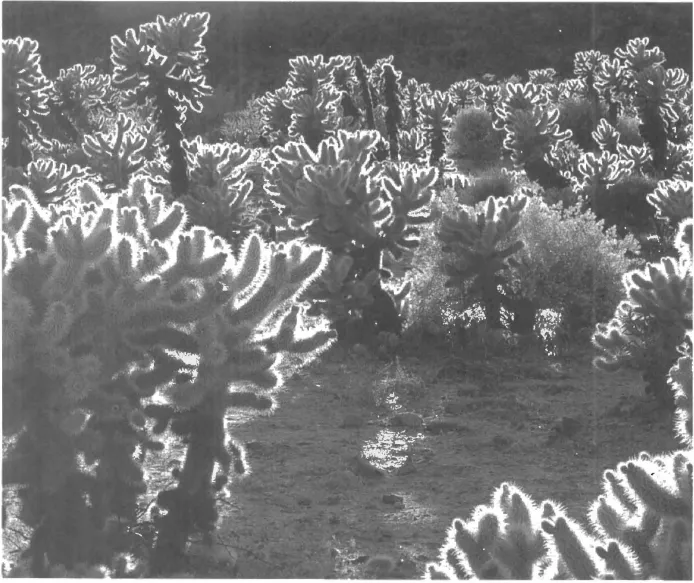
Within any major desert can be found subdeserts which may sometimes differ greatly from their parent environment. Take, for example, the Coachella Valley where I currently live and work. This area occurs in the extreme western end of the Sonoran Desert. This portion of the Sonoran is referred to locally as the Colorado Desert. The Colorado Desert was so named by early Spanish explorers, because the Colorado River serves as its eastern boundary. The Sonoran is the most variable of North American deserts, being either extremely lush, as deserts go, or extremely hot and dry.
In terms of mean annual rainfall and temperatures, the Colorado Desert compares favorably with the Great Sahara Desert of North Africa and the Western and Arabian Deserts of the Middle East. What causes the Colorado Desert to be so hot is its low elevation. Several areas within the Coachella Valley itself are below sea level. The town of Thermal, in fact, is more than 100 feet below sea level. Two main factors cause the Colorado Desert to be so dry. First, winter rains approaching from the west are blocked by extremely high mountain ranges. Second, the summer monsoon rains originating in the Gulf of Mexico and blowing inland usually only travel as far west as Central Arizona. Thus, while the Northern Mexican and Arizonan parts of the Sonoran Desert rate among the lushest desert environments on earth, the Colorado section is truly desolate.
Any number of physical or environmental factors can cause any given area of any given desert region to differ from what is considered the norm. Research of local conditions is critical as is an appreciation for any subtle natural nuance that may impact the native or built landscape.
Climate
The desert environment is marked by extremes: hot and cold; day and night; summer and winter; wet and dry. As harsh as conditions may seem, the desert is a very sensitive environment. It takes a long time for perennial plants to become established and animal populations to become stable. The life spans of all desert organisms are determined by one major limiting factor — water.
The availability of water, as it pertains to desert environments, is not always just a measurement of mean annual precipitation, but also is a function of the rate of evaporation. If water brought into an ecosystem evaporates before it can be utilized, the ecosystem exhibits aridity and can thus be classified as a desert. Factors contributing to evaporation are heat, wind, and solar radiation. Deserts occur where the rate of evaporation meets or exceeds the rate of precipitation. The rate of evaporation is measured from exposed surfaces. Life can exist in this type of environment because the ground plane is not always completely exposed. Also, on brief occasions, rainfall is intense enough to percolate below the ground surface to be stored within the soil for longer periods of time.
Even in deserts there is a noticeable difference in the availability of water. Parts of the Sonoran Desert, for example, receive 8 to 10 inches of rain annually. The Mohave receives only 4 to 6 in. of annual rain, while the Chihuahuan is considered the wettest North American desert.
In all instances, no North American desert receives more than an average of 10 in. of annual precipitation.
Rain clouds travelling from the equator or originating over the Pacific Ocean and moving eastward do reach desert environments, either with less moisture or through mountain passes. The trade winds which carry these rain clouds travel in currents or tracts. Due to the spinning of the earth on its slightly tilting axis, these winds, known as the “westerlies” exhibit a seasonal shift. They travel over Mexico and the southwestern U.S. in the winter months and shift northward into Canada during the summer. As the westerlies shift to the north in July, storm cells oftentimes occur in the Gulf of Mexico and are drawn northwestward into desert regions. The northern and western deserts receive winter rain, while southeastern deserts receive summer rain, and some intermediate deserts, most notably parts of the central Sonoran, receive biseasonal rain.
In terms of annual mean temperature, North American deserts can be classified as being either cold or hot. These classifications are primarily related to latitude. The Great Basin, Painted, and northern parts of the Mohave deserts are frequently categorized as cold deserts. The southern Mohave, Sonoran, and Chihuahuan are categorized as hot deserts. This cold or hot classification pertains to how a desert environment receives precipitation. Most of the moisture available to cold desert organisms comes in the form of snow melt. Hot deserts receive their moisture predominantly in the form of rainfall.
Daily temperatures in any given desert environment can vary widely, sometimes by as much as 50 degrees. Because deserts infrequently have cloud cover, thermal energy from the sun is shallowly absorbed by the desert surfaces and rapidly re-radiates back into the atmosphere at night. That is, there is no cloud cover to hold heat closer to the ground surface at night.
A desert environment’s mean annual temperature is also affected by altitude. Temperature rises or falls by 3 degrees for every 1000 feet of elevational change. Thus, record high temperatures have been recorded at Bad Water Basin in the Death Valley portion of the Mohave Desert, which lies at 232 feet below sea level. This is quite atypical of the rest of the Mohave which lies predominately at 4500 feet above sea level. The Mohave, in general, is considered quite temperate as deserts go. Another interesting fact to note is that freezing temperatures are often a more major limiting factor to desert adapted organisms than is extreme heat. During winter freezes, warm air which always rises, will travel up the side slope of hills at the same time cold air is conversely falling to the desert floor. Proof that this temperature inversion does indeed occur can be evidenced by plant materials of the same size and species freezing on the desert floor and surviving unharmed just 500 feet upslope. Temperature, especially nighttime temperature, is influenced by sun orientation. A north- or east-facing slope that lies in afternoon shade is cooler considerably earlier in the evening than a south- or west-facing slope. If you have ever camped in the desert or ever intend to, this is a fact well worth remembering.
Physiography
The physical geography of North American deserts falls into the area that is known as the Basin and Range Province. In terms of land area, the basins usually exceed the ranges, sometimes by as much as 70%. Visually, the mountain ranges dominate the landscape. Elevational changes can be dramatic. Mountain ranges in this provence often exceed 13,000 feet above sea level. With the highest basins occurring at 5,000, feet there can be over 8,000-foot high mountains in any given desert environment, and elevational differences of over 10,000 f...
Table of contents
- Cover Page
- Title Page
- Copyright Page
- Contents
- Foreword
- Biographies
- Acknowledgments
- Inroduction
- 1 North American Deserts
- 2 Landscape Architecture Design
- 3 Grading Design
- 4 Hardscape Design
- 5 Plant Materials and Planting Design
- 6 Irrigation Design
- 7 Lighting Design
- 8 Installation and Maintenance
- Conclusion
- Bibliography
- Appendices
- Index
Frequently asked questions
Yes, you can cancel anytime from the Subscription tab in your account settings on the Perlego website. Your subscription will stay active until the end of your current billing period. Learn how to cancel your subscription
No, books cannot be downloaded as external files, such as PDFs, for use outside of Perlego. However, you can download books within the Perlego app for offline reading on mobile or tablet. Learn how to download books offline
We are an online textbook subscription service, where you can get access to an entire online library for less than the price of a single book per month. With over 1.5 million books across 990+ topics, we’ve got you covered! Learn about our mission
Look out for the read-aloud symbol on your next book to see if you can listen to it. The read-aloud tool reads text aloud for you, highlighting the text as it is being read. You can pause it, speed it up and slow it down. Learn more about Read Aloud
Yes! You can use the Perlego app on both iOS and Android devices to read anytime, anywhere — even offline. Perfect for commutes or when you’re on the go.
Please note we cannot support devices running on iOS 13 and Android 7 or earlier. Learn more about using the app
Please note we cannot support devices running on iOS 13 and Android 7 or earlier. Learn more about using the app
Yes, you can access Desert Landscape Architecture by John C. Krieg in PDF and/or ePUB format, as well as other popular books in Architecture & Ecology. We have over 1.5 million books available in our catalogue for you to explore.