- 160 pages
- English
- ePUB (mobile friendly)
- Available on iOS & Android
eBook - ePub
About this book
Although Colombia is the third-largest country in Latin America, it has been little known until recent years and does not fit many of the patterns common to other countries in the region. Competition between political parties, for example, has always been more important than class conflict; there is no tradition of military dictatorship; and corporatist structures are weak. Over the past decade, however, Colombia has gained notoriety, principally as the supplier of 80 percent of the cocaine consumed in the United States. The second edition of this comprehensive country profile begins with a discussion of the blend of Andean and Caribbean characteristics that define Colombia, particularly in its geography, demography, and social structure. The author then presents a detailed political history that extends from before the arrival of the Spanish, including a portrait of early Amerindian populations, and continues through the turbulence of guerrilla, drug, and paramilitary violence in the 1980s and constitutional reforms of the 1990s. Harvey Kline argues that Colombia is now conscientiously attempting to alter historical patterns that have led it to play a key role in the international drug trade and to lead the world in the rate of homicides. A chapter on the economy offers a historical analysis of its evolution and examines economic and trade policies of recent presidents. Finally, the author looks at the international dimension of Colombian politics, especially its long-standing relationship with the United States and its increasingly important regional ties.
Trusted by 375,005 students
Access to over 1 million titles for a fair monthly price.
Study more efficiently using our study tools.
Information
1
The Land and the People
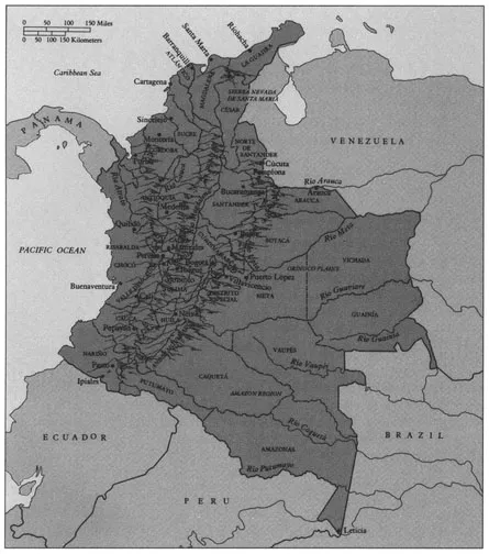
COLOMBIA, AT THE NORTHWEST comer of South America, covers 1,141,748 square kilometers (440,829 square miles), two-thirds again the area of the state of Texas. With Venezuela and Brazil to the east, Ecuador to the south, and Panama to the west, it is both a Caribbean country and one with a long Pacific coastline. Its 35 million people make it the third-most-populous Latin American country, ranking behind only Brazil and Mexico.
Geographical Variation and Regionalism
Colombia includes the Andes mountains, the tropical rain forest of the Amazon jungle, the grasslands of the Orinoco River, and other tropical rain forests on both the Caribbean and Pacific coasts. The whole of the country is in the Tropics between 12° north latitude and 4° south latitude (see map). This means that length of-day variations by time of year are slight, but it does not mean that all parts of Colombia are alike climatically or geographically or that all are hot. Rather, climate varies with altitude. In the Andes, for example, in an hour's drive one can travel from a cool area where potatoes are the major crop to a warm one where coffee and bananas are grown. Mean temperature ranges from 28° C (82° F), corresponding to summer in Washington, D.C., to 13° C, the temperature of a southern New England spring. Indeed, the argument has been made that one reason national economic integration did not come sooner to Colombia was that the diversity of crops available near the major cities made trade unnecessary.
Colombia
The Andes mountain range splits near the border with Ecuador into three major cordilleras that continue north all the way to Venezuela. The mountains are higher than the U.S. Rockies, and until the advent of air transportation in the 1930s travel between the regions was difficult and time-consuming. Even today a trip from Bogotá to Medellin, half an hour away by jet, takes at least eight hours by bus. The western range is the lowest of the three; although its highest peak is 4,400 meters (14,436 feet), a number of others are between 3,600 and 4,000 meters (from 11,811 to 13,123 feet). The central range is the highest, with a number of permanently snow-covered peaks (despite their being less than 4° from the equator), the highest of which is Sierra Nevada del Huila at 5,429 meters (17,812
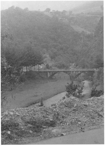
Neusa, near Bogotá, in Andean Colombia (Photo by Andrés Rothstein, reprinted by permission.)
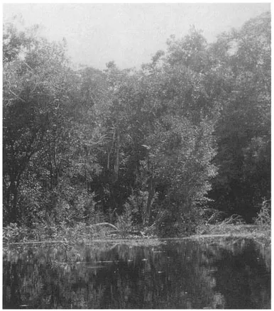
The Amazon (Photo by Andrés Rothstein, reprinted by permission.)
feet). The eastern range is somewhat lower on average than the central, although its highest peak (5,493 meters or 18,022 feet) is higher than any in the central. The eastern is both the longest and the widest of the three ranges. The highest peaks in Colombia are, however, not in the Andes but in the Sierra Nevada, where the Colón and Bolivar peaks are 5,775 meters (18,947 feet) high. On a clear day, these peaks are visible from the Caribbean beaches of Santa Marta.
Most authorities agree that the three major regions in Colombia are the East, the Andean, and the Caribbean, but because the Andes form such formidable barriers, there is much disagreement about subregions. In this book I follow the four region division shown in Table 1.1.1
The Andean Regions
The most important events in Colombia's history have taken place in the Andes. It is there that the most complex Amerindian societies developed, that the Spanish
TABLE 1.1 Major Characteristics of Colombian Regions
| Percentage of National | |||
| Region | territory | population | Industry |
| Central Andean | 8.6 | 37.6 | 36.4 |
| Western Andean | 21.9 | 35.2 | 51.1 |
| Caribbean Coast | 11.6 | 20.0 | 12.0 |
| East | 57.8 | 7.2 | 0.5 |
sources: Atlas basíco de Colombia (Bogotá: Instituto Geografico "Agustín Codazzi," 1980), 80-133; Colombia Today, 24,1 (1989): 2-5.
established the major city of the area, Santafé de Bogotá, and that most Colombians have traditionally lived (about 75 percent of the people live there to-day—probably the lowest proportion of the population in recent centuries). In addition, most industrial and political activities have taken place there. Until the recent growth of the Caribbean coast, this 30 percent portion of the country's territory was, for all intents and purposes, "Colombia."
Some parts of the Andes (for example, Nariño and the Cundiboyacense area; historically had large Indian populations, while others—intermountain valleys that were warm enough for sugarcane cultivation (Valle del Cauca) and contained gold deposits (Antioquia, Chocó)—had relatively few Indians and saw the introduction of large numbers of African slaves. Still other areas (such as the San tanderes) where the number of Indians was small supported the development of small farms and artisan industries.
The Central Andean. Except during the nineteenth-century federal period, the Central Andean region has always been the governmental and administrative center of the country. In addition, this area is characterized by agriculture that varies with elevation: cultivation of potatoes and grains on the plains of Bogotá, at 2,600 meters (8,530 feet), and Boyacá; tobacco in the Santanderes; and corn, coffee, and citrus fruits at lower elevations.
The capital, Santafé de Bogotá (as it is officially called according to the Constitution of 1991), is in the Central Andean region. Although Bogotá does not compare in size or in percentage of the nation's population with some of the other metropolises of Latin America, it has grown rapidly in recent decades (50 percent from 1973 to 1980 and from 350,000 to more than 6 million in the past fifty years). Bogotá is by far the largest Colombian city, with a full 17 percent of the national population, and has a cool, vernal climate. The original population was Indian, white, and a mixture of the two (mestizo). Today, because of in-migration from all parts of the country, Bogotanos are physically much more diverse, and many speak with their regional accents. Although the city was not the original industrial center of Colombia, during the past thirty
Bogotá, near the center of the capital of six million people (Photo courtesy of the Organization of American States.)
years manufacturing establishments have moved into the area because of its abundance of low-priced labor. Most of the employed, however, work in other sectors of the economy, especially services. Bogotá celebrated its 450th anniversary in 1988, and many of the buildings in its center, including the National Cathedral and the La Candelaria residential section, date from the seventeenth century.
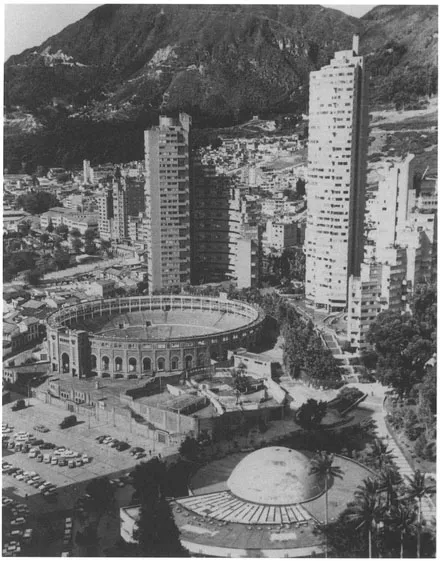
The Western Andean. The Western Andean region includes the northwestern department of Antioquia, whose capital, Medellín, is the second-largest city in Colombia and the country's original industrial center. Today 63 percent of Colombia's textile industry is in Medellín, including the oldest and largest company in that field, Coltejer. Antioquia is also a major coffee-producing area, along with Caldas, Quindiío, and Risaralda, all in the Western Andean region. The region also contains the sugarcane-growing Valle del Cauca. As the center of this prosperous sugarcane area, Cali, the third-largest Colombian city, plays an important role in the national economy. The two major cocaine-exporting groups are centered in Medellín and Cali. Valle has a large black population, and so does the gold mining department of Chocó. Slaves were imported to the region to supplement Indian labor in gold mining, and consequently whites, blacks, mestizos (white-Indian), mulattos white-black), zambos (Indian-black) and occasionally pure Indians can be found there. La raza antioqueña (the Antioquian race), as the inhabitants proudly call themselves, is light-skinned. The Western Andean region (especially Antioquia and the areas populated by Antioqueño migration in the nineteenth century) was traditionall...
Table of contents
- Cover
- Half Title
- Series Page
- Title
- Copyright
- Dedication
- Contents
- List of Tables and Illustrations
- List of Acronyms
- Preface
- 1 THE LAND AND THE PEOPLE
- 2 COLOMBIA FROM PREHISTORY TO 1930
- 3 PARTISAN CONFLICT, 1930-1974
- 4 THE EDGE OF CHAOS, 1974-1994
- 5 GOVERNMENT AND POLITICS
- 6 THE COLOMBIAN MIXED ECONOMY AND PUBLIC POLICY
- 7 THE INTERNATIONAL DIMENSION
- 8 PROGNOSIS
- Bibliography
- About the Book and Author
- Index
Frequently asked questions
Yes, you can cancel anytime from the Subscription tab in your account settings on the Perlego website. Your subscription will stay active until the end of your current billing period. Learn how to cancel your subscription
No, books cannot be downloaded as external files, such as PDFs, for use outside of Perlego. However, you can download books within the Perlego app for offline reading on mobile or tablet. Learn how to download books offline
Perlego offers two plans: Essential and Complete
- Essential is ideal for learners and professionals who enjoy exploring a wide range of subjects. Access the Essential Library with 800,000+ trusted titles and best-sellers across business, personal growth, and the humanities. Includes unlimited reading time and Standard Read Aloud voice.
- Complete: Perfect for advanced learners and researchers needing full, unrestricted access. Unlock 1.4M+ books across hundreds of subjects, including academic and specialized titles. The Complete Plan also includes advanced features like Premium Read Aloud and Research Assistant.
We are an online textbook subscription service, where you can get access to an entire online library for less than the price of a single book per month. With over 1 million books across 990+ topics, we’ve got you covered! Learn about our mission
Look out for the read-aloud symbol on your next book to see if you can listen to it. The read-aloud tool reads text aloud for you, highlighting the text as it is being read. You can pause it, speed it up and slow it down. Learn more about Read Aloud
Yes! You can use the Perlego app on both iOS and Android devices to read anytime, anywhere — even offline. Perfect for commutes or when you’re on the go.
Please note we cannot support devices running on iOS 13 and Android 7 or earlier. Learn more about using the app
Please note we cannot support devices running on iOS 13 and Android 7 or earlier. Learn more about using the app
Yes, you can access Colombia by Harvey F. Kline in PDF and/or ePUB format, as well as other popular books in Politics & International Relations & Politics. We have over one million books available in our catalogue for you to explore.