1 The scope of geography and occupation
The attitude to occupation is mostly political, juristic, economic, demographic, or administrative, but rarely geographical, rarely taking into account the meaning of physical changes that take place in an occupied region and all their consequences regarding the population that has to live under conquest. The link between geography and occupation does not have deep roots in academic literature, and features of terrain, land use, population distribution, or ethnic diversity are aspects of geography that have not received particular attention in the theme of occupation. Empirical studies have been less than successful in establishing a clear link between the geographic distribution of physical and human facts and occupation. While occupation is engaged first and foremost with territory, it turns out to be an issue that has geographical significance, describes and analyzes the influence of people, army, and occupier on its environment, and the impact of the changes they make in the natural and physical landscape when they use a region for their own occupational purposes.
Occupation, in traditional law, refers generally to the acquisition of territory by the victorious State in a war at the expense of the defeated State. Some authorities identify occupation with the provisional conquest of territory resulting from successful military operation, and describe the legal process of transferring title as subjugation, if the defeated State is totally annexed by the occupier, or as cession, if the defeated State retains its identity and agrees by treaty to the alteration of the territorial status quo in favor of the victor. According to another view, the term “occupation” is dissociated from the physical appropriation of territory during hostilities and used as a synonym for subjugation. In either case, occupation is associated with the principle of traditional international law that sovereign States may resort to in war at their discretion and, by military victory, achieve territorial and other gains that will be recognized as having legal validity. The State acquiring territory by occupation is regarded as the successor, with certain qualifications, to the rights and duties previously appertaining in the territory. Private rights, interests, and property in the territory are not affected by the change of sovereignty, and legal rules applicable to such matters remain in effect until altered by the legislative authority of the new sovereign.
While occupation is generally followed by annexation of territory, it was understood by international law in the nineteenth century that sovereign States were free to make war for reasons of State and consequently had the right to annex occupied territory. Title could not, however, be claimed until occupation was complete, that is, until the defeated State surrendered or lost all capability to resist further. Some international lawyers held that, after occupation was complete, title did not pass to the victor until the defeated State had ceded it by treaty or other States had generally recognized the change.
Annexation is a formal act whereby a State proclaims its sovereignty over territory hitherto outside its domain. Unlike cession, where territory is given or sold by means of a treaty, annexation is a unilateral act made effective by actual possession and legitimized by general recognition. Annexation is frequently preceded by occupation, a process by which a State ousts the existing government within a territory and places in authority its own military forces, thus setting up conditions of military occupation. Occupation and annexation may be limited to only a portion of territory of a State but such acquisition is usually effected by cession and by means of a treaty. An official announcement of an annexation, before occupation has been completed, has long been deemed irregular and, according to the widely accepted Stimson doctrine of 1932, annexation following completed occupation should not be recognized if the occupier has violated an antiwar obligation. The formalities of annexation are not defined by international law; whether it is done by one authority or another within a State is a matter of constitutional law. In international law annexation is the formal act by which a State declares its title to a territory. It differs from acquisition in that a State may acquire territory without formal annexation, by means of prescription, or uncontested occupation of territory of another State over a long period of time, by accretion, or adding to its territory on a river or maritime frontier through the operation of natural forces, or by discovery and occupation of unclaimed territory.
From a geographical point of view, occupation is usually executed by a massive penetration of military forces into a territory, by dominating roads and junctions, strategic points, important regional and environmental sites, and also towns and villages in which most of the population is concentrated. The occupation of a region can be executed in different ways, but in most cases it does not match with its internal structure and form. Occupation is executed more rapidly and is generally carried out violently and against the nature of the environment and against the whole fabric of its settlements and artificial networks. Occupation is not a constructive action but a move of destruction and exploitation of the existing infrastructure of a region by the occupying country for its specific aims. On the one hand it uses the geographical elements of the territory for purposes of dominance, and on the other hand it misuses them in their natural layout, and creates a military fabric of its own, which may be separated from or be in contrast with the traditional surroundings.
As the military fabric imposes itself on the existing physical elements of a region, it not only destroys it but also leaves behind it remnants, after the occupation comes to an end, that are harmful to the natural environment.
Communications arteries such as roads, railway lines and all kinds of transportation means are the most important elements in an action of engagement. A communications artery is a geographical linear element that allows the occupier rapid penetration into a region in a relatively short time and in a most effective way. The capturing of a communications axis provides dominance over the interrelationships and economic connections between cities and villages and control over population movements in the area. A regional road system connects population, dwellings, economic and social relationships and is, therefore, the main target in any invasion. The axis dominance is also used for conveying combat matériel, goods and army troops: it is a channel that can be opened or closed intermittently according to the occupier’s decisions and benefits, and enables the occupier to direct the daily life of the population under occupation. While a communications system is usually constructed in a branched form, its dominance enables the occupier to control large areas with minimal military forces. Instead of distributing troops to all parts of a region, it is sufficient to dominate the main arteries and road junctions. The reason why dominance on communications axes makes occupation easier is that roads are usually aligned according to topography and such physical elements as soil composition, slope gradients, mountain passages, water resources, climatic conditions, land uses, settlements, etc. If no reasonable road system exists in an area efficient enough for the occupier’s needs, the latter may construct a new communications system of its own with arteries and by-passing roads, parallel with or even in contrast to the existing one, on condition that its access to all parts of the occupied region will be safe and efficient.
Territorial occupation is also connected with seizure of land. Occupation needs land for its own uses, such as military camps, engineering installations, places for arms and ammunition storage, training fields, and administration buildings that cannot be combined with civilian land uses in towns, villages, or even in open space. The land uses of an occupier are typically exploitative and are aimed at providing urgent needs and services, to enforce dominance in the occupied territory, and are far from being oriented to civilian sustainable development. There is no doubt that occupation causes damage to agricultural land, especially when the army has, for instance, to clear an area to widen its field of view for safeguarding the surroundings against attacks. Military occupational land uses do not fit local outline schemes or civilian detailed building plans, because they are different in their style and construction, they have a monotonous appearance, and are usually anomalous in the nature and in the history of a region. An occupied region creates a new fabric of sites that have nothing in common with the geographical features of a natural region.
Territorial occupation is also engaged with the exploitation of water resources, especially in arid or semi-arid regions. The dependence on water resources gives the occupier the power of directing the life, economy, and agricultural production of a region, and to provide for its own needs in the ruling territory. Occupation of water resources is executed by seizing land under which the aquifers lie, where rain water is accumulated and where the upper installations, the wells, the drilling pumps, and the conveying water network are. This kind of occupation administers water supply, controls reservoirs, and even keeps water resources as an economic and strategic means for more efficient dominance of the population that is under occupation.
Territorial occupation is connected with the conquest of towns and villages. The geographical layout of settlements in a region demonstrates the interrelationships between people and the environment and the artificial fabric that people have created for their existence. Such interrelationships develop gradually over time by the adaptation of people to their surroundings, which shape over periods of time an optimal form of land use that suits the local population. Some settlements function as service centers for the region, and their rate of growth is determined by their regional position and their economic power which creates a hierarchy of settlements of different size. The occupation of towns and villages, or their encirclement by walls or ditches, as a means of disconnecting them from their surroundings, is an effective way for the occupier to gain control over the majority of a region’s population through a few occupied cities and villages. The occupation of towns and villages holds and prevents local development, is not constructive, and in the best case succeeds in maintaining a restraining situation.
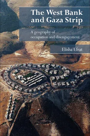
There is also a way of dominating an occupied region by an initiated penetration of rural and urban population into it and by establishing there a separate layout of settlements under military administration. In such a case the occupier may dominate a region by creating many faits accomplis. Such an imposed settlement layout is from the geographical point of view far from ideal, because the best parts of a region are usually taken by the local inhabitants, and what remains for the occupier are no more than marginal areas of low economic potential. Such an imposed settlement layout may entail serious geographical deficiencies regarding agricultural soil, water resources, and adjustment to main communications arteries. It is hard to imagine a deeper change in a region than a new imposed artificial layout of settlements with settlers who have not lived there before, who are outsiders in the region, who have had no relationship to it in the past, and who since the military occupation have decided to make their life there for political and economic reasons. If such a layout includes outposts and remote fringe settlements that have been established for political purposes, the result will be unreasonable and far from having any geographical logic.
Territorial occupation causes damage to the natural landscape. Occupation does not consider nature and landscape values and certainly not ecological sites with special fauna and flora as important elements that have to be protected. These are neglected by the occupier because its actions are typically drastic, exploitative, short-range, and based on aims that do not consider the efforts invested by the local inhabitants in the slow and gradual development of their region. Therefore, tree felling, soil erosion, land dissection, irrational land-use, waste of building remnants after evacuation – all these are signs of a military and occupied landscape, whether it is under occupation or abandoned later on. Terrible environmental damage is being inflicted on large areas in occupied regions in Israel. Millions of cubic metres of soil, with tens of thousands of trees, thousands of acres of orchards and groves, tens of thousands of acres of natural growth, greenhouses, archaeological sites and wells, as well as the fabric of life of hundreds of people, are being crushed. A desperate thought comes to mind: before the fate of a disputed land is resolved, there will be nothing left to fight about, and then a great cry will be heard over the ruins.
When the Jewish settlers arrived in Judea and Samaria following the Six Day War, they found a strip of land that still preserved an amazing likeness to the landscape of Second Temple days, as far as this can be imagined, and even a likeness to the landscape of biblical times. Today one must search for the scenery, because it hides in the shadow of the controlling presence of the outposts, settlements, and by-pass roads. Love of land is the last thing one thinks of when encountering the sight of the region today. It is not the aesthetics of the settlements themselves but their impact and their associated infrastructure on their near and distant surroundings, especially the landscape that has been used for agriculture and grazing for thousands of years. Settlements were spread over large territories and their houses were scattered in every direction, slicing up the typical landscape and damaging cliffs and hills. The landscape is broken from every direction with heavy equipment, the hills lose their soil and vegetation, and the slopes become naked waste ground. Israel decided in April 2005 to transfer garbage beyond the “Green Line” and dump it in the West Bank for the first time since 1967. The project was launched despite international treaties prohibiting an occupying State from making use of occupied territory unless it benefits the local population. The dump operators planned to deposit some ten thousand tons of garbage from the Sharon region every month in what was known as the largest quarry in the West Bank. The initiative started out as a plan to rehabilitate a 4-acre plot in a quarry by filling it with building waste, junk, and shredded tyres. It evolved into a huge project spread over dozens of acres for household garbage. Israel’s construction and operation of the dump appeared to be in violation of international law, as it involves transferring garbage to territory defined as occupied. Experts warned that the dump would jeopardize the mountain aquifer, one of the largest freshwater sources in Israel and the West Bank.
It seems that the occupation of the West Bank and the Gaza Strip – until the end of 2005 still the only regions in the world under occupation by a neighboring country – realizes the scope of geography of occupation. In these two regions, which were once to be a Palestinian State, we find all the typical elements of occupation mentioned above – capturing of a territory, disregarding land ownership, dominating water resources, ruling over rural and urban local population, establishing new types of settlements with settlers who come from outside, erecting outposts in remote and peripheral areas in order to seize more land, by-passing local communications arteries and constructing separate road networks, creating faits accomplis to establish arbitrary borderlines and all these in conflict and clashes with the strong national emotions of the Palestinian people under occupation, and have been the cause of two Intifadas and terrorism.
2 The West Bank:
a Jewish–Arab struggle
for sovereignty
Background
The West Bank, or Judea and Samaria as it is called in Israel, is a part of western Palestine which during the period 1948–67 was under Jordanian rule, when it was referred to as the West Bank, as distinct from the East Bank of the Jordan which formed the core of the Hashemite Kingdom of Jordan. To the north of it are the Gilbo’a hills and the Valley of Yesreel, in the west it borders on the Plain of Sharon, the Jerusalem Corridor and the Judean Lowlands, and in the south is the Arad region. Between Israel’s War of Independence of 1948 and the Six Day War of 1967, the region of Judea and Samaria was bounded by an armistice line between Israel and Jordan, but no physical links connected it with the State of Israel. After 1948 the region no longer had access to the Mediterranean Sea or to the Coastal Plain and the Gaza Strip; its only link was with the Kingdom of Jordan to the east. The armistice line caused changes in the pattern of towns and villages that were reflected in their number, population, interrelationship and eastward orientation. Geographical changes in the settlement pattern were the result of the unnatural political conditions, which affected the physical, economic and social factors of this area. For 19 years, from Israel’s War of Independence in 1948 until the Six Day War in 1967, the area was virtually isolated from its natural surroundings, being cut off from the more densely populated and highly developed parts of Israel by an armistice line.
Judea constitutes the southern part of the area. The western slopes of the Judean Mountains have been included in the State of Israel since 1948, as have their southern slopes which form part of the Arad region. Mount Hebron forms a wide crest with a syncline on each side, the lowland in the west and the desert in the east. Rising to an altitude of 3,000 ft (1,000 m) it runs in a northeast to southwest direction. To the west a tectonic fold line provides a gradual 900–1,500 ft (300–500 m) ascent. In the east another fold forms the transition from the crest to the Judean Desert. The Samarian Hills in the north, on the other hand, are entirely included in what was formerly known as the West Bank. The Hills of Samaria fall gradually from the south. They extend from the Mountains of Jerusalem up to the Yesreel Valley in the north, and border on the Jordan Valley in the east and the Coastal Plain in the west. In contrast to the Hebron Mountains, the Samarian Hills, whose average height is 1,650 ft (550 m), are dissected by rifts and valleys underlining the topographical differences between one section and another. Economically and politically Samaria was less isolated and maintained close ties with the East Bank. Although Samaria and Judea each have distinct geographic, demographic, and economic characteristics, they should nevertheless be regarded as a single entity. The region has an area of 2,296 sq. miles (5,878 sq. km), constituting 21 per cent of western Palestine, and extends along 75 miles (120 km) from north to south with an average east to west width of 25 miles (40 km). The armistice line of 1948 was fixed according to the disposition of Jewish and Arab forces at the end of the 1948 war and determined the administrative and political boundaries of the region. In the east the earlier international border runs along the course of the Jordan River down to the Dead Sea (Fig. 2.1).
In the Hebron Mountains the dispersion of the villages is linear and concentrated, owing to the geographical features of the area. To the east the influence of the desert is very noticeable; the annual precipitation is between 4 and 12 in. (100 and 300 mm), the vegetation is scanty, there are few springs and little soil. All these factors severely limit the extension of human settlement beyond a line of 3.1 miles (5 km) east of the mountain crest. To the south, the influence of the Negev Desert penetrates some distance into the Hebron Mountains, and as result the number of villages falls off as one nears the border of the desert.
The villages in the Hebron Mountains are dispersed along a line parallel to the watershed, but at some distance from it, near deposits of good soft building stone. The villages also refrained from settling on fertile land on the plateau. To the west, a number of villages are located along a tectonic axis parallel to the general orientation of the mountain. Their position on the edge of the mountainous backbone ensures geographical advantages and adequate supplies of spring water. The larger villages, of three to five thousand inhabitants, are found mainly in the southwest, while in the central part of the region the average village has only five hundred to a thousand inhabitants. The larger population of the border villages may be explained by the need for protecting the settled farmers against the predations of desert nomads and by the gradual intermingling, over the years, of farmers and nomads in settlements that enjoy favorable soil and water conditions. The settlement pattern in the Hebron Mountains has, therefore, crystallized along well-defined axes, as a result of the geographical character of the hill country and its agricultural possibilities.
The pattern of settlement in Samaria is more scattered and covers almost the entire area. The broken mountainous topography has resulted in a network of villages located on hilltops and mountain spurs, where they dominate the surrounding country. The valleys are as a rule not settled, since they contain fertile sedimentary soil suitable for intensive cultivation. The wide dispersion of villages in the Samaria Hills is made possible by the presence of a large number of springs, as a result of many fault lines that are characteristic of these mountains. The villages are generally small and only a few h...