Hemalata C. Dandekar
Introduction
Although the story in the sidebar “Two Scenarios” in the Introduction of this book is something of a caricature, problems can and do end up on a planner’s desk in similarly circuitous ways: a mix of perception, rumor, anecdote, and misinformation. A planner needs to get good information that provides insight into the problem and enables changes in policy and action that can remedy or ameliorate the problem or turn it into an opportunity for change and development. Getting an intuitive sense of the situation and the problem context by collecting information firsthand, in situ, and getting a good reading of the forces at play is both an acquired skill and an art worth cultivating. With practice, field observations can yield information that provides a holistic and integrated snapshot of conditions “on-site.” They can often be a good investment of a planner’s time. As the story entitled “Collecting Information Firsthand On-Site” which follows illustrates, field methods offer a way to research a problem, focus on the topic of interest, and formulate the questions that need to be asked in the process of plan making. They required Assistant Planner to make judicious choices about who he chose to talk to or “interview” and what he chose to document. They reflect his imbedded understanding of the context, the systems that organize and impact it, and the people he believes to be knowledgeable.
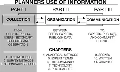
This chapter describes various methods, generically categorized as field methods, that planners use to investigate existing site-specific conditions. These are designed to gather data from primary sources of information on a particular place, issue, or problem. They include direct observations, scrutiny of materials, and conversations with and/or observations of individuals, and personal knowledge of the place and situation. The information is gleaned from sources generally unavailable except by actual visits to the specific locale. Before visiting a site, it is advisable to generally identify what one wants to learn from the field. Site visits are expensive and involve personnel and travel costs. There is a potential for encountering hostility when engaging with client or community on “home turf.” But field work also yields insights, a holistic sense of place, people, history, and context. Executing an effective site visit can yield rich information as well as serendipitous unplanned encounters that provide unexpected and useful perspectives.
Collecting Information Firsthand On-Site
When Assistant Planner was assigned the problem of weekend trash litter on Happyville’s Main Street, the first thing he did was to execute a basic site reconnaissance. Before he left his office, he printed out a promotional map of downtown from the website of the Chamber of Commerce. It identified all the businesses on Main Street. He examined their building facades on Google Earth and took a screen print that showed the alleys behind these structures.
While strolling down Main Street he photographed and took video-clips on his cell phone of pedestrian activity on the street, observed the levels of litter blowing around, and noted on the map, firmly attached to a clip board, where likely spots for further observation might be, including public trash receptacles. He noted the level of trash in each.
On Friday afternoon, he noticed that the receptacles were not full and there was not much litter on the street. He paused to eat an ice cream cone at the street plaza on Liberty and Main and was eventually joined by numerous high school students who, he knew, had adopted this corner as their usual after-school hangout. He noticed that they and other plaza visitors were mostly careful to deposit their trash in receptacles. Office workers populated this particular plaza during lunchtime. A group of four homeless men were using the plaza for their daytime hangout. They too were making good use of the trash receptacle near their bench. The plaza was relatively litter-free at that time of the afternoon. In addition to public trash receptacles, Assistant Planner noted that a number of businesses had their dumpsters in alleys not too far from public view. Some of these were already full, though not overflowing. On returning to the office he recorded his field observations on the map and in notes, referenced the photos and videos geotagged to location downloaded from his cell phone, and strolled over to chat with his friend Molly in Public Works. She assigned the contracts each year for garbage collection in the city. Public Works too, he learned, had also been getting complaints about trash in the downtown.
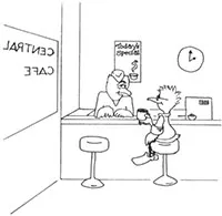
The next morning, Assistant Planner revisited Main Street. He noted the level of trash in the chosen public receptacles, using a printout of a simple spreadsheet he had prepared on his computer. Most were now full. Business dumpsters, especially those for restaurants, were full to overflowing. A cup of coffee at Central Café (a place popular with university students and staff) provided an opportunity to talk with the café owner, Joe, and his clients, and to observe the activity of people on that part of Main Street through the café’s front window.
Joe told him that most of his suppliers made their largest material deliveries on Fridays in preparation for the weekend crowds. This meant that Joe needed to dispose of a number of bulky containers that evening or early Saturday morning, which filled his dumpsters to capacity and, at times, left them overflowing. He did not enjoy, he said a bit defensively, contributing to the trash littering the alley behind the café but, between the limited space in the alley where the dumpsters were kept and the high cost of additional dumpsters, he didn’t have much choice but to continue to let the trash pile up.
By late Saturday afternoon, Assistant Planner’s notes, photographs, and videos documented the fact that overflowing public receptacles had additional cups and other trash placed on and around them. Meanwhile, trash from the overloaded dumpsters was blowing around the alleyways and onto the street. The plaza had cups and fast-food containers left on benches near the overloaded receptacles.
He went back to his office, typed up his notes from interviews, added some observations, downloaded and attached his digital images, and summarized the data on levels of trash in receptacles over the 24 hours he had been recording them. He attached all the files to an email he sent to Planning Director, and wrote him a quick update.
Field methods are often categorized as qualitative rather than quantitative and in fact, field methods do tend to assess a situation qualitatively. However, they can and should be structured to provide systematic observations that can, over time, yield quantitative indicators to inform, evaluate, and assist in policy formulation. The definition of what constitutes a qualitative versus a quantitative method has periodically been addressed in the academic planning literature. Although interesting, this discussion is not particularly useful here as it has little direct relevance to planning practice. What is relevant is to identify why field work is needed in a particular planning context. Time in the field is expensive, needs to be used well, and key to this is preparation. Technology has made it easier to organize a site-based effort. Overview and street views of a project area are available through applications such as Google Earth. Assessors’ records provide lot-level information online. The Chamber of Commerce and other groups provide business data and census information that are easy to retrieve (see Chapter 3, Information from Secondary Sources). The use of drones to photograph sites providing information tailored to a site may eliminate the need for some aspects of on-the-ground information collection. These and other advancements in technology are reducing the costs of obtaining area-specific data.
But field work remains useful and essential in that it can help to augment, update, and add to information that is available through secondary sources. It can allow observation of people and their behavior in situ. It can open up possibilities for “person-on-the street” interviews that may yield insight from those very familiar with, and impacted by, the context under review. Being on-site allows the observer to make assessments about aesthetics, about sense of security, and other textural and experiential characteristics. The dense imagery and variety of information that exists in the field can overwhelm an observer. Preplanning and documenting can help to stay on track. Recording accurately while in the field is key to justifying the validity of the information that is collected. Background and support material such as detailed maps, street views, demographic, economic and housing data can be downloaded on devices that are taken to the field such as an iPad or other handhelds. If digital connectivity is reliably available on-site information uploads can allow an integration of information, in real time, across various observers. But background material can also be used in low-technology formats such as hard copies on clipboards to enable quick, accurate, and reliable recording and updating of information.
One important purpose of field methods—and the descriptive studies that can result from it—is to provide the planner and ultimately the client, either a public or private entity, with an intuitive, integrative, conceptual framework for understanding the problem, and for placing in context quantitative and technical information developed during other stages of a project inquiry. Selecting the right field method for a particular task is often a function of time, resources, person-power, skills, readily available technology, the political economy of the context in which the information is available, and the anticipated desired outcome and use of the collected information. It is usually not a question of knowing which method is best, but rather of knowing which one is adequate and “do-able” given prevailing constraints.
In this chapter, methods that might be particularly effective on-site are described. But in selecting methods planners must make trade-offs between efficacy, utility, and affordability and customize methods so that they are appropriate to a particular context and time. A planner needs to learn to make these decisions purposefully, know what is possible, learn from practice and experimentation, and stay abreast of new technologies for learning about people and place.
In framing a planning problem (see the Introduction), the first step is to develop a good working definition of the problem. Field methods can sometimes provide valuable, “grounded” information to make a judgment about what it is, or to test out and reformulate a given problem, as Ass...


