This book is available to read until 31st December, 2025
- 188 pages
- English
- ePUB (mobile friendly)
- Available on iOS & Android
eBook - ePub
Available until 31 Dec |Learn more
About this book
This book should be required reading for all who believe New Mexico is nothing but plains, mesas, and cacti. It proves in spectacular fashion that the Land of Enchantment is very much a mountain state, with at least sixty summits 12,000 feet or higher. Photographer-author Mike Butterfield has spent forty years hiking these high mountains, and his magnificent images are paired here with the chronicle of his adventures.
To help readers become acquainted with his beloved mountains, Butterfield divides the high peaks of northern New Mexico into their geographical regions, each with its unique geology, history, and plants and animals. Butterfield’s primary focus, however, remains on the peaks, which have attracted generations of hikers, backpackers, climbers, hunters, and horsemen.
To assist those visitors, Butterfield covers not only named summits but also the many individual points exceeding 12,000 feet. He includes valuable information about important trails and trailheads, access points, and, for car-bound visitors, places from which the mountains can be most favorably viewed.
Frequently asked questions
Yes, you can cancel anytime from the Subscription tab in your account settings on the Perlego website. Your subscription will stay active until the end of your current billing period. Learn how to cancel your subscription.
At the moment all of our mobile-responsive ePub books are available to download via the app. Most of our PDFs are also available to download and we're working on making the final remaining ones downloadable now. Learn more here.
Perlego offers two plans: Essential and Complete
- Essential is ideal for learners and professionals who enjoy exploring a wide range of subjects. Access the Essential Library with 800,000+ trusted titles and best-sellers across business, personal growth, and the humanities. Includes unlimited reading time and Standard Read Aloud voice.
- Complete: Perfect for advanced learners and researchers needing full, unrestricted access. Unlock 1.4M+ books across hundreds of subjects, including academic and specialized titles. The Complete Plan also includes advanced features like Premium Read Aloud and Research Assistant.
We are an online textbook subscription service, where you can get access to an entire online library for less than the price of a single book per month. With over 1 million books across 1000+ topics, we’ve got you covered! Learn more here.
Look out for the read-aloud symbol on your next book to see if you can listen to it. The read-aloud tool reads text aloud for you, highlighting the text as it is being read. You can pause it, speed it up and slow it down. Learn more here.
Yes! You can use the Perlego app on both iOS or Android devices to read anytime, anywhere — even offline. Perfect for commutes or when you’re on the go.
Please note we cannot support devices running on iOS 13 and Android 7 or earlier. Learn more about using the app.
Please note we cannot support devices running on iOS 13 and Android 7 or earlier. Learn more about using the app.
Yes, you can access New Mexico's High Peaks by Mike Butterfield in PDF and/or ePUB format, as well as other popular books in Art & Photography. We have over one million books available in our catalogue for you to explore.
Information
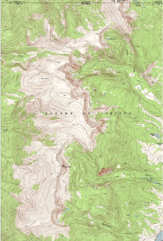
CULEBRA RANGE
State Line Peak 12,867
Un-12,383 12,383
Un-12,450 estimated 12,450
Un-12,225 estimated 12,225
Vintrero 12,881
Big Costilla Peak 12,739
Un-12,931 12,931
The Culebra range, a prominent subrange of the Sangre de Cristo Mountains, is located primarily in Colorado and contains one of that state’s 14ers: 14,011-foot Culebra Peak. Culebra Peak misses being New Mexico’s highest summit, instead of being Colorado’s forty-first highest, by a mere 9 miles. From Culebra Peak, the peaks maintain a high profile before dropping in altitude just north of the New Mexico state line. Rising abruptly from its forested north slope is reclusive State Line Peak, whose actual summit lies a few hundred feet north of the New Mexico state line and introduces the Culebra range into New Mexico.
These peaks are on private property, and permission must be granted for access. Not located on public land and not within any wilderness, these mountains see limited use from the casual recreationist. They are seen to some effect from the north-south highway connecting Questa and Taos, New Mexico, from the west. They are best viewed from parts of SR 196, which cuts through the Valle Vidal, as well as from the trail that leads from Little Costilla Creek up Powderhouse Canyon toward Little Costilla Peak. For the most part, the peaks in New Mexico are high points on a rather flat-lying ridge, with little to distinguish one summit from another. Only from Little Costilla Peak’s summit to the east can the Culebra range be seen to good advantage.
The primarily Precambrian rocks of the Culebra range exhibit a gentle western aspect, while the east faces are more deeply incised by glacial action and display the steep faces and cirques typical of that environment. These east-facing cirques hold numerous small lakes, but with no established trail system, it is left to the more adventurous to discover these lake basins. Permission to access any of the land owned by the Rio Costilla Livestock Association must be made in advance. The best contact numbers are 575-586-0542 and 800-RIO-PARK. For more information on access to this mountainous area as well as to the northern Latir area, visit www.riocostillapark.com.
Comanche Point at the confluence of Little Costilla Creek and Comanche Creek in the Valle Vidal.
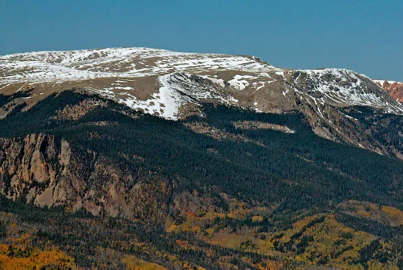
Viewed from high above Comanche Creek, near the confluence of Little Costilla Creek, the southern ramparts of the Culebra range can be seen, with the range’s highest summit, Un-12,931, on the right. On the extreme right, Big Costilla Peak can just be seen.

State Line Peak (12,867 feet) introduces the Sangre de Cristo Mountains to New Mexico. The peak’s highest point is a few hundred feet over the state line, so New Mexico’s claim to the peak is vague, yet the New Mexico high point is only a few feet lower than the Colorado high point, so most people include State Line as a New Mexico peak. Furthermore, the bulk of the mountain is in New Mexico, with a high ridge connection of over 12,000 feet to its nearest neighbor, Un-12,383 (the more diminutive summit on the left). The peak’s north flank drops to a low saddle, with more than 4.5 miles to the next high point.
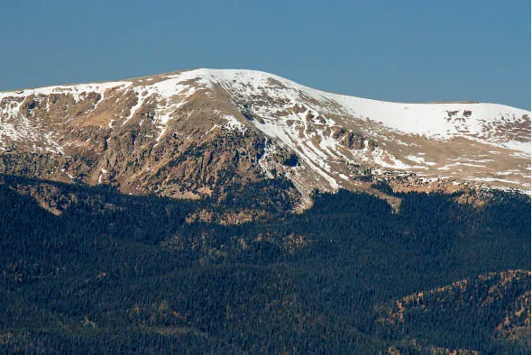
The broad, flat summit of Vintrero (12,881 feet) from Little Costilla Peak. Although one of the state’s highest summits, Vintrero is almost unknown. Located on private property, its summit sees few visitors.
The Culebra range’s highest point (Un-12,931) as seen from Little Costilla Peak in the Valle Vidal. Even though most maps identify only Big Costilla Peak (12,739 feet), Un-12,931 is the true high point in the Culebra range in New Mexico. Big Costilla Peak (seen on the far right) rises approximately 189 feet from its connecting high saddle with Un-12,931. Therefore it does not meet the criteria for sovereign status.
CIMARRON RANGE
Little Costilla Peak 12,584
Baldy Mountain 12,441
Touch-Me-Not Mountain 12,045
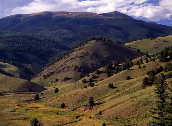
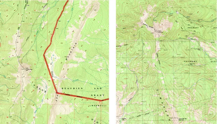
The main Cimarron range borders the Moreno Valley to the west and has two main summits: Baldy Mountain and Touch-Me-Not Mountain. The high crest of the main Cimarron peaks is delineated by Mills Divide on their north side and the Cimarron River to the south, but high ridge connections can be traced north all the way to the South Fork Purgatoire River well into Colorado and south to the Tooth of Time Ridge within the Philmont Scout Ranch. Thus I have included Little Costilla Peak in this group. Separated by the Costilla Creek valley from the main Culebra crest, its claim to brotherhood with that group is dubious at best. Rising in parallel ridges trending north to south, including the Little Wall, the Wall, the Rock Wall, Ash Mountain, and finally the Vermejo Peak–Little Costilla Peak ridge, one can see the regional makeup of this area of peaks. Separating the north-south-oriented Valle Vidal and Moreno Valley by only a moderate east-west ridge and one pass, Windy Gap, the high ridge connection from Colorado to the Cimarron River, can be seen in its entirety.
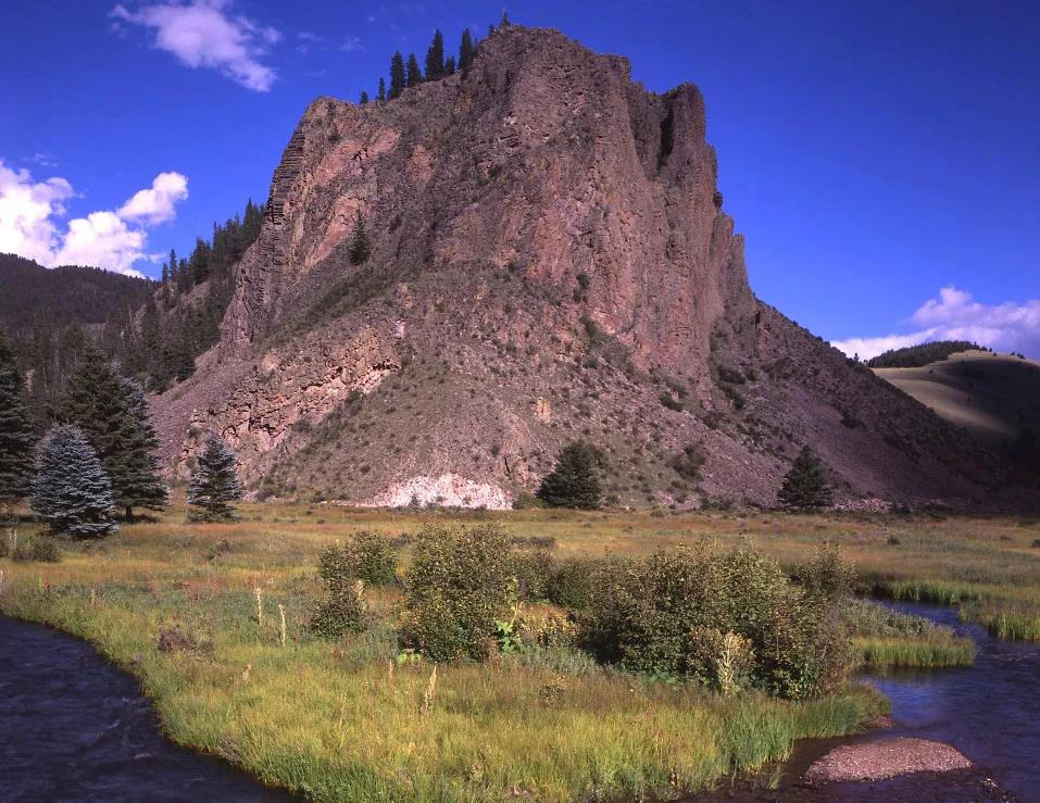
The geologic record indicates rocks in the Cimarrons ranging in age from Precambrian (more than one billion years in age) to Tertiary (sixty-five million years and younger) with a vast gulf in time separating these rocks known as the Great Unconformity. They have been further intruded upon by widespread volcanic action. The most spectacular display is along the highway through Cimarron Canyon State Park, where a body of magma forcibly intruded along the Great Unconformity in this area, creating the vertical jointed rocks of the Palisades. The volcanic nature of the area can also be seen at Windy Gap, where the great dike known as the Rock Wall is breached. From the summit of Little Costilla Peak, evidence of volcanism is everywhere: from the Spanish Peaks north into Colorado to Ash Mountain; a long rhyolite dike just to the east of Little Costilla Peak and 1,000 feet lower.
The east slopes of Baldy and Touch-Me-Not are part of the Philmont Scout Ranch, and permission must be granted for access from that direction. The approach up Willow Creek from the Virginia City townsite north of Eagle Nest may be the best. Local inquiry should be made for this approach, as the land is on private property and permission may be needed for access. Touch-Me-Not is within the Colin Neblett State Wildlife Area, but the best approach to the mountain is from Willow Creek as well. The best view of these peaks is from Elizabeth-town just off Highway 38.
Little Costilla Peak can be approached by road and trail from either Powderhouse Canyon or Little Costilla Creek. Both of these approaches might best be done as an overnight trip due to the distance involved.
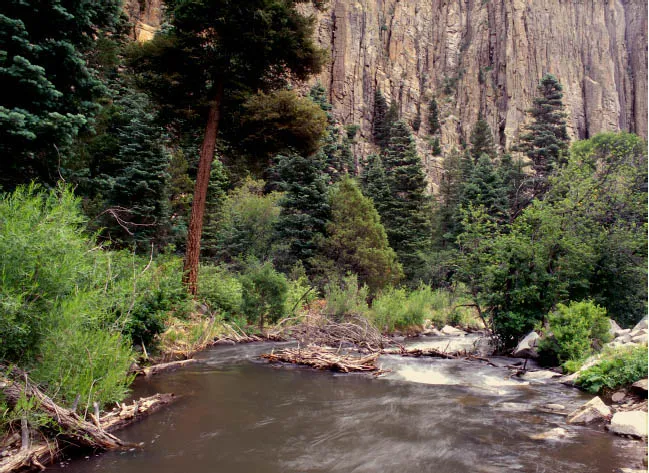
The Palisades along the Cimarron River.
The shortest approach for Little Costilla Peak is from the Clayton Corral on FR 1950 before Windy Gap. Some trail segments exist, and the hike is steep in spots. The opportunity to see wildlife on this approach mitigates the steep sections. One can return by way of the ridge west of Grassy Creek, with a short hike back to the car. The peak sees light visitation.
Little Costilla Peak is a somewhat reclusive peak and can be glimpsed onl...
Table of contents
- Cover
- Half title
- Title
- Contents
- Foreword
- Preface
- Introduction
- 1 Chapter One: The Northern Ranges
- 2 Chapter Two: The Santa Fe Rances
- 3 Chapter Three: Sierra Blanca
- 4 Chapter Four: What is a Peak?
- Acknowledgments
- Notes on Photography
- Works Cited
- Index