- 224 pages
- English
- ePUB (mobile friendly)
- Available on iOS & Android
eBook - ePub
About this book
This book provides an overview of Uganda, a country that represents the hope and despair of modern Africa. It deals with a brief examination of the factors and themes that have influenced Uganda's historical development, focusing mainly on the postindependence period.
Trusted by 375,005 students
Access to over 1.5 million titles for a fair monthly price.
Study more efficiently using our study tools.
Information
Subtopic
African PoliticsIndex
History1
The Physical Setting
UGANDA IS A LANDLOCKED COUNTRY located along the equator, about 500 miles from the Indian Ocean. The country is bordered by Sudan in the north, Kenya in the east, Tanzania and Rwanda in the south, and Zaire in the west. Uganda’s total area is 91,076 square miles, including 16,364 square miles of open water or swamp. The country is largely situated on a plateau 3,000 to 5,000 feet above sea level, dissected by many rivers, swamps, and lakes. Mountain ranges and other relief features are located on the borders. Uganda’s western region contains the western Rift Valley, the Mufumbiro Volcanoes, and the Ruwenzori Mountains, which are also known as the Mountains of the Moon. Lake Victoria constitutes much of the country’s southern boundary, and the highlands, which are dominated by volcanic Mount Elgon, mark most of the eastern boundary.
Mineral Resources
Uganda possesses a variety of commercially valuable minerals.1 Copper, first discovered in 1906, is found at Kilembe, which is located in a valley among the Ruwenzori Mountains’ lower eastern slopes. There is a tin belt that reaches a width of 40 miles and runs northwest to southeast between two gold belts. The center line of the tin belt is located where the Ruizi River turns southward to join the Berarara River. Mwirasandu was the country’s largest mine, but operations stopped after thirty years because the deposits had been exhausted. Low-level tin mining is still possible in other parts of the southwest. Beryllium ore, used for nuclear energy and as an alloy with copper and other metals, is also found in the southwest. Although deposits are sufficient to allow Uganda to become a beryllium-producing country, a large-scale export market has never been developed.
Large gold deposits are located in two belts running northwest to southeast. The western gold belt, which has a maximum width of about 20 miles, passes near Kabale. The center line of the eastern belt, which is approximately the same width, is west of Mbarara. Lesser amounts of gold can be found in the north near Kitgum and around Moyo. There are four low-grade tungsten (wolfram) mines in Kigezi District. However, historically unstable world prices have prevented Uganda from realizing a consistent profit from these mines.
Other minerals present in Uganda are columbium and tantalumores (Tororo); bismuth (Kigezi District); lithium (west of Lake Victoria); silver (Kitaka); galena (Kitaka); mica (Labwor Hills, West Nile District, and south of Kampala); and chromium (Karamoja). Additionally, the country possesses a variety of high- quality iron ores, including hematite ores (Kigezi and northeast Ankole); magnetite (Sukulu and Bukusu); thorium (Karamoja); barites (Ankole and Karamoja); asbestos (West Nile, Acholi, and Karamoja); diatomite (west of Katonga River); topaz (East Mengo); and graphite (Karamoja and West Nile). There are also garnet, talc, feldspar, gypsum, vermiculite, and potash deposits scattered throughout Uganda.2 In late 1991, the Ugandan government announced the discovery of cobalt in Kasese; the deposits were about 1.1 million tons and could earn the country about $228 million.
Uganda lacks commercially exploitable oil reserves. In 1985, the World Bank funded the Petroleum Exploration Promotion Project, which sought to help the country define its policy toward oil exploration and development. As part of this program, geologists carried out field surveys in and around Lakes Albert and Edward. These activities, however, have failed to locate any petroleum deposits.3
Soils
Generally speaking, Uganda is blessed with fertile soil.4 Indeed, those in the Lake Victoria zone and in the Mabira forests yield two crops a year, making them among the most productive in the world. There are, however, some significant variations between northern and southern soils, largely because of different rainfall and land use patterns.
In the south, the most common soil is red loam overlaying a compact clay subsoil. Southwestern soils are browner. These soils are deep, up to 15 inches, and extremely fertile. Similar soils are located in the foothills of the Ruwenzori Mountains and on Mount Elgon. Another good soil is the deep red loam found over Karagwe-Ankolean rocks in regions with a 50- to 70-inch mean annual rainfall. The topsoil, which can be 15 to 20 feet deep, is a dark chocolate color and is found in Bunyoro, Mubende, and eastern Kyagwe. In general, the north has poorer soils than the south. The third kind of soil, which is present on low-lying land, consists of a dark humic top layer from 3 to 12 inches thick on almost pure sand. In its extreme form it is nearly uncultivable. Such soil is found on the Lake George plain, in Gomba, east of the Masaka-Bukoba road, and in parts of the Lake Kyoga drainage basin. An intermediate form of this soil is located over parts of eastern and northern Uganda. It has a thin top layer and the subsoil can be hard and gravelly.
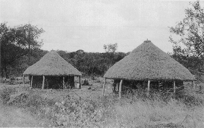
Traditional housing (Photo courtesy of U.S. Committee for Refugees.)
Ironstone, which is also called murram, is present in all these soils. Normally, it is found as a nodular gravel or as solid ironstone somewhere between 1 to 40 inches below the surface. Murram makes excellent gravel roads. Solid ironstone, which is useful for building purposes, exists in large sheets in the central lake basin.
Soil erosion intensified after the introduction of cotton, which was cultivated on a million acres of new agricultural land. Cotton cultivation exposes the land to months of heavy rainfall and, until the plants mature, to intense sun. Large clearings for cotton cultivation result in the exposure of large pieces of land to soil wash. Since most farmers fail to construct cross drains, channels are created that carry away the best part of the soil. Despite this problem, erosion from runoff is minimal since most of the country is located on a plateau. Moreover, high rainfall speeds the growth of protective vegetation, which covers much of the south, and builds and restores soil fertility and structure.
Ever since colonial times, the government has sought to control soil erosion with a variety of reforestation and tree planting programs. Nevertheless, in 1968 forest reserves totaled only approximately 8 percent of the land, or about 5,770 square miles. By the early 1990s, the situation was worse. Theoretically, forests covered only 7.5 percent of the country’s landmass; however, because encroach - ers had almost destroyed forests such as Kibale, Kisangi, Mount Elgon, Mabira, and Bukaleba, most foresters believed that the actual percentage was much lower.5
Climate
There are six climatic regions in Uganda: Lake Victoria, Karamoja, western, Acholi-Kyoga, Ankole-Buganda, and Mount Elgon. Although they usually merge near their edges, each region possesses some unique characteristics.6
The Lake Victoria region is about 30 to 50 miles wide. Because of adequate rainfall, bananas, coffee, and several other intensively cultivated crops grow well. This region is characterized by a group of flat-topped hills, which range in altitude from 4,300 to 4,400 feet; swampy inlets of the lake; and a swampy valley. At the lakeshore the daily temperature variation is about 13 degrees Fahrenheit; 30 to 50 miles further inland this increases to approximately 20 degrees. Although some rain falls every month, there are two dry seasons: from December to March and from June to July. Rainfall is greatest during the March-May and Oc- tober-November periods. On the shores annual rainfall totals between 60 and 70 inches and occurs between 160 and 170 days per year. Elephant grass is the main vegetation in the southern parts of East Mengo and Mubende Districts, nearly all of West Mengo, and the eastern portion of Masaka District.
Most of Karamoja is on a wide, flat plain at an altitude of 3,500 to 4,000 feet. There are a few hill ranges with peaks rising to 8,000 to 9,000 feet. The absence of adequate rainfall and good soil requires the region’s people to be pastoralists rather than farmers. With the exception of the west and northwest, much of Karamoja is semiarid. Rainfall is intermittent and averages about 15 inches in the dry regions to 35 inches on the western border. The rainy season is from April to August and the dry season is from November to March, when brushfires are common. During the dry season temperatures can be as high as 96 degrees Fahrenheit in the shade. In the rainy season high temperatures normally are about 85 degrees Fahrenheit in the shade.
The western region extends 30 to 70 miles inland from the Ugandan-Zairian border. It includes portions of West Nile, Bunyoro, Toro, Ankole, and Kigezi districts; and Lakes Albert, George, and Edward. The Ruwenzori Mountains and the Mufumbiro Volcanoes are in the southwest. In the northwest and southeast highlands, and the escarpment and hill east of Lake Albert, the elevation is anywhere between 4,000 and 5,000 feet. Temperatures can reach 90 degrees Fahrenheit or more throughout the region. Rainfall patterns are varied. Annually, the lake areas receive 34 to 40 inches, higher elevations get about 50 to 55 inches, and 60 to 80 inches fall on the slopes of the Ruwenzori Mountains. The dry season is from December to February. The rainy seasons are from September to October and from April to May.
The Acholi-Kyoga region includes parts of Acholi, West Nile, Madi, Teso, Lango, Busoga, and Bukedi districts. The areas altitude ranges from 3,000 to 4,000 feet. There are few hills. The most prominent geographic feature is Lake Kyoga. The papyrus swamp around the lake moderates the climate. Annual rainfall varies between 35 and 50 inches. The rainy season lasts from April to October. South of the swamp there is a dry season from December to March; north of the swamp there is low rainfall rather than a dry season during June and July.
The Ankole-Buganda region, which is on a plateau, comprises much of Busoga, Bukedi, and Ankole districts and most of the former kingdom of Buganda. There are hills in the north and south and swamps around Katonga River and Lakes Wamala and Kachira. There is an average of 40 inches of rain per year. Rainy seasons last from September to November and from April to May, and the dry seasons are between June and July and between December and February. Temperatures are moderate.
Mount Elgon, an extinct volcano, dominates this region, which includes parts of Bugisu and Sebei districts. In the south and southwest rainfall can amount to 70 inches a year; the northern slopes are somewhat drier.
Forests
Despite favorable climatic and soil conditions, Uganda has comparatively few closed (i.e., state-managed) forests.7 In the 1930s, these forests covered only about 1,860 square miles, which put Uganda in a worse position than any other territory in the British Empire except Tanganyika (now Tanzania) and South and Western Australia. However, Uganda also possessed thousands of square miles of savanna forests, which were not under government control. Over the years, the latter gradually diminished in size, largely because farmers had cleared huge areas for crop production and grass fires had destroyed or damaged large tracts.8 Despite this poor record, there are sizable forests throughout the country, especially in western Uganda, the Lake Victoria region. Smaller forests exist in many places, some of which include western Buganda, Ankole, Kigezi, West Nile, Budama, Bugwere, and Busoga.
These forests possess a wide array of species.9 In Busoga s high grass savanna, for example, the mvule or Uganda iroko, with a bole that may rise to 70 feet and have a girth of 18 feet, dominates the landscape. The muwafu or incense tree resembles an oak. The kirundo or African upas has a slender white bole to 150 feet.
The mpewere, which can reach a height of 110 feet, produces red fruits the size of cherries. Other common trees include the African umbrella tree, the mahoganies, and the Uganda ironwood or muhimbi.
During the colonial period, the Department of Forestry, which was established in 1917, managed the country’s forests to produce a sustained yield of timber, poles, and firewood. The Department of Forestry also maintained eucalyptus and cassia plantations near all the larger towns to provide the inhabitants with fuel and building poles. Additionally, the Department of Forestry planted hardwoods such as mahogany and mvule and established cypress and pine forests in the western highlands.
After independence, Uganda’s forests were placed under increasing pressure by growing instability, an expanding population, and the collapse of effective government.10 Agricultural encroachment, logging, charcoal making, and harvesting for firewood increased each year and caused widespread deforestation throughout the country. Neither natural regrowth nor tree-planting projects kept pace with the growing demand for forest products.11
After seizing power in January 1986, the National Resistance Movement regime promised to reverse these trends and to rehabilitate Uganda’s forests. In 1988, the Ministry of Environment Protection assumed responsibility for administering forest policy. The following year, this ministry implemented a six-year Forestry Rehabilitation Project financed by the United Nations Development Program (UNDP) and the United Nations Food and Agriculture Organization. The project, which is expected to cost $37.2 million, included a nationwide tree planting campaign and a group of three-year training courses for farmers, rural extension agents, educators, and women’s groups. As part of this project, the Department of Forestry devised a “set aside” policy whereby 50 percent of the country’s high forests and savanna woodlands would be set aside as nature reserves and buffer zones. These areas would protect Uganda’s forest cover, act as genetic pools, ...
Table of contents
- Cover
- Half title
- Title Page
- Copyright Page
- Contents
- Dedication
- List of Illustrations
- Preface
- List of Acronyms
- Introduction
- 1 The Physical Setting
- 2 History
- 3 Government and Politics, 1962-1994
- 4 Society and Culture
- 5 The Economy
- 6 Independence and New Foreign Policy Directions
- 7 The Ugandan Experience After Three Decades
- Notes
- Bibliography
- About the Book and Author
- Index
Frequently asked questions
Yes, you can cancel anytime from the Subscription tab in your account settings on the Perlego website. Your subscription will stay active until the end of your current billing period. Learn how to cancel your subscription
No, books cannot be downloaded as external files, such as PDFs, for use outside of Perlego. However, you can download books within the Perlego app for offline reading on mobile or tablet. Learn how to download books offline
Perlego offers two plans: Essential and Complete
- Essential is ideal for learners and professionals who enjoy exploring a wide range of subjects. Access the Essential Library with 800,000+ trusted titles and best-sellers across business, personal growth, and the humanities. Includes unlimited reading time and Standard Read Aloud voice.
- Complete: Perfect for advanced learners and researchers needing full, unrestricted access. Unlock 1.5M+ books across hundreds of subjects, including academic and specialized titles. The Complete Plan also includes advanced features like Premium Read Aloud and Research Assistant.
We are an online textbook subscription service, where you can get access to an entire online library for less than the price of a single book per month. With over 1.5 million books across 990+ topics, we’ve got you covered! Learn about our mission
Look out for the read-aloud symbol on your next book to see if you can listen to it. The read-aloud tool reads text aloud for you, highlighting the text as it is being read. You can pause it, speed it up and slow it down. Learn more about Read Aloud
Yes! You can use the Perlego app on both iOS and Android devices to read anytime, anywhere — even offline. Perfect for commutes or when you’re on the go.
Please note we cannot support devices running on iOS 13 and Android 7 or earlier. Learn more about using the app
Please note we cannot support devices running on iOS 13 and Android 7 or earlier. Learn more about using the app
Yes, you can access Uganda by Thomas P Ofcansky in PDF and/or ePUB format, as well as other popular books in History & African Politics. We have over 1.5 million books available in our catalogue for you to explore.