The Medicine Line: Life and Death on the North AmericanBorderland, is a complex and oftentimes dramatic mix of narrative storytelling and history in which ironies are explored, patterns of deed and response are uncovered, examined and evaluated...Beth Ladow is a compelling stylist who writes with warmth and insight, and she has given us a smart book, which will help us understand one another, and a good read. We need more books like this one. -- William Kittredge, Author of THE NATURE OF GENOROSITY(knopf,2000)
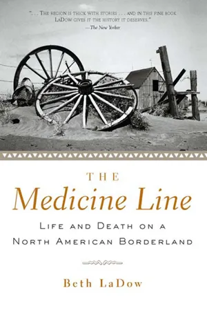
- 256 pages
- English
- ePUB (mobile friendly)
- Available on iOS & Android
eBook - ePub
CHAPTER ONE
DRAWING THE LINE
George VandeVen nodded toward the broad seascape of Montana prairie and gave his voice the inflection of someone dismissing a terrible rumor. “We didn't even know a line was there,” he said. He was referring to the U.S.-Canada border, our destination that day driving north from the town of Chinook, and as we stepped from his Dodge Sierra pickup truck onto the homestead site where he was born in 1913, eighty-five years earlier, it was hard not to believe him.
North Americans tend to divide the American story from the Canadian along this boundary, as if it split the past as neatly as a meat cleaver. How many Americans know that in the summer of 1793 the British North American explorer Alexander Mackenzie made his own trip to the Pacific Ocean through present-day Canada, twelve years before Lewis and Clark famously paddled up the Missouri not fifty miles south of Chinook, carrying a copy of Mackenzie't Voyages in their boat, as well as copies of British explorer David Thompson't charts and British-made maps? How many Americans or Canadians know the saga of the building of parallel railroads, one American, one Canadian, some eighty years later less than a hundred miles apart across George VandeVen't childhood home? The West, we have come to believe, is an “American” story.
It was midmorning, soon after we had begun our four hours of jolting over dirt roads under an already furnace-hot sky, when VandeVen, a second Chinook octogenarian named Anne Schroeder, and my eleven-year-old daughter, Kate, and I made our first stop. We all clambered out of the truck except for Kate, who remained in the covered truck bed reading, patiently suffering her mother't historical field research. I could hardly blame her. The ground was a sparse mix of brown and green grasses a few inches high, clumps of silvery sage, and little prickly pears, connected by a dry and cracked tissue of gray earth. Cowless, telephone-pole-less, practically fenceless, to my eye it was an arbitrary port of call in a vast, undifferentiated ocean of space and distance. A place of forgetting, haunted by disappointment. But VandeVen was brimming with life. As we walked over the ground he gave shape to the place with memories. He introduced a human scale. Here, he said, was the site of the garbage dump, still riddled with shards of pottery and metal. Over there was the coulee where his pregnant mother had trekked down to get water, in what year? 1916? She had had to stop and rest on her way back up, burdened with the heavy bucket and with child. Here was the house. I followed George to a shallow pit about thirty feet by twenty feet where the sagebrush cropped up vigorously like the waves of a rough sea. He bent over into it and, like Crusoe finding his shipwreck, lifted one end of a slim twenty-five-foot pole, the roof beam to the underground house, called a dugout, where he was born and raised— the VandeVen place. “This will always be home,” George said. It was, he insisted, a home indifferent to the international border twenty miles to the north.
The border, after all, had emerged more as a political construct than as a natural feature of the landscape. In April 1803, the United States purchased the Louisiana Territory from France without knowing much about its northern edge. Thomas Jefferson, then president, pulled from memory or from somewhere in his Monticello study an unratified article, buried in the 1713 Treaty of Utrecht between France and Britain, that proposed dividing New France from British North America. It specified a boundary at 49 degrees north latitude. On January 15, 1804, Jefferson wrote a memo to his diplomats in France and Spain suggesting this line as the northern boundary of the Louisiana Purchase, and the world't longest continuous straight international border was created.
To Meriwether Lewis and William Clark, whom Jefferson sent west to explore the Purchase in 1804, the Monticello memorandum was of little interest. Like Jefferson, they hoped to cross the 49th parallel along a Missouri River tributary, an American river extending north that might give the United States an excuse to claim more land. In May 1805, following the Missouri through a country they described as “desert and barren” and “astonishingly dry,” the explorers would come close to Jefferson't boundary—just below its exact midpoint, in fact, between Minnesota and the Pacific Ocean, on the high plains of present-day Montana. Here they might have followed a smaller river north beyond the 49th parallel. Yet they did not. They had trouble finding firewood. They judged the soil “poor.” While Jefferson believed it would take a thousand generations to settle the West, Clark judged as nil the prospects for populating this area along the Missouri. “I do not think it can ever be settled,” he declared. As it turned out, both Clark and Jefferson were wrong. It took only five generations to settle the West, and the last generation came here, to one of the toughest arid prairie environments in the world, on a short stretch of the 49th parallel boundary between the United States and Canada that the last of the roaming Plains Indians would come to call “the medicine line.”1
Today, history divides on either side of the border, into the distant camps of the American Wild West and the orderly Canadian hinterland, peacefully separate national stories. Since 1867, we believe, when Britain withdrew its military outposts and Canada became a nation, the U.S.Canada border has lapsed into an agreeable somnolence. Yet what is now the world't most peaceful border, its largest commercial sieve, was for more than a century the battleground of empires. The United States and British Canada, after all, were continental rivals. By the late nineteenth century, in the wake of the American Civil War, escalating native-white conflict, and the making of an independent Canada, the struggle for empire aroused familiar and often nationalistic visions. The forces of nature, however, were so strong, and the populations so mixed, that telling an American citizen from a Canadian became increasingly difficult. All were driven or drawn to this place, their last, best hope—the Indians for escape and refuge, the settlers for the open western lands that seemed nearly gone—and lived a common story of hardship, disappointment, failure and, in fewer cases than not, persistence.
The medicine line forms a small part of the U.S.-Canada boundary, scarcely more than a hundred miles long—a place that most people have never heard of. Stand today on the border, at the center of the 49th parallel boundary curve, facing the Rocky Mountains 200 miles to the west, and you will see why. To the left, the American half of medicine line country, lies Blaine County, Montana, and near its center, just south of the old VandeVen place, is the small town of Chinook, thirty miles south of the border on dirt and gravel roads. Beyond that lie the Bears Paw Mountains, known locally as the Bear Paws, and the Missouri River at the county't southern border. To the right is the Cypress District of Saskatchewan, including the Cypress Hills and the towns of Eastend and Maple Creek, thirty and sixty miles north of the border. Together, the two sides cover an area about the size of Vermont. Natural boundaries are absent. There is no river here, no precipice, no mountain divide, no indentation or canyon. The prairie stretches seamlessly outward, as if the wind were blowing it toward the Rockies. Straddling the border, feet between cacti and clumps of gray-green sage, one conjures other borders with imposing names—iron curtains, great walls, grand rivers, Pyrenees. Those are borders where history has physical shape, borders that define peoples and their enemies.
Not so here. No guard keeps watch, no narcotics agent stands at the ready. There is only a fence with four strands of barbed wire, and sometimes not even that. This boundary seems the creation of a minimalist. Traveling the long stretches of the Trans-Canada Highway, or along U.S. Highway 2 to Chinook, it is easy to see why so many visitors compare this country to the ocean. The Rocky Mountains are a tidal wave to a vast, tawny sea. A mailbox, a gravel driveway, and trees clumped around buildings or in the long row of a shelterbelt indicate a ranch. Occasional fences cast a wide berth, nets of barbed wire cordoning off crops and ungulates that show from the roadside like bright algae or schools of fish. The small towns are strung out in lonely archipelagos, each island posted with signs, like pier posts along a quay: motels, cafes, chambers of commerce. “Rudyard: Home of 596 nice people and one old sorehead!” A country of reluctant charm, it is seldom crossed, less often visited. Walking along what seems scarcely more than a home for prairie dogs, we can hardly imagine a place more uneventful. Its history, however, holds another prospect.
My first introduction to this borderland came through reading Wolf Willow, Wallace Stegner't memoir of growing up in medicine line country. Stegner, who went on to win the Pulitzer prize for literature, spent his boyhood here, from 1914 to 1920, in the town of Eastend in winter and on a homestead on the boundary line during the summers. A brilliant, powerful writer and an even more charismatic and influential human being, Stegner framed the questions of this borderland frontier throughout his life. Yet he did not answer them. What was Canadian—the line, limits, the law? What was American—the frontier, the limitless, the lawless? The border, he wrote, “ran directly through my childhood … disturbing as a hair in butter”—somehow a divide in affiliations and loyalties, yet artificial, ignored, undistinguished. I was intrigued, charmed, and unsatisfied. Shouldn't the line by which we measure American and Canadian distinctiveness have stronger medicine than that?2
My interest in medicine line country is also rooted in a childhood conundrum of what it means to be an American. My first awareness of the U.S.-Canada border as something significant came at an early age. It wasn't so much that we crossed it every July or August on forays from my family't summer home in Montana, when I would press my nose against the car window to see the treeless swath through the forest that some mysterious boundary keeper had made with herbicide to make the border visible. It was to be found in the expression of an uncle of mine, a worried man with a mole in the exact center of his forehead, who used to sit at the kitchen table in our cabin in Glacier Park, not forty miles from the Canadian border, declaring that the condition of the United States had at last sunk so low that he was pulling up stakes. “By God,” he would say in his customary tone of world-weary resignation, “I'm goin' to Canada.”
Like most Americans, I wasn't sure what the border, or the borderland, meant. I knew the fame of the 100th meridian, the line where the arid plains so dramatically begin that has determined so much of the story of America and the West. Only after I began to study history did I discover the medicine line. Here, I realized, was another line worth examining—one that could explain some deep part of the Canadian and American experience that our separate nationalistic television documentaries leave out. Following a long tradition that includes Stegner, I am a westerner come East, then returned West, in order that I might explain the West to myself.
When W. J. Twining brought his tired body and weather-beaten chronometer across the 49th parallel, he saw little sign of civilization. As chief astronomer for the United States surveying party in 1874, Twining was spending his third and last summer locating the U.S.-Canada boundary, and he had traveled much of the way on the upper Missouri River, through the Dakota and Montana Territories, in a boat that did not inspire confidence. “No one in search of the amenities need look on the deck of an up-river boat,” Twining complained of his party't rig, the rattletrap Fontenelle, whose rough machinery and primitive design he found “constantly suggestive of unpleasant accidents.” Its condition was so bad that Twining attributed the absence of boiler fires or explosions on the upper Missouri to the “special providences” rather than to “any skill on the part of the builders or owners.” “Certainly no thought of anything so worthless as human life entered into their calculation,” he concluded.3
The scene awaiting the Fontenelle on July 24 as it pulled into Fort Benton in Montana Territory, the backwater burg where an upriver boat ended its journey, was no more an advertisement for civilized life than the boat itself. The eye could take it in “at one glance,” as fur trader James Willard Schultz described it—the rectangular adobe fort with cannons mounted at the corners, a few log cabins and adobe huts, the scattered camps of traders and trappers, strings of canvas-covered freighter wagons, clustered Indian tepees, and the Overland Hotel, a log structure likely offering a dinner of “boiled buffalo boss ribs, bacon and beans, ‘yeast powder’ biscuit, coffee with sugar, molasses, and stewed dried apples.”4
On the banks of the river waited a motley collection of Creoles, whites, and Indians, what Schultz described as “the entire population,” turned out in the full regalia of a fading fur-trade economy: trader elites in long-tailed blue broadcloth coats with brass buttons and black cravats, their long hair neatly combed; trade company clerks and carpenters in black fustian suits and beaded moccasins; French-speaking Creoles in hooded coats and sash-tied buckskin trousers; bull whackers, mule skinners, and independent traders and trappers, festooned with knives and six-shooters and wearing buckskin suits and kit fox hats; Indians in leather leggings and calico shirts carrying bows and arrows or rifles; women in calico dresses and fringed shawls. Desperate for tobacco and liquor, they thronged the banks of the upper Missouri, the center of a thriving north-south trade zone, waving flags and firing cannons to greet the latest steamboat to arrive in Montana Territory. It was a greeting of exuberant, risk-taking hope reminiscent of the Fontenelle itself, the kind of hope a man of precision and science could not be expected to warm to—the kind of hope that, over the next fifty years, Twining't survey would unleash upon this borderland to a degree that he could not possibly have imagined.5
Twining himself was among the crowd that day. The boat't progress had been so slow he had unloaded the survey party't livestock somewhere past Bismarck, Dakota, and made his way upriver on land. He arrived at Fort Benton on July 12, twelve days ahead of the Fontenelle, only to discover that the overburdened steamer had off-loaded a good part of his provisions when it hit shallow waters at Cow Island, 120 miles downriver.6
In 1874, the calculations of engineers or astronomers like Twining had created few amenities on the Northern Plains. The fur trade, which had brought with it the presence of steamboats, distilleries, and the occasional cannon, had long since waned from its height in the 1830s. The cosmopolitan if crude Montana gold rush of the 1860s was over. The infant whiskey trade into Canada and the imminent arrival of railroads had yet to boost the economy. As Twining and his colleagues set out to meet their Canadian counterparts along the border, there was no promise of civilization in the air, only flies and dust.7
Outside Fort Benton, the land was still home to Sitting Bull and his counterparts, Crowfoot, Piapot, and Poundmaker. On the prairie, the surveyors crossed the paths of other groups. Sioux, Assiniboine, Blackfeet, and Piegan Indians “hovered about our trail,” noted the American first lieutenant Greene—curious, doing the visitors no harm, keeping their distance. At closer range, the newcomers also found nature't tracings, the cautionary signs of drought in the parched earth. The weather was “intensely hot,” reported Twining't colleague Captain Gregory; water was “very scarce,” and what they found was scarcely potable. The ground was “dry, hard, and fissured,” as if from a very dry season, according to the Canadian Boundary Commission geologist. It was a world of cracks and trails, wind and grass. The only plumb line these men could see was the enduring straight edge of the horizon, where the enormous sky met the land. They had come to remedy that situation, to visibly divide and subdivide the land, to realize what the con...
Table of contents
- Cover
- Half Title
- Title Page
- Copyright Page
- Dedication
- Table of Contents
- Acknowledgments
- Prologue: Through the Looking Glass
- 1. Drawing the Line
- 2. The “Melting Pot of Hell”
- 3. Sanctuary
- 4. If You Build It, Will They Come?
- 5. Which Side Are You On?
- 6. A Living or a Way of Life?
- 7. What Are We Fighting For?
- 8. The Cosmopolitan Throng
- 9. “We Can Play Baseball on the Other Side”
- 10. Nature's “Incivilities”
- Epilogue: Wallace Stegner and the North American West
- Notes
- Index
Trusted by 375,005 students
Access to over 1.5 million titles for a fair monthly price.
Study more efficiently using our study tools.
Frequently asked questions
Yes, you can cancel anytime from the Subscription tab in your account settings on the Perlego website. Your subscription will stay active until the end of your current billing period. Learn how to cancel your subscription
No, books cannot be downloaded as external files, such as PDFs, for use outside of Perlego. However, you can download books within the Perlego app for offline reading on mobile or tablet. Learn how to download books offline
Perlego offers two plans: Essential and Complete
- Essential is ideal for learners and professionals who enjoy exploring a wide range of subjects. Access the Essential Library with 800,000+ trusted titles and best-sellers across business, personal growth, and the humanities. Includes unlimited reading time and Standard Read Aloud voice.
- Complete: Perfect for advanced learners and researchers needing full, unrestricted access. Unlock 1.5M+ books across hundreds of subjects, including academic and specialized titles. The Complete Plan also includes advanced features like Premium Read Aloud and Research Assistant.
We are an online textbook subscription service, where you can get access to an entire online library for less than the price of a single book per month. With over 1.5 million books across 990+ topics, we’ve got you covered! Learn about our mission
Look out for the read-aloud symbol on your next book to see if you can listen to it. The read-aloud tool reads text aloud for you, highlighting the text as it is being read. You can pause it, speed it up and slow it down. Learn more about Read Aloud
Yes! You can use the Perlego app on both iOS and Android devices to read anytime, anywhere — even offline. Perfect for commutes or when you’re on the go.
Please note we cannot support devices running on iOS 13 and Android 7 or earlier. Learn more about using the app
Please note we cannot support devices running on iOS 13 and Android 7 or earlier. Learn more about using the app
Yes, you can access The Medicine Line by Beth LaDow in PDF and/or ePUB format, as well as other popular books in History & North American History. We have over 1.5 million books available in our catalogue for you to explore.