- 272 pages
- English
- ePUB (mobile friendly)
- Available on iOS & Android
eBook - ePub
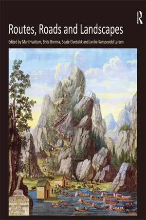
Routes, Roads and Landscapes
About this book
Routes and roads make their way into and across the landscape, defining it as landscape and making it accessible for many kinds of uses and perceptions. Bringing together outstanding scholars from cultural history, geography, philosophy, and a host of other disciplines, this collection examines the complex entanglement between routes and landscapes. It traces the changing conceptions of the landscape from the Enlightenment to the present day, looking at how movement has been facilitated, imagined and represented and how such movement, in turn, has conditioned understandings of the landscape. A particular focus is on the modern transportation landscape as it came into being with the canal, the railway, and the automobile. These modes of transport have had a profound impact on the perception and conceptualization of the modern landscape, a relationship investigated in detail by authors such as Gernot Böhme, Sarah Bonnemaison, Tim Cresswell, Finola O'Kane, Charlotte Klonk, Peter Merriman, Christine Macy, David Nye, Vittoria Di Palma, Charles Withers, and Thomas Zeller.
Trusted by 375,005 students
Access to over 1.5 million titles for a fair monthly price.
Study more efficiently using our study tools.
Information
Section I Moving through the Landscape
This section discusses pictorial and textual representations of routes and landscapes, ranging from eighteenth-century topographical literature and landscape gardens, to the multifaceted landscapes of early nineteenth-century expeditions. Oscillating between scientific investigations, colonial conquest and romantic reverence, these descriptions and depictions make up a vivid testimony to the reciprocal relationship between the landscape and the route.
1 King of the Road: Describing Norwegian Landscapes in the Eighteenth Century
In the 1920-publication The Artistic Discovery of Norway we meet Norwegian landscapes, drawn, painted and etched by the artist Erik Pauelsen after his tour through Norway in 1788. The author of this publication, the renowned cultural historian Carl W. Schnitler, hails Pauelsen as the first to give an artistic depiction of Norwegian nature. ‘In Erik Pauelsen’s drawings we trace for the first time an agitated mind and a willingness to express the greatness and beauty of what he sees – in other words a feeling for nature’.1 From the inception of the nineteenth century, Norwegian landscape painting was instrumental in producing a national imagery and instilling a sense of a unique Norwegian nature, connected to the creation of a Norwegian state in 1814 after 400 years of Danish rule. By the beginning of the twentieth century, Norwegian nature and landscape imagery had been naturalized to the degree that one could talk about the artistic discovery of the Norwegian landscape. To query in what sense this could be termed a ‘discovery’, the path followed in this article heads towards what existed before this discovery.
On a drawing made by a local clergyman in a parish in the eastern part of Norway in 1685, we meet the king of the road (Figure 1.1): The absolutist monarch king Christian V towers over the valley landscape with snow-clad mountain-tops, pleasant pine trees and a sun emanating rays over this king of God’s grace. In 1685 the absolutist king made his seven weeks long royal progress through Norway, the Northern part of the state of Denmark-Norway. The local clergyman Henning Munch used the rare occasion to present the king with a so-called ‘supplikk’, a letter of humble request, where he asked for funds to keep his parish church in good repair. On the top of the ‘supplikk’ he had made a sketch of the king overlooking the valley and taking possession over the territory.2 The king has the presence of an equestrian statue, similar to the actual statue produced in Copenhagen at the same time, to be placed on the central square of the town, Konges Nytorv. In Munch’s sketch, however, the king is not in command of the state, the capital Copenhagen, demonstrating his power over his subjects, but of nature, in the form of a Norwegian landscape.

Figure 1.1 This drawing is part of a letter to the king, a ‘supplikk’, drawn and written by the clergyman Henning Munch in 1685 to ask for means to mend his parish church (photo by Leif Stavdahl)
Maihaugen, Lillehammer: SS-DS-1995-0022. Reproduced with permission from Maihaugen.
Munch’s drawing frames this article, which will discuss landscape as a product of relations of power and knowledge in early modern Norway. A network of different practices and actors took part in establishing a Norwegian territory politically, scientifically and aesthetically. The material is scattered and varied, and this heterogeneity is of importance to the argument, which holds that different practices were important for what would later be named ‘a feeling for nature’ and an ‘artistic discovery of Norway’. The visual landscape descriptions produced in the wake of the kings’ journeys through the country during the eighteenth century is the most important material, together with the landscapes written into topographic literature from the middle of the eighteenth century onwards.
In his article ‘Knowledge of the Territory’, historian Jacques Revel investigates maps and proto-statistics as ways of knowing the territory in early modern France. Spanning a long period from the thirteenth to the nineteenth century, the article surveys efforts by public authorities to describe and homogenize a national territory, only to find that these were heterogeneous and contradictory for a long period of time.3 This argument is relevant also for the material I am researching, even if I am more interested in the visual character of this territorial knowledge. I will look at how visual descriptions of landscape were connected to different kinds of political, scientific and aesthetic practices for charting territory, or rather how these practices were entangled. One large shift is evident, namely the transition from a description of territory for the king to a description of territory for the citizens. But within this larger transformation there were strategies with quite divergent genealogies and often contradictory results.
The caption on the above drawing reads Invia gratia nulla est via. This is a word-play on Ovid’s Metamorphoses, book 14, where Anaeas asks for help to get through to the underworld to meet the ghost of his father, and is answered by the sentence Invia virtuti nulla via est, ‘no way to noble vertue is denide’, in the words of a seventeenth-century English translation.4 In Munch’s drawing, grace is substituted for virtue, and the translation can be something like: ‘No way is impassable for grace’. We could translate it even more freely, as ‘All roads are accessible for the king of God’s grace’. The king in Copenhagen ruled over a conglomerate state, dispersed territories, with the capital Copenhagen as the uncontested political, religious, economical, and cultural centre. Norway was ruled by the king in Copenhagen, but had approximately the same number of inhabitants, a much larger territory and a very different topography. As opposed to the flat and fertile fields of Denmark, Norwegian territory consisted of forests and mountains. Norway possessed rich natural resources – fish abounded in the North Sea, large amounts of timber were shipped from ports along the coast, and in the mountains there were metals and minerals. These were sources of income for the king, but the country was undeniably a vast, unknown and uninviting territory. If Munch’s caption alluded to the context of the proverb in Ovid, the message was that travelling through Norway was like descending into an underworld inhabited by the ghosts of heroes.
THE KING’S PROGRESS
The territory was accessible for the king of God’s grace, but travel was filled with hardships, and removed the king from the centre of the kingdom for months. Kings would regularly visit the different parts of the kingdom, but their visits to Norway were not exactly frequent.5 During the whole eighteenth century, sovereigns toured the country only four times, in 1704, 1733, 1749 and 1788. The 1749 tour was limited to the eastern region.6

Figure 1.2 This large scale map measures 142 × 520 cm and gives a detailed account of the King’s route from 2 June to 28 July 1733
The Royal Library, Copenhagen: KBK 1112-0-1733/3. Reproduced with permission from The Royal Library, Copenhagen, Department of Maps, Prints and Photographs.
During one full century, most of what was produced of landscape depictions from Norway came about through the different kings’ journeys through the country.7 Norwegian painters and draftsmen were a scarce commodity, and most of the ornamental work produced in churches and wealthy homes as well as portraits produced during this period were executed by travelling artists of Swedish, German and Dutch origin.8 Landscapes were not in demand, and no significant activity in mapping or prospect making can be documented. Thus, the largest collection of landscapes of early modern Norway came about as a result of the trip made by King Christian VI and Queen Sophie Magdalene in 1733. They brought with them approximately 190 people, and it has been said that rather than travelling through the country as a regent, the king was moving his court ‘over mountains, rivers and inlets’.9 The queen’s presence was unprecedented and made for the size of the company. They travelled from Copenhagen through Jutland up to Flatstrand (now Frederikshavn) before boarding nine ships that took them to Christiania, where the governor resided.10 After visiting towns around the fjord, they travelled inland through Hamar, over Dovre to Trondheim. Part of the company took the same route back to Christiania, while the king and the rest of the company went by small boats down the coast and back again to Larvik. After 4 months and 11 days, the court was back in the Royal palace.
MAP OF THE ROAD
Three maps and one lavishly illustrated manuscript remain from this journey, where the route of the royals forms the main topic.11 The maps were most certainly made after the tour, to commemorate the journey. These are impressive both in figurative content and in size, the largest measuring 142 × 520 cm, and beautifully hand-coloured. Roads, rivers, bridges and the most strenuous passages are depicted, the last ones by ‘perspective’, as indicated in the title of the maps.12 On the largest map, seven of the difficult passages are drawn, as well as seven plans of cities and fortresses. There is also a ‘record’ giving the details of the day to day movement of the entourage from 2 June to 28 July in the first two maps, between 28 July and 25 August on the third. One map is heavily worn, but the second is a copy in good condition, with a cartouche which differs from the original and with a text giving the names of Sergeant Torban Knorr and Corporal Steffen Nicolay Holstein. This also states that the first map was made in 1733, the second ‘copied and represented’ in 1735. The third map is smaller (161 × 275 cm) and is basically representing the Norwegian coastline, but with the East upwards, so that the journey of the king is represented horizontally from West to East. The main focus here is on the difficult passage Manseidet, where the entourage had to leave the boats to pass over a mountain. Thus, the king’s journey can be followed day by day in the texts on these maps, looking at the map we locate the exact position from day to day, but the main focus in the perspective drawings is on how the king could be seen moving through the landscape.
Taking the largest of the map as an example (Figure 1.2) we see how different systems of representations are combined: the fortresses and cities are depicted as plans, the difficult sequen...
Table of contents
- Cover
- Half Title
- Title Page
- Copyright Page
- Table of Contents
- List of Figures
- Notes on Contributors
- Acknowledgements
- Introduction: Routes, Roads and Landscapes
- Section I Moving Through The Landscape
- Section II The Route as Icon and Occurrence
- Section III Landscapes of Mobility
- Coda
- Index
Frequently asked questions
Yes, you can cancel anytime from the Subscription tab in your account settings on the Perlego website. Your subscription will stay active until the end of your current billing period. Learn how to cancel your subscription
No, books cannot be downloaded as external files, such as PDFs, for use outside of Perlego. However, you can download books within the Perlego app for offline reading on mobile or tablet. Learn how to download books offline
Perlego offers two plans: Essential and Complete
- Essential is ideal for learners and professionals who enjoy exploring a wide range of subjects. Access the Essential Library with 800,000+ trusted titles and best-sellers across business, personal growth, and the humanities. Includes unlimited reading time and Standard Read Aloud voice.
- Complete: Perfect for advanced learners and researchers needing full, unrestricted access. Unlock 1.5M+ books across hundreds of subjects, including academic and specialized titles. The Complete Plan also includes advanced features like Premium Read Aloud and Research Assistant.
We are an online textbook subscription service, where you can get access to an entire online library for less than the price of a single book per month. With over 1.5 million books across 990+ topics, we’ve got you covered! Learn about our mission
Look out for the read-aloud symbol on your next book to see if you can listen to it. The read-aloud tool reads text aloud for you, highlighting the text as it is being read. You can pause it, speed it up and slow it down. Learn more about Read Aloud
Yes! You can use the Perlego app on both iOS and Android devices to read anytime, anywhere — even offline. Perfect for commutes or when you’re on the go.
Please note we cannot support devices running on iOS 13 and Android 7 or earlier. Learn more about using the app
Please note we cannot support devices running on iOS 13 and Android 7 or earlier. Learn more about using the app
Yes, you can access Routes, Roads and Landscapes by Brita Brenna,Janike Kampevold Larsen, Mari Hvattum in PDF and/or ePUB format, as well as other popular books in Physical Sciences & Geography. We have over 1.5 million books available in our catalogue for you to explore.