High Lean Country captures the rich history and haunting character of the New England region of northern New South Wales.
The authors explore how memory - of land, of family, of patterns of life on the other side of the world - has influenced the identity of New England. They also consider how the high country itself has shaped its people and their sense of regional uniqueness. In doing so, this book sets a new direction for understanding Australia as a whole.
Weaving together the histories of human settlement, economic, social and cultural development, as well as interactions with the environment, High Lean Country shows how colonial settlers strived for decades to literally create a new England. It traces the story of the graduates of Oxford and Cambridge who turned their hands to sheep husbandry and developed a squattocracy, the establishment of schools and other institutions, and the cultivation of traditional arts. It also examines the early colonial bushranging period, and a history of not always friendly relations between white settlers and the local Aboriginal population.
A project of the Heritage Futures Research Centre at the University of New England, High Lean Country is a fascinating study of this distinctive Australian high country.
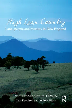
eBook - ePub
High Lean Country
Land, people and memory in New England
- 432 pages
- English
- ePUB (mobile friendly)
- Available on iOS & Android
eBook - ePub
High Lean Country
Land, people and memory in New England
About this book
Part 1: Physical Environment
CHAPTER 2
The Rocks Beneath
The winter of the year 1818 in what is now northern New South Wales was extremely cold, frosty and wet.1 That winter a party of explorers led by John Oxley struggled with their horses and dogs through bogs and across flooded rivers to be the first official expedition from the Sydney-based colony to reach the New England Tableland.2 They had entered what seemed to be a strange, almost inverted landscape. That the lowlands adjacent to the Liverpool Plains were boggy after heavy rain Oxley could understand, but he was puzzled that even as he left the plains and entered the highlands all the way up he encountered numerous ‘wet hollows’. As he approached the Great Escarpment from the west the only indication of high altitude was the hard August frost. Also, instead of displaying the serrations of a mountain range, as experience had led them to expect, the land remained one of gentle rolling relief.
Oxley and his party came from west to east, up the gentle gradient of the inland slopes, rather than tackling the highlands from their steep coastal margin. As a result, the transect cut by their path inadvertently revealed the structure of the south-eastern highlands of Australia. They found no ‘Great Dividing Range’, as had been imagined by those who viewed the highlands from the coast or from ships at sea and who saw there a landform apparently similar to the ‘tented’ range of high, Alpine-style peaks to be found in Europe and North America. Instead, they discovered an ‘upside-down land’ of plateaux cut by deep gorges, ‘natural phenomena’ as Oxley remarked, ‘which, from their defiance of all rule, perplex us … greatly’.3
So powerful was the cultural expectation that Australia should have a defining range on the lines of the Rocky Mountains that for 150 years maps and atlases have perpetuated the cartographic myth of a ‘Great Dividing Range’. In fact, the continental drainage divide is usually so flat that it accommodates lakes, lagoons, and even airstrips and race-courses. The water-shed is marked along most of its course by the modern New England Highway, built by engineers who presumably sought the easiest gradient, hardly an indication of a near-impassable barrier of peaks that the term ‘Dividing Range’ implies.
From the beginning, British settlers had been bemused by the contradictory style of nature in the Antipodes, and Oxley and his men were about to make a discovery that would show that Australian landscapes could be as perverse as any black swan or hopping marsupial. Reaching the edge of the Tableland, a greatly surprised Oxley recorded:
fine open forest land ended abruptly on … precipices … and deep and apparently impassable glens … the country eastward of these glens appeared very lofty, and much broken … the country between us and the coast was of an equal elevation and appeared broken and divided by ravines and steep precipices.4
Oxley’s ordeal began when he left the Tableland and struggled through a maze of gorges. As he neared the coast, he realised that the many high ‘peaks’ were remnants of a once continuous plateau, now dissected by the gorges. Some, such as the Carrai Tableland, are flat; further erosion reduces them to rugged ridges.5 After a final effort, Oxley exclaimed, ‘Bilboa’s ecstasy at the first sight of the South Sea could not have been greater than ours, when on gaining the summit of a mountain, we beheld Old Ocean at our feet’.6 There is a hint of the ‘wild surmise’ of John Keats (see his poem, ‘On first looking into Chapman’s Homer’) in the descriptions in Oxley’s journal, as he looked back from the coast and realised that the apparent mountain range was not what it had seemed. But it took another 150 years of surmising before the problem of its peculiar formation could be resolved.
SKETCH OF NEW ENGLAND
Modern geomorphic descriptions of the landscape confronting Oxley, like his original description, stress the contrast between the bland relief of the plateau and the abruptness of its edge. Modern accounts also set it in the time scale needed to account for its formation. The New England Tableland consists of ancient rocks planed down to a low-relief surface and then uplifted in association with the opening of the Tasman Sea from about 80 million years ago. Granitic intrusions were eventually stripped of their cover to form stark outcrops such as the Moonbi Range in the south, Mount Duval near Armidale and Bald Rock near Tenterfield. After uplift between 50 and 30 million years ago, the ancient surface was blanketed with outpourings of flood lava from multiple local vents. Between twenty and fourteen million years ago, parts were also covered with lava from some of the great shield volcanoes surrounding New England, particularly from the Ebor/Dorrigo volcano in the east. This preserved part of the ancient surface (including gold-bearing fossil river beds) has been systematically exhumed over the last twenty million years by the erosion of the basalt cover. This down-cutting erosion has also formed the present east-flowing river system, which rolls sluggishly over the Tableland until it meets the gorges cutting back from the escarpment.
The New England Tableland is the second highest surface in Australia (after the Southern Alps). Because of its height it has been subjected to recurring extremes of cold as well as drought over the last two million years. Until 15 000 years ago, the higher parts of the Tableland formed a largely treeless, cold and windy steppe, with an estimated 40 snow days a year.7 Large sand dunes built up in areas such as the Llangothlin Lakes near Guyra. Evidence obtained from lake sediments indicates that the climate began to improve 13 000 years ago, with permanent water in the many ponds and lagoons that dotted the uplands before European settlement.8
The mid-nineteenth century onwards has seen significant landscape changes, caused by stock trampling and consequent erosion. Many local streams have been transformed from stable ‘chain of ponds’ systems to more deeply incised channels with sharply variable flow patterns.9 The dominant relief feature in the region is the abrupt eastern edge of the old, flat, eroded Tableland surface. This local escarpment (roughly equivalent to the so-called ‘falls’ country) is part of the continent-long Great Escarpment, the dominant relief feature of Australia that extends from North Queensland to Gippsland in Victoria as a chain of tablelands and plateaux, their eastern edges sharply truncated by an advancing erosion front. The confounding feature of the New England escarpment is the extremely deep, entrenched gorge system that cuts cross-wise through the Tableland to the eastern sea. This pattern is repeated along the entire hinterland of the east coast of Australia, but nowhere are the gorges so pronounced as in New England.
TABLELANDS, CONTINENTAL MARGINS, AND GREAT ESCARPMENTS
The mapping of the New England Tableland in the years following Oxley’s expedition allowed the first recognition of landforms and landscapes that were seen later to be the pattern for the full length of the eastern highlands. The west–east route taken by Oxley across the southern edge of the Tableland revealed not a range of mountain peaks (as one would expect in a ‘Great Dividing Range’), but a high, smooth land surface that terminated in a line of steep and rugged cliffs up to almost 1600 metres in altitude above the Pacific Ocean. This line of cliffs is part of the 3000 kilometre-long north–south bulwark of the Great Escarpment.10

Darkies’ Point, from Point Lookout, on New England’s eastern escarpment, said to be the site of a massacre of Aborigines. These heights reach almost 1600 metres, making the eastern side of the upwarped Tableland over 600 metres higher than the area around Armidale in the west (see diagrams later on). (photo: I. Davidson)
The gorges and cliffs that blocked Oxley’s way were analogous to the steep canyon sequence of the Blue Mountains that held back inland expansion of the Sydney settlement for almost 30 years. But the same landscape pattern of deep ‘glens’ and terminal escarpments in New England was reproduced from rocks completely different from the near-horizontal sandstones of the Sydney Basin. The ‘inverted relief’ of plateau and ravine was imposed on the very different rocks of the New England Fold Belt. What could produce similar landscapes with dissimilar geology? It was, obviously, something on a continental rather than a local scale. By way of answer, the first hint of global tectonics was presented to the discerning mind.
The ‘deep and impassable glens’, while driving the explorers at times to despair, do not seem to have quenched either their romantic sensibility or their scientific inquisitiveness. Oxley remarked on the ‘grand natural spectacle’ of the gorges blocking his progress, and he wondered ‘how dreadful must the convulsion have been that formed these glens’.11 He somehow managed to record the major physical features of what later Earth scientists would call a ‘passive continental margin’ produced by the break-up of Gondwana (the landmass comprising South America, Africa, India and Australia) 80 million years earlier. The subdued relief of the top of the New England Tableland, as traversed by Oxley, was the Australian equivalent of the South African Highveld.
Oxley was entering New England at the very moment when worldwide European exploration had concluded its first great task of mapping the world’s coastlines and the extent of the World Ocean.12 New England exploration represented one of the first forays involving an understanding of continental interiors. Oxley’s expedition followed on the Lewis and Clark penetration and survey of inland North America, and was nearly contemporary with the first quests for the source of the Nile, where African explorers encountered features of highveld and rift valley structure of a tectonic mould similar to the formation of eastern Australia. Trained in the methods of the scientific enlightenment, officers of the British Empire such as Oxley were in fact engaged in mapping the major surviving fragments of Gondwana. These explorers and surveyors were beginning the process that would lead to the great advance in Earth science represented by plate tectonic theory. The puzzle of the New England landscape was to play a key role in deciphering such mysteries as drifting continents and globally disjunct flora and fauna distributions. It thus led to one of the greatest intellectual advances in the understanding of Earth dynamics.
The process of interpreting inland landscapes such as New England went hand-in-hand with improved and accessible mapping. The false geomorphic aim of some Australian explorers, the location of an inland sea, compelled them to think in continental terms when interpreting the landscape. If the rivers they discovered ended up in many cases running nowhere, it nevertheless brought to early attention the strangeness of the drainage systems originating in the Tableland.
GEOLOGY AND ART INTERPRET THE TABLELAND
In 1852, the colony’s leading geologist, the Church of England clergyman William Branwhite Clarke, began his official survey of the headwaters of rivers rising in the ‘Great Divide’ north of the Hunter River, that is, in our region of New England. The first feature that impressed him was the non-existence of a ‘dividing range’ and the flatness of the country that separated the inland from the coastal rivers. He also noted the extensive alluvial gold-bearing deposits, often containing the bones of extinct megafauna. But these remnants of ancient rivers were located in the most unlikely places—in many cases on the tops of present-day hills beneath ancient lava flows. As he looked at these ‘deep leads’ on his tour of the New England diggings, Clarke reasoned:
No one can believe that our present conditions of climate consort with such deposits as those which fill up receptacles 100 feet deep with detritus of shales, sandstones, quartz rock, bones of extinct animals, trappean alluvium and … gold.13
He leapt to a startling conclusion. What were now hilltops must once have been valleys, and if these valleys contained great quantities of rounded cobbles they must have been worn down by great and rapid streams that could only have come from a higher and wetter land to the east. But there was now a mighty absence of land to the east—first the gap of the gorges and the Great Escarpment, and beyond that only the Pacific Ocean running to South America. A thought came to Clarke that was to revolutionise Earth science...
Table of contents
- Cover
- Title Page
- Copyright Page
- Contents
- List of Maps and Diagrams
- List of Contributors
- Acknowledgements
- ‘South of My Days’
- Note on Aboriginal Language Names
- Prelude: Uplands Always Attract
- Part 1: Physical Environment
- Part 2: First Peoples
- Part 3: Newcomers
- Part 4: Representations
- Epilogue: ‘a high lean country/full of old stories’
- Endnotes
- Index
Trusted by 375,005 students
Access to over 1.5 million titles for a fair monthly price.
Study more efficiently using our study tools.
Frequently asked questions
Yes, you can cancel anytime from the Subscription tab in your account settings on the Perlego website. Your subscription will stay active until the end of your current billing period. Learn how to cancel your subscription
No, books cannot be downloaded as external files, such as PDFs, for use outside of Perlego. However, you can download books within the Perlego app for offline reading on mobile or tablet. Learn how to download books offline
Perlego offers two plans: Essential and Complete
- Essential is ideal for learners and professionals who enjoy exploring a wide range of subjects. Access the Essential Library with 800,000+ trusted titles and best-sellers across business, personal growth, and the humanities. Includes unlimited reading time and Standard Read Aloud voice.
- Complete: Perfect for advanced learners and researchers needing full, unrestricted access. Unlock 1.5M+ books across hundreds of subjects, including academic and specialized titles. The Complete Plan also includes advanced features like Premium Read Aloud and Research Assistant.
We are an online textbook subscription service, where you can get access to an entire online library for less than the price of a single book per month. With over 1.5 million books across 990+ topics, we’ve got you covered! Learn about our mission
Look out for the read-aloud symbol on your next book to see if you can listen to it. The read-aloud tool reads text aloud for you, highlighting the text as it is being read. You can pause it, speed it up and slow it down. Learn more about Read Aloud
Yes! You can use the Perlego app on both iOS and Android devices to read anytime, anywhere — even offline. Perfect for commutes or when you’re on the go.
Please note we cannot support devices running on iOS 13 and Android 7 or earlier. Learn more about using the app
Please note we cannot support devices running on iOS 13 and Android 7 or earlier. Learn more about using the app
Yes, you can access High Lean Country by Alan Atkinson,JS Ryan,Iain Davidson,Andrew Piper in PDF and/or ePUB format, as well as other popular books in History & Australian & Oceanian History. We have over 1.5 million books available in our catalogue for you to explore.