The South China Sea is a major strategic waterway for trade and oil shipments to Japan, Korea as well as southern China. It has been the focus of a maritime dispute which has continued now for over six decades, with competing claims from China, Vietnam, the Philippines, Indonesia and Brunei. Recently China has become more assertive in pressing its claims – harassing Vietnamese fishing vessels and seizing reefs in the Philippine claim zone. China has insisted that it has "indisputable sovereignty" over the area and has threatened to enforce its claim. All of this is unsettling and draws in the United States which is concerned about freedom of navigation in the area. The US has been supporting the Philippines and has been developing security ties with Vietnam as a check upon China. This book examines the conflict potential of the current dispute, it discusses how the main claimants and the United States view the issue, and assesses the prospects for a resolution of the problem.
eBook - ePub
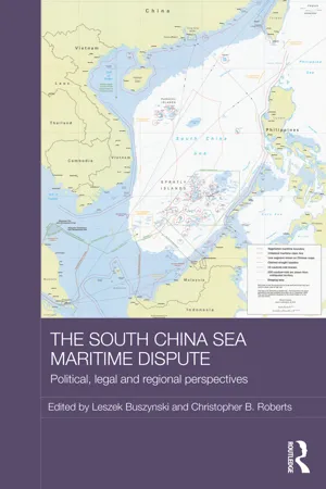
The South China Sea Maritime Dispute
Political, Legal and Regional Perspectives
- 222 pages
- English
- ePUB (mobile friendly)
- Available on iOS & Android
eBook - ePub
The South China Sea Maritime Dispute
Political, Legal and Regional Perspectives
About this book
Trusted by 375,005 students
Access to over 1.5 million titles for a fair monthly price.
Study more efficiently using our study tools.
Information
Subtopic
Ethnic StudiesIndex
Social Sciences1 The origins and development of the South China Sea maritime dispute
DOI: 10.4324/9781315858029-1
Introduction
The South China Sea maritime dispute has evolved considerably over the past five decades. Once it was once a regional dispute over maritime claims left over from the past that did not trouble the main business of governments at the time. It escalated in importance for all governments concerned as maritime territory became coveted, not only for the resources found there, but for the purpose of state completion, as defined borders and the possession of territory have become symbols of statehood. The need to define maritime borders was an accompaniment to the task of state formation in the postcolonial era. Modern statehood is understood in terms of sovereignty, which is the right to rule over territory, as well as defined borders that mark the political and geographic boundaries of that territory. This created particular difficulties for the decolonised world, where frontiers were often vague and frequently overlapping. The legal principle of uti possidetis governed the formation of land borders and meant that decolonised states would inherit their borders from the colonial power at the time of independence. States were decolonised, however, without defined maritime borders, and the process of their definition was, for the most part, a postcolonial experience. The People's Republic of China (PRC) inherited the borders of the premodern Chinese state where they existed and claimed maritime borders as a similar inheritance. For the other claimants, Vietnam, the Philippines and Malaysia, the colonial powers had left them with no clear maritime borders, yet the completion of the process of state formation required that they declare them, particularly in the South China Sea. The result has been a scramble for occupation of islands and reefs among the claimants to demonstrate their claims.
The escalation of what is now known as the South China Sea maritime dispute has been the result of China's assertion of its claim to the area. Indeed, China's inveterate consistency over the issue has been remarkable over the past decades, and despite the predictions that China would negotiate the issue and compromise with the other claimants, it has persisted in its claim. China's assertiveness has been cyclical and comes in lurches, alternating with periods of quiescence and declarations of good neighbourliness, which others mistakenly understand as a willingness to negotiate and settle for the existing status quo. China has been motivated by various factors at different times; initially, it was the desire to exclude rival powers from the area, whether France, Japan and, much later, the Soviet Union. Then, when hydrocarbon resources were discovered in the area, it was oil and gas. Later, as the barely suppressed forces of nationalism were released by economic success, it became a matter of appropriating an outlying area within national borders as state completion. What was once a remote area of little interest to China became transformed into national territory that was under ‘illegal’ foreign occupation and had to be returned to the motherland. Accordingly, China has resorted to pressure tactics against the ASEAN claimants, Vietnam and the Philippines in particular, to recognise its claim. The dispute has become an arena of shadow great power rivalry as China's assertiveness draws in external powers, the US, Japan and also India.
The South China Sea as China's southern maritime frontier
Sovereignty and demarcated borders are modern notions. Premodern dynastic states had frontiers as protective spaces around their core territory from which threats would be excluded. Full control over the frontier was not required as long as rivals were kept at a distance. China's northern frontier with the Mongol tribes that continually threatened the empire was not a line, but a zone within which control shifted according to the vicissitudes of military campaigns.1 Frontiers were governed indirectly and local leaders served as buffer zones protecting the Han core of China against the threat posed by the nomadic tribes. There was no tradition of direct rule in the frontier zone, as many frontier states maintained relations with other states, as well as with the centre of empire.2 On the other hand, a border in the Ming period was clearly defined and would have garrisons at regular intervals, sentry posts and border guards. At the border, officials would carry out the inspection of foreign embassies and tribute missions to Beijing, and would also prevent Chinese leaving without permission. China's sea border followed the Chinese coast, where local officials would inspect foreign ships and their cargoes. They would look for the kanhe, a document issued by the Ministry of Rites to show that the mission was genuine.3
The task for China since the late nineteenth century has been to recast an ancient empire system with outlying frontiers, including distant ethnic groups, into a modern state with sovereignty over territory and the establishment of clear and demarcated borders. This process has been called national territorialisation, and involves the absorption of ethnic groups into the dominant nationality, and the integration of frontier zones and borderlands into a modern nation state.4 China has managed to negotiate defined land borders with most of its neighbours, but maritime borders are another story, as the outlying oceanic frontiers through which China's trade passed were distant from the centre and often shared with other states. The Chinese have reached to their ancient past to justify the conversion of maritime frontiers, over which they had little control, into maritime borders, over which they would be able exercise full sovereignty and control. One such area that has become a critical dispute because of the involvement of other claimants and external powers is the South China Sea. This was China's southern maritime frontier, an indeterminate area that was distant from the mainland and not part of the empire proper. Oceanic sovereignty, or the extension of state authority over distant sea space, made no sense to the Confucian literati of dynastic China when the sea border was understood as the coastline.5 The Chinese habitually claim rights of first discovery over the South China Sea, but the difficulty is that while Chinese records mention the Paracels, there are no unambiguous ancient records for the Spratlys. China had little contact with the Spratly Islands, as Chinese trade routes in the South China Sea skirted the area.
Chinese interaction with this distant frontier in the South China Sea was weak. Two major trade routes connected southern China with Southeast Asia; the western route went along the along the Vietnamese coast; the eastern route connected Guangdong and southern China with Luzon and the Philippines; later, it linked up with the galleon trade, which operated between Acapulco, Manila and Southern China from the late sixteenth century until 1815. These two routes were well documented in Chinese sources, but neither traversed the Spratlys, which were known to be dangerous for navigation.6 One of China's earliest sea maps is the Mao Kun map, dating from the early Ming period in the sixteenth century, which shows only the western sea route, which avoided the Spratlys. The Wang Dayuan text of 1349/50 AD was an early description of the South China Sea, the northern limit of which was the Paracel Islands, then a maritime zone beyong China.7 There is little historical evidence of Chinese interest in the Spratlys.8
As a result of contact and rivalry with the Western colonial powers, the Chinese were compelled to define their maritime interests more clearly. The British were the first to navigate and survey the islands over 1762–1802, and in 1805 the Admiralty published a map of the South China Sea with many of the features named. It was Richard Spratly, the captain of the British Whaler Cyrus who visited the area in 1843, who gave his name to one island, as well as the archipelago.9 At that time, the British interest was limited to surveying and charting, and there was no effort to claim sovereignty over the area. Most important in the definition of Chinese claims was the Sino-French war of 1884–1885 over the Tonkin Gulf, since France did have a specific interest in claiming the area. French intrusion into the Gulf of Tonkin alarmed the Chinese, and in 1902 Guangdong province dispatched three naval vessels to the Paracels under Vice Admiral Wu Ching-yung and Admiral Li Chun. They planted the imperial Chinese flag on several islands and erected a stone monument on North Island.10 There were other reasons for the Chinese to be anxious, as the Japanese appeared on the scene when Japanese merchant Nishizawa Yoshiji settled on the Pratas Islands to mine the guano deposits of the area. In 1908, Guangdong despatched a second expedition to the Paracels under the same admirals, and in the same year the Pratas and Paracels appeared in maps published by Guangdong province for the first time.11 A special provincial commission was established to manage and develop the islands, and it recommended that the Paracels be incorporated into Guangdong province. This was delayed by the collapse of the Qin dynasty in 1911, and only came into effect over 1921–1922.12 Guangdong province sent a third expedition to the Paracels, which included members of a government commission headed by Shen P'eng-fei, which spent 17 days in the area. Shen's report was entitled ‘Text of the Report on the Investigation of the Paracel Archipelago’, and he wrote that ‘the Paracel archipelago is our nation's southernmost territory. However, our people have paid it little attention’.13 The Shen P'eng-fei report revealed little interest in the Spratlys, even though Hainanese fishermen had been visiting these islands for many years and named the largest island Itu Aba in their local dialect.14
China's interest in the Spratlys was awakened by French and Japanese intrusion into the area in the 1930s when it acted to exclude the presence of threatening foreign powers. A Japanese company had begun to fish in the area and to mine the guano deposits in 1917.15 French action in the area was intended to exclude the Japanese, and in April 1930 France sent the gunboat ‘Le Malicieuse’ to the Paracels and Spratlys. The French championed the Vietnamese claim to both the Paracels and the Spratlys to give their own colonial rule over the area greater legitimacy. The governor of Indo-China, Pierre Pasquier, supported Vietnamese claims to the Paracels in 1931, and occupied the two main islands in the Spratlys, Itu Aba and Spratly Island. On 26 July 1933, France announced the occupation of nine islands and the annexation of the Spratlys. On 3 July 1938, the French announced the occupation of the Paracels to prevent the Japanese, who were becoming active in the area, from claiming the islands. Again, France declared that it was claiming these islands for the Vietnamese, whose claims to the area they supported. The Japanese, however, displaced the French, who by then were preoccupied with events in Europe. Japan occupied Hainan Island in February 1939, and by the following March occupied the major islands in the Spratlys, which were renamed ‘Shinan’. A submarine base was constructed on Itu Aba to attack allied shipping and to support operations in the Philippines and Indo-China while a small garrison occupied Spratly Island.16 Though the Japanese had claimed the South China Sea and occupied at least six islands, their defeat in the Pacific War resulted in their expulsion. After the end of the war on 9 December 1946, China sent a naval force to the Paracels and Spratlys. Two vessels went to the Paracels and Spratlys, where they removed Japanese markers and planted the Chinese flag over Itu Aba. On 7 April 1949, the Chinese Embassy in Manila declared that a garrison of 150 had been placed on Itu Aba to interdict the arms traffic through Hainan to communist forces.17 As China fell to the communists, the KMT withdrew from the Paracels, where it had maintained a presence on Woody Island, which was subsequently occupied by the PRC in May 1950.18 An unresolved issue was who had sovereignty after the Japanese occupation.
The San Francisco Conference was convened in September 1951 to decide the disposition of territories conquered by Japan, including the South China Sea. By this time, China had converted its southern maritime frontier into an area over which it claimed sovereignty according to modern international law. Before the Conference was convened on 15 August 1951, Chinese Foreign Minister Zhou Enlai declared Chinese sovereignty over the South China Sea, including the Spratlys, the Paracels, the Pratas islands and the Macclesfield Bank. Since the modern concept of sovereignty allowed for no half measures or ambiguity, China was obliged to declare Ml title ...
Table of contents
- Cover Page
- Half-Title Page
- Series Page
- Title Page
- Copyright Page
- Table Of Contents
- List of illustrations
- Notes on contributors
- Acknowledgements
- List of abbreviations
- Maps
- Introduction
- 1 The origins and development of the South China Sea maritime dispute
- 2 Adrift on complex waters: geographical, geopolitical and legal dimensions to the South China Sea disputes
- 3 The 1982 UN Convention on the Law of the Sea and its relevance to maritime disputes in the South China Sea
- 4 China’s South China Sea policy: evolution, claims and challenges
- 5 Vietnam’s evolving claims
- 6 The 2012 Scarborough Shoal stand-off: from stalemate to escalation of the South China Sea dispute?
- 7 ASEAN: the challenge of unity in diversity
- 8 The US rebalance to Asia and the South China Sea disputes
- 9 Australia’s interests in the South China Sea
- 10 The South China Sea as a ‘crisis’
- 11 The South China Sea: stabilisation and resolution
- Conclusion
- Index
Frequently asked questions
Yes, you can cancel anytime from the Subscription tab in your account settings on the Perlego website. Your subscription will stay active until the end of your current billing period. Learn how to cancel your subscription
No, books cannot be downloaded as external files, such as PDFs, for use outside of Perlego. However, you can download books within the Perlego app for offline reading on mobile or tablet. Learn how to download books offline
Perlego offers two plans: Essential and Complete
- Essential is ideal for learners and professionals who enjoy exploring a wide range of subjects. Access the Essential Library with 800,000+ trusted titles and best-sellers across business, personal growth, and the humanities. Includes unlimited reading time and Standard Read Aloud voice.
- Complete: Perfect for advanced learners and researchers needing full, unrestricted access. Unlock 1.5M+ books across hundreds of subjects, including academic and specialized titles. The Complete Plan also includes advanced features like Premium Read Aloud and Research Assistant.
We are an online textbook subscription service, where you can get access to an entire online library for less than the price of a single book per month. With over 1.5 million books across 990+ topics, we’ve got you covered! Learn about our mission
Look out for the read-aloud symbol on your next book to see if you can listen to it. The read-aloud tool reads text aloud for you, highlighting the text as it is being read. You can pause it, speed it up and slow it down. Learn more about Read Aloud
Yes! You can use the Perlego app on both iOS and Android devices to read anytime, anywhere — even offline. Perfect for commutes or when you’re on the go.
Please note we cannot support devices running on iOS 13 and Android 7 or earlier. Learn more about using the app
Please note we cannot support devices running on iOS 13 and Android 7 or earlier. Learn more about using the app
Yes, you can access The South China Sea Maritime Dispute by Leszek Buszynski,Christopher B. Roberts in PDF and/or ePUB format, as well as other popular books in Social Sciences & Ethnic Studies. We have over 1.5 million books available in our catalogue for you to explore.