Borders exist in almost every sphere of life. Initially, borders were established in connection with kingdoms, regions, towns, villages and cities. With nation-building, they became important as a line separating two national states with different "national characteristics," narratives and myths. The term "border" has a negative connotation for being a separating line, a warning signal not to cross a line between the allowed and the forbidden. The awareness of both mental and factual borders in manifold spheres of our life has made them a topic of consideration in almost all scholarly disciplines – history, geography, political science and many others. This book primarily incorporates an interdisciplinary and comparative approach. Historians, sociologists, anthropologists and political science scholars from a diverse range of European universities analyze historical as well as contemporary perceptions and perspectives concerning border regions – inside the EU, between EU and non-EU European countries, and between European and non-European countries.
eBook - ePub
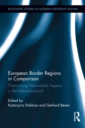
European Border Regions in Comparison
Overcoming Nationalistic Aspects or Re-Nationalization?
- 380 pages
- English
- ePUB (mobile friendly)
- Available on iOS & Android
eBook - ePub
European Border Regions in Comparison
Overcoming Nationalistic Aspects or Re-Nationalization?
About this book
Part I
Territorial Disputes and Questions of Identity
1 The Spanish-Portuguese Frontier (1297–1926)
Identity Midway Between Dialogue and Settlement of Accounts*
Introduction
In 1769, when an employee of the Spanish Department of the Treasury visited the border with Portugal in order to find out what was going on there, he noted in his report that “even the oldest and most important natives of the Province, know as much about what goes on in the interior of Portugal as about what goes on in Malvar or China.”1 At the beginning of the 19th century, Dulong, a colonel of the 12th Light Infantry Regiment of the French Army, states in his Mémoire sur le Portugal, that “we do not know Portugal well; the Spanish don’t know it, and I believe even the Portuguese themselves are as ignorant as us foreigners about the topography of their continental territory”; he does not understand that Spain, as powerful as it was, would have acknowledged more than a century before the independence of “this essential part of the peninsula.”2 The world of difference that separated the Spanish from the Portuguese was also so large that by the end of the 19th century, in spite of the efforts of a small group of intellectuals from both countries to improve relations, one of them wrote with sadness that “the despicable Caya border,” between Elvas and Badajoz, “which some might consider the impenetrable Pyrenees, instead of a mere creek,” had contributed on its own to the “divorce of two sister nations, more than the border drawn on account of the separation of the two kingdoms in 1668.”3 Like them, many soldiers, travelers, scholars, and the curious crossed this fragile line and were surprised at how difficult it was at times not only to simply find the exact point at which one country ended and the other began, but in a deeper and more meaningful sense to find the true causes of an inconceivable distancing between closely located towns on different sides of the border with a history full of communal commonality.
The border between Spain and Portugal, the oldest in Europe, has been since the Middle Ages one of the main factors defining the relationship between the two countries and it was the focus of a large number of decisions that contributed little or nothing to the unity between the two peoples, which, having had the same origins, were destined to share an infinite number of vicissitudes. Located in the natural “void” between the two sides, away from the more populated and rich areas of both kingdoms, it is not only a geographic border, but a historical one. When observing the different phases it has undergone, one can see the peculiarities of its evolution and how these have shaped it through time.4 As a result, we find this peculiar status beneath which are the marks left by the incidents that have punctuated its history throughout the centuries and written a past equally infused with turmoil, discipline, and uncertainty until acquiring an idiosyncrasy typical of peoples set against each other for the control of a land belonging to no one between two alien nations. Its identity, in between dialogue and the permanent settlement of accounts for past or current offenses, suggested the profiles of a proud autonomy opposed to any interference or protection on the part of outside authorities and converted the relationships between the center and the edge into a dialogue without answers since “those who live on the border, be it geographic or cultural, consider themselves stakeholders and guardians of the history and culture of the borderland of their nation and feel misunderstood by the rest of their own people, which they consider unworthy of being a nation.”5 The answers for the reasons why history unfolded as it did in this borderland area shall be looked for in different places, but the main reference points reside in the wars and conflicts generated by the farming exploitation of an undivided place.
The Milestones of a Dispute Extended Over Time
Defining the border between Spain and Portugal is a process that began toward the end of the 13th century and did not end until the third decade of the 20th century. It was first established in the Tratado de Badajoz (Treaty of Badajoz) of 1267, followed in 1297 by the defining treaty of Alcañices, which specified the inclusion of the towns on both sides of the dividing line in the areas around the Duero, Coa, Tajo, and Guadiana Rivers, and established the municipal areas through which its 1,234 kilometers would cross. The agreements reached then by the kings, Fernando IV of Castile and Don Dinís of Portugal would continue, in general terms, with a few exceptions, such as the Olivenza case, until the present.6 Here, we find the first element of discord, caused by the lack of definition in the separating line between the sovereignties, which would pass through the respective municipal areas of the towns located in the surrounding area, but which lacked the exact boundary milestones, leading to different interpretations about the use and exploitation of pastures, water, forests, and hunting areas, which culminated in countless small skirmishes upon which the seed of warring behavior began to settle.7
Annexing Portugal in 1580 required that the problem be handled differently, and introduced a new defining element, as the erasure of Portugal from the peninsular territory would also have implied the erasure of the borders of the two empires, according to current historiography.8 The Restoration War (1640–1668) would contribute to the definition of the Iberian Wall through a system of fortresses, which did not need descriptive directions in the Treaty of Lisbon (1668), later confirmed by the treaties of Utrecht (1713), Paris (1763), and Versailles (1783). The Treaty of Badajoz (1801) implied the loss of Olivenza for Portugal and marked the beginning of a dispute between both states which has yet to be settled; the Treaty of Fontainebleau (1807) established the tripartite division of Portugal and the change of dynasty during the rule of Napoleon in this country. This long “diplomatic journey” would end with the border treaties of September 29, 1864 and November 4, 1866, with the Acta General (General Agreement) of December 1, 1906, and with the agreement signed on June 29, 1926. The first of these agreements is based upon three considerations explained in its introduction, the first being “having taken into consideration the state of restlessness of many of the towns located near the borders of both kingdoms, since there is no exact demarcation of the territory, nor any international treaty establishing it.” The second one states the desire “to end once and for all the unpleasant conflicts arising due to that reason in several locations of the border, and to establish and consolidate peace and harmony between bordering populations.” Finally, it acknowledges the need to “make this unusual situation disappear, in which, shadowed by old feudal traditions, some of the towns next to the dividing line between both states have until now been suffering to their significant and common detriment.”9 These are issues that have remained unresolved for centuries and have been the cause of conflict, but were not exclusive to this peninsular region.10
Based on these premises, the Tratado de límites desde la desembocadura del Miño hasta la unión del río Caya con el Guadiana entre España y Portugal (Border Treaty from the mouth of the Miño to the confluence of the Caya and the Guadiana Rivers between Spain and Portugal), was drafted and signed in Lisbon on September 29, 1864. It includes 31 articles defining the exact rights of the border towns and the limits of both sovereignties; it is also supplemented by a series of attachments, signed on November 4, 1866, including the Reglamento relativo a los ríos limítrofes entre ambas naciones and Reglamento sobre prendamiento de Ganado (Regulation pertaining to the border rivers between both nations and the Confiscation of Cattle Regulation). On December 1, 1906, the Acta general de demarcación de la frontera entre España y Portugal desde la desembocadura del río Miño hasta la confluencia del Caya en el Guadiana (General Agreement Delineating the Borders Between Spain and Portugal from the mouth of the Miño River to the confluence of the Caya and Guadiana Rivers) was approved in Lisbon. It includes 801 natural and artificial milestones. Lastly, on June 29, 1926, also in Lisbon, the Demarcation of the Spain-Portugal Border Agreement was signed, which spans from the confluence of the Cuncos and the Guadiana Rivers to the mouth of the latter; it was ratified on June 17, 1927, and it was supposed to conclude on paper the demarcation of the border more than 600 years after the first border was established (except with the issue of Olivenza, the demarcation of which does not appear in any official document or plan).
The political border, materialized over the sphere of difficult diplomatic negotiations and agreements between the parties, was completed with a series of military and customs posts that served to define, defend, and protect it. Based on its features, at the end of the Old Regime, the Spanish Army engineers divided the Portuguese border in four parts, from south to north: the Kingdom of Seville, Extremadura, Old Castile, and Galicia. The military border of the Kingdom of Seville extended from the mouth of the Guadiana River, in Ayamonte, to the southern border of the province of Extremadura. The Extremadura border consisted of five zones, the first of which was from the border of Andalusia to the confluence of the Friego and Guadiana Rivers; the second one from this point to the Caya River; the third from the confluence of the Caya and Guadiana Rivers to the confluence of the Sever and the Tajo Rivers, with Badajoz and Elvas as key strongholds; the fourth one from the Sever River to the confluence of the Eljas and Tajo Rivers; and the fifth one from this point to the border with Old Castile. The Portuguese border with Castile was considered divided into three bands, the first one starting from the border with Extremadura to the confluence of the Duero and Águeda Rivers; the second one from there to the town of Pera; and the third one from this last point to the border with Galicia; the only significant military establishments were the forts of La Concepción and Ciudad Rodrigo, across from the town of Alameida, both linked together by one of the main access routes toward Portugal. The border between Galicia and Portugal extended from the border with Old Castile to the mouth of the Miño River and it was divided into two parts. The first one went from the border between Portugal in Castile to the town of Freixe, “known by the name of dry line (dry border)”; the second part went from that town to the mouth of the Miño River, where “the border line moves along the tops of high mountains that serve as borders for both kingdoms, and where just a few paths are found, frequented only by smugglers and peasants.”11
The first legal provisions to establish an economic border were presented in the Cortes de Guadalajara of 1390, which established the legal framework under which trade relationships would be enforced with the neighboring kingdom.12 In 1559, in response to the Portuguese decisions on the same issue, dry ports were established for Portugal, including the tariffs that should be charged there,13 with 62 customs posts divided among three districts and in operation by 1571: Andalusia (20), Castile (26), and Galicia (16). When Portugal was annexed in 1580, these were eliminated by the royal charter of June 29, 1580, with the following intention: “for the benefit of the population, and all over these kingdoms, and to increase trade and good relations with those from Castile, His Majesty shall see fit to open the dry ports on both sides, so that merchandise can pass through freely, as it used to before the current tariffs were put in place,” according to the Twenty-first Agreement of the Patente das Merçes de las Cortes de Tomar.14 The customs posts were re-established in 1592, which incited a series of revolts15 and the subsequent protest of the Courts of Lisbon in 1619, which informed Phillip III of the discomfort of the Portuguese and reminded him of his “obligation to ...
Table of contents
- Cover
- Half Title
- Title Page
- Copyright Page
- Table of Contents
- List of Figures
- Introduction
- Part I: Territorial Disputes and Questions of Identity
- Part II: Cross-Border Cooperation
- Part III: Perceptions of Borders and Border Regimes
- Part IV: Prejudices, Stereotypes, and Nationalism
- Editors and Contributors
- Index of Persons
- Index of Places
- Subject Index
Trusted by 375,005 students
Access to over 1.5 million titles for a fair monthly price.
Study more efficiently using our study tools.
Information
Publisher
RoutledgeEdition
1Year
2014Topic
GeschichtePrint ISBN
9781032920689
9780415725989
Subtopic
Geschichte des 21. JahrhundertseBook ISBN
9781317808060
Frequently asked questions
Yes, you can cancel anytime from the Subscription tab in your account settings on the Perlego website. Your subscription will stay active until the end of your current billing period. Learn how to cancel your subscription
No, books cannot be downloaded as external files, such as PDFs, for use outside of Perlego. However, you can download books within the Perlego app for offline reading on mobile or tablet. Learn how to download books offline
Perlego offers two plans: Essential and Complete
- Essential is ideal for learners and professionals who enjoy exploring a wide range of subjects. Access the Essential Library with 800,000+ trusted titles and best-sellers across business, personal growth, and the humanities. Includes unlimited reading time and Standard Read Aloud voice.
- Complete: Perfect for advanced learners and researchers needing full, unrestricted access. Unlock 1.5M+ books across hundreds of subjects, including academic and specialized titles. The Complete Plan also includes advanced features like Premium Read Aloud and Research Assistant.
We are an online textbook subscription service, where you can get access to an entire online library for less than the price of a single book per month. With over 1.5 million books across 990+ topics, we’ve got you covered! Learn about our mission
Look out for the read-aloud symbol on your next book to see if you can listen to it. The read-aloud tool reads text aloud for you, highlighting the text as it is being read. You can pause it, speed it up and slow it down. Learn more about Read Aloud
Yes! You can use the Perlego app on both iOS and Android devices to read anytime, anywhere — even offline. Perfect for commutes or when you’re on the go.
Please note we cannot support devices running on iOS 13 and Android 7 or earlier. Learn more about using the app
Please note we cannot support devices running on iOS 13 and Android 7 or earlier. Learn more about using the app
Yes, you can access European Border Regions in Comparison by Gerhard Besier,Katarzyna Stokłosa in PDF and/or ePUB format, as well as other popular books in Geschichte & Geschichte des 21. Jahrhunderts. We have over 1.5 million books available in our catalogue for you to explore.