- 366 pages
- English
- ePUB (mobile friendly)
- Available on iOS & Android
eBook - ePub
About this book
Describes British relations with the Pashtun tribes of Waziristan in the years after the annexation of the Punjab in 1849, offering the most detailed historical account that has so far been written of relations between the British Government of India and the tribes along this (or any) part of the north-west Frontier in this period.

A Land of Insolence
Waziristan in 1849
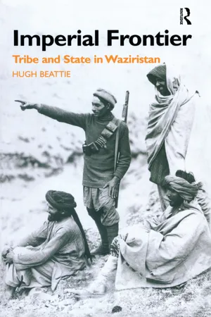
The Vizeerees are said to be tall and muscular, of fair complexions and high features. Their whole dress is a high conical black cap, a loose great coat of black blanket, fastened round the waist with a girdle of the same material, and sandals of straw rope, or untanned leather. From this attire, and from the descriptions which are given of their shaggy hair and beards, and their hairy limbs, their appearance may be conceived to be wild and terrible. Their arms are generally an Afghaun knife and a shield; and every man carries a matchlock, at the use of which they are very expert. … Their manners are haughty, and their voices loud, distinct, and commanding; but they are gentle and good-tempered in their intercourse with their guests and with each other.
Elphinstone, Account of the Kingdom of Caubul1
Waziristan and the border
When a British presence was established along its eastern fringes following the annexation of the Punjab early in 1849, Waziristan appears to have been, as it had for centuries, a largely independent ‘land of insolence’.2 This was the case even though it had been encapsulated in various empires, most recently the one established by the Afghan military leader Ahmed Shah Abdali (later Durrani) (1747–72).3 Nor did the Sikh, Ranjit Singh, who supplanted the Durranis as ruler of the central and western Punjab at the end of the eighteenth century, establish control of it.4
Today, though it retains a considerable degree of autonomy, most of Waziristan is part of Pakistan, but it has never been a political or administrative unit, and does not have particularly well-defined boundaries. About sixty miles across at its widest point, it may be envisaged as a rough parallelogram, extending from the Gumal river in the south about ninety miles north as far as the Kaitu river, and then across the river as far as Thal. It is bordered by the Bannu basin and the Derajat on the east, while to the west it extends through the Afghan district of Birmal to the Afghan plateau and the provinces of Paktia and Paktika.5 The southern half of this ‘frontier Switzerland’ is a ‘tangled mass of mountains’, the hills rising gradually from east to west, reaching a height of over 3,000 metres: Preghal, 3513 metres high, to the south-west of Makin is the highest point.6 North Waziristan, however, is more open, consisting of ‘large and fertile valleys separated by high barren hills’.7 The climate is harsh with high temperatures in the summer and cold winters; most rain falls in early spring and late summer.8 From north-east to south-west the most important rivers are the Kurram, Kaitu, Tochi, Khaisora, Shakhtu, Shuza, Tank Zam, Khaisara, and Wana Toi.9 Their wide beds are full of rocks and boulders and usually contain little water, but after monsoonal summer showers they may quickly turn into raging torrents. The rivers tend to run from east to west, so that at some places they meet the hills, which have a north-south alignment, more or less at right angles, passing through them by means of narrow gorges or tangis. In the mid-nineteenth century the western hills were still partly forested with holm oaks, pines and deodars. Other areas, like Sarwekai (where some Bahlolzai Mahsuds went in the winter) had limited water supplies, and were mostly treeless and suitable only for grazing, while to the south of Wana was the desert area of Zarmelan.10
On the north-eastern edge of Waziristan is the fertile and well-watered Miranzai valley, which is about three miles across, and twenty miles long.11 To the south of Miranzai, on the other side of the Salt Range which runs more or less east-west between the Kurram and the Indus Rivers and rises to a maximum of about 1,200 metres, is the district of Bannu. This ‘lovely country of eastern Afghanistan’ as Herbert Edwardes referred to it, is about thirty miles wide and hemmed in by mountains on three sides, opening up to the south into the plains of Marwat.12 In the mid-nineteenth century the inhabitants of Bannu itself consisted mostly of Pashtu-speaking Bannuchis, and Punjabi-speaking Muslims referred to collectively as Jats.13 On the whole fertile, especially when irrigated, the Bannu district is crossed by several rivers, the most important ones being the Kurram and the Tochi. Interrupted by a projecting spur of hills, the plains extend south through Marwat (inhabited principally by Lohani Pashtuns referred to as Marwats) some sixty miles towards the district of Tank. This also had some productive areas watered by the Gumal and Tank rivers. As well as Jats, Tank was also inhabited by Lohani Pashtuns, who included Marwats and Kundis.14 At this time Tank itself appears to have been the most important settlement along this border. It was protected by a mud wall and a fortress with high walls and towers and equipped with artillery; the traveller Masson described it as ‘the most massive piece of defensive erection I have seen in these parts’.15 In both Tank and Bannu there was a Hindu and Sikh minority consisting mostly of shop-keepers, traders and money-lenders.16

Map 1: Waziristan and the North-West Frontier c. 1875
The tribes
The inhabitants of Waziristan were almost entirely Pashtuns, though there were small colonies of Hindu traders and a settlement of people known as Urmars, or, as they referred to themselves, Barakis, at Kaniguram.17 Most Pashtuns are supposedly descended from sons of the founding ancestor, Qais Abd al-Rashid, although opinions differ as to the origins of many of the north-west frontier tribes including the Afridis, Orakzais, Darwesh Khel Wazirs and Mahsuds.18 Whichever version they accept, like other Pashtuns, the tribes of the frontier thought of themselves as having a place on a genealogical charter, which comprised ever more inclusive segments up to the level of the well-known ‘tribes’ or ‘tribal confederations’ like the Yusufzais and Durranis, and began with Qais himself.19 The most important groups in Waziristan were the Mahsuds, Darwesh Khel Wazirs (referred to from now simply as Wazirs), Bhittanis and Dawars.20 Akbar S. Ahmed has classified Pashtun tribes into two basic categories: nang (honour) or qalang (rent, tax).21 Nang tribes, he suggests, live in remote areas supporting only subsistence agriculture, do not have strong leaders and possess an acephalous segmentary lineage system, while qalang ones are found in areas which support irrigated agriculture and produce substantial surpluses, and are politically centralised with landlords extracting the surpluses from an oppressed, generally non-Pashtun, landless class. In these terms the tribes of Waziristan clearly belonged to the nang category. The most important feature of the economy of the frontier tribes in general, including the Wazirs and Mahsuds, Richard Christensen has suggested, was that it did not produce enough food for subsistence, and therefore the tribes were economically dependent on the outside world.22 In fact, as we shall see, in Waziristan the extent of this economic dependence appears to have varied from one group to another.
The Mahsuds
The Mahsuds lived in the centre and south of Waziristan.23 To the east their territory adjoined that of the Bhittanis, and to the south-west, west, and north Wazirs. Only at one point, at the western end of the Gumal valley, did Mahsud territory directly abut on the plains.24 When British travellers and officials first encountered the Mahsuds, they often referred to them as Mahsud Wazirs, or just Wazirs, because their genealogy linked them closely with other Wazir groups. However, during the nineteenth century they were in the process of establishing a distinct identity of their own. Their three main branches, the Alizais, Bahlolzais and Shaman Khels, claimed descent from Ali, Bahlol and Shaman respectively, the three sons of Mahsud (the son of Mahmud, the brother of Musa Darwesh from whom the Wazirs were supposedly descended).25
It is very difficult, if not impossible, to do more than make an informed guess at the tribe’s population in 1849.26 The figures in the earlier British sources, almost without exception, refer only to the ‘fighting men’ of the tribe, and are highly unreliable, tending considerably to exaggerate the size of the tribe. Thus, for example, using the figures for fighting men in MacGregor’s Gazetteer of Central Asia, published in the early 1870s, and a ratio of three women and children to one fighting man, we arrive at a total Mahsud population of 66,800, whereas sixty years later in the early 1930s the South Waziristan Deputy Commissioner, H.H. Johnson, estimated it at only 68,095.27 One British estimate, dating from the end of the nineteenth century, put the total number of fighting men at about 8,000, which, using the same multiplier, gives a total population of some 32,000, which seems more reasonable.28 It appears that Mahsud population began to rise rapidly in the twentieth century, from an estimated 88,046 in 1946 to 247,040 in 1972.29 If the population was also rising in the second half of the nineteenth century, albeit at a lower rate than in the twentieth, then the number of Mahsuds may not have been much more than around 20,000 in 1849.
Some sections occupied fairly discrete territories, but by contrast with most other frontier tribes, people from different sections often lived quite close to each other in the same areas, and in some areas, in the Shakhtu valley in particular, their settlements were interspersed with Wazir ones.30 A large proportion of the Bahlolzai and Shabi Khel Alizai Mahsuds were nomadic and mainly pastoral, moving from summer to winter quarters in the autumn and back again in the spring, and living for part of the year at least in caves, tents or grass huts. The Manzai Alizais and Shaman Khels appear to have been more sedentary, mostly living in dispersed settlements. Their houses often had defensive towers and high walls, and were sometimes built of stone.31 The main centres of population were around Kaniguram and Makin.32 Makin, which lies in a valley between the Preghal and Shuidar mountains, consisted at that time of twelve hamlets inhabited mainly by Bahlolzais, mostly Abdullais.33 Kaniguram, which was about ten miles to the south, was ‘pleasantly situated’ between the Baddar and Tangi rivers, and surrounded by orchards and gardens, and terraced fields. It had as many as 500 stone houses, and its main street was roofed over to keep out rain and snow.34 It was described by Herbert Edwardes as the ‘religious capital of the Vizeeree country where the Syuds, who are their spiritual guides, reside’.35 Most of its inhabitants were not in fact Mahsuds but Urmars.36 In 1881 the latter had six main sections, and were associated with the Shaman Khel Mahsuds. The Shaman Khels therefore received an extra share in the genealogically-based charter for the distribution of profits and sharing of loss known as nikkat.37 There was also a small settlement containing members from the various Mahsud sections at Kaniguram.38 In 1850 few Mahsuds lived in the plains, though some of the Shabi Khels owned a little land in the Bannu district.39
The Mahsuds’ occupations in the second half of the nineteenth century included agriculture, pastoralism, trade, forestry, mining, small-scale manufacturing, and raiding.40 Cultivable land was a scarce resource, and, where life was sufficiently secure, considerable skill and labour went into using every bit of available ground. In the wide river beds, which usually contained little water, patches of cultivable land (kaches) were created, using the silt brought down by the spring floods, and surrounded by walls made of boulders and wood.41 Water was also limited, and where possible, around Makin and Kaniguram for example, fields were carefully terraced with stone walls, and irrigation channels constructed to make the best possible use of it.42 Spring crops were wheat and barley, and autumn ones jowar (Indian millet) and rice. Landholdings appear to have been small, and the cultivation was mostly caried out by the Mahsuds themselves. Trees were an important resource for fuel and construction; wil...
Table of contents
- Cover
- Half Title
- Title Page
- Copyright Page
- Table of Contents
- Acknowledgements
- Maps
- Foreword
- Preface
- 1. A Land of Insolence
- 2. First Acquaintance
- 3. Negotiation and Conciliation
- 4. A Cactus Hedge
- 5. Every Peon with a Badge is Our Master
- 6. A Fresh Start
- 7. Direct Communication
- 8. Triumph and Disaster
- 9. Satisfaction in the Eyes of the People
- 10. Influences on British Tribal Policy
- 11. Tribe and State in Waziristan 1849–83
- 12. Epilogue
- 13. Summary and Conclusions
- Abbreviations Used in the Notes
- Bibliography
- Glossary
- Appendices
- Notes
- Index
Trusted by 375,005 students
Access to over 1.5 million titles for a fair monthly price.
Study more efficiently using our study tools.
Information
Publisher
RoutledgeEdition
1Year
2013Topic
Social SciencesPrint ISBN
9781138862432
9780700713097
Subtopic
Ethnic StudieseBook ISBN
9781136839641
Index
Social SciencesFrequently asked questions
Yes, you can cancel anytime from the Subscription tab in your account settings on the Perlego website. Your subscription will stay active until the end of your current billing period. Learn how to cancel your subscription
No, books cannot be downloaded as external files, such as PDFs, for use outside of Perlego. However, you can download books within the Perlego app for offline reading on mobile or tablet. Learn how to download books offline
Perlego offers two plans: Essential and Complete
- Essential is ideal for learners and professionals who enjoy exploring a wide range of subjects. Access the Essential Library with 800,000+ trusted titles and best-sellers across business, personal growth, and the humanities. Includes unlimited reading time and Standard Read Aloud voice.
- Complete: Perfect for advanced learners and researchers needing full, unrestricted access. Unlock 1.5M+ books across hundreds of subjects, including academic and specialized titles. The Complete Plan also includes advanced features like Premium Read Aloud and Research Assistant.
We are an online textbook subscription service, where you can get access to an entire online library for less than the price of a single book per month. With over 1.5 million books across 990+ topics, we’ve got you covered! Learn about our mission
Look out for the read-aloud symbol on your next book to see if you can listen to it. The read-aloud tool reads text aloud for you, highlighting the text as it is being read. You can pause it, speed it up and slow it down. Learn more about Read Aloud
Yes! You can use the Perlego app on both iOS and Android devices to read anytime, anywhere — even offline. Perfect for commutes or when you’re on the go.
Please note we cannot support devices running on iOS 13 and Android 7 or earlier. Learn more about using the app
Please note we cannot support devices running on iOS 13 and Android 7 or earlier. Learn more about using the app
Yes, you can access Imperial Frontier by Dr Hugh Beattie,Hugh Beattie in PDF and/or ePUB format, as well as other popular books in Social Sciences & Ethnic Studies. We have over 1.5 million books available in our catalogue for you to explore.