This classic in West Indian history is invaluable, not only for a study of the history of Barbados, but for its wealth of information about the island.
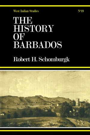
- 768 pages
- English
- ePUB (mobile friendly)
- Available on iOS & Android
eBook - ePub
History of Barbados
About this book
Information
History of Barbados.
Part I.
A Geographical and Statistical Description of
the Island.
the Island.
Chapter I.
Introductory Remarks on the West Indian Archipelago in General.
THE West Indian Archipelago consists of a group of islands which extend from the Gulf and Straits of Florida to the Gulf of Paria. They are situated between the tenth and the twenty-eighth degree of north latitude, and between the fifty-ninth and eighty-fifth degree of west longitude from Greenwich. Their general direction is from the coast of East Florida, south-east to Cabo Engaño, which forms the eastern point of Hispaniola or St. Domingo; from thence they describe a curved line, first eastward, and then southward. On the east and north they are bounded by the Atlantic ; on the south by the Caribbean Sea, which separates them from the northern coast of the republic of Colombia; and on the west, the Gulf of Mexico intervenes between these islands and Mexico. The south-eastern group, or those which extend from the Gulf of Florida to the south-east, contain the largest; they are Cuba, St. Domingo, Jamaica and Porto Rico; the others, which stretch from north to south, are smaller; the principal islands of this group are Guadaloupe, Martinico, Barbados, and Trinidad.
Without entering into a disquisition as to whether America was not known previous to its discovery by Columbus, I would only observe here that the great navigator landed on the 12th of October, 1492, on St. Salvador, one of the Bahama Islands, where he erected a cross and took possession of it in the name of his catholic majesty. The southern point of this island is called to this day Columbus Point. The Archipelago received its name under the erroneous impression, that the great discoverer landed at Cipango, bordering on the eastern shores of Asia, and lying in the neighbourhood of the rich countries of which Mandeville and the Poli had given such glowing descriptions. From this error the new discoveries received the name of the West Indies, an appellation by which they are recognised in the titles of the Spanish Crown, and which has been adopted generally.
Some geographers of the fifteenth century called this group Antillia. The first trace of this name occurs in the ‘Oceanica’ of Peter Martyr d’Anghiera1. Bartholmeus de las Casas observes2 that the Portuguese preferred calling Hispaniola by the name of Antillia. At that time the new discoveries were divided into the Islas de Lucayos and Islas de Bar-lovcnto, or Islas de los Caribes and de los Canibales; however, a considerable period elapsed before the name of Antilles was generally adopted.
A more advanced state of geographical knowledge rendered local distinctions necessary, and the broad expanse of sea which is surrounded by the chain of islands between Florida, the river Orinoco and the coast of America, was divided into three distinct parts, the Gulf of Mexico, the Bay of Honduras, and the Caribbean Sea. The earlier Spanish navigators divide the chain of islands into the Islas de Barlovento and Islas de los Caribes ; at a later period the latter were likewise called Islas de Sotavento, from whence the name Windward and Leeward Islands arose.
In strict propriety, the islands of Cuba, Jamaica, Hispaniola and Porto Rico, constitute the Leeward Islands, and those which extend from Porto Rico to the Gulf of Paria, or the Islas de los Caribes of the discoverers, the Windward Islands: English mariners however have adopted a different division, and they have applied the term of Windward and Leeward Islands exclusively to the Caribbee chain, and subdivide these islands according to their situation in the course of trade, into Windward and Leeward Islands; consequently the Windward Islands commence with Trinidad and terminate with Martinico, and the Leeward commence with Dominica and extend to Porto Rico.
The division of the continental geographer into the Greater or Lesser Antilles is no doubt preferable. The Greater Antilles constitute the Leeward Islands, and the remainder, excluding the Bahamas, the Lesser Antilles, which are subdivided into Windward and Leeward Islands. The first compose the Caribbee Islands, the second the small islands which extend from the Gulf of Maracaybo to the coast of Paria. According to this system we have the following great division:—
The West Indies.
- LUCAYOS OR BAHAMA ISLANDS.
The number of islands, islets and rocks which extend from the Gulf and Straits of Florida, and along; the northern coast of Cuba, to the sixty-ninth degree of longitude west of Greenwich. - THE GREATER ANTILLES.
Cuba, Jamaica, Hispaniola, Porto Rico. - THE LESSER ANTILLES.
- The Windward Islands or Caribbee Islands1: the Virgin Isles, Santa Crux, Anguilla, St. Martin, St. Bartholomew, Saba, St. Eustatius, St. Christopher, Nevis, lledonda, Montserrat, Antigua, Barbuda, Guadaloupe, the Saintes, Deseada, Mariagalante, Dominica, Martinico, St. Lucia, Barbados, St. Vincent, Bequia, the Grenadines, Grenada, Tobago, Trinidad.
- The Leeward Islands: Oruba, Curacao, Buen Ayre, Los Roqucs, Orchilla, Blanca, Tortuga, Salada, Margarita, Cabaguaand Coche. The four latter are sometimes excluded from the Leeward Islands, as being too close to the coast of Venezuela; but if this be adopted, Trinidad must be excluded for similar reasons from the Caribbee Islands.
These islands are in the possession of six European nations; Hayti constitutes an independent state, and the island of Margarita and its dependencies is annexed to the republic of Venezuela. The Archipelago contains an area of 86,548 square miles, and a population of about 3,399,683 souls, of which


1 See the first book of the Decades of the Ocean in the famous History of the Indies by Hackluyt, 2nd edition, p.9 (b); and for an able disquisition, Histoire de la Géographie du Nouveau Continent, par Alexandre de Humboldt, Paris, 1837, Svo. vol. ii. p. 195.
2 Hist. Gen. de Iudias, lib. i. cap. 164.
1 If we cast a glance over a chart of the West Indies on a large scale, the Caribbee Islands, from the Island of Grenada to the Virgin Isles, and including Porto Rico, form a remarkable regular curve, the chord of which from the south point of Grenada to the south-western point of Porto Rico extends in the direction of north 4l½° west, 470 nautical miles. Barbados lies separate and isolated to the east of this curve, the extent of which amounts to about 750 miles. According to the general chart of the West Indies and the Gulf of Mexico, published by the Hydrographical Office of the Admiralty, a north-eastern line drawn from the semidiameter of the chord passes close to the small island Aves, and strikes Barbuda.
2 Tableaux de Population, de Culture, de Commerce, &c. sur les Colonies Franquises pour Tannée 1841.
1 See Parliamentary Papers, West Indies and British Guiana, No. 426, June 30th, 1845. The census of the Bahamas and the Virgin Islands was taken in 1841; the others in 1844.
2 This includes 278 Caribs.
3 Cariacou has 3825 inhabitants.
4 This number is too low. It is specified in the Penny Cyclopaedia as St. John, 2490; St. Thomas, 7000; St. Crux, 32,000. It is considered that the town of St. Thomas by itself has a population of 12,000 inhabitants.
5 These numbers respecting the population are merely assumed; the areas are more correct.
1 See Humboldt’s Personal Narrative, vol. vi. pp. 133. 160.
Chapter II.
Geographical Position of the Island of Barbados.
BARBADOS is the most windward or the most eastern of the group of islands which are known to English geographers under the name of the Caribbee Islands. It is comparatively removed from that chain, and occupies an isolated position, the nearest island being St. Vincent, which is about seventy-eight miles distant from it.
The geographical position of the Engineer’s wharf near the Fort of St. Anne, in Bridgetown, is, according to Lieut. Raper’s ‘Maritime Positions‚’ in latitude 13° 4′ north, and longitude 59° 37′ west from Greenwich. It is to be regretted that this position is not well determined; Lieut. Raper considers that there may be a difference of a mile or two in the longitude. As Barbados is the principal station of the military command of the Windward and Leeward Islands, and as its position, in a nautical point of view, is of such great importance, an astonishment naturally arises that there should still exist such uncertainty. The late Dr. Nevil Maskelyne communicated the latitude of St. Michael’s church, the present cathedral of the See, as 13° 5′ 30″ north; the longitude has varied between 59° 37′ and 59° 43′ west.
I have adopted Lieut. Raper’s position, and according to it, and discarding the seconds, I deduce the following data for the most remarkable points, namely—
The Cave or North Point, latitude 13° 19′north, longitude 59° 37′ west.
The South Point, latitude 13° 2’ north, longitude 59° 32′ west.
Kitridge Point, the most eastern point of the island, latitude 13° 8′ north, longitude 59° 26′ west.
Harrison’s Point, the most western point of the island, latitude 13° 17′ north, longitude 59° 39′ west.
The exact date of the discovery of Barbados is hidden in obscurity, but the observation which we find in most of the modern Geographies and Encyclopaedias, that no mention of it occurs prior to 1600 is perfectly erroneous, and has been copied from one work into another without investigation of the truth of the assertion. I shall give the proofs which I possess in another part of this work, and will here only observe, that the island occurs under the name of Baruodo in the Map of the World by Michaelis Tramezini, in 1554, and there is great probability that it was known as early as 1518.
The derivation of its name has been ascribed to the number of a species of fig-tree (Ficus laurifolia, Lam.), from the branches of which great mats of twisted fibrous roots hang down, which have been compared to luxuriant beards. It is conjectured that the Portuguese, who, in their voyages to Brazil, were the first Europeans that landed on the island, gave it the name Las Barbadas from this circumstance. The derivation of the name is no doubt ingenious, and there is every probability of its being the correct one; only it ought to be Barbudos, instead of Barbadas; and we find that in the earlier maps it is called Baruodo, Baruodos, Barbudos. Bolognini Zaltery, who published his map of Nova Franza in 1566, calls it S. Barduda: Barbudo signifies in the Portuguese language one that has a thick beard. In the French maps which were published about the middle of the seventeenth century it is called La Barboude, at present it is generally named La Barbade. Ligon, in some parts of his text1, and after him Oldmixon, calls it Barbadoes. For the proper orthography of this derivation no reasonable grounds can be assigned, and it should be strictly avoided. In all documents emanating from the government offices it is called Barbados.
Ligon has given the first map of the island. He tells us2 that a Captain Swann had executed an exact plan of the whole island, which he was commanded to deliver up to Sir Henry Hunks, then Governor, who carried it with him to England in 1641, where it was lost. It appears that Ligon received a copy of it from Captain Swann, as far as his memory and loose papers assisted him to give such a document. It must have been considered of great interest at that time, as it was published in France under the title of ‘Déscription Topographique de l’Isle de Barbade3
The description of Barbados in Oldmixon’s ‘British Empire in America4‚’is accompanied by a map of the island by Hermann Moll, geographer. This map, on a larger scale, is in the library of the British Museum. The legislature of Barbados commissioned Mr. William Mayo to make a map or plan of the island, and to fix the parish lines, which when finished should be considered the true and real boundaries1. An act passed the legislature under the administration of Governor Robert Lowther on the 21st June, 1720, declaring Mr. Mayor’s map legal evidence in all disputes respecting the bounds of the parishes.
At a later period Captain Barrallier surveyed the island of Barbados upon trigonometrical principles, which occupied him, according to his own statement, seven years. The survey was finished in June 1818, and it was subsequently published. It is much to be regretted that this map, which is otherwise so exact in its positions, should be so erroneous in the names of the estates and in the division of the parishes, which faults can be only ascribed to oversight.
These are the principal maps which exist of the island; the others are mostly spurious, and without authenticity.
1 “A true and exact History of the Island of Barbados, by Richard Ligon, Gent., London, 1657.” On the map, on the title, and in his dedication, Ligon writes it Barbados, but in the text it is written Barbadoes.
2 Ligon, p. 26.
3 A copy of this map is preserved in the King’s Library in the British Museum.
4 The British Empire in America, containing the history of the discovery, settlement, progress and present state of all the British Co...
Table of contents
- Cover
- Half Title
- Title Page
- Copyright
- Dedication
- Preface
- Contents
- Part I: Geographical and Statistical Description of the Island
- Part II: Narrative of Events from the Settlement of the Island to the Year 1846
- Part III: Remarks on the Geological Structure of Barbados, and a Sketch of its Natural Productions
- Appendix
- Index
Trusted by 375,005 students
Access to over 1.5 million titles for a fair monthly price.
Study more efficiently using our study tools.
Frequently asked questions
Yes, you can cancel anytime from the Subscription tab in your account settings on the Perlego website. Your subscription will stay active until the end of your current billing period. Learn how to cancel your subscription
No, books cannot be downloaded as external files, such as PDFs, for use outside of Perlego. However, you can download books within the Perlego app for offline reading on mobile or tablet. Learn how to download books offline
Perlego offers two plans: Essential and Complete
- Essential is ideal for learners and professionals who enjoy exploring a wide range of subjects. Access the Essential Library with 800,000+ trusted titles and best-sellers across business, personal growth, and the humanities. Includes unlimited reading time and Standard Read Aloud voice.
- Complete: Perfect for advanced learners and researchers needing full, unrestricted access. Unlock 1.5M+ books across hundreds of subjects, including academic and specialized titles. The Complete Plan also includes advanced features like Premium Read Aloud and Research Assistant.
We are an online textbook subscription service, where you can get access to an entire online library for less than the price of a single book per month. With over 1.5 million books across 990+ topics, we’ve got you covered! Learn about our mission
Look out for the read-aloud symbol on your next book to see if you can listen to it. The read-aloud tool reads text aloud for you, highlighting the text as it is being read. You can pause it, speed it up and slow it down. Learn more about Read Aloud
Yes! You can use the Perlego app on both iOS and Android devices to read anytime, anywhere — even offline. Perfect for commutes or when you’re on the go.
Please note we cannot support devices running on iOS 13 and Android 7 or earlier. Learn more about using the app
Please note we cannot support devices running on iOS 13 and Android 7 or earlier. Learn more about using the app
Yes, you can access History of Barbados by Sir Robert Schomburg in PDF and/or ePUB format, as well as other popular books in History & World History. We have over 1.5 million books available in our catalogue for you to explore.