eBook - ePub
Cartophilia
Maps and the Search for Identity in the French-German Borderland
- English
- ePUB (mobile friendly)
- Available on iOS & Android
eBook - ePub
Cartophilia
Maps and the Search for Identity in the French-German Borderland
About this book
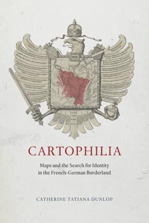
The period between the French Revolution and World War II was a time of tremendous growth in both mapmaking and map reading throughout Europe. There is no better place to witness this rise of popular cartography than in Alsace-Lorraine, a disputed borderland that the French and Germans both claimed as their national territory. Desired for its prime geographical position and abundant natural resources, Alsace-Lorraine endured devastating wars from 1870 to 1945 that altered its borders four times, transforming its physical landscape and the political allegiances of its citizens. For the border population whose lives were turned upside down by the French-German conflict, maps became essential tools for finding a new sense of place and a new sense of identity in their changing national and regional communities.
Turning to a previously undiscovered archive of popular maps, Cartophilia reveals Alsace-Lorraine's lively world of citizen mapmakers that included linguists, ethnographers, schoolteachers, hikers, and priests. Together, this fresh group of mapmakers invented new genres of maps that framed French and German territory in original ways through experimental surveying techniques, orientations, scales, colors, and iconography. In focusing on the power of "bottom-up" maps to transform modern European identities, Cartophilia argues that the history of cartography must expand beyond the study of elite maps and shift its emphasis to the democratization of cartography in the modern world.
Turning to a previously undiscovered archive of popular maps, Cartophilia reveals Alsace-Lorraine's lively world of citizen mapmakers that included linguists, ethnographers, schoolteachers, hikers, and priests. Together, this fresh group of mapmakers invented new genres of maps that framed French and German territory in original ways through experimental surveying techniques, orientations, scales, colors, and iconography. In focusing on the power of "bottom-up" maps to transform modern European identities, Cartophilia argues that the history of cartography must expand beyond the study of elite maps and shift its emphasis to the democratization of cartography in the modern world.
Frequently asked questions
Yes, you can cancel anytime from the Subscription tab in your account settings on the Perlego website. Your subscription will stay active until the end of your current billing period. Learn how to cancel your subscription.
At the moment all of our mobile-responsive ePub books are available to download via the app. Most of our PDFs are also available to download and we're working on making the final remaining ones downloadable now. Learn more here.
Perlego offers two plans: Essential and Complete
- Essential is ideal for learners and professionals who enjoy exploring a wide range of subjects. Access the Essential Library with 800,000+ trusted titles and best-sellers across business, personal growth, and the humanities. Includes unlimited reading time and Standard Read Aloud voice.
- Complete: Perfect for advanced learners and researchers needing full, unrestricted access. Unlock 1.4M+ books across hundreds of subjects, including academic and specialized titles. The Complete Plan also includes advanced features like Premium Read Aloud and Research Assistant.
We are an online textbook subscription service, where you can get access to an entire online library for less than the price of a single book per month. With over 1 million books across 1000+ topics, we’ve got you covered! Learn more here.
Look out for the read-aloud symbol on your next book to see if you can listen to it. The read-aloud tool reads text aloud for you, highlighting the text as it is being read. You can pause it, speed it up and slow it down. Learn more here.
Yes! You can use the Perlego app on both iOS or Android devices to read anytime, anywhere — even offline. Perfect for commutes or when you’re on the go.
Please note we cannot support devices running on iOS 13 and Android 7 or earlier. Learn more about using the app.
Please note we cannot support devices running on iOS 13 and Android 7 or earlier. Learn more about using the app.
Yes, you can access Cartophilia by Catherine Tatiana Dunlop in PDF and/or ePUB format, as well as other popular books in Technology & Engineering & French History. We have over one million books available in our catalogue for you to explore.
Information
Index
Page numbers in boldface refer to illustrations.
Aimé, Robert, 228n24
Ajoncourt, 34
Algermissen, Johan Ludwig, 103
Alps, 51
Alsace. See Alsace and Lorraine
Alsace and Lorraine, 2, 3; ethnic and racial groups in, 54–59, 56, 64, 66–68; geography curriculum in, 101–14, 108, 116–25, 117, 123, 124, 125, 126; languages in, 55, 57–58, 70–89, 82, plate 6, plates 9–13; state maps of, 21–24, 22, 33, 36–40, 37, 38, 95–101, 97, 98, 99, 206n5, plate 1; transfers between France and Germany, 2–3, 11–12, 24, 31–34, 60–61, 66–67, 80, 86, 221n7
Alsace-Lorraine (Reischland, 1871–1918). See Alsace and Lorraine
Alsace-Lorraine and the North-East Frontier (atlas), 66
Alsace Photographed (Braun), 136
Alsatian Archaeology Society, 148–49
Alsatian Banker’s Association, 68
Alsatian dialect, 70, 74, 83–85, 87–88, 215n1, 219n47
Alsatian Dialect Dictionary (Lienhart and Martin), 85, 87
Alsatian Lectures (Pfister), 123, 127
Alsatian Plain, 21, 42, 131, 137, 155, 157
Alsatians Correct Our Accent! (de Dietrich), 86
Anderson, Benedict, 10, 48
Annales school, 68, 188
anthropologists, and territorial identity, 5, 48–49, 62–66, 111–12
archaeologists, and territorial identity, 48, 62–66, 132, 147–48
Argentina (ancient name of Strasbourg), 161. See also Strasbourg
Arndt, E. M., 75
Arraye, 34
artists, ...
Table of contents
- Cover
- Title Page
- Copyright Page
- Dedication
- Contents
- Introduction
- I Mapping Borders
- II Borderland Maps for Everyday Life
- Epilogue
- Acknowledgments
- Notes
- Bibliography
- Index
- Color plates