Biblical Zoara is located in the Ghor as-Safi, precisely at the lowest place on earth. Its environmental and cultural history is therefore unique. During two decades, an archaeological project was conducted which discovered many significant finds of human occupations spanning some 12,000 years. These have been meticulously studied and the results are now presented here in Volume I. Volume II will follow and will complete and complement Volume I.
eBook - ePub
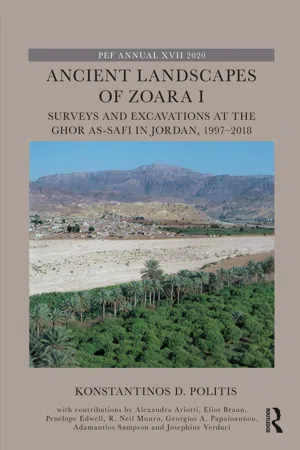
Ancient Landscapes of Zoara I
Surveys and Excavations at the Ghor as-Safi in Jordan, 1997–2018
- 384 pages
- English
- ePUB (mobile friendly)
- Available on iOS & Android
eBook - ePub
Ancient Landscapes of Zoara I
Surveys and Excavations at the Ghor as-Safi in Jordan, 1997–2018
About this book
Trusted by 375,005 students
Access to over 1.5 million titles for a fair monthly price.
Study more efficiently using our study tools.
Information
Topic
EducationSubtopic
Teaching Arts & HumanitiesPart I
Introduction
1. Location, topography and climate
Konstantinos D. Politis
Location and topography
The Ghor as-Safi of modern Jordan is a valley located in the south-eastern region of the Dead Sea in the southern part of the Jordan Rift Valley, the lowest place on earth (Figures 1.1 and 1.2). This region is about 45 km long and varies in width from 1 km to 7 km, extending from the Wadi Ibn Hammad in the north to 18 km in the south at the Ghor as-Safi. The eastern boundary of the region is the escarpment and rough landscape which forms the eastern boundary of the Rift Valley and part of the structural trough bounded by mountains and filled with alluvial sediments derived from the bordering highlands (Shamoot and Husseini 1969, 89). The highlands of the east side, as in the west, extend approximately 1,000 m above the valley and have a different environment from that of the valley floor where the Ghor as-Safi is situated.

FIGURE 1.1 Map locating Ghor as-Safi in modern Jordan (J. M. Farrant).

FIGURE 1.2 Satellite image of the southern end of the Dead Sea locating Ghor as-Safi, 1990. The arrow marks the alluvial fan of the Wadi al-Hasa flourishing with green vegetation in relatively arid environs (Landsat 4 path/row 174/38, 30 August 1990).
The Ghor as-Safi (Palestine grid reference E 195, N 048) is situated along the south-eastern shore of the Dead Sea at about 300 m below mean sea level. It lies at the mouth of the Wadi al-Hasa along the westward dissections resulting from erosion from the eastern highlands intensified by perennial springs which carry rich alluvial soils into the valley floor. These two elements (water and soil) are fundamental to understanding the success of human settlements in the Ghor as-Safi for over 12,000 years.
The topography of the Ghor as-Safi is typical of the entire Dead Sea Rift Valley formed by wadis (river gullies in Arabic, usually ephemeral). The Ghor as-Safi is formed by the Wadi al-Hasa, a major wadi on the eastern side of the Dead Sea littoral with the largest alluvial fan fed by the most constant and reliable water source (Figure 1.3). The availability of water facilitated agriculture through the ages (Figure 1.4). The average yearly base outflows of the Wadi al-Hasa into the Ghor as-Safi have been graded at 810 litres per second (l/s), the highest in the region (MacDonald 1992, 16).

FIGURE 1.3 Aerial digital image in 2000 of the Ghor as-Safi showing agricultural lands in the alluvial fan created by the Wadi al-Hasa, which runs SE-NW across the centre of the photograph. The modern city of Ghor as-Safi is in the upper right (no. 13260 153.20. 2859 Royal Jordanian Geographic Centre).

FIGURE 1.4 View from the west of Wadi al-Hasa which brings rich alluvial soils from the highlands into the Ghor as-Safi, facilitating agriculture (J. Taylor).
Climate
During the last 5,000 years, climate fluctuated greatly in the southern Dead Sea basin where the Ghor as-Safi lies. A discerning study has shown that an increase in precipitation corresponded to a rise in the level of the Dead Sea (Bookman et al. 2004, 561–563). When the climate was wetter it also enabled human communities to develop, leaving behind more archaeological remains. This is clearly evident by high levels of rainfall during the Early Bronze Age (over 4,500 years ago), the Late Hellenistic to Early Roman periods (first century BC to second century AD) and peaking in Early Byzantine times (fifth to sixth century AD). A rise in rainfall during the 13th–15th centuries is also reflected in the Middle Islamic archaeological record (Figure 1.5).

FIGURE 1.5 Graph charting levels of the Dead Sea in relation to historic years (after Bookman et al. 2004, 561, fig.5).
Today the Ghor as-Safi has an arid climate with a very hot summer and relatively warm dry winter. The average rainfall is 65 mm annually occurring from mid-October to April (25–130 mm yearly*). Midday summer temperatures are daily over 43°C. Annual monthly mean maximum temperatures range from 30 to 32°C and minimum from 18 to over 20°C.* The high temperatures are often with a relatively low humidity of 54% and 45% mean annual relative humidity*, which rapidly evaporates water in the soil. Further aridity is exacerbated by an annual prevailing wind direction degree from 330 to 294.*
Note
- * Jordanian Metrological Department, Climate Division, Ghor Safi station, 1977–1996 data.
Bibliography
- Bookman, R., Y. Enzel, A. Agnon and M. Stein (2004) Late Holocene Lake Levels of the Dead Sea. Geological Society of America Bulletin (May/June), 555–571.
- MacDonald, B. (1992) The Southern Ghors and Northeast `Arabah Archaeological Survey, Sheffield Archaeological Monographs No. 5 (Sheffield: J. R. Collis).
- Shamoot, S. and K. Husseini (1969) Part I—Soil and Land Resources in Jordan. In Land and Water Use in Jordan, 89–94 (Amman, Hashemite Kingdom of Jordan, Natural Resource Authority: Al-Hurieh Printing Press).
2. Geology, geomorphology and landscape history
Robert Neil Munro
Introduction
Regional examinations of the soils and geomorphology in the Dead Sea Rift and Ghor as-Safi were made between 1989 and 2000 first as part of National Soil Map and Land Use Project (NSMLUP) based in the Department of Forests and Afforestation in the Ministry of Agriculture (Hunting Technical Services, HTS 1993) and during later visits.
Bibliographical sources
This investigation has drawn on the studies made at Deir ‘Ain ‘Abata (Munro 2003; Politis 2012, 16–22) and many other works on the physical geology of the region. Attention also has been given to publications made by the Ghor as-Safi team during the past 13 years (Politis et al. 2005, 2007; Politis 2010, 2013a, 2013b, 2017).
A bibliography of the Dead Sea area was compiled by V. Arad et al. (1997). J. H. Powell (1988, 1989a, 1989b) with the UK Geological Mission gave a description of the regional geology in the memoir accompanying the geological map of the Karak Area (1:50,000 Sheet No. 3152 III) and has recently given a comprehensive account of the Lower Palaeozoic rocks of Jordan (Powell et al. 2014). The Kerak mapping drew on the earlier baseline studies in Jordan by M. G. Ionides and G. S. Blake (1939), D. J. Burdon (1959), A. M. Quennell (1956) and F. Bender (1968a, 1968b, 1974a, 1974b, 1975). Information on soils, geomorphology and land systems in the study area was utilised from the maps and report of the NSMLUP (HTS 1993), and earlier studies compiled by F. Moorman (1959), C. Vita-Finzi (1964, 1966, 1969, 1982) and C. Mitchell (1975). Key studies of the Dead Sea area include monographs by D. Neev and K. O. Emery (1967), Z. B. Begin et al. (1974) and M. N. Niemi et al. (1997): in the latter, papers by A. Frumkin, I. Beit-Arieh, Niemi and D. Bowman have been of particular interest in studying the history of this area.
The impact and issue of the declining level of the Dead Sea, and what can be done about it, are covered by increasing numbers of authors: S. Abu Ghazleh et al. (2009a, 2009b, 2010) look at the terraces; Harza JRV Group (1996) was commissioned to study the Red–Dead channel, and this has been further examined by, for example, Markel et al. (2013), who concluded that environmental impacts of the Red Sea–Dead Sea Conveyance Pilot (RSDSCP) on the Red Sea and the Dead Sea that were of primary concern (ex. Beyth 2007) could be mitigated if the project were to be properly planned and managed.
Geological setting of the Jordan Rift
The Ghor as-Safi sites lie along the foot of the great west-facing erosional escarpment that has developed along the eastern margins of the Dead Sea Rift, where the Wadi al-Hasa exits onto the plains bordering the Dead Sea (Figure 2.1).

FIGURE 2.1 Annotations by R. N. Munro of Google Earth Pro image, dated 26 February 2016.
In the escarpment a wide range of metamorphic and sedimentary rocks ranging from the Pre-Cambrian to Late Cretaceous are exposed. The NNE–SSW aligned Dead Sea Transform (DST) fault system runs past the mouth of the Wadi al-Hasa, and rifting with upward movement, here at the northern section of the Afro-Arabian dome, commenced in the early to mid-Miocene, that is after 23 million years ago (Ma), and is still active as the Arabian plate moves northeast in relation to the African plate due to opening of the Red Sea. While there is separation in the Red Sea basin, the DST results in a northward movement of both plates and it has resulted in a 105-km displacement over the past 47,500 years. The DST is currently moving at a rate of 0.004–0.005 m a year along the left lateral displacement transform fault. Implications for earthquakes are discussed later.
Late Proterozoic formations and denudation
Along the Dead Sea escarpment erosion has exposed the Pre-Cambrian Arabian-Nubian Shield (Aqaba and Araba Complexes). During the late Neoproterozoic (that lasted from 1000 Ma to about 540 Ma) the Aqaba Complex (610–900 Ma), comprising calc-alkaline Granitoids and Gabbros, was intruded through more ancient metamorphic. It was succeeded by a long period of erosion, the Araba Unconformity dated at ca. 610–600 that peneplaned much of the landscape.
The subsequent Araba Complex, of which the lowest formation, the Safi Group, lies in our area, was the Saramuj, and later granites and the Aheimir Volcanics. In the Dana-Feinan area south of Safi and elsewhere there were localised rifting and half-grabenformation with associated volcanism. The uplift and erosion of the Aqaba Complex led to a mountain front with conglomerates of the Saramuj Formation, a proximal fan sequence with well-rounded pebbles and cobbles eroded from Aqaba Complex granitoids (Powell et al. 2014).
The original mountainous landscape of these source granites and the Saramuj (Safi Group) were mostly denuded in the late Pre-Cambrian prior to the Cambrian Ram sedimentation: at Safi the Saramuj surface is peneplaned. The succeeding Araba Complex of granitoids was intruded through this and denuded. In Dana and Petra there is a strong relict palaeo-re...
Table of contents
- Cover
- Series Page
- Half Title
- Title Page
- Copyright Page
- Dedication
- Table of Contents
- List of figures
- List of tables
- List of contributors
- Preface
- Phase, historic or archaeological period and absolute dates for the Ghor as-Safi Project
- Acknowledgements
- List of abbreviations
- Part I Introduction
- Part II The Pre-Pottery Neolithic periods
- Part III The Bronze Age periods
- Part IV The Iron Age II period
- Part V The Late Hellenistic and Nabataean period
- Part VI The Early Byzantine period
- Part VII The Abbasid and Ayyubid-Mamluk periods
- Part VIII The Ottoman period to modern times
- Part IX Conclusion
Frequently asked questions
Yes, you can cancel anytime from the Subscription tab in your account settings on the Perlego website. Your subscription will stay active until the end of your current billing period. Learn how to cancel your subscription
No, books cannot be downloaded as external files, such as PDFs, for use outside of Perlego. However, you can download books within the Perlego app for offline reading on mobile or tablet. Learn how to download books offline
Perlego offers two plans: Essential and Complete
- Essential is ideal for learners and professionals who enjoy exploring a wide range of subjects. Access the Essential Library with 800,000+ trusted titles and best-sellers across business, personal growth, and the humanities. Includes unlimited reading time and Standard Read Aloud voice.
- Complete: Perfect for advanced learners and researchers needing full, unrestricted access. Unlock 1.5M+ books across hundreds of subjects, including academic and specialized titles. The Complete Plan also includes advanced features like Premium Read Aloud and Research Assistant.
We are an online textbook subscription service, where you can get access to an entire online library for less than the price of a single book per month. With over 1.5 million books across 990+ topics, we’ve got you covered! Learn about our mission
Look out for the read-aloud symbol on your next book to see if you can listen to it. The read-aloud tool reads text aloud for you, highlighting the text as it is being read. You can pause it, speed it up and slow it down. Learn more about Read Aloud
Yes! You can use the Perlego app on both iOS and Android devices to read anytime, anywhere — even offline. Perfect for commutes or when you’re on the go.
Please note we cannot support devices running on iOS 13 and Android 7 or earlier. Learn more about using the app
Please note we cannot support devices running on iOS 13 and Android 7 or earlier. Learn more about using the app
Yes, you can access Ancient Landscapes of Zoara I by Konstantinos D. Politis in PDF and/or ePUB format, as well as other popular books in Education & Teaching Arts & Humanities. We have over 1.5 million books available in our catalogue for you to explore.