This book is the first investigation of the relationship between Palmyra and its surrounding territory from the Roman to the early Islamic period since D. Schlumberger's pioneer campaigns in the mountains northwest of Palmyra in the late 1930s. It discusses the agricultural potential of the hinterland, its role in the food supply of the city, and the interaction with the nomadic networks on the Syrian dry steppe. The investigation is based on an extensive joint Syrian-Norwegian surface survey north of Palmyra in 2008, 2010 and 2011 and on studies of satellite imagery. It contains a gazetteer of 70 new sites, which include numerous villages, estates, forts, stations and water management systems.
eBook - PDF
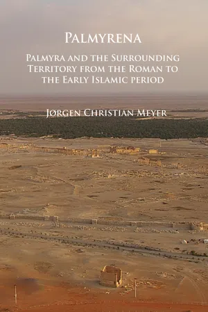
Palmyrena: Palmyra and the Surrounding Territory from the Roman to the Early Islamic period
- 236 pages
- English
- PDF
- Available on iOS & Android
eBook - PDF
Palmyrena: Palmyra and the Surrounding Territory from the Roman to the Early Islamic period
About this book
Trusted by 375,005 students
Access to over 1.5 million titles for a fair monthly price.
Study more efficiently using our study tools.
Information
Topic
Ciencias socialesSubtopic
ArqueologíaTable of contents
- Cover
- Copyright Page
- Contents Page
- List of Figures
- Preface
- Introduction
- Figure 1 La Palmyrène du nord-ouest. (PNO fig. 1).
- Survey
- Chronology of the sites
- Topography and climate
- Water supply
- Villages and estates
- Forts and stations
- Conclusion
- Gazetteer of surveyed sites
- Figure 146. JA26. Rock-cut tombs (N. Anfinset).
- Figure 147. Al-Matna. The triangular valley (J.C. Meyer, based on Google Earth).
- Figure 148. Al-Matna. The triangular valley seen from the Hilltop (J.C. Meyer).
- Figure 149. Al-Matna. Corral D (Nils Anfinset).
- Figure 150. Wadi al-Takara, looking S (J.C. Meyer).
- Figure 151. Northern end of Wadi al-Takara with the entrance to Wadi al Masek and the watershed to the Plain of Jazal (J.C. Meyer)
- Figure 152. Wadi al-Takara S (J.C. Meyer, based on Google Earth).
- Figure 153. Wadi al-Takara S. Building on hilltop and cistern 1, looking SW. In the background the Plain of Sahl Feïf al-Mazraâ (J.C. Meyer).
- Figure 154. Wadi al-Takara S. Hilltop building
- Figure 155. Wadi al-Takara S. Elliptical structure (J.C. Meyer).
- Figure 156. Wadi al-Takara S. Elliptical structure
- Figure 157. Al-Khoula
- Figure 159. Al-Khoula. Wadi al-Khoula, looking SW. In the foreground, the outlet from the supply channels on the hilltop to Cistern 3 and 4 below. In the background Wadi al-Takara (J.C. Meyer).
- Figure 160. Al-Khoula. Corral C
- Figure 161. Al-Khoula. Corral D (J.C. Meyer).
- Figure 162. Al-Khoula. Corral E (J.C. Meyer).
- Figure 163. WT42, cross-wadi wall (J.C. Meyer, based on Google Earth).
- Figure 164. WT42, cross-wadi wall, looking NE (J.C. Meyer).
- Figure 165. Wadi al-Takara N (J.C. Meyer, based on Google Earth).
- Figure 166. Wadi al-Takara N, looking E
- Figure 167. Wadi al-Takara N. Fort (J.C. Meyer).
- Figure 168. Wadi al-Takara N. Wall on the northern tip of the wadi island, looking N (J.C. Meyer).
- Figure 169. Wadi al-Takara N. Wall on the northern tip of the wadi island (J.C. Meyer).
- Figure 170. Wadi al-Takara N. Iron fragments
- Figure 171. Wadi al-Takara N. Iron fragments (J.C. Meyer).
- Figure 172. Wadi al-Takara N. Islamic burial ground on the western bank of the wadi (J.C.Meyer).
- Figure 173. Bir Jazal. The triangular plain, looking NW (J.C. Meyer).
- Figure 174. Kheurbet al-Alali Gharbun. Rock cut tombs and habitation
- Figure 175. Kheurbet al-Alali Gharbun. Architectural fragments from sanctuary
- Figure 176. Bir Jazal. The oasis (J.C. Meyer, based on Google Earth).
- Figure 177. Bir Jazal. The oasis, looking NE (J.C. Meyer).
- Figure 178. Bir Jazal. Well from the southern part of the oasis (J.C. Meyer).
- Figure 179. Bir Jazal. The tell area (J.C. Meyer).
- Figure 180. Bir Jazal. Walls in the southern part of the digging in the tell. To the left destruction layer with Charcoal
- Figure 181. Bir Jazal. Digging in the tell (J.C. Meyer).
- Figure 182. Bir Jazal. Oblong ash layers in the eastern face of the digging (J. Krzywinski).
- Figure 183. Wadi Jihar, Wadi Masaadé and the southeastern spur of Jebel Chaar (J.C. Meyer, based on Google Earth).
- Figure 184. Madaba (J.C. Meyer, based on European Space Imaging).
- Figure 185. Madaba. Overview from the looking northwest (J.C. Meyer).
- Figure 186. Madaba. Area A and B (J.C. Meyer).
- Figure 187. Madaba. Area C (J.C. Meyer).
- Figure 188. Madaba. Area D (J.C. Meyer).
- Figure 189. Madaba. Area E (J.C. Meyer).
- Figure 190. Madaba. Foot of unguentarium, 1st cent. BC/early 1st cent. AD (J.C. Meyer).
- Figure 191. Bir al-Arfa (J.C. Meyer, based on Google Earth).
- Figure 192. Bir al-Arfa. The cone-shaped mountain at the entrance to the valley. In the background Wadi Jihar, Jebel Chaar to he left, and the southwestern spur of Jebel Merah to the right (J.C. Meyer).
- Figure 193. Bir al-Arfa. The center of the valley with Cistern 4 and the enclosure, looking S (J.C. Meyer).
- Figure 194. Bir al-Arfa. Cistern 3 with broken-through semicircular dam (J.C. Meyer).
- Figure 195. Bir al-Arfa. Cistern 7 with supply channels
- Figure 196. Bir al-Arfa. Eastern side of Jebel al-Tarfa with buildings and cisterns (
- Figure 197. Bir al-Arfa. Building A (J.C. Meyer).
- Figure 198. Bir al-Arfa. Building B (J.C. Meyer).
- Figure 199. WJ071. Circular structure (J.C. Meyer, based on European Space Imaging).
- Figure 200. WJ098
- Figure 201. WJ098. Building (J.C. Meyer).
- Figure 202. WJ098. Wall east of the tell (J.C. Meyer).
- Figure 203. WJ098. Fragment of tile
- Figure 204. WJ242 (J.C. Meyer, Bing Maps, Microsoft).
- Figure 205. Shanaeh (J.C. Meyer, based on Google Earth).
- Figure 206. Shanaeh. Fort and shrine on the hilltop
- Figure 207. Shanaeh. Northern wall of fort (J.C. Meyer).
- Figure 208. Shanaeh. Overview of the wadi area seen from the hilltop (J.C. Meyer).
- Figure 209. Shanaeh. Buildings and wells in the wadi area (J.C. Meyer).
- Figure 210. Shanaeh. View towards the southeast and Wadi Jihar from the hilltop
- Figure 211. Khabar
- Figure 212. Khabar. Fort, buildings and wells (J.C. Meyer, based on Google Earth).
- Figure 213. Khabar. Banks of the fort, looking SE (J.C. Meyer).
- Figure 214. Khabar. Tell on the eastern side of Wadi Khabar (J.C. Meyer).
- Figure 215. Khabar. Profile of the tell towards the wadi bed
- Figure 216. Khabar. Remains of buildings in the tell
- Figure 217. Khabar. Well 11 east of Wadi Khabar
- Figure 218. Jebel Merah. The southern section of the mountain (J.C. Meyer, based on Google Earth).
- Figure 219. Jebel Merah. The southern central section of the mountain (J.C. Meyer, based on Google Earth).
- Figure 220. Jebel Merah. The northern central section of the mountain (J.C. Meyer, based on Google Earth).
- Figure 221. Jebel Merah. The northern section of the mountain (J.C. Meyer, based on Google Earth).
- Figure 222. Jebel Merah. The western shoulder looking S. To the left the ridge of the mountain, to the right the hills on the edge of the shoulder (J.C. Meyer).
- Figure 223. Jebel Merah. A bowl-shaped valley at the western side at site JMW089 (J.C. Meyer).
- Figure 224. Jebel Merah. The eastern shoulder at site JME209, looking SE (J.C. Meyer).
- Figure 225. Jebel Merah. A bowl-shaped valley at the eastern site at site JME232 (J.C. Meyer).
- Figure 226. View from the southern spur of Jebel Merah towards the northwestern part of Wadi Abyad and the northeastern corner of Jebel Abyad. To the right the watershed between Wadi Abyad and Wadi Jihar. In the foreground a Prehistoric cairn (T.P. Schou)
- Figure 227. Jebel Merah. The landscape between the Jebel Merah plateau and Wadi Abyad (J.C. Meyer).
- Figure 228. JMW073 (J.C. Meyer, based on Google Earth).
- Figure 229. JMW073. Building A (J.C. Meyer).
- Figure 230. JMW073. Building B (J.C. Meyer).
- Figure 231. JMW035 (J.C. Meyer, based on Google Earth).
- Figure 232. JMW035. Building A (J.C. Meyer).
- Figure 233. JMW035. Building B (J.C. Meyer).
- Figure 234. JMW035. Building C (J.C. Meyer).
- Figure 235. JMW035. Building D (J.C. Meyer).
- Figure 236. JMW035. Building E (J.C. Meyer).
- Figure 237. JMW035. Cistern 1
- Figure 238. JMW035. Cistern 1, looking S. In the background, the oblong hill on the edge of the shoulder with openings near building A towards the west (J.C. Meyer).
- Figure 239. JMW079 (J.C. Meyer, based on Google Earth).
- Figure 240. JMW079. Building (J.C. Meyer).
- Figure 241. JMW083
- Figure 242. JMW083. Building A (J.C. Meyer).
- Figure 243. JMW083. Building B (J.C. Meyer).
- Figure 244. JMW083. Building B, looking NE. In the background the only passage across Jebel Merah, Tanîyet ez Zerr (J.C. Meyer).
- Figure 245. JMW083. Glass bracelet (J.C. Meyer).
- Figure 246. JMW089 (J.C. Meyer, based on Google Earth).
- Figure 247. JMW089. Overview of the western part of the site (J.C. Meyer).
- Figure 248. JMW089. Overview of the eastern part of the site (J.C. Meyer).
- Figure 249. JMW089. Building A (J.C. Meyer).
- Figure 250. JMW089. Building B (J.C. Meyer).
- Figure 251. JMW089. Building C (J.C. Meyer).
- Figure 252. JMW089. Building C, lookinwg NW
- Figure 253. JMW089. Building D (J.C. Meyer).
- Figure 254. JMW089. Building D, looking SW (J.C. Meyer).
- Figure 255. JMW089. Cross-wadi wall A, looking S (J.C. Meyer).
- Figure 256. JMW089. Cross-wadi wall A (J.C. Meyer).
- Figure 257. JMW089. Cross-wadi wall B, looking N (J.C. Meyer).
- Figure 258. JMW089. Cross-wadi wall C, looking S (J.C. Meyer).
- Figure 259. JMW089. Cross-wadi wall D, looking S (J.C. Meyer).
- Figure 260. JMW089. Safaitic inscription (J.C. Meyer).
- Figure 261. JMW089. Cistern 1, looking S (J.C. Meyer).
- Figure 262. JMW161 (J.C. Meyer, based on Google Earth).
- Figure 263. JMW161. Building A (J.C. Meyer).
- Figure 264. JMW161. Building B
- Figure 265. JMW172 (J.C. Meyer, based on Google Earth).
- Figure 266. JME215 and JME222 (J.C. Meyer, based on Google Earth).
- Figure 267. JME215. Building A, looking N. In the background Cistern 1 and 2
- Figure 268. JME215. Building A (J.C. Meyer).
- Figure 269. JME222. Building A and B (J.C. Meyer).
- Figure 270. JME202 (J.C. Meyer, based on Google Earth).
- Figure 272. JME202. Cistern 1, looking SE
- Figure 274. JME374
- Figure 275. JME374. Building on hilltop, looking N. In the background a Prehistoric cairn
- Figure 276. JME374. Palmyrene inscription
- Figure 277. JME209 (J.C. Meyer, based on Google Earth).
- Figure 278. JME209. Building A, looking S (J.C. Meyer).
- Figure 279. JME209. Building A (J.C. Meyer).
- Figure 280. JME209. Building C (J.C. Meyer).
- Figure 281. JME330 (J.C. Meyer, based on Google Earth).
- Figure 282. JME330. Buildings in the tell area
- Figure 283. JME330. Building A, looking S (J.C. Meyer).
- Figure 284. JME320 (bottom), JME318 (left) and JME304 (top) (J.C. Meyer, based on Google Earth).
- Figure 285. JME320. Building (J.C. Meyer).
- Figure 286. JME304. Building A and B (J.C. Meyer).
- Figure 287. JME298. Building (J.C. Meyer).
- Figure 288. JME291 (J.C. Meyer, based on Google Earth).
- Figure 289. JME291. Cistern 5, looking S (J.C. Meyer).
- Figure 290. JME252 (bottom) and JME263 (Top) (J.C. Meyer, based on Google Earth).
- Figure 291. JME263. Building (J.C. Meyer).
- Figure 292. JME257. Stone circles, looking SE (J.C. Meyer).
- Figure 293. JME231 (right) and JME232 (left) (J.C. Meyer, based on Google Earth).
- Figure 294. JME231. Bank north of the wadi, looking NE. To the left the entrance to the cistern (J.C. Meyer).
- Figure 295. JME231. Bank south of the wadi, looking S (J.C. Meyer)
- Figure 296. JME231. Cistern west of the northern bank, looking W
- Figure 297. JME232 area, looking N from building A
- Figure 298. JME232. Building A
- Figure 299. JME232. Building B (J.C. Meyer).
- Figure 300. JME232. Building C and Wall D (J.C. Meyer).
- North of Jebel Chaar
- North of Jebel Chaar
- Figure 301. The area north of Jebel Chaar (J.C. Meyer, based on Google Earth).
- Figure 302. Khaleed al-Ali (J.C. Meyer, based on Google Earth).
- Figure 303. Khaleed al-Ali. The tell, looking northwest
- Figure 304. Khaleed al-Ali. The tell (J.C. Meyer).
- Figure 305. Khaleed al-Ali. Diggings in the southern part of the tell disclosing courses of mudbricks
- Figure 306. Khaleed al-Ali. Marble blocks in digging B in the northern part of the tell
- Figure 307. Khaleed al-Ali. Mosaic stones from digging D (J.C. Meyer).
- Figure 308. Fasida. (J.C. Meyer, based on Google Earth).
- Figure 309. Fasida (J.C. Meyer).
- Appendix
- Appendix
- Safaitic inscriptions mentioning Tadmur
- Safaitic inscriptions mentioning Tadmur
- Bibliography
- Bibliography
Frequently asked questions
Yes, you can cancel anytime from the Subscription tab in your account settings on the Perlego website. Your subscription will stay active until the end of your current billing period. Learn how to cancel your subscription
No, books cannot be downloaded as external files, such as PDFs, for use outside of Perlego. However, you can download books within the Perlego app for offline reading on mobile or tablet. Learn how to download books offline
Perlego offers two plans: Essential and Complete
- Essential is ideal for learners and professionals who enjoy exploring a wide range of subjects. Access the Essential Library with 800,000+ trusted titles and best-sellers across business, personal growth, and the humanities. Includes unlimited reading time and Standard Read Aloud voice.
- Complete: Perfect for advanced learners and researchers needing full, unrestricted access. Unlock 1.5M+ books across hundreds of subjects, including academic and specialized titles. The Complete Plan also includes advanced features like Premium Read Aloud and Research Assistant.
We are an online textbook subscription service, where you can get access to an entire online library for less than the price of a single book per month. With over 1.5 million books across 990+ topics, we’ve got you covered! Learn about our mission
Look out for the read-aloud symbol on your next book to see if you can listen to it. The read-aloud tool reads text aloud for you, highlighting the text as it is being read. You can pause it, speed it up and slow it down. Learn more about Read Aloud
Yes! You can use the Perlego app on both iOS and Android devices to read anytime, anywhere — even offline. Perfect for commutes or when you’re on the go.
Please note we cannot support devices running on iOS 13 and Android 7 or earlier. Learn more about using the app
Please note we cannot support devices running on iOS 13 and Android 7 or earlier. Learn more about using the app
Yes, you can access Palmyrena: Palmyra and the Surrounding Territory from the Roman to the Early Islamic period by Jørgen Christian Meyer in PDF and/or ePUB format, as well as other popular books in Ciencias sociales & Arqueología. We have over 1.5 million books available in our catalogue for you to explore.