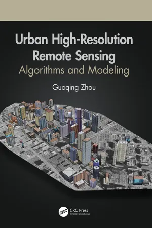
Urban High-Resolution Remote Sensing
eBook - ePub

Urban High-Resolution Remote Sensing

Algorithms and Modeling

Guoqing Zhou

  1. 344 pages
  2. English
  3. ePUB (mobile friendly)
  4. Available on iOS & Android
eBook - ePub

Urban High-Resolution Remote Sensing

Algorithms and Modeling

Guoqing Zhou

Book details
Book preview
Table of contents
Citations

About This Book

With urbanization as a global phenomenon, there is a need for data and information about these terrains. Urban remote sensing techniques provide critical physical input and intelligence for preparing base maps, formulating planning proposals, and monitoring implementations. Likewise these methodologies help with understanding the biophysical properties, patterns, and process of urban landscapes, as well as mapping and monitoring urban land cover and spatial extent.

Advanced sensor technologies and image processing methodologies such as deep learning, data mining, etc., facilitate the wide applications of remote sensing technology in urban areas. This book presents advanced image processing methods and algorithms focused on three very important roots of urban remote sensing: 3D urban modelling using different remotely sensed data, urban orthophotomap generation, and urban feature extraction, which are also today's real challenges in high resolution remote sensing. Data generated by remote sensing, with its repetitive and synoptic viewing and multispectral capabilities, constitutes a powerful tool for mapping and monitoring emerging changes in the city's urban core, as well as in peripheral areas.

Features:


  • Provides advances in emerging methods and algorithms in image processing and technology


  • Uses algorithms and methodologies for handling high-resolution imagery from a ground sampling distance (GSD) less than 1.0 meter


  • Focuses on 3D urban modelling, orthorectification methodologies, and urban feature extraction algorithms from high-resolution remotely sensed imagery


  • Demonstrates how to apply up-to-date techniques to the problems identified and how to analyze research results


  • Presents methods and algorithms for monitoring, analyzing, and modeling urban growth, urban planning, and socio-economic developments

In this book, readers are provided with valuable research studies and applications-oriented chapters in areas such as urban trees, soil moisture mapping, city transportation, urban remote sensing big data, etc.

Frequently asked questions

How do I cancel my subscription?
Simply head over to the account section in settings and click on “Cancel Subscription” - it’s as simple as that. After you cancel, your membership will stay active for the remainder of the time you’ve paid for. Learn more here.
Can/how do I download books?
At the moment all of our mobile-responsive ePub books are available to download via the app. Most of our PDFs are also available to download and we're working on making the final remaining ones downloadable now. Learn more here.
What is the difference between the pricing plans?
Both plans give you full access to the library and all of Perlego’s features. The only differences are the price and subscription period: With the annual plan you’ll save around 30% compared to 12 months on the monthly plan.
What is Perlego?
We are an online textbook subscription service, where you can get access to an entire online library for less than the price of a single book per month. With over 1 million books across 1000+ topics, we’ve got you covered! Learn more here.
Do you support text-to-speech?
Look out for the read-aloud symbol on your next book to see if you can listen to it. The read-aloud tool reads text aloud for you, highlighting the text as it is being read. You can pause it, speed it up and slow it down. Learn more here.
Is Urban High-Resolution Remote Sensing an online PDF/ePUB?
Yes, you can access Urban High-Resolution Remote Sensing by Guoqing Zhou in PDF and/or ePUB format, as well as other popular books in Technology & Engineering & Civil Engineering. We have over one million books available in our catalogue for you to explore.

Information

Publisher
CRC Press
Year
2020
ISBN
9781000287714
Edition
1

Section II

Information Extroduction

4Urban 3D Surface Information Extraction from Aerial Image Sequences

4.1Introduction

Urban three-dimensional (3D) modeling for various applications such as town planning, microclimate investigation, transmitter placement in telecommunication, noise simulation, and heat and exhaust spread in big cities has been an interesting research topic. In the past decades, Light Detection And Ranging (LiDAR) has been widely applied for extraction of urban buildings. A number of methods have been proposed and investigated, such as Baltsavias et al. (1995), Haala (1995), Haala et al. (1998), Eckstein and Muenkelt (1995), Hug (1997), Morgan and Tempfli (2000), and Morgan and Habib (2002). In general, these methods can be grouped into two categories (Yoon and Shan 2002): the classification approach and adjustment approach. The classification approach detects the ground points using certain operators designed based on mathematical morphology (Lindenberger 1993; Vosselman 2000), or terrain slope (Axelsson 1999), or local elevation difference (Wang et al. 2001). The refined classification approach uses the triangulated irregular network (TIN) data structure (Tao and Hu 2001) and iterative calculation (Sithole 2001) to consider the discontinuity in the LiDAR data or terrain surface. The adjustment approach essentially uses a mathematical function to approximate the ground surface, which is determined in an iterative least adjustment process while outliers of non-ground points are detected and eliminated (Kraus & Pefifer 2001). Despite plenty of efforts, difficulties for high accuracy and high reliability of extraction of urban buildings still remain (Vosselman and Mass 2001). It has been widely accepted by many scholars in photogrammetry, remote sensing, artificial intelligence, computer vision, and image processing communities that methods based on single terrain characteristics or criteria often fail to obtain satisfactory results in other terrain types.
On the other hand, the cost of using LiDAR for urban 3D DSM creation is large, so many small private companies cannot bear the cost. For this reason, UAV-based oblique photogrammetry is widely attracting many researchers...

Table of contents

Citation styles for Urban High-Resolution Remote Sensing

APA 6 Citation

Zhou, G. (2020). Urban High-Resolution Remote Sensing (1st ed.). CRC Press. Retrieved from https://www.perlego.com/book/2038992/urban-highresolution-remote-sensing-algorithms-and-modeling-pdf (Original work published 2020)

Chicago Citation

Zhou, Guoqing. (2020) 2020. Urban High-Resolution Remote Sensing. 1st ed. CRC Press. https://www.perlego.com/book/2038992/urban-highresolution-remote-sensing-algorithms-and-modeling-pdf.

Harvard Citation

Zhou, G. (2020) Urban High-Resolution Remote Sensing. 1st edn. CRC Press. Available at: https://www.perlego.com/book/2038992/urban-highresolution-remote-sensing-algorithms-and-modeling-pdf (Accessed: 15 October 2022).

MLA 7 Citation

Zhou, Guoqing. Urban High-Resolution Remote Sensing. 1st ed. CRC Press, 2020. Web. 15 Oct. 2022.