Building the St. Helena II tells the story of the 1970 reconstruction of an authentic, operational 1825 canal boat. The narrative unfolds in the small village of Canal Fulton, Ohio, along the surviving one- mile section of the 333-mile Ohio & Erie Canal, which in the 1820s connected the new nation's western frontier to the thriving coastal states. Canal Fulton was at the leading edge of a national environmental movement to reclaim, restore, and reuse historic U.S. canals for education and recreation.
Author Carroll Gantz describes how canals penetrated the wilderness and became the nation's first interstate transportation system—transforming the Northeast and Midwest from an agrarian to an industrial society—and how the construction of the 4,700 mile network of man-made waterways attracted settlers inland. In Ohio, the canals transformed the state from a wild, western territory into a productive and prosperous business region. Canals were soon replaced by railroads, however, and by 1900 they had mostly been abandoned, built over, or destroyed by nature.
Inspired by the innovative actions of Canal Fulton to preserve its canal history, the rest of Ohio and then the country joined the environmental and historical preservation movement. Dozens of replica canal boats were built, and over a thousand miles of land were reclaimed for the education and recreation of millions of Americans, from Massachusetts to Illinois. As a result, part of the national heritage once on the verge of being lost was instead reborn.
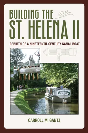
Complemented by scores of photographs, the historical origin of St. Helena II as well as her design, construction, launch, and use over her 18 years of operation are discussed in detail. Her final restoration as a permanent exhibit is also described, with full-color illustrations. St. Helena II's tradition survives today in her worthy replacement, St. Helena III.
Canal buffs, historians, educators, engineers, sailors, and those interested in restoration will welcome this addition to ca- nal literature.
Trusted by 375,005 students
Access to over 1.5 million titles for a fair monthly price.
After 1825, before railroads rendered them functionally superfluous, canals were the primary and most efficient interstate transportation system of the new United States for about thirty years. At their peak, there were 117 canals (53 major ones) in nineteen states (there were only twenty-four states in 1825), ranging in length from a half of a mile to 363 miles (seven were 200 miles or longer), for a total of 4,700 miles. The canals provided passengers, settlers, and immigrants with overland travel more comfortable and less expensive than dusty stagecoaches or wagons on unpaved roads and, more important, provided inexpensive transport for raw materials and commercial cargo between deepwater ports and the vast wilderness territories of farms and isolated communities. The fundamental legacy of the canal systems is that they bound the early United States together in industry and commerce, fostered massive immigration into the expanding frontier, and enabled the country to compete with Europe in the Industrial Revolution.
Canals had been built since antiquity. China’s Grand Canal and Nebuchadnezzar’s Royal Canal of Babylon were constructed in 500 B.C. Leonardo da Vinci designed canals and canal locks in Milan in the fifteenth century. Canals had been used in France since the seventeenth century, and England built canals linking saltworks to Liverpool, with the River Mersey, between 1713 and 1741. The Bridgewater (Worsley) Canal, which transported coal from Lancashire to Manchester, was built in 1761. By 1792 there were thirty canal schemes in England competing for capital, since canals were essential to support the English Industrial Revolution, by then transforming the country economically. Americans were well aware of canal technology and understood its potential for the development of commerce and industry. Transportation in colonial America was essentially limited to seaports, the Great Lakes, and deep-river access by sailing ships. A number of major rivers reached inland to city ports such as New York, Boston, Baltimore, Philadelphia, Pittsburgh, and Savannah, but beyond them lay a vast, expanding frontier with impossible access by sail. As they climbed inland toward their sources, rivers became shallower and narrower, and were blocked by rapids, preventing access by large ships. (See map in color insert, middle of book.)
Canals, beside and watered by the smaller rivers in inland valleys, could tame these rivers by creating level stretches so that large flat-bottomed boats with shallow draft could be pulled inland by horses or mules. Hydraulic locks, huge boxlike structures, could be filled with and emptied of water, permitting boats to be raised or lowered to follow the riverbank topography. In this way, boats could reach far into the American wilderness. The problem was the enormous cost of construction.
Former colonies, now states responsible for their own commercial development, looked to canals to improve river navigation, then the only means of transporting heavy cargo and people inland. In 1792, the State of Pennsylvania began construction of the one-mile Conewago Canal to bypass treacherous Conewago Falls on the Susquehanna River at York Haven, Pennsylvania, eleven miles south of Harrisburg; it opened in 1797. Also in 1792, Pennsylvania initiated a navigable waterway to connect the Susquehanna and Schuylkill Rivers, but in 1794, after fifteen miles had been completed, financing was exhausted, and it would languish until work resumed in 1815, after the war of 1812.
In 1793, the Western Inland Lock Navigation Company built the one-mile long Little Falls Canal with five locks to pass the forty-foot fall on the Mohawk River in New York. It was completed in 1795. Also in 1793, a close friend of George Washington, Revolutionary War major general William Moultrie (1730–1805), governor of South Carolina and president of the Santee Canal Company, began construction of the twenty-two-mile Santee Canal, which enabled crops from the uplands to reach the port of Charleston directly, rather than by wagon or along the unpredictable coastal waters of the Atlantic. It was the first summit-level canal, that is, one for which lakes, rather than rivers, provided water for operation. The ten-lock canal opened in 1800 and continued operation until 1850.
After the American Revolution, convinced of the importance of canals to the new United States, George Washington (1732–1799) hoped the Potomac River could be made navigable westward to the Ohio River Valley and thus open the frontier. In 1785, he founded the Potowmack Company, which built a canal from Georgetown, near where the new capital city of Washington, D.C., was being built, that skirted the rapids of the Potomac River in Virginia and allowed boats to reach upstream to Harpers Ferry. The famous Watergate complex in Washington was named after a series of locks with a water gate opening into the Potomac River. The canal (westward from Georgetown) included Little Falls (two miles, three locks, already built in the 1770s by canal promoter John Ballendine), Great Falls (nine miles, five locks; the most difficult), Seneca Falls, and House Falls, the latter two near Harpers Ferry and the easiest to construct. The Potowmack Canal became operational in 1802 but was engineered poorly, thus making it difficult to navigate upstream against a swift current. The company went bankrupt, by 1823 the canal was considered a failure, and in 1824 it was ceded to the Chesapeake & Ohio Company, which would rebuild it starting in 1828.
The Middlesex Canal in Massachusetts, chartered in 1793 by Governor John Hancock (1737–1793) and built between 1795 and 1803, connected the Merrimack River near Lowell, an industrial center, with Boston Harbor, a distance of twenty-two miles, with twenty locks. It cut in half the previous route down the Merrimack River to the seaport at Newburyport on the Atlantic, and thence to Boston.
These early efforts were of a local nature only and were discouraged by costs generally too large for private enterprise. Robert Fulton (1765–1815), who would in 1807 devise the first commercially successful steamboat, had studied canal technology in England and as early as 1796 had written a treatise on canal design and construction, containing detailed drawings of vertical lifts, aqueducts, and bridges. He submitted copies to Governor Thomas Mifflin of Pennsylvania (1744–1800), who had appealed to Congress for more affordable transportation systems since 1795.
Other states with transportation problems were already planning similar local canals but were stymied by the immense cost. To reach westward to the frontier beyond the coastal areas and Appalachian Mountains with a connected network, a federal program was needed to finance and encourage development of larger transportation systems. In 1807, the U.S. Senate passed a resolution calling for the Treasury Department to compile a report proposing ways that the federal government could address the transportation problems in the new nation. The task fell to Albert Gallatin (1761–1849), treasury secretary in Jefferson’s cabinet, who in 1808 produced a landmark “Report on Roads, Canals, Harbors, and Rivers” that proposed, among other ideas, a series of canals parallel to the Atlantic coast from New York City to South Carolina; a major turnpike from Maine to Georgia; a canal crossing New York state; a series of inland canals heading to Ohio; sand improvements to make rivers, including the Potomac, Susquehanna, James, and Santee, passable to major river navigation.
This was an innovative plan to open the interior of the country to commerce and immigration. The cost of this transportation infrastructure was estimated at $20 million, and when proposed, many viewed it as impractical for the federal government, though over time many of these concepts were realized. The earliest was the National Road from Baltimore, Maryland, started in 1811 and completed to Illinois in 1839. Today this is known as Route 40, but in the 1830s it was merely gravel that sunk into the mud, and was prone to landslides. Other Gallatin proposals that eventually would be built included the Erie Canal in New York and other canals in New Jersey, Pennsylvania, and Ohio; the Atlantic Intracoastal Waterway; and a north-south Route 1 along the Atlantic coast.
The War of 1812 not only delayed action but further dramatized the need for better national transportation systems for military purposes. A cannon worth $400 at the foundry in Philadelphia had cost the government $2,000 when it was delivered overland to the Canadian frontier. A barrel of pork for the troops cost $100 to deliver over muddy roads by wagon. Even worse than the cost was the time required for such transport, which severely limited the promptness of military response to threats. Similar problems affected civilian commerce. The nation had adequate transportation along its coasts to encourage international commerce and, with the recent development and use of steamboats, on major rivers and the Great Lakes to support regional trade. But rapidly expanding inland populations suffered because of the difficulty and cost of transporting crops and goods to and from trading centers in the East and South. Last but not least was the ever-increasing flow of immigrants seeking cheaper land in the interior of the country.
The federal government did not take action until 1816. Faced with a persistent economic depression after the war, Congress passed legislation to strengthen and unify the new nation in agriculture, commerce, and industry, and federal help became available. This legislation rechartered the Bank of the United States to promote a single currency, provided federal credit to fund improvement of the nation’s roads and canals to expand agricultural markets, and funded manufacturing societies to organize new businesses to reduce reliance on European imports.
States were quick to respond to these national priorities; many had already seen the need for canals, had surveyed potential routes, and were ready to provide their own financing and engineering. Most were financed with state bonds, often bought by English investors but also by Americans.
A canal in New York from the Hudson River to Lake Ontario had been proposed as early as 1768, but surveys did not begin until 1808, by James L. Geddes (1763–1838). In April 1817, a report by canal commissioners, appointed by New York state legislators and headed by DeWitt Clinton (1769–1828), completed a study of the proposed route for a canal through the state from Albany on the Hudson River to Buffalo on Lake Erie, a distance of 363 miles. The Erie Canal would be the first major canal in the United States, and also the longest.
Clinton was elected governor of New York on July 1, 1817, and work on the canal began that July 4 in Rome, New York, in the middle of the state. Construction proceeded east and west at the same time. The canal was forty feet wide at the waterline, twenty-eight feet at its bottom, and four feet deep. A ten-foot-wide towpath was constructed along the bank of the canal to accommodate the horses, mules, or oxen that pulled the boats. Eighty-three locks and eighteen aqueducts were required to cross ravines and rivers and scale 568 feet from the Hudson River to Lake Erie. Eight years later, on October 26, 1825, Governor Clinton presided over the opening celebrations and joined the first through passage from Buffalo to Albany with other dignitaries on the Seneca Chief.
Coincidentally, just one month before, on September 27, in England, George Stephenson (1781–1848), at the controls of his locomotive, the Locomotion, had opened the world’s first public railroad, the Stockton and Darlington, to pull thirty-six freight wagons of coal and flour nine miles at fifteen miles per hour.
In its first year of operation, nineteen thousand boats passed through the Erie Canal, carrying freight such as salt from the saltworks in Onandaga County, as well as over forty thousand immigrants. A ton of freight now cost only $10 to ship, compared with $100 by land. The canal attracted businesses and small communities, provided access to Ohio and the Northwest Territories, and made New York City the greatest port in America. In its first eight years, the canal paid for its initial investment and maintenance in tolls. Land values increased by $100 million. Within twelve years, the canal had recouped the cost of its original construction.
These obvious benefits were recognized and publicized around the nation, and “canal fever,” the rush to build canals, spread to almost every state. In the mid 1820s, the forty-five-mile Blackstone Canal was built, connecting Providence, Rhode Island, with Worcester, Massachusetts, along the Blackstone River. It was completed in 1828 and required forty-nine locks for climbing the 438-foot difference in elevation.
In 1824, the Potowmack Company in Washington, D.C., ceded its holdings to the Chesapeake and Ohio Company, which had the intention of reaching the Ohio River at Pittsburgh with a canal. Benjamin Wright (1770–1842), formerly chief engineer of the Erie Canal, was named chief engineer of the new effort, and construction began July 4, 1828, with groundbreaking by president John Quincy Adams. Due to money and labor problems, and the difficult mountain terrain, the canal never reached its destination. By 1850, it spanned only 184 miles, from Georgetown to Cumberland, Maryland, along the Potomac River.
Also in 1824, the New Jersey legislature chartered the Morris Canal and Banking Company to construct a canal connecting Phillipsburg on the Delaware River, eastward through New Jersey to the Hudson River at Jersey City, a distance of 107 miles. The canal had to rise 760 feet, then descend 914 feet; this was accomplished with twenty-three locks and twenty-three inclined planes, where open cars carrying canal boats were lifted by waterwheel-powered winches up and down hills. It was completed to Newark by 1831, and to Jersey City by 1836. By then, canal boats could cross the Delaware River in Phillipsburg via a cable ferry and link up with Pennsylvania canals at Easton on the west side. Another New Jersey canal, the Delaware & Raritan, running forty-four miles from Bordertown on the Delaware River to New Brunswick on the Raritan, was completed in 1834, and a feeder canal twenty-two miles north along the Delaware River’s east bank, from Bordertown to Bull’s Island near Frenchtown, extended the length to sixty-six miles. In the 1860s, it was used to transport coal from Pennsylvania to New York City.
Pennsylvania’s Schuylkill Navigation Company restarted work in 1815 and by 1827 had completed its waterway of 108 miles, combining 46 miles of river slackwater pools with 62 miles of separate canals linking Port Carbon in the coal region to Philadelphia. At Reading, the Schuylkill River connected to the Union Canal, which went west to the Susquehanna River at Middletown, 81 miles total, and was completed in 1828.
In 1825, the same year the Erie Canal was completed, Ohio began construction of an 800-mile canal system, which was completed in 1845. This project, central to our Ohio canal boat story, is detailed in chapter 2.
Also in 1825, the Delaware & Hudson Canal Company began building a 109-mile canal—from the Hudson River near Kingston in New York, to Port Jervis on the Delaware River, then north to cross the Delaware into Pennsylvania at Lackawaxen and thence to Honesdale, Pennsylvania. It opened in 1828 to transport anthracite coal to New York City. In 1829, the company purchased the first steam locomotive to be operated in the United States, the Stourbridge Lion, built in England the previous year. In Honesdale, it began operation to carry coal to the canal.
Coal was the primary cargo of Pennsylvania’s 48-mile Lehigh Canal, from Mauch Chunk (now Jim Thorpe) south to Easton, where it connected to the 60-mile Delaware Division Canal from Easton to Bristol. Both were completed in 1832 and brought coal the 108 miles from Mauch Chunk to Philadelphia.
In 1826, the Pennsylvania Main Line of Public Works system (known as the “Main Line”) was authorized to span Pennsylvania from east to west, roughly 315 miles, over the Allegheny Mountains. Yes, over the mountains! The system was divided into geographical divisions for construction. The Western Division Canal began in Pittsburgh, on the Ohio River. It proceeded eastward up the Allegheny River 104 miles to Johnstown and became operational that far in 1831.
There, to cross the Alleghenies, a thirty-seven-mile Portage Railroad from Johnstown was constructed with an ingenious mechanical system of ten inclined planes, each climbing and descending peaks of several hundred vertical feet. Boats were loaded on flat railway cars. At either end of the plane, cars were attached to continuous hemp cables, which had separate rail tracks for each direction. Cars were then raised and lowered on opposite sides of the plane by a stationary steam engine at the peak. Between the planes, horses and, later, locomotives pulled boats on flat railway cars to the next plane.
The Portage railroad, opened in 1834, connected in Hollidaysburg on the east side of the Alleghenies to the Juniata Division Canal, which had opened in 1832 and spanned 127 miles down the Juniata River to meet the Susquehanna Division Canal. It ran 41 miles south along the west bank of the Susquehanna River. There, boats were towed across the river alongside the Clark’s Ferry Bridge, built with a floating towpath, to the east side of the river at Northumberland, where it met the Eastern Division of the canal, operational in 1833, which traveled 46 miles south to Columbia. From Columbia to Philadelphia, a distance of about 75 miles, the federal government constructed a toll-financed railroad, one of the first in the nation, which began operations in 1834. Initially, horses pulled sectional canal boats on flat railcars, but they progressively shared the road with steam locomotives until 1844, when horses were banned.
The Cumberland & Oxford Canal, constructed in Maine between 1828 and 1830, was started just several weeks before the other C & O canal, the Chesapeake & Ohio. The Maine canal linked the port and industries of Portland with lumber and wood products to Sebago Lake, a distance of twenty miles with twenty-seven locks to raise canal boats 270 feet above sea level. A twenty-eight lock allowed boats to rise up to Long Lake and enabled them to reach fifty miles inland. The sixty-four-foot-long boats were equipped with sails to cross the lakes.
In western Pennsylvania, the Beaver and Erie Divisions connecting Pittsburgh on the Ohio R...
Table of contents
Cover
Title
Copyright
Dedication
Contents
Preface
Acknowledgments
1. American Canals
2. Ohio Canals
3. Decline and Survival
4. Stark County, Ohio
5. Canal Fulton’s Boat
6. Construction Begins
7. The St. Helena II Is Born
8. Dedication
9. Canal Boats USA
10. Ohio & Erie Canalway
Epilogue
Appendix A: “Canal Nostalgia,” by James Dillow Robinson
Appendix B: Honorable Ralph Regula’s Dedication Address
Appendix C: Transcript of Recorded Lecture Played on the St. Helena II
Notes
Bibliography
Illustration Credits
Index
Frequently asked questions
Yes, you can cancel anytime from the Subscription tab in your account settings on the Perlego website. Your subscription will stay active until the end of your current billing period. Learn how to cancel your subscription
No, books cannot be downloaded as external files, such as PDFs, for use outside of Perlego. However, you can download books within the Perlego app for offline reading on mobile or tablet. Learn how to download books offline
Perlego offers two plans: Essential and Complete
Essential is ideal for learners and professionals who enjoy exploring a wide range of subjects. Access the Essential Library with 800,000+ trusted titles and best-sellers across business, personal growth, and the humanities. Includes unlimited reading time and Standard Read Aloud voice.
Complete: Perfect for advanced learners and researchers needing full, unrestricted access. Unlock 1.5M+ books across hundreds of subjects, including academic and specialized titles. The Complete Plan also includes advanced features like Premium Read Aloud and Research Assistant.
Both plans are available with monthly, semester, or annual billing cycles.
We are an online textbook subscription service, where you can get access to an entire online library for less than the price of a single book per month. With over 1.5 million books across 990+ topics, we’ve got you covered! Learn about our mission
Look out for the read-aloud symbol on your next book to see if you can listen to it. The read-aloud tool reads text aloud for you, highlighting the text as it is being read. You can pause it, speed it up and slow it down. Learn more about Read Aloud
Yes! You can use the Perlego app on both iOS and Android devices to read anytime, anywhere — even offline. Perfect for commutes or when you’re on the go. Please note we cannot support devices running on iOS 13 and Android 7 or earlier. Learn more about using the app
Yes, you can access Building the St. Helena II by Carroll Gantz in PDF and/or ePUB format, as well as other popular books in Tecnologia e ingegneria & Trasporti marittimi. We have over 1.5 million books available in our catalogue for you to explore.