eBook - ePub
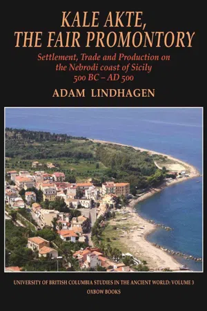
Kale Akte, the Fair Promontory
Settlement, Trade and Production on the Nebrodi Coast of Sicily 500 BC–AD 500
- 272 pages
- English
- ePUB (mobile friendly)
- Available on iOS & Android
eBook - ePub
Kale Akte, the Fair Promontory
Settlement, Trade and Production on the Nebrodi Coast of Sicily 500 BC–AD 500
About this book
This volume investigates the interaction between the natural environment, market forces and political entities in an ancient Sicilian town and its surrounding micro-region over the time-span of a thousand years. Focusing on the ancient polis of Kale Akte (Caronia) and the surrounding Nebrodi area on the north coast of Sicily, the book examines the city's archaeology and history from a broad geographical and cultural viewpoint, suggesting that Kale Akte may have had a greater economic importance for Sicily and the wider Mediterranean world than its size and lowly political status would suggest. Also discussed is the gradual population shift away from the hill-top down to a growing harbour settlement at Caronia Marina, at the foot of the rock. The book is particularly important for the comprehensive analysis of the 1999–2004 excavations at the latter, with fresh interpretations of the function of the buildings excavated and their chronology, as well for reviewing the present state of our knowledge about Kale Acte/Calacte, and defining research questions for the future. The archaeological material at the heart of this study comes from excavations at the site conducted by the author. It is one of the few detailed publications from Sicily of Hellenistic and Roman amphora material. The conclusions about changing trends of commercial production and exchange will be of interest to those working on ceramic material elsewhere in Sicily and indeed further afield. The study also offers a fresh perspective of the economic history of ancient Sicily, and concludes that Kale Akte's privileged location on the north coast was well suited for the export trade to Italy and the city of Rome itself, which enabled the Sicilian town to prosper during the Roman Empire. The origins of Kale Akte and its alleged foundation by the exiled Sikel leader, Ducetius, in the fifth century BC, are also discussed in the light of the latest archaeological discoveries. An Italian summary of each chapter is also included.
Information
Topic
StoriaSubtopic
Storia dell'antica Grecia1
The settlements
The identification of Kale Akte
The modern town of Caronía on the north coast of Sicily is usually identified as the site of the ancient town Kale Akte, founded according to literary sources by the exiled former Sikel leader Ducetius in 446 BC. Caronía enjoys a very advantageous, strategic position on a steeply sloping hill c. 304 m above sea level (Fig. 1.1). Thanks to its location, the hill-site controlled the ancient major route connecting urban centres along the north coast of the island, and so also enjoyed direct links stretching from Capo Peloro, at the south-eastern tip of Sicily, all the way to Lilybaeum (modern Marsala) on the west coast (Figs 1.2-3). There have been several different opinions about the exact location of the city supposedly founded by Ducetius. The historian Fazello already in the sixteenth century mentioned ruins at the site of Marina di Caronía ad aedem Annunciatae circa Caroníae littora, but identified the site with the ancient Halaesa.1 At the beginning of the seventeenth century, however, the German geographer Phillip Klüver became the first to identify Marina di Caronía, the maritime counterpart to Caronía, with Kale Akte.2 Since then both Caronía and Marina di Caronía have remained the firm focus of scholars interested in the location of Kale Akte. Dinu Adamesteanu investigated a high plateau (contrada Trapiessi) immediately to the east of Caronía in 1961, identifying through aerial photography what he interpreted as the remains of fortifications. This led him to formulate the hypothesis that this hill-top was the actual site of Ducetius’ Kale Akte.3 Adamesteanu’s hypothesis has, however, been shown to be false.4 In 1982 a short rescue excavation was carried out at Marina di Caronía, uncovering the badly preserved walls of a building.5 Only from the early 1990s has attention been paid in earnest to Caronía and Kale Akte, witnessed by a series of excavation campaigns conducted by the Soprintendenza per i Beni Culturali di Messina.6 The campaigns in 1993-1999 and 2005 in contrade Telegrafo and Sotto San Francesco resulted in the discovery of an urban settlement on the hill-top of Caronía dating from the fourth century BC to the first century AD, when several Hellenistic terrace walls and cisterns were uncovered. The latest, and also the most extensive, excavations (in both 1999 and 2005) have concentrated on the ancient maritime settlement at Marina di Caronía.7

Fig. 1.1 The hill-town Caronía, ancient Kale Akte, seen from the west

Fig. 1.2 Map of ancient Sicily

Fig. 1.3. The north coast of Sicily as seen from a satellite, indicating the locations of ancient towns
With the archaeological material available to us today from excavation and field survey, it is possible to confirm finally that the identification of the settlement founded by Ducetius in 446 BC with the hill-town of Caronía is correct. The most important evidence is probably that based on numismatic finds. Coins from the mint of Kale Akte (22 finds) constitute more than a quarter of the identified Hellenistic coins found at Marina di Caronía and Caronía, and all five series known to have been issued by the Kale Akte mint are represented in the excavated material.8 Other poleis are represented only by one or two coins each except, of course, for the prolific mint of Syracuse, which is represented by 19 coins. In addition, two brick-stamps bearing letters which have been interpreted as an abbreviation of the name of the town have been found, one at Marina di Caronía, another in the territory of Caronía.9 This clear numismatic and epigraphic evidence can be added to the testimony of the Roman road handbooks: the road distances given by the latter fit well with the identification of Caronía as Kale Akte.10
The Samos and Miletos joint settlement project11
Herodotus mentions an invitation in 494 BC by the city of Zancle to fugitive Ionians to settle at a place on the north coast of Sicily, known as ‘Fair Coast’ or ‘Fair Promontory’.12 The Samians and Miletians accepted the invitation and left the coast of Asia Minor for Sicily. However, when they had reached Lokri, they were persuaded by the tyrant of Rhegion, Anaxilaos, to found instead a new settlement at Zancle, while his enemies, the Zancleans, were away busy besieging a Sicilian town elsewhere. The Samians and Miletians, therefore, abandoned the project to sail on to Kale Akte but instead took control of Zancle. It is uncertain whether Herodotus, in mentioning Kale Akte, is referring to a general stretch of coastline or is using a precise toponym of a particular site. The Miletians would not have accepted the proposal to found a settlement so far from the motherland unless a secure location had already been chosen by the Zancleans, who would have had, of course, good knowledge of the north coast of Sicily. The finds from Marina di Caronía (contrada Pantano) leave little doubt that this site must have hosted a harbour already by the second half of the sixth century BC, and trading activity can possibly be traced even further back, to the end of the seventh century.13 The daughter foundation of Zancle, Himera, was founded according to tradition in 649 BC, but this lies some 170 km from Zancle. The cove at Marina di Caronía (in antiquity there was possibly also a protected harbour for ships with an artificial quay) is the most sheltered available along the whole stretch of north coast between Zancle’s satellite settlement of Mylai (Milazzo) to the east, and Cefalù to the west. More or less halfway between Zancle and Himera, Caronía would have been a perfect port of call for the Greek ships on this (probably very busy) route for seaborne commerce. The Zanclean messengers sent to Ionia would certainly have had detailed information about this small port on the Sicilian north coast, because they knew it well, had trading contacts with it, and would already have found the Sikel inhabitants there friendly and welcoming. The only other possibility for shelter between Milazzo and Cefalù was at Tindari (Tyndaris), but the latter provided no more than a number of very small bays capable of accommodating only a few ships.
Today’s settlement of Marina di Caronía is clustered around a shallow bay (Figs 1.4-5; colour Pl. 4). The shore-line here seems to be the same as that in antiquity, but it was probably not the location of the principal port. The deepest part of the bay, which would have been the natural choice for sheltered mooring, was in Hellenistic times occupied by a necropolis,14 and no buildings associated with a harbour have been found there. Rather, this area must have represented the easternmost outskirts of the settlement, since in antiquity cemeteries were always situated outside the limits of the inhabited area. The area of contrada Di Noto, which has not so far been explored archaeologically, has plentiful surface pottery dating back at least to the late Classical period,15 and there are further finds of Archaic and Classical date in contrada Pantano. These suggest that ships would have anchored not only on the eastern, sheltered, side of the promontory, but also in an inlet that probably existed in antiquity in the area of today’s contrada Pantano (Fig. 1.4). If there had not been a suitable anchorage in the contrada Di Noto area, protected on the west from currents, the choice of site for a coastal settlement would be puzzling. We should thus imagine some kind of sheltered basin for ships lying to the west of the excavated ancient buildings at contrada Pantano. Marina di Caronía is today the best harbour in terms of its position on this stretch of coastline,16 dominated by an easily defendable hill. The promontory with shelter for ships on both sides would have made it a perfect choice for a settlement already before the arrival of the Greeks. As mentioned above, there are signs of a trading post at Marina di Caronía already by the second half of the sixth century BC and possibly earlier, and perhaps by the same date also on the hill-top which dominated the harbour. The later hypothesis is based on unpublished finds from a late Archaic and Classical necropolis in the area of the modern municipio, which include a few examples of Sikel pottery of that date.17 The Zancleans would, of course, not have suggested to the Ionians a site that lacked a decent harbour, and, with the identification of an Archaic trading post at Marina di Caronía, it seems almost certain that Kale Akte referred to a particular place and not the coastline in general here.18 We do not know if the Sikel population would have been included in this planned settlement. In any case, controlling the wealthy town of Zancle, a vital crossroads of the Mediterranean, was of course much more inviting to the Miletians and Samians than the occupation of a small Sikel settlement, set in a wild landscape a long way from other Greek settlements.

Fig. 1.4. Caronía and Marina di Caronía, map of rural settlements and archaeological discoveries
The most straightforward translation of Kale Akte is ‘Fair’ or ‘Beautiful Shore’, or ‘Fair’ or ‘Beautiful Coast’, in Italian Bella Costa, and this has also been the most common interpretation in the scholarly literature.19 However, a translation of Kale Akte as ‘Fair Promontory’ or ‘Fair Point’ is equally possible or even preferable, the primary meaning of ἀκτή meaning ‘promontory’ or ‘point where the waves break’.20 That would have indicated a precise site, compared with the much more general ‘Fair Coast’. The ‘Point’ would presumably have been the promontory to the west of Marina di Caronía, with its harbour and the plateau (contrada San Todaro/Pianu dei Pupiddi), as well as the hill-top occupied by modern Caronía above it. This promontory with its hill must have been an obvious landmark for Greek sailors, just as it still is today (Figs 1.6-7). The nearby settlement of Kephaloidion to the west is an example of how a promontory gave the city its name. There the prominent landmark to sailors was seen as having the shape of a ‘head’ (in Greek kefale). The example serves to strengthen the hypothesis that the name Kale Akte would also have been derived from a specific and geographically striking natural headland. The name would presumably already have been current in the sixth century BC among Greek merchants, trading with the maritime settlement at Marina di Caronía, long before the invitation was issued to Samians and Miletians to come and settle there. Since no buildings have yet been found which can be identified as part of a settlement of Archaic date,21 it is not possible to speculate as to whether the harbour was merely a scalo (a landing-place) for smaller ships, or whether it also included buildings suitable for permanent habitation.
The hill-top of Caronía above this harbour must surely have had a Sikel settlement. The locatio...
Table of contents
- Cover
- Title
- Copyright
- Contents
- Foreword, by R. J. A. Wilson
- Preface and acknowledgements
- 1 The settlements
- 2 The territory: resources and communications
- 3 Archaeological research at Caronía and Marina di Caronía
- 4 The material evidence
- 5 Patterns of production and supply
- 6 Trading mechanisms: market and state
- 7 From trading post to rural village
- Riassunto italiano
- Appendix 1 Methodological problems and quantification of finds
- Appendix 2 Thin-section analyses of selected amphorae, by Anders Lindahl
- Appendix 3 Catalogue of amphora fabrics
- Appendix 4 Catalogue of finds
- Notes
- Bibliography
- List of illustrations
- Plate section
Trusted by 375,005 students
Access to over 1.5 million titles for a fair monthly price.
Study more efficiently using our study tools.
Frequently asked questions
Yes, you can cancel anytime from the Subscription tab in your account settings on the Perlego website. Your subscription will stay active until the end of your current billing period. Learn how to cancel your subscription
No, books cannot be downloaded as external files, such as PDFs, for use outside of Perlego. However, you can download books within the Perlego app for offline reading on mobile or tablet. Learn how to download books offline
Perlego offers two plans: Essential and Complete
- Essential is ideal for learners and professionals who enjoy exploring a wide range of subjects. Access the Essential Library with 800,000+ trusted titles and best-sellers across business, personal growth, and the humanities. Includes unlimited reading time and Standard Read Aloud voice.
- Complete: Perfect for advanced learners and researchers needing full, unrestricted access. Unlock 1.5M+ books across hundreds of subjects, including academic and specialized titles. The Complete Plan also includes advanced features like Premium Read Aloud and Research Assistant.
We are an online textbook subscription service, where you can get access to an entire online library for less than the price of a single book per month. With over 1.5 million books across 990+ topics, we’ve got you covered! Learn about our mission
Look out for the read-aloud symbol on your next book to see if you can listen to it. The read-aloud tool reads text aloud for you, highlighting the text as it is being read. You can pause it, speed it up and slow it down. Learn more about Read Aloud
Yes! You can use the Perlego app on both iOS and Android devices to read anytime, anywhere — even offline. Perfect for commutes or when you’re on the go.
Please note we cannot support devices running on iOS 13 and Android 7 or earlier. Learn more about using the app
Please note we cannot support devices running on iOS 13 and Android 7 or earlier. Learn more about using the app
Yes, you can access Kale Akte, the Fair Promontory by Adam Lindhagen in PDF and/or ePUB format, as well as other popular books in Storia & Storia dell'antica Grecia. We have over 1.5 million books available in our catalogue for you to explore.