A "wide-ranging, vivid" narrative history of one of the most coveted and complex regions of the world: the Caribbean (
The Observer).
Ever since Christopher Columbus stepped off the Santa Maria and announced that he had arrived in the Orient, the Caribbean has been a stage for projected fantasies and competition between world powers. In
Empire's Crossroads, British American historian Carrie Gibson offers a panoramic view of the region from the northern rim of South America up to Cuba and its rich, important history.
After that fateful landing in 1492, the British, French, Spanish, Portuguese, Dutch, Danish, and even the Swedes, Scots, and Germans sought their fortunes in the islands for the next two centuries. These fraught years gave way to a booming age of sugar, horrendous slavery, and extravagant wealth, as well as the Haitian Revolution and the long struggles for independence that ushered in the modern era.
Gibson tells not only of imperial expansion—European and American—but also of life as it is lived in the islands, from before Columbus through the tumultuous twentieth century. Told "in fluid, colorful prose peppered with telling anecdotes,"
Empire's Crossroads provides an essential account of five centuries of history (
Foreign Affairs).
"Judicious, readable and extremely well-informed . . . Too many people know the Caribbean only as a tourist destination; [Gibson] takes us, instead, into its fascinating, complex and often tragic past. No vacation there will ever feel quite the same again." —Adam Hochschild, author of
To End All Wars and
King Leopold's Ghost
eBook - ePub
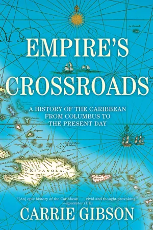
Empire's Crossroads
A History of the Caribbean from Columbus to the Present Day
- 480 pages
- English
- ePUB (mobile friendly)
- Available on iOS & Android
eBook - ePub
About this book
Trusted by 375,005 students
Access to over 1.5 million titles for a fair monthly price.
Study more efficiently using our study tools.
Information
Chapter One
A Passage to the Indies
The story of the modern Caribbean does not begin with Christopher Columbus’s famous voyage. It starts, instead, in a small port town in northern North Africa, almost within sight of the Iberian peninsula. On 25 July 1415, the feast day of St James, Prince Henry† of Portugal – later known as the ‘Navigator’ – led a fleet of around 200 ships down the Tagus, which would carry them out of Lisbon and into the Atlantic Ocean. Of an estimated 45,000 soldiers on board, only a handful were aware of their final destination. Rumours had been circulating about the expedition but very few people had actual facts.
† For the sake of consistency I will use the anglicized versions of the names of royals throughout the book.
Preparing that number of ships and men had been no small operation, and it had attracted some attention. The Portuguese fleet was not sufficient for the plans, whatever they were, so another hundred ships had to be chartered from Castile, Flanders, Brittany, and England.1 A Castilian agent in Lisbon could not help but notice the ships being readied, and he reported to King Ferdinand I that by his count there were around 5,400 men at arms, 4,900 bowmen, and 9,000 foot-soldiers.2 This was a worrying development for Castile, as both agent and king expected the Portuguese to head for neighbouring Granada, which was the last Islamic foothold in Catholic Iberia. Once a mighty empire that spread almost over the entire peninsula, Islam was now contracting. As the Islamic caliphate was riven by its own internal crises, the Catholics were able to retake their kingdoms, bit by bit. Granada, at the foothills of the Sierra Nevada mountains, home of the mighty Alhambra palace, was the final – and most highly sought – prize.
Ferdinand I was surprised by the rumours, not so much because of the scale of the operation but because he thought Henry would have known Castile had laid claim to the right to invade and reconquer Granada.3 Portugal had reconquered its southern Algarve territories in 1249, but the continued Islamic governance of Granada was a Muslim thorn in the side of the Catholic rulers of Castile. Ferdinand I also considered the idea that the vessels could have been heading for Gibraltar, which was still under Muslim control. He was wrong on both counts.
As the ships set sail, details of the plan emerged. The target was the North African port of Ceuta, 150 miles from the Portuguese coast. Most, if not all, of the soldiers on board would have been surprised when they found out where they were going. Ceuta was a small, peninsular outpost in North Africa with a fortress; it was not a dazzling jewel of a city, like Granada. But what it lacked in splendour it made up for in bustling trade. In Henry’s time this port was known for its commerce in wheat and in gold. Ceuta sat at a crucial location; mirrored by the rock of Gibraltar in the north, it was the southern part of the ‘Pillars of Hercules’ – the gateway to the commercial world of the Mediterranean. It was also the exit to the terrifying and mostly unknown waters of the Atlantic. Whatever the reason, Ceuta was a puzzling choice for an attack. The call to arms against the infidel was not a new motivating factor but the target was. Although battling Islam contributed to Prince Henry’s idea for an invasion, it was not his only reason. Gold and wheat loomed large in his mind.
Wheat was a problem for Portugal. The small kingdom had a mountainous interior, and could grow very little, making it dependent on imports. These were too often manipulated by the state of political relations with the Genoese, Dutch, or other exporters of wheat, or more volatile still, the vicissitudes of the climate, which could lead to surpluses in some years and shortages in others. Access to a steady, dependable source of grain could have manifold benefits, and Ceuta was the place to access it. And then there was the matter of gold. Many people believed that Ceuta was the last link in the long supply chain that connected the Mediterranean with the rumoured riches that lay deep in the unknown African interior. When it came to gold, no European ruler could stockpile enough of it. Certainly not Henry, the third of five surviving sons of John I of Portugal and Philippa of Lancaster and raised to expect the courtly splendour of his counterparts in England. But unlike England, Portugal’s population was tiny – only about a million people, most of whom were eking out an existence; taxing them would not raise sufficient revenues. Indeed, Portugal did not even issue its own gold currency. What money there was had to be spent on the ongoing struggle against the growing power of Castile, which had been brought to a temporary halt under a treaty signed in 1411.
Born in Porto on Ash Wednesday, 4 March 1394, Henry was a devout Catholic. He was schooled in the chivalric ways of England, as imparted by his Plantagenet mother, while also being infused with a hatred of the ‘infidel’ Moors by his family.4 This attack on Ceuta was to be his moment, his stance against Islam, but it was also his chance to improve his own fortunes. This was not unusual. In Castile, the armies that had fought against the Moors were led by noblemen who were allowed to keep some of the spoils of war. Henry was acting within this tradition, but hoping, by extending his geographical reach, to find something more.
Into the mix of grain, gold, and God would also be added the figure of Prester John, a mythical Christian who had travelled to a faraway land (often Ethiopia), where he had become king and had access to enough gold and soldiers to defeat all enemies of Christendom. He had an army strong enough to fend off any rising menace from Islam and the growing power of the Ottoman world. If only Prester John knew what dangers were in store for his Christian brothers, so the thinking went, he would send his armies to defeat the infidels. And, of course, he had a lot of gold. Although Prester John haunted the medieval world, no evidence proves that he actually existed, though he was alive in the minds of Henry and his contemporaries. The account of who Prester John was varies through the centuries, changing with the wishes and anxieties of whoever wrote and talked about him. Henry certainly appeared to believe the story. He thought that by securing Ceuta, the Portuguese would not only have a stronghold in the Muslim Mediterranean and access to wheat supplies, but that they could then penetrate into the hinterland, find Prester John, and share in his riches. Henry was not alone in this desire – the legend of Prester John had existed since the Crusades began more than 300 years earlier, and the story compelled people to search for him and his treasure. Henry’s unwavering belief in Prester John and his desire for gold would have ramifications that would reach well beyond the confines of Ceuta’s fortress.
As Henry’s ships set sail that July across the Straits of Gibraltar, there was an ominous eclipse of the sun. The storm that followed drove the fleet back to Algeciras, on the southern coast of Andalusia, where they had to lie at anchor. Meanwhile, the governor of Ceuta, Salah ben Salah, had received word of the fleet’s arrival and was on the brink of calling in reinforcements when he heard that the would-be attackers had turned away and presumed they had changed their minds. Ben Salah’s assumption would prove to be disastrous. He called off the extra troops, and so was in for a very unpleasant surprise on 21 August when, after a thirteen-hour fight, the Marinid people of Ceuta were defeated.5In the style of the victorious, the Portuguese troops looted the city, searching everywhere for the fabled gold. They found little precious metal, but in their lust for it, they managed to destroy stocks of valuable spices, ignorant of the fact that these exotic flavourings were often worth their weight in gold.
As the Portuguese settled into occupation and the local inhabitants fled, it soon became clear that the enterprise was an economic failure. Henry’s troops had taken over Ceuta, and the prince established his reputation, but it was a hollow victory. The Muslim traders – the vital conduits of wheat and gold – had left, and no Muslim merchants from the wheat-growing interior would do business with the Portuguese. With such slim economic prospects, no one from the mainland wanted to settle there, and so soldiers were forced to stay in the colony.‡ The longed-for gold was nowhere to be found. But Henry was not deterred. The search had begun.
‡ This, however, did not prevent another attack, this time a disastrous failure, in 1437, on Tangiers, led by Henry’s brother, Ferdinand. After complicated negotiations, Henry reneged on his deal to exchange his captured brother for Ceuta, leaving him to die. Ceuta stayed under Portuguese control until 1668, when it passed into Spanish hands under the Treaty of Lisbon, and is today an autonomous city governed by Spain. Tangiers was eventually won by Portugal in 1471, though today it is part of Morocco.
Despite his sobriquet, there is little evidence Henry the Navigator ever sailed beyond Ceuta.§ Instead, it was in his role as a leading ship owner that Henry contributed to the rise of Portugal’s maritime domination in the fifteenth century, which resulted in part from his triumph in Ceuta. Although something of a false victory, Henry and others had tasted overseas conquest – not peninsular reconquest. The prince and fellow elites understood that access to gold was crucial not only to their own personal fortunes, but for overall prosperity, to fund the ongoing struggle against Islam, and to find Prester John. Henry was buoyed by his success, and he pushed Castile to invade Granada in 1419 and 1434, but that battle would be not be fought for decades yet.
§ With Henry’s partial English heritage, the English liked to claim him as their own. Seventeenth-century geographers Samuel Purchas and Richard Hakluyt hailed Henry’s exploits as exemplifying the natural English gift for navigation, and it is around this time the nickname emerged. Henry’s image was later appropriated by Portugal’s dictatorships from 1926 to 1974..
Around the time of Henry’s foray into North Africa, there were profound changes in maritime techniques in the Mediterranean. Sailing in the fifteenth century was a cumbersome process, as it had been for hundreds of years. Galleys needed oarsmen, which meant they could neither go far nor carry much. Space was needed for the gangs of men on the oars and sufficient water and food for everyone on board. Explorers were limited as well, though the Vikings are believed to have reached parts of North America centuries earlier. But as shipbuilding design changed, some intrepid Portuguese were able to engage in a more systematic exploration of the Atlantic, then known as the ‘Ocean Sea’, well beyond the limits of the known waters of the Mediterranean. The crucial element in this change was the design of the caravel. Many of the earlier ships were cogs, which were Baltic in origin, and had rounded hulls. They were designed to sail using currents, not wind – although they had a square-rigged sail – and could only go relatively short distances. The design of the caravel– which, and it is no coincidence, bears a relation to the Arab dhow – used lateen, or fore-and-aft, sails which allowed the ships to manoeuvre with more ease and sail closer to the wind. The Chinese, too, had used new technologies to travel further, arriving on the African coast in the 1400s. They also had gunpowder and compasses – but that was because they had invented them.6And while these discoveries may have seemed very exciting and new to the Portuguese, it was only because Western Europe was so very far behind much of the rest of the world. In the fifteenth century China, the Indian kingdoms and the Islamic world had produced scientific discoveries well ahead of those coming out of a Europe emerging from the Dark Ages. But shifts were happening again, and the combination of Islamic weakness and a European resurgence meant the balance of power in the Mediterranean was changing.
For Portuguese and other European sailors, the switch from manpower to wind power would prove a dramatic one. These ships needed fewer men, and could go further than their predecessors. Around the time of the attack on Ceuta in 1415, the known southern limit of the world was around 27º N, near Cape Bojador (on the coast of today’s Western Sahara). It was infamous for having a violent current, frequent dense fog, and difficult prevailing winds that could frustrate any attempt to sail back north to Lisbon. Arab geographers were more familiar with this region than the Portuguese and called it the ‘Green Sea of Darkness’. To many sailors and map-makers it marked a true point of no return. But the Portuguese caravels could weather the journey and soon began to round the cape and find they could, with the help of the wind, make their way back. The sailors’ newfound confidence helped override their fear of the blank spots on their maps.
Bit by bit, wave by wave, Portuguese sailors began to make sense of the currents and winds, realizing there were patterns that would allow them to go beyond the Pillars of Hercules into the unknown, and return in one piece. Using their intuition, logic, and experience, they soon discovered they could bump southwards along Africa’s western coast by harnessing the winds to sail further into the Atlantic and catch the westerlies back home. Ocean currents in the northern hemisphere move in a clockwise direction. Understanding this was the trick – if they sailed too close to the coast on the way back, the northerlies could wreak havoc, as had happened in the past, sending ships into oblivion. By expanding their loop, sailors could catch the winds they needed. Soon mariners saw there was a mostly reliable pattern to these winds. The stars helped, too; after crossing the equator, sailors familiar with navigating using the position of Polaris in relation to the horizon were able to make calculations using different celestial bodies.7
New realizations dawned on map-makers as well. Some of the earliest known European maps from around the eighth century are called T-O maps, which were symbolic rather than cartographic. They were framed in a circle, with Asia taking up the top half, and the bottom half split between Africa and Europe. The T shape represented the Mediterranean, the Nile, and the River Don in Russia, which separated Europe and Asia.8 Maps were the physical embodiment of a Christianized world, and they became almost devotional objects. They charted spiritual realities, not geographic ones. Jerusalem was usually at the centre, as it was supposed to represent the spiritual heart of the Christian universe. But over time, and fed by reports from sailors,maps began to change shape. Newer maps reflected geographic realities. Portolan charts had emerged by the 1300s as a navigational aid, the maps often looking like spiders’ webs of criss-crossing lines and compass points of sailing routes. The Crusaders had brought back to Europe a physical knowledge of parts of the East, and now sailors were adding to the understanding of the seas outside the M...
Table of contents
- EMPIRE'S CROSSROADS
- Title
- Copyright
- Dedication
- Contents
- Maps
- List of Illustrations
- Introduction
- Chapter One
- Chapter Two
- Chapter Three
- Chapter Four
- Chapter Five
- Chapter Six
- Chapter Seven
- Chapter Eight
- Photo Insert
- Chapter Nine
- Chapter Ten
- Chapter Eleven
- Chapter Twelve
- Chapter Thirteen
- Chapter Fourteen
- Conclusion
- Timeline
- Gazetteer
- Acknowledgements
- Selected Bibliography
- Notes
- Index
- Back Cover
Frequently asked questions
Yes, you can cancel anytime from the Subscription tab in your account settings on the Perlego website. Your subscription will stay active until the end of your current billing period. Learn how to cancel your subscription
No, books cannot be downloaded as external files, such as PDFs, for use outside of Perlego. However, you can download books within the Perlego app for offline reading on mobile or tablet. Learn how to download books offline
Perlego offers two plans: Essential and Complete
- Essential is ideal for learners and professionals who enjoy exploring a wide range of subjects. Access the Essential Library with 800,000+ trusted titles and best-sellers across business, personal growth, and the humanities. Includes unlimited reading time and Standard Read Aloud voice.
- Complete: Perfect for advanced learners and researchers needing full, unrestricted access. Unlock 1.5M+ books across hundreds of subjects, including academic and specialized titles. The Complete Plan also includes advanced features like Premium Read Aloud and Research Assistant.
We are an online textbook subscription service, where you can get access to an entire online library for less than the price of a single book per month. With over 1.5 million books across 990+ topics, we’ve got you covered! Learn about our mission
Look out for the read-aloud symbol on your next book to see if you can listen to it. The read-aloud tool reads text aloud for you, highlighting the text as it is being read. You can pause it, speed it up and slow it down. Learn more about Read Aloud
Yes! You can use the Perlego app on both iOS and Android devices to read anytime, anywhere — even offline. Perfect for commutes or when you’re on the go.
Please note we cannot support devices running on iOS 13 and Android 7 or earlier. Learn more about using the app
Please note we cannot support devices running on iOS 13 and Android 7 or earlier. Learn more about using the app
Yes, you can access Empire's Crossroads by Carrie Gibson in PDF and/or ePUB format, as well as other popular books in History & Latin American & Caribbean History. We have over 1.5 million books available in our catalogue for you to explore.