"A superb new book . . . explores the history of Britain's first National Park from the Stone Age to the modern day . . . lavishly illustrated."—Reflections Magazine
The moors of the Peak District provide some of the finest walking country in England. The pleasure of rambling across them is enhanced by a knowledge of their history, ranging from prehistoric times and the middle ages to their conversion for grouse shooting and the struggle for the "right to roam" in modern times. This distinctive landscape is not an untouched, natural relic for it has been shaped by humans over the centuries. Now it is being conserved as part of Britain's first National Park; much of it is in the care of The National Trust.
The book covers all periods of time from prehistory to the present, for a typical moorland walk might take in the standing stones of a prehistoric stone circle, a medieval boundary marker, a guide stoop dated 1709, the straight walls of nineteenth-century enclosure, a row of Victorian grouse butts, a long line of flagstones brought in by helicopter, and very much more besides.
"This is no 'desk-based study' but the product of a lifetime of living, working and researching in or immediately adjacent to the moors."—The Local Historian
"David writes with a contagious enthusiasm. This generously illustrated book roams amongst the best—and lesser-known—moorland features . . . a guide par excellence."—Peak Advertiser
"Few tomes can have been quite as comprehensive as David's. Within these pages are Romans and Vikings, railways and canals, ramblers and World War Two soldiers."—The Star (Sheffield)
- 192 pages
- English
- ePUB (mobile friendly)
- Available on iOS & Android
eBook - ePub
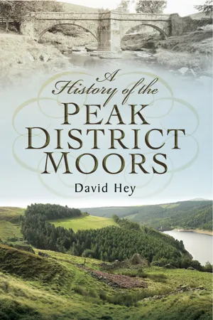
A History of the Peak District Moors
About this book
Trusted by 375,005 students
Access to over 1.5 million titles for a fair monthly price.
Study more efficiently using our study tools.
Information
Chapter 1
Introduction: The Longshaw Estate
The meaning of ‘moor’
When we speak of moors we may have two very different types of landscape in mind. Most of us immediately think of the barren uplands of the Pennines and the North York Moors, or perhaps of the similar rugged terrain of Bodmin Moor, Dartmoor and Exmoor in the south-west. But for others the word is associated with low-lying, wet districts such as the Old Moor at Wombwell (now a RSPB sanctuary) or the peat moors near Hatfield and Thorne to the east of Doncaster.
In the sixteenth century, John Leland, King Henry VIII’s topographer, described the Isle of Axholme, just across the border from Thorne in Lincolnshire, as ‘fenny, morische, and full of carrs’. The Anglo-Saxons, who came from lowland countries beyond the North Sea, seem to have applied their word mor particularly to areas such as these. Oliver Rackham tells us that mor occurs 174 times in Anglo-Saxon charters and that the context ‘always demands the fen or bog sense’, as indeed do many place-names containing mor from that time. Yet the Anglo-Saxons also used mor to translate the Latin mons, meaning ‘mountain’, and moor in the upland sense also appeared in their place-names. Perhaps two separate words came to have the same form, or perhaps the sense of boggy, barren land was applied to the hills once the Anglo-Saxons got that far inland. But if so, the meaning of the word must have changed over the centuries for it was eventually used to include dry heath and grass. It is now applied generally to any uncultivated parts of the Pennines and other highland areas.
Upland moors form a very distinctive British landscape; about 80 per cent of the world’s heather moorland is found in the British Isles. But the Peak District moors once looked very different from what they do now. It is hard for us to imagine that in early prehistoric times they were quite well-wooded. Today’s moors are not just the remnants of a ‘natural’ landscape, formed by the underlying geology, soils and vegetation, as many people suppose, for they have been influenced by thousands of years of human activity. It is often the case, for instance, that a large patch of grassland, devoid of heather, is the result not of natural forces but of the long-term digging of peat for domestic fires in the nearby farms and cottages or as fuel for local industries. And though we tend to speak of ‘the moors’ as if they are all the same, each one has its own individual character and a name that is usually taken from the nearest settlement, as with Abney Moor and Eyam Moor or Langsett Moors and Midhope Moors. Collectively, they owe much of their present appearance to their widespread use for grouse-shooting after they had been enclosed within drystone walls in the late eighteenth and early nineteenth centuries.
Longshaw over the centuries
The National Trust’s estate at Longshaw, just over 7 miles south-west of the centre of Sheffield, provides some of the most accessible moorland and woodland for ramblers to enjoy. It lies just inside Derbyshire and adjoins the city boundary for a couple of miles at about 1,000 feet above sea level. Young and old people alike find plenty of interest within the estate’s 5-mile circumference or as the start of a longer walk up on to the surrounding ridges. Many a child who came for a paddle in Burbage Brook and an ice-cream afterwards learned to love moorland scenery at an early age. A visit here is a perfect introduction to the Dark Peak, as we now call the gritstone moorlands. This distinguishes them from the limestone plateau and deep gorges of the White Peak. Longshaw illustrates every aspect of the long and changing history of this distinctive scenery, from the first prehistoric settlers to the present day.
The contribution of prehistoric people to the creation of the view looking north from the Visitors’ Centre at Longshaw Lodge is not immediately apparent, yet finds of scattered flints show that hunter-gatherers were here in the Mesolithic era, the technical name for the Middle Stone Age. Our eyes are first attracted to the natural rocky profile of Higger Tor, the ‘higher tor’ on the skyline. ‘Tor’ is a term that most people associate with Devon, but it has been used in Derbyshire too since at least the Middle Ages and probably much earlier. Mam Tor, the ‘breast-shaped hill’ towering above the western end of Hope Valley, is the one that everyone knows, but many other examples can be found. Our view from Longshaw takes in Owler Tor below the Surprise View car park and Over Owler Tor near Mother Cap stone on the skyline beyond. Owler is a dialect word for an alder tree, which is found in local place-names such as Owler Bar and Owlerton. Just below Higger Tor another prominent escarpment has the intriguing name of Carl Wark, ‘the work of the karls or churls’, Viking and Anglo-Saxon words for the better-off peasants. The name must have arisen in the Middle Ages to suggest something that was created long ago. From Longshaw Lodge we see it as a natural rocky plateau with steep sides, but the approach from Higger Tor is much easier and so on the northern side a forbidding, massive wall of sturdy boulders was erected by herculean labour. The wall looks almost modern but is probably 2,000–3,000 years old. Just beyond it, on the western side, an entrance that was fashioned from the rocks can still be used to gain access to the summit.
Carl Wark has traditionally been interpreted as an Iron Age hill fort, but the truth of the matter is that we do not really know what its purpose was. Certainly in the Middle Ages local people regarded it as an old fort, for they named the stream below it the Burbage Brook, ‘the stream near the fortification’. The brook had acquired this name by the early thirteenth century when it was recorded in a Latin document as Aque de Burbache, ‘Burbage water’. But though the massive wall looks defensive, the summit is strewn with boulders and no signs of dwellings or any other prehistoric features have been detected there. It looks a singularly unattractive place to have lived. Perhaps, then, it was not a fort but a communal gathering place at certain times of the year, similar in purpose to that on Gardom’s Edge, which was once thought to have a Neolithic or New Stone Age origin but has now been placed in the late Bronze Age. At the moment we simply do not know the purpose of Carl Wark, but the consensus is that it dates from somewhere in the first millennium BC, when the Bronze Age merged into the Iron Age.
The quarry faces at Bole Hill and Millstone Edge and the cast-offs that litter the ground below the escarpment still bear the shot holes and channels by which stones were removed by blasts of gunpowder. Travelling cranes, powered by steam, raised the newly cut stones into trucks, which were then moved by rail to the top of a steep incline that descended to the railway at Grindleford. This incline was worked by cables connected to a self-winding drum, the weight of each full truck on the descent pulling an empty truck back up.
The incline is now overgrown but can still be followed, with difficulty, down into the valley. The former quarry is eerily silent and colonised by birch trees. Its rock faces now pose a series of interesting challenges to young climbers.
Roads
Motorists who drive through the Longshaw Estate follow the lines of eighteenth- and nineteenth-century turnpike roads, some of which were improvements of much more ancient highways. The old routes that were closed to the public after the Duke of Rutland built Longshaw Lodge are now difficult to follow. A mid-eighteenth-century packhorse bridge, which spans Burbage Brook below Carl Wark, was built to serve travellers on the Dore to Hathersage bridleway who came over Reeve’s Edge and aimed for the skyline at Winyards Nick. Two guide stoops from the same era mark other routes through the estate. Stoop is a North Country word, derived from the language of the Vikings, for a post.

Packhorse bridges date from the seventeenth or eighteenth century, when they often replaced wooden structures. Many were demolished when turnpike trusts provided wider bridges to take wheeled vehicles, but some survive across the upper reaches of moorland streams. This one crossed the Burbage Brook below Carl Wark on the bridleway from Dore to Hathersage. It has no parapets.
There is a tall one that can be seen about 100 yards to the north of the gateposts that marks the drive that leads from Longshaw Lodge towards the Grouse Inn. It is among the sturdiest of the many stoops that the Derbyshire justices of the peace ordered to be erected in 1709 to guide travellers across the moors and other lonely places.

The Derbyshire JPs first ordered the construction of guide stoops across lonely moors in 1709. This one uses phonetic spelling in the local dialect to point the way to Sheffield. Some stoops were inscribed with pointing hands, but the implicit method here is to face the inscription then turn to the right.
Because of changes to the landscape when conifers were planted in the nineteenth century, it is now hard to believe that this stoop once stood at an important crossroads. But the inscriptions on its four sides point the ways to the nearest market towns. The destinations are indicated in phonetic spellings that reflect the broad speech of the times: ‘To Tidswel, To Chasterfild, To Shafild 1709’, and best of all, ‘To Hatharsich And So To Chapil in Lee Frith’. Perhaps Chapel-en-le-Frith was added when the masons realised that Hathersage was not a market town.
We can work out the directions that were taken from the stoop. Tideswell was reached via Grindleford Bridge, the Sir William Hill, and the ridgeway to Great Hucklow. Chesterfield was approached via the Wooden Pole and a route across the Big Moor. Travellers heading for Sheffield crossed Houndkirk Moor, and those going in the opposite direction to Hathersage, perhaps used the millstone road to the Surprise View.
The other guide stoop in Longshaw Park is not in its original position. It now stands just inside the entrance gate on the approach to the lodge from the road leading from Fox House to Grindleford. It was recovered by National Trust staff in the late 1960s and placed there because its exact former site was not known. But it was aligned incorrectly, for the old practice was to face the inscription and then turn to the right. Many other old stoops have pointing fingers that confirm this custom. This small stoop is one of several that were erected in 1737, when the Derbyshire JPs decided that the original provision in 1709 was insufficient to meet the needs of travellers through the Peak District. On one side it is inscribed ‘Hope Rode 1737’, on its other faces ‘Sheiffeild Rode, Dronfield Rode, Tidswal Rode’, so it marked the same route system as the earlier stoop at the other side of the lodge. As a market had been established in Hope in 1715, the long inscription to Hathersage and Chapel-en-le-Frith on the 1709 stoop was no longer needed.
By the mid-eighteenth century the movement to upgrade the major highways into turnpike roads where tolls were paid by travellers was well underway. The first one across Longshaw was the Sheffield to Tideswell and Buxton turnpike road of 1758, which came over Houndkirk Moor from Ringinglow. The character of an old moorland highway before modern road surfaces were introduced is well-preserved here, for in 1812 this route was largely replaced by the present road from Sheffield via Hunter’s Bar, Banner Cross and Whirlow to Fox House. A milestone near Thieves Bridge is inscribed ‘Tideswell 10, Buxton 17’ on one side and ‘Sheffield 6’ on the other. The road reached Longshaw by descending to Fox House, which was named after its owner, a Mr Fox of Callow Bank. This inn was completely rebuilt by the Duke of Rutland about 1830 in the same mock-Jacobean style as his new lodge.
The continuation of the turnpike road through Longshaw Meadow was blocked off and the present complicated system of road turnings was created, so that the route down to Grindleford was set further back from the ducal view from his lodge. The former route through the meadow is indicated by another turnpike milestone that is shaped in the same style as the one on Houndkirk Moor and which marks 8 miles from Sheffield on one side and 8 miles from Tideswell and 15 miles from Buxton on the other.
Beyond Granby Wood, the original line of the turnpike road can be picked up again as it descends towards the junction with the present road at Yarncliff Cottage. This old route is now a pleasant grassy track, but it is supported firmly by a strong embankment on the north-western side. It must have been a steep climb for horse-drawn coaches coming the other way up the hill from Grindleford.
Meanwhile, in 1781 another old route out of Sheffield and north-east Derbyshire had been turnpiked. This came via Greenhill, Bradway, Holmesfield and Owler Bar. Near the Wooden Pole one branch turned left down the hill to Calver and Stoney Middleton, while the other continued to Fox House, Toad’s Mouth and along the present route to Hathersage. The original descent from near the Wooden Pole to Fox House followed what is now a grassy track below the pole down to Longshaw Lodge, but by Victorian times this had become a private drive that took the guests at the lodge on to the moors. Near Toad’s Mouth rock, a cast-iron turnpike milestone is inscribed ‘Hathersage 2, Castleton 8, Chapel-en-le-Frith 14’ on one side and ‘Sheffield 8’ on the other. The cutting at Millstone Edge, which produces the Surprise View, was made in 1826.
The enclosure of the commons and wastes
In the opening decades of the nineteenth century the moors around Longshaw were divided into private ownership and common rights, such as the grazing of livestock and the digging of peat for fuel, were extinguished. Throughout England and Wales upland commons and wastes were enclosed by numerous private Acts of Parliament. These Acts dealt with individual parishes or their sub-divisions, the townships, and if the owners of about seventy-five to eighty per cent of the land (in terms of rateable value) agreed to enclose they were able to impose their will on the other owners.
Commissioners and surveyors were employed to divide the commons into ‘allotments’ in lieu of the common rights that had been attached to each farm. The largest landowners, therefore, got the biggest shares and the lord of the manor was compensated further for his loss of other rights. In the huge parishes that straddled the Pennines, lords opted to receive large stretches of the ‘wastes’, tracts of little value that could be converted into grouse moors. For example, when the 2,650 acres of Holmesfield township were enclosed between 1816 and 1820, the Duke of Rutland was awarded 1,998 acres of the least productive land. By such means, and by purchases, the duke gradually acquired a huge grouse moor that also included former commons and wastes within the parishes and townships of Barlow, Baslow, Brampton, Hathersage, Dore ...
Table of contents
- Front Cover
- Title Page
- Copyright Page
- Contents
- Preface
- Chapter 1 Introduction: The Longshaw Estate
- Chapter 2 The Early History of the Moors
- Chapter 3 The Middle Ages
- Chapter 4 ‘A waste and houling wilderness’ 1550–1750
- Chapter 5 Improvement and Enclosure
- Chapter 6 Grouse Moors
- Chapter 7 The Right to Roam
- Chapter 8 Conclusion: Present Times
- Bibliography
Frequently asked questions
Yes, you can cancel anytime from the Subscription tab in your account settings on the Perlego website. Your subscription will stay active until the end of your current billing period. Learn how to cancel your subscription
No, books cannot be downloaded as external files, such as PDFs, for use outside of Perlego. However, you can download books within the Perlego app for offline reading on mobile or tablet. Learn how to download books offline
Perlego offers two plans: Essential and Complete
- Essential is ideal for learners and professionals who enjoy exploring a wide range of subjects. Access the Essential Library with 800,000+ trusted titles and best-sellers across business, personal growth, and the humanities. Includes unlimited reading time and Standard Read Aloud voice.
- Complete: Perfect for advanced learners and researchers needing full, unrestricted access. Unlock 1.5M+ books across hundreds of subjects, including academic and specialized titles. The Complete Plan also includes advanced features like Premium Read Aloud and Research Assistant.
We are an online textbook subscription service, where you can get access to an entire online library for less than the price of a single book per month. With over 1.5 million books across 990+ topics, we’ve got you covered! Learn about our mission
Look out for the read-aloud symbol on your next book to see if you can listen to it. The read-aloud tool reads text aloud for you, highlighting the text as it is being read. You can pause it, speed it up and slow it down. Learn more about Read Aloud
Yes! You can use the Perlego app on both iOS and Android devices to read anytime, anywhere — even offline. Perfect for commutes or when you’re on the go.
Please note we cannot support devices running on iOS 13 and Android 7 or earlier. Learn more about using the app
Please note we cannot support devices running on iOS 13 and Android 7 or earlier. Learn more about using the app
Yes, you can access A History of the Peak District Moors by David Hey in PDF and/or ePUB format, as well as other popular books in History & British History. We have over 1.5 million books available in our catalogue for you to explore.