"Simply breathtaking. It doesn't simply offer alternatives to the history of Pointe du Hoc, it blows them away . . . for fans of anything WWII [or] D-Day."—
War History Online
The Rangers mission was clear. They were to lead the assault on Omaha Beach and breakout inland. Simultaneously other Ranger units would scale the cliffs at Pointe du Hoc to destroy the "huge" gun battery there and thus protect the invasion fleet from being targeted. But was the Pointe du Hoc mission actually necessary? Why did the Allies plan and execute an attack on a gun battery which they knew in advance contained no field guns? And more importantly, why did they ignore the position at Maisy that did?
Using personal interviews with the surviving Rangers who fought on the beach and at Pointe du Hoc, Gary Sterne has made a painstaking study of what the Allies actually knew in advance of D-day and about the Maisy Battery. Maps, orders and assault plans have been found in the UK, German and US archives, many of which were not released from the Top Secrecy Act for 60+ years. Radio communications have been found from the Rangers as they advanced inland towards Maisy and intelligence evaluations made by the RAF of bombing missions directed at the site have now been released. All these combine to make this one of the most up-to-date references on the subject.
"A gritty first hand-yard by yard account of what combat was like . . . will forever change the way you think about the battle for Omaha Beach and the importance of Pointe du Hoc."—The Armourer
- 316 pages
- English
- ePUB (mobile friendly)
- Available on iOS & Android
eBook - ePub
About this book
Trusted by 375,005 students
Access to over 1.5 million titles for a fair monthly price.
Study more efficiently using our study tools.
Information
Chapter 1
Uncovering Maisy
The story you are about to read is one that certainly contains mystery, but it also features examples of mis-direction and bravery of the highest order. The information included in this book was known only to a few Second World War American veterans and a handful of people from the villages of Grandcamp and Maisy, who are now in old age. Even people who lived nearby and many of the US soldiers that fought in the vicinity were unaware of what existed there.
The reason for this is simple. It was buried. The site was buried physically under 1m to 3m of soil. A whole area of battlefield which in total covers approximately 144 acres was wiped off the face of the earth and buried before the end of the war, ensuring that the site drifted into obscurity – until 2004. For sixty years it simply vanished.
Fast forward to January 2004. It was a cold winter’s day and the end of a fruitless search for me. I was driving around in drizzle looking for somewhere to build a Second World War museum. My brother and I had been looking at old maps for days – the general idea was to find a building that would provide both historical Second World War interest in itself and be an interesting backdrop for the proposed museum. I was looking for somewhere to house my collection of US and German militaria and artifacts related to D-Day and it was proving to be a far more difficult proposition than I had originally thought.
That was until I recalled that I had bought a US Army veteran’s uniform some years earlier and that it had come in a box with a map and other personal items. I found the map, which was in itself not of particular interest, except for an area marked on the coast near Grandcamp-Maisy. This was about a mile from the sea and marked in red pencil with the words ‘area of high resistance’. Knowing the area quite well, my brother and I went down the lane called Route des Perruques the following day. On arrival, I could see nothing other than three old and frankly fairly uninteresting looking gun casements facing Utah Beach. Certainly not the place to consider putting up a museum, I thought.
We turned the car around and headed back up the lane. But some 500yd later I slowed down to look at the map again. The area marked on the map was to my right in fields, not behind and to my left where we had just come from. I double-checked the field edges and decided that I was indeed looking at the correct place, but I could see absolutely nothing.
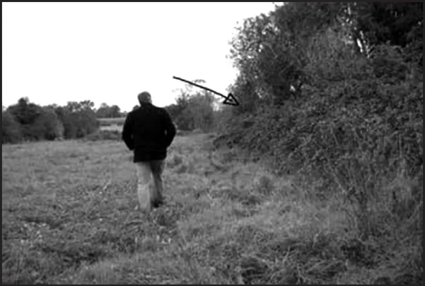
We stopped the car and debated the merits of getting out on such a miserable day. The wind was blowing sideways and the rain was starting to pick up. But something inside my head told me to get out of the car, so I did. There was a row of small 2ft-high posts every 10yd and a single-strand rusty barbed wire fence running along the roadside. I stepped over the wire and I walked into a series of overgrown fields, literally untouched and unploughed – just empty, unkempt fields. The vegetation had become so dense over the years that the area had become a wilderness, forming almost a forest of weeds and scrub. In some areas there were brambles with inch-thick stems, while bushes and trees were impenetrable, but there was nothing visible to indicate that anything had been there during the Second World War.
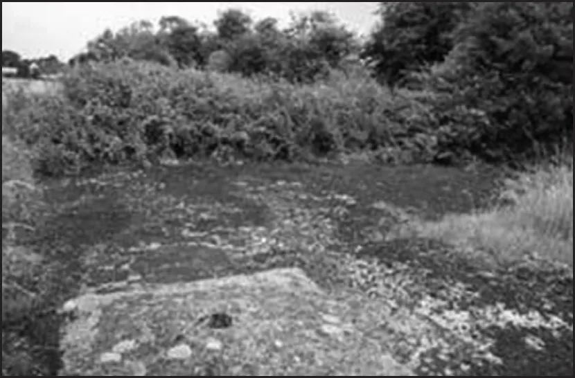
The bunker roof as it was first discovered. The chimney is in the foreground and the surrounding weeds were covering it from view. Over the years the soil had been washed away to reveal the roof top.
This photograph gives you an idea how well covered and overgrown the site was. This particular building was a radio room on D-Day, but at the time of its discovery it was invisible beneath the weeds.
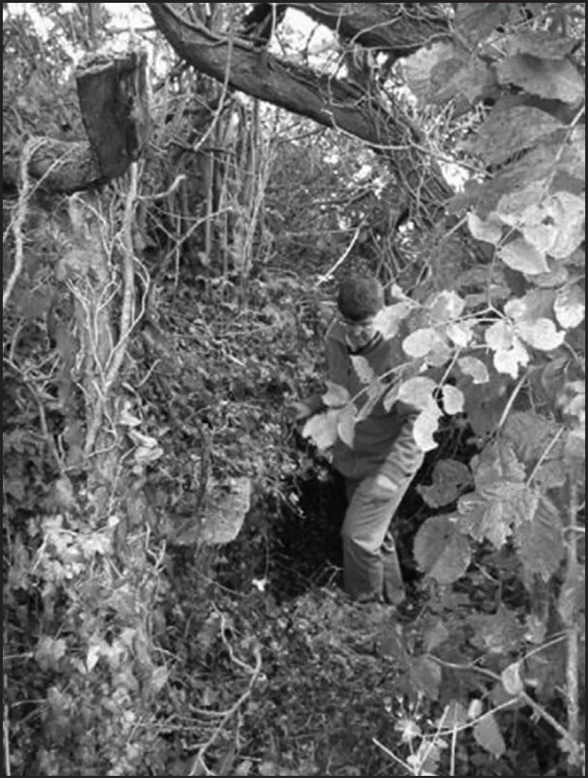
We searched and searched for an entrance to the building and eventually found the top of a tunnel some 20yd away. Only about 12in of it was visible, but it was most definitely the top of a tunnel. At first it looked just like a wide rabbit hole that had given way over time due to the rain, but it had a ramp of soil going inside into the gloom and it was shouting out to be entered.
We went back home and returned more suitably dressed and armed with torches. If the building was still there underground, then logically it would have an entrance somewhere. We found the small mound on the surface where water had flowed in. Using the torches, we entered what turned out to be a concrete and brick entrance and slid down into the darkness. It opened out as the soil decreased and led us into a German ammunition store. The whole building that had been virtually invisible from the surface consisted of two big storage areas on our left for large-calibre ammunition and another smaller room to the right, which would have been used for fuses. There was a 2m-thick concrete, bomb-proof roof and the floor was littered with ammunition and debris – just as it had been left when it was filled in. It was clearly part of a textbook German artillery position designed to be hidden from the Allies as they attacked the coast.
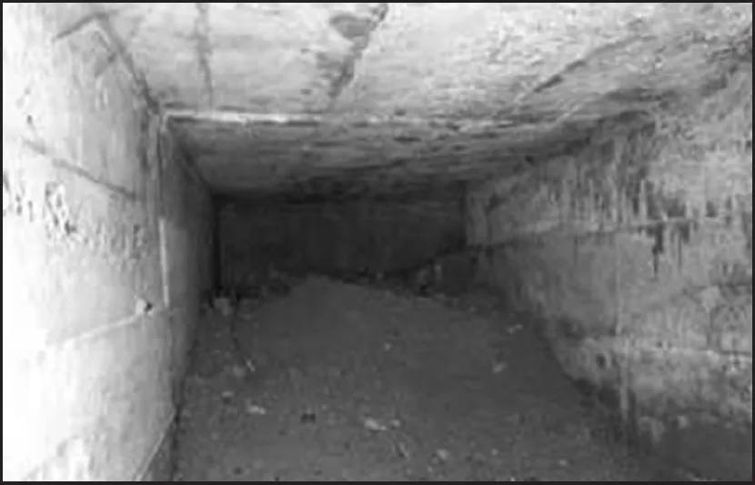
Many tunnels were only just visible where the soil had settled down over the years. The filling of this building was not done randomly. Soil could simply not get into tunnels and around corners by being bulldozed over the top. People had been engaged in literally filling them all the way up with soil to block them. It was not just a case of putting soil over entrances. The tunnel seen here, for example, turns a corner, is approx 6ft high and it is filled throughout. This is not something you could do easily unless you shovelled soil inside manually, but who would go to the trouble of doing that after the war? No farmer would bother to go to these lengths to bury dozens of bunkers when a simple piece of wood would have helped fill the entrance before it was buried. Maisy was well and truly buried – but not by any farmer.
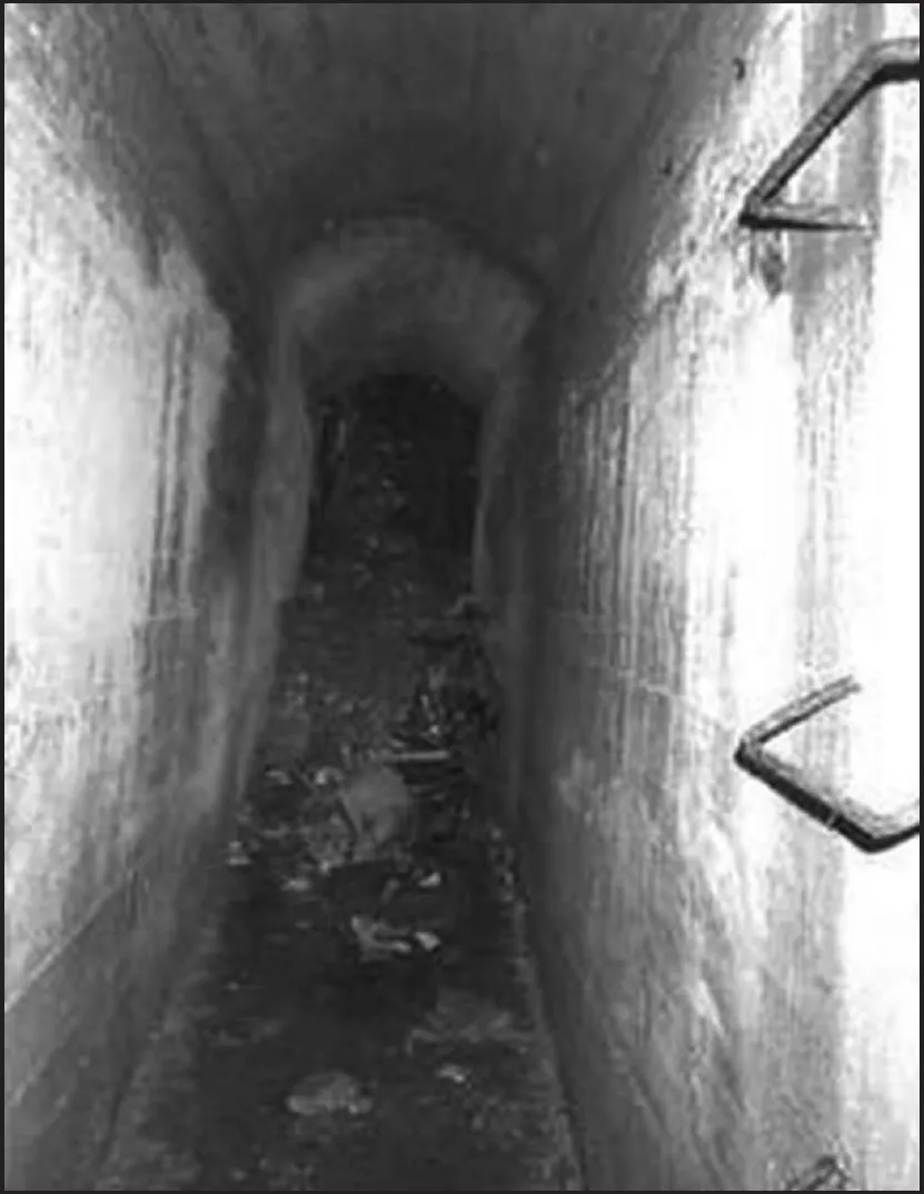
This tunnel still had pieces of wartime debris on the floor and at one end it was buried with tons of soil which had poured inside.
One area of the fields … long grass and heavily weeded areas. Nothing was visible and in this particular picture I am standing on what was a trench in 1944, now completely buried.

One of the old Maisy land plans from the 1900s. You can see that this area was owned by so many people.
The search began to find out what the site could have been. The Internet revealed only two websites with mentions of there being a gun battery at Maisy La Martiniere, and in one large-volume work on the Atlantic Wall it was referred too as having ‘played no part in D-Day’. These books did not suggest there was a significant site on this land, so perhaps I had bought a dummy site – I honestly did not know. I could find no other recorded information about the site and there was nothing written about it in any of the major academic works on the subject, so I started to investigate myself.
I wrote to some members of the 2nd Rangers who were still alive via their association and to most who had fought at Pointe du Hoc. I logically assumed they would have come on towards the Maisy area after the Pointe du Hoc battle. Surely they would have information and know if anything existed on the site. I received replies from a number of Ranger veterans, with most of these telling me that the site that was attacked in the area was called Pointe du Hoc and that the battle was well researched. Many sent me details of their D-Day experiences, but nothing related to what I had found.
I then began to wonder what academics thought about Maisy. While I was in the process of buying the last couple of pieces of land I began corresponding via email with a professor at Texas University, whom I met some months later at Pointe du Hoc. It transpired that every year a group of students from Texas University visited Pointe du Hoc and that they were w...
Table of contents
- Front Cover
- Title Page
- Copyright Page
- Contents
- Preface
- Chapter 1 Uncovering Maisy
- Chapter 2 The US Rangers on D-Day
- Chapter 3 Rangers Lead the Way
- Chapter 4 The Close of D-Day
- Chapter 5 The Assault on Pointe du Hoc
- Chapter 6 Starting from Zero
- Chapter 7 German Operations
- Chapter 8 Allied Air Force and Army Intelligence
- Chapter 9 The Rangers’ Advance on Maisy
- Chapter 10 The Battle for Maisy
- Chapter 11 Challenging a D-Day Myth
- Acknowledgements
Frequently asked questions
Yes, you can cancel anytime from the Subscription tab in your account settings on the Perlego website. Your subscription will stay active until the end of your current billing period. Learn how to cancel your subscription
No, books cannot be downloaded as external files, such as PDFs, for use outside of Perlego. However, you can download books within the Perlego app for offline reading on mobile or tablet. Learn how to download books offline
Perlego offers two plans: Essential and Complete
- Essential is ideal for learners and professionals who enjoy exploring a wide range of subjects. Access the Essential Library with 800,000+ trusted titles and best-sellers across business, personal growth, and the humanities. Includes unlimited reading time and Standard Read Aloud voice.
- Complete: Perfect for advanced learners and researchers needing full, unrestricted access. Unlock 1.5M+ books across hundreds of subjects, including academic and specialized titles. The Complete Plan also includes advanced features like Premium Read Aloud and Research Assistant.
We are an online textbook subscription service, where you can get access to an entire online library for less than the price of a single book per month. With over 1.5 million books across 990+ topics, we’ve got you covered! Learn about our mission
Look out for the read-aloud symbol on your next book to see if you can listen to it. The read-aloud tool reads text aloud for you, highlighting the text as it is being read. You can pause it, speed it up and slow it down. Learn more about Read Aloud
Yes! You can use the Perlego app on both iOS and Android devices to read anytime, anywhere — even offline. Perfect for commutes or when you’re on the go.
Please note we cannot support devices running on iOS 13 and Android 7 or earlier. Learn more about using the app
Please note we cannot support devices running on iOS 13 and Android 7 or earlier. Learn more about using the app
Yes, you can access The Cover Up at Omaha Beach by Gary Sterne in PDF and/or ePUB format, as well as other popular books in History & Military & Maritime History. We have over 1.5 million books available in our catalogue for you to explore.