eBook - ePub
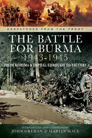
The Battle for Burma, 1943–1945
From Kohima & Imphal Through to Victory
- 208 pages
- English
- ePUB (mobile friendly)
- Available on iOS & Android
eBook - ePub
About this book
Despatches in this volume include that on operations in Burma and North-East India between November 1943 and June 1944, by General Sir George J. Giffard; the despatch on operations in Assam and Burma between June 1944 June and November 1944, by General Sir George J. Giffard, Commander-in-Chief; the despatch on Naval operations in the Ramree Island area (Burma) in January and February 1945 by Vice-Admiral Sir Arthur J. Power, Commander-in-Chief, East Indies Station; and the despatch on operations in Burma between November 1944 and August 1945 by Lieutenant-General Sir Oliver Leese.This unique collection of original documents will prove to be an invaluable resource for historians, students and all those interested in what was one of the most significant periods in British military history.
Information
1
GENERAL SIR GEORGE J. GIFFARD’S DESPATCH ON OPERATIONS IN BURMA AND NORTH-EAST INDIA, 16 NOVEMBER 1943 TO 22 JUNE 1944
MONDAY, 19 MARCH, 1951
The following Despatch was submitted to the Secretary of State for War on the 19th June, 1945, by GENERAL SIR GEORGE J. GIFFARD, G.C.B., D.S.O., A.D.C., Commander-in-Chief, 11 Army Group, South-East Asia Command.
PART I. – INTRODUCTION.
1. This Despatch covers the operations in Burma and North-East India between the 16th November, 1943, the date on which the Supreme Allied Commander,1 South-East Asia, assumed responsibility from the India Command, and the 22nd June, 1944, the date on which our lines of communication from Manipur Road (Dimapur) to Imphal were re-opened, after the defeat of the Japanese forces at Kohima. By this date, also, the enemy had been cleared from the area north of Kamaing, Mogaung and Myitkyina by the Chinese-American forces under General Stilwell,2 and a re-adjustment of our dispositions to meet monsoon conditions had been made in Arakan. Thus a definite phase of the campaign may be said to have ended. The Despatch also gives an account of the administrative situation and certain major changes in our organization during the period.
Forces allotted and assigned to South-East Asia Command (S.E.A.C.).
2. The formation of the South-East Asia Command necessitated a reorganization of the system of command of the land forces. Until then, the Eastern Army had been under the command of the Commander-in-Chief, India,3 who was responsible for the conduct of operations in Burma and Assam. The assumption of command by the Supreme Allied Commander entailed the formation of 11 Army Group Headquarters and of Fourteenth Army Headquarters, which then assumed command of the operations which had, up to then, been directed by me as G.O.C.-in-C., Eastern Army.
I was appointed to command 11 Army Group and Lieut.-General W.J. Slim,4 was selected for command of Fourteenth Army.
The undermentioned formations, etc., previously under India Command, were allotted to South-East Asia Command:-
FOURTEENTH ARMY.
4 Corps.
Lieut.-General G.A.P. Scoones.5
17 Indian Light Division.
20 Indian Division (less 32 Brigade – joined end of November).
23 Indian Division.
15 Indian Corps.
Lieut.-General A.F.P. Christison.6
5 Indian Division (less 9 Brigade – joined in December).
7 Indian Division.
26 Indian Division (less 4 Brigade – joined in February, 1944).
81 (West African) Division (less 3 Brigade, allotted to Special Force).
CEYLON ARMY COMMAND.
Lieut-General H.E. de R. Wetherall.7
11 (East African) Division.
99 Indian Infantry Brigade.
Royal Marine Group, Mobile Naval Base Defence Organization (less one A.A. Brigade assigned to S.E.A.C. in Southern India).
INDIAN OCEAN BASES.
Addu Atoll | } | Containing |
Diego Garcia | } | small |
Cocos Islands | } | garrisons. |
In addition, the following troops in India were assigned to South-East Asia Command, being allotted later:-
Headquarters 33 Indian Corps (Lieut.-General M.G.N. Stopford).8
2 British Division.
19 Indian Division (Did not arrive until October, 1944; in the interim 25 Indian Division was substituted for it).
36 Indian Division (This consisted of two British brigades, and of divisional troops, some of which were Indian; but it was called “Indian” for deception purposes. It was renamed 36 British Division in July, 1944, and I shall refer to it as such throughout this Despatch).
3 Indian Division (Cover name of Major-General Wingate’s9 “Special Force”: consisting of six Long-Range Penetration Brigades; 14, 16 and 23 British Infantry Brigades; 77 and 111 Indian Infantry Brigades and 3 (West African) Infantry Brigade. It contained Gurkha but no Indian units. I shall refer to it hereafter as “Special Force”).
50 Indian Tank Brigade.
3 Special Service Brigade (consisting of No. 5 Commando and No. 44 Royal Marine Commando).
Details showing when these “assigned” formations were actually transferred to my command, and allotted to Fourteenth Army, will be given later in this Despatch. In November, 1943, 15 Corps, consisting of 7 Indian Division and 36 Brigade of 26 Indian Division and 81 (West African) Division (which was just moving in), was holding a line in Arakan approximately from Teknaf to Taung Bazaar facing 55 Japanese Division. The enemy Division had its Headquarters in Akyab, its 143 Regiment was on a line from Maungdaw to Buthidaung, with 112 and 213 Regiments disposed in depth behind this line, in reserve.
4 Corps, composed of 17 Indian Light Division and 20 and 23 Indian Divisions, was responsible for the defence of the Imphal and Tiddim areas of the Central front. The Light Division (48 and 63 Indian Infantry Brigades) was holding the Fort White – Tiddim area against 214 and 215 Regiments of 33 Japanese Division, which was disposed generally along the line of the Chin-dwin River as far north as Mawlaik. 23 Indian Division was in the Imphal Plain, and had under command 80 Indian Infantry Brigade of 20 Indian Division which was coming forward in relief of 23 Indian Division.
In the north of Burma (designated Northern Combat Area Command – N.C.A.C.) the American-trained and equipped Chinese 22 and 38 Divisions under the command of General Stilwell were in the general area between Ledo and Maingkwan towards which they were advancing. They were opposed by 18 Japanese Division, with 114 Regiment between Myitkyina and Sumprabum, 56 Regiment around Katha and Rail Indaw, and 55 Regiment between Wuntho and Shwebo.
In no sector was there close contact but we, and the Japanese, were patrolling to gain contact; and in Arakan we were preparing for an offensive. The Headquarters of Fourteenth Army was at Barrackpore (later at Comilla) and of 15 Japanese Army at Maymyo.
Geography and Topography.
3. Before discussing the numerous plans which were made and discarded for various reasons and describing the operations which actually took place, it is essential to appreciate the extent to which all operations for the capture of Burma are affected by peculiar topographical and climatic conditions such as exist in few other parts of the world.
4. The Indo-Burmese frontier, from where it leaves the sea in Arakan, near Maungdaw, until it joins the Sino – Thibetan frontier on the Salween River north of Myitkyina, follows a series of mountain ranges, the general axes of which run from north to south. The main features of these mountain ranges are their precipitous sides and the fast flowing rivers in the deep valleys. These mountains are at their maximum heights at the north-east end of the frontier, where they rise to heights of ten to twelve thousand feet and more. Their height gradually declines as the ranges run southwards, though in the Naga and Chin Hills there are many peaks of 9,000 feet, until they reach the lesser ranges in Arakan where the maximum heights are seldom over 2,000 feet. The main spine, however, of this range continues southwards, parallel to the coast, towards the mouth of the Irrawaddy and finally disappears just north of the town of Bassein. Throughout these ranges the hillsides are for the most part covered with jungle so dense that it is not possible to move without cutting paths. In the whole length of this mountain system there are only three roads, none of them of good quality, over which wheels can pass. These are the Ledo – Myitkyina road, the Dimapur – Imphal – Tamu road and the Taungup – Prome road, none of which has been completed to a standard which will carry heavy traffic all the year round.
5. East and south of this great mountain system lies the main river basin of the Irrawaddy with its principal tributary the Chindwin to the west and almost parallel to it until it joins the Irrawaddy at Myingyan. The Irrawaddy forms a delta which begins just north of Henzada, but the main mouth reaches the sea just south of Rangoon. The Irrawaddy is navigable by various craft, according to the time of the year, as far north as Myitkyina; and the Chindwin can be navigated up to Tamanthi. These two great rivers provide, therefore, first class lines of communication throughout the year. The valley of the Irrawaddy and other tributary valleys provide access for a system of railways which, starting at Rangoon, pass through Mandalay to Myitkyina. There are various branches such as that from Rangoon to Prome and from Sagaing to Ye-U. The road system in Burma is reasonably good, especially from Ye-U southwards. Communications, therefore, in Burma, may be said to be adequate for the maintenance and movement of large forces. It is clear, therefore, that it should always be possible for the Japanese with these communications to concentrate superior forces to meet any advance by us over the three indifferent roads over the mountains.
6. In Arakan the “chaungs” (or waterways) with which the coastal strip is intersected are almost as great an obstacle as the hills and the jungle. In dry weather they can be forded by infantry at low water, but at other times a six-foot tide makes them difficult to cross. In the rains of the South-West monsoon they are swollen by flood water which makes them greater obstacles. The banks are usually muddy and crumbling. Bridging presents considerable difficulties and special arrangements have to be made at each for the passage of tanks and mechanical transport.
7. There are other difficulties also for our forces operating southwards in Arakan. The two main rivers, the Mayu and the Kaladan, with their tributaries, converge on the main Japanese base at Akyab. By his command of the entrance to these two waterways, the enemy was able to make use of excellent water communications which were denied to us.
Climatic Conditions.
8. The climate of Burma is affected by the two monsoons, the North-East in the winter and the South-West in the summer. The influence of the former produces fine dry weather with little cloud and conditions are good for operations both on land and in the air. The South-West monsoon on the other hand, blowing as it does across the Bay of Bengal, is heavily charged with moisture which it discharges over Burma and Eastern Bengal during the months of May to October. Precipitation of rain, especially on the Arakan coast, is extremely high, reaching in places as much as 200 inches. The climate varies too, according to the altitude, the temperatures above 3,000 feet being reasonably low and above 5,000 feet cool and invigorating. In the lowlands along the coast, the temperatures are high, with a high humidity which makes campaigning in those areas exhausting.
9. Malaria is endemic throughout the country below 3,000 feet but it is worse in some areas than others; for instance, the Kabaw Valley is reputed to be one of the worst malarial valleys in the world. There are two seasonal increases in the rate of infection, one at the beginning of the monsoon in May, and the other at the end of the monsoon in October and November. Much has been done to reduce the casualties from malaria during the past two years and the ineffective rate amongst all troops has fallen very considerably. This is due to much improved personal discipline, efficient draining of bad areas on the lines of communication, training and various medical prophylactic measures which have been introduced. In such a climate there are other diseases which are products of the conditions; dysentry, the worst effects of which have been reduced by discipline and good hygiene measures, skin diseases of various types, especially during the rainy season, and scrub typhus which is endemic in various areas.
10. While the South-West monsoon has a bad effect upon the health of troops and causes them also acute discomfort from wet, its really worst effect is upon the communications in the country. The heavy rain turns Arakan, a rice growing area, into a muddy swamp quite impassable to wheeled vehicles unless the roads have proper foundations and surfaces capable of withstanding heavy rain. In Assam and Burma there is very little stone, most of the hills, which are clothed in forest or bamboo, being composed of a soft shale quite useless fo...
Table of contents
- Cover
- Title Page
- Copyright
- Contents
- Introduction
- Abbreviations
- Chapter 1: General Sir George J. Giffard’s Despatch on Operations in Burma and North-East India, 16 November 1943 to 22 June 1944
- Chapter 2: General Sir George J. Giffard’s Despatch on Operations in Assam and Burma, 23 June to 12 November 1944
- Chapter 3: Vice-Admiral Sir Arthur J. Power’s Despatch on Naval Operations in Ramree Island area, 19 January to 22 February 1945
- Chapter 4: Lieutenant-General Sir Oliver Leese’s Despatch on Operations in Burma, 12 November 1944 to 15 August 1945
Trusted by 375,005 students
Access to over 1.5 million titles for a fair monthly price.
Study more efficiently using our study tools.
Frequently asked questions
Yes, you can cancel anytime from the Subscription tab in your account settings on the Perlego website. Your subscription will stay active until the end of your current billing period. Learn how to cancel your subscription
No, books cannot be downloaded as external files, such as PDFs, for use outside of Perlego. However, you can download books within the Perlego app for offline reading on mobile or tablet. Learn how to download books offline
Perlego offers two plans: Essential and Complete
- Essential is ideal for learners and professionals who enjoy exploring a wide range of subjects. Access the Essential Library with 800,000+ trusted titles and best-sellers across business, personal growth, and the humanities. Includes unlimited reading time and Standard Read Aloud voice.
- Complete: Perfect for advanced learners and researchers needing full, unrestricted access. Unlock 1.5M+ books across hundreds of subjects, including academic and specialized titles. The Complete Plan also includes advanced features like Premium Read Aloud and Research Assistant.
We are an online textbook subscription service, where you can get access to an entire online library for less than the price of a single book per month. With over 1.5 million books across 990+ topics, we’ve got you covered! Learn about our mission
Look out for the read-aloud symbol on your next book to see if you can listen to it. The read-aloud tool reads text aloud for you, highlighting the text as it is being read. You can pause it, speed it up and slow it down. Learn more about Read Aloud
Yes! You can use the Perlego app on both iOS and Android devices to read anytime, anywhere — even offline. Perfect for commutes or when you’re on the go.
Please note we cannot support devices running on iOS 13 and Android 7 or earlier. Learn more about using the app
Please note we cannot support devices running on iOS 13 and Android 7 or earlier. Learn more about using the app
Yes, you can access The Battle for Burma, 1943–1945 by John Grehan,Martin Mace in PDF and/or ePUB format, as well as other popular books in History & Asian History. We have over 1.5 million books available in our catalogue for you to explore.