A deep dive into the complex history of the Queen City, Cincinnati, Ohio, from after the American Revolution to today.
So many colorful stories are lost to time. The last passenger pigeon on earth, Martha, died in the Cincinnati Zoo in 1914. Just outside the city, a young Annie Oakley beat her future husband in a shooting contest. The deadliest maritime disaster in American history was the explosion of the steamboat Sultana, built in the Queen City. The nation's first train robbery occurred in the Cincinnati area, and some clever victims hid jewelry in their hair and bodices.
From the Black Brigade's role in protecting the city against Confederate siege to the original 1937 Cincinnati Bengals, author Jeff Suess reveals the triumphs and tribulations of the first major American city founded after the American Revolution.
- 160 pages
- English
- ePUB (mobile friendly)
- Available on iOS & Android
eBook - ePub
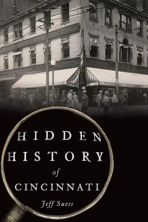
Hidden History of Cincinnati
About this book
Information
PART I
EARLY DAYS

Cincinnati in 1802 was a small town on the western frontier. The placement of Fort Washington (at rear right) helped establish Cincinnati as the dominant settlement in the West. Courtesy of the Cincinnati Enquirer archives.
1
THE SERPENT MOUND
The history of a region typically begins at the recorded events. In the case of Cincinnati, that’s what was chronicled by European settlers starting in the eighteenth century. Earlier events are relegated to study by archaeologists, anthropologists and geologists. But, really, it is all history. The study of what transpired before the first white men trekked to the area, and even those early days of settlement, lead to new discoveries that help us solve the mysteries of the past.
In geological terms, the Cincinnati topography was formed over eons by the invasions of three glaciers. Two million years ago, in the Pleistocene epoch known as the ice age, the land where Cincinnati sits was flat, with a meandering north-flowing river that geologists call the Teays River. The Kansan glacier advanced from the north 1.2 million years ago, stopping at northern Kentucky before retreating. The ice sheet created a great lake that, over hundreds of thousands of years, eroded a deep valley about one hundred feet lower than the Ohio River today. Two more glaciers, the Illinoian (400,000 years ago) and the Wisconsinan (70,000 years ago), left deposits within the deep valley, creating shelves of rock and clay that formed the region’s hills and the basin in which Cincinnati was settled. The melted ice forged the west-flowing Ohio River.
Spear points as much as 12,000 years old indicate that the earliest occupants in Hamilton County were Paleo-Indians. But three later native cultures were the predominant settlers in the area. The Adena people lived in southern Ohio from 800 BC to AD 100, during the Early Woodland period. They were noted for burying their dead in mounds left as territory markers. The Hopewell, also mound builders, followed from 100 BC to AD 400. They had an interest in geometry and astronomy, evident in their earthworks. The Fort Ancient culture occupied the area from AD 1000 to 1650.
Indian mounds are concrete evidence of the ancient peoples who would have roamed the same grounds that Cincinnati lies on today. There were several Adena burial mounds in what is now Hamilton County, from Sayler Park to Indian Hill, though most have been obscured or erased by development. Elliptical burial mounds were identified throughout the Cincinnati basin, from Fifth Street to Liberty, by early Cincinnatians Daniel Drake, William Henry Harrison and Robert Clarke. But there was no real attempt to preserve the mounds as the city grew on top of them. Drake described the largest mound in the center of the city in 1815:
It is a very broad ellipsis; one diameter extending 800 feet east from Race-street; and the other about 660 feet south from Fifth-street.…On the east side it had an opening nearly 90 feet in width. It is composed of loam, and exhibits, upon being excavated, quite a homogenous appearance. Its height is scarcely three feet, upon a base of more than thirty. There is no ditch on either side. Within the wall, the surface of the ground is somewhat uneven or waving; but nothing is found that indicates manual labor.1
The most prominent and intriguing prehistoric earthwork in the region is the Serpent Mound, located about seventy miles east of Cincinnati in neighboring Adams County. No one knows who built the effigy mound, perhaps the world’s largest, or when. Archaeologists studying the site have theorized based on available evidence, but even the authorities are not in agreement.
Early archaeologists Ephraim Squier and Edwin H. Davis of Chillicothe, Ohio, first documented the Serpent Mound in 1848 in their landmark book Ancient Monuments of the Mississippi Valley, the first publication by the Smithsonian Institute. Until then, the earthwork located on a bluff overlooking Brush Creek had been known by only the local rural inhabitants. Squier and Davis’s map and description identified the raised dirt mound as a serpent, an undulating line with a coil at one end and a triangular “head” at the other, along with a second oval shape.

The enigmatic Serpent Mound has intrigued archeologists and anthropologists trying to uncover the mysteries of the region. Courtesy of Ohio History Connection.
The Serpent Mound was not immediately protected. A tornado in 1859 wiped out the trees on the mound, and the landowner, John J. Lovett, cultivated the site for a few years, letting his livestock graze there. Frederic Ward Putnam of the Peabody Museum of Archaeology and Ethnology at Harvard University first visited and photographed the Serpent Mound in 1883. Concerned about vandals and erosion, he raised funds for the museum to purchase the land in 1887 and preserve the site. Putnam conducted thorough investigations of the effigy mound, then carefully restored it by repacking dirt that had washed down from the embankments. In 1900, Harvard deeded the Serpent Mound to the Ohio State Archaeological & Historical Society, now known as Ohio History Connection, which continues to own the site.
The Serpent Mound measures about 1,370 feet in length, including the oval and a triangular feature on the other side of the oval, and ranges from 1 to 4 feet in height. The geoglyph unmistakably depicts a serpent, possibly a connection to the Great Horned Serpent of Native American mythology, but there is little agreement about what the oval represents. It has been suggested as an egg or sun being swallowed by the serpent, or perhaps the serpent’s eye.

Professor Frederic W. Putnam created the sketch map of the Serpent Mound in 1890. From The Century Magazine.
Early archaeologists thought the Serpent Mound was constructed by the Adena culture, as Adena burial mounds were found near the location. Investigators in the 1990s used radiocarbon dating on samples taken from the serpent’s body to date construction around AD 1070, making the builders the Fort Ancient people, who built monumental animal effigies.2 This was the prevailing opinion, at least until archaeologist William F. Romain led a project in 2010 that tested radiocarbon dates of several core samples within the mound. The project findings released in 2014 suggest that the effigy was constructed much earlier, about 321 BC, by the Adena people.3 A possible explanation for the discrepancy with earlier radiocarbon findings could be that the Fort Ancient people refurbished the site, and the sample could have been from the soil that Putnam used to restore the mound. Regardless, there is no consensus among archaeologists.
The meaning of the effigy is also unclear. Squire and Davis saw a serpent devouring an egg, while archaeologist John P. MacLean, in 1884, interpreted the triangular section as a frog in the act of leaping away and depositing an egg down the serpent’s throat.4 In 1886, William Henry Holmes of the Smithsonian saw the effects of a semicircle around the western end of the oval, thus completing the eye of the serpent.5 Romain once suggested that the effigy could be of a serpent devouring the sun, as in a solar eclipse, with the serpent representing the underworld and the sun, the upper world, as found in many Native American mythologies. With that interpretation, the Serpent Mound symbolizes “the eternal conflict between the opposite forces of light and dark, good and evil, life and death.”6
The Serpent Mound is a site that inspires people to ponder the wonders of our past and drives archaeologists to keep searching for answers, just as Putnam did in 1883 when he wrote:
Reclining on one of the huge folds of this gigantic serpent, as the last rays of the sun, glancing from the distant hilltops, cast their long shadows over the valley, I mused on the probabilities of the past; and there seemed to come to me a picture as of a distant time, of a people with strange customs, and with it came the demand for an interpretation of this mystery. The unknown must become known!7
For now, the secrets remain hidden.
2
WESTERN FRONTIER
During the time of the American Revolutionary War, the Ohio River Valley and Kentucky were America’s western frontier. White settlers had started trickling into Kentucky around 1769. Among the first to cross the Cumberland Gap from Tennessee was the frontiersman Daniel Boone. North of the Ohio River was Indian territory occupied by Shawnee and Miami tribes, who crossed the river into the Kentucky lands during the winter to hunt buffalo. The Point, where the Licking River meets the Ohio River at present-day Covington, Kentucky, was a natural gateway between the territories. Hostility from the native peoples against intrusion into their hunting grounds kept white settlers scarce. When fighting in Massachusetts ignited the revolution on April 19, 1775, there were fewer than three hundred whites in Kentucky and none north of the Ohio River.
On March 14, 1775, land speculator Richard Henderson from North Carolina signed the Treaty of Watauga with representatives of Cherokee tribes. The pact granted Henderson’s Transylvania Company the deed to seventeen million acres between the Kentucky, Cumberland, and Ohio Rivers, the majority of what would become Kentucky. Henderson, intending to establish a fourteenth colony, enlisted Boone to blaze a trail, the Wilderness Road, through the Cumberland Gap for prospective settlers. A few forts scattered throughout the territory were the first settlements. Boone was given charge of Fort Boonesborough along the Kentucky River, southeast of Lexington.
The Transylvania Purchase, though, was in violation of the Proclamation of 1763, in which the British government forbade any colonial settlement of lands west of the Appalachian Mountains. The proclamation was notoriously difficult to enforce and angered both settlers and Indian tribes. Eventually, the Transylvania Company’s claims on the land were nullified. As far as the British were concerned, the land belonged to the Crown, anyway. The British claims to the land traced to the second charter of the Virginia colony in 1609. In addition to establishing the boundaries surrounding the first settlements, the charter granted an unfettered western boundary that extended “from sea to sea, west and northwest”8 all the way to the Pacific Ocean—a bold claim, considering that much of that land had yet to be explored.
While the mighty British army chased George Washington all over the East Coast, the Kentucky settlers were more worried about Indian raiding parties recruited by the British. Fighting in Kentucky was “frontier warfare”—raids and hand-to-hand combat instead of pitched battles.9 The threat to the white settlers was so great that, in 1776, two men were sent to petition the Virginia government for supplies to defend their forts.
George Rogers Clark, one of the delegates, was a twenty-three-year-old Virginian working as a deputy surveyor in Kentucky. His younger brother William would partner with Meriwether Lewis in 1804 on the Lewis and Clark Expedition. At Williamsburg, Clark asked the assembly for aid, but it treated the settlers as friends rather than fellow Virginians and offered only some gunpowder. Clark implied that they could go elsewhere for protection, possibly to the British, and told the assembly “if a country was not worth protecting it was not worth claiming.”10 The assembly relented, in effect recognizing Kentucky as part of Virginia. Clark argued that the Kentucky settlements were necessary for the protection of the Virginia frontier and successfully petitioned for the creation of Kentucky County in December 1776. In this way, Clark became one of the founders of the commonwealth.
Back in Kentucky, the legend of Daniel Boone was born. On July 14, 1776, a few days after the Declaration of Independence was approved, Shawnees abducted Boone’s daughter Jemima Boone and sisters Betsy and Fanny Callaway from their canoe outside Boonesborough. Boone led a group of settlers that caught up to the Indians at camp near the Licking River. The girls were rescued and the Indians fled. News of the rescue spread, as did Boone’s reputation, and the incident later inspired James Fenimore Cooper’s novel The Last of the Mohicans.

The reputation of Daniel Boone as a frontiersman was forged in the wilderness of Kentucky and the Northwest Territory. Courtesy of the Cincinnati Enquirer archives.
In March 1777, Clark was commissioned as a major of the new Kentucky County. Boone and the fort leaders were made captains. Simon Kenton, a man equal in accomplishment to Clark and Boone, was enlisted as a spy to sneak into Indian lands. Kenton went by the name Simon Butler at the time, believing wrongly that he was wanted for murder (the man he fought still lived). Kenton proved his worth during an Indian attack on Boonesborough on April 24, when a bullet struck Boone in the ankle. Kenton shot an Indian who had his tomahawk raised to scalp Boone and clubbed another attacker, then picked up Boone and carried him ba...
Table of contents
- Front Cover
- Half Title
- Title Page
- Copyright
- Dedication
- Contents
- Acknowledgements
- Introduction
- PART I: EARLY DAYS
- PART II: THE CIVIL WAR
- PART III: QUEEN CITY OF THE WEST
- PART IV: TWENTIETH CENTURY
- Afterword
- Notes
- Bibliography
- About the Author
Trusted by 375,005 students
Access to over 1.5 million titles for a fair monthly price.
Study more efficiently using our study tools.
Frequently asked questions
Yes, you can cancel anytime from the Subscription tab in your account settings on the Perlego website. Your subscription will stay active until the end of your current billing period. Learn how to cancel your subscription
No, books cannot be downloaded as external files, such as PDFs, for use outside of Perlego. However, you can download books within the Perlego app for offline reading on mobile or tablet. Learn how to download books offline
Perlego offers two plans: Essential and Complete
- Essential is ideal for learners and professionals who enjoy exploring a wide range of subjects. Access the Essential Library with 800,000+ trusted titles and best-sellers across business, personal growth, and the humanities. Includes unlimited reading time and Standard Read Aloud voice.
- Complete: Perfect for advanced learners and researchers needing full, unrestricted access. Unlock 1.5M+ books across hundreds of subjects, including academic and specialized titles. The Complete Plan also includes advanced features like Premium Read Aloud and Research Assistant.
We are an online textbook subscription service, where you can get access to an entire online library for less than the price of a single book per month. With over 1.5 million books across 990+ topics, we’ve got you covered! Learn about our mission
Look out for the read-aloud symbol on your next book to see if you can listen to it. The read-aloud tool reads text aloud for you, highlighting the text as it is being read. You can pause it, speed it up and slow it down. Learn more about Read Aloud
Yes! You can use the Perlego app on both iOS and Android devices to read anytime, anywhere — even offline. Perfect for commutes or when you’re on the go.
Please note we cannot support devices running on iOS 13 and Android 7 or earlier. Learn more about using the app
Please note we cannot support devices running on iOS 13 and Android 7 or earlier. Learn more about using the app
Yes, you can access Hidden History of Cincinnati by Jeff Suess in PDF and/or ePUB format, as well as other popular books in History & North American History. We have over 1.5 million books available in our catalogue for you to explore.