This story of a Scottish lighthouse keeper's years-long quest to build a road and revive a town is "an incredible testament to one man's determination" (
The Sunday Herald).
Shortlisted for the Royal Society of Literature's Ondaatje Prize
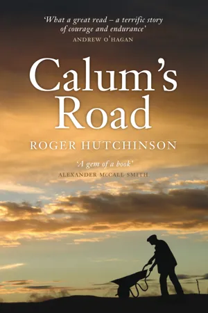
Calum MacLeod had lived on the northern point of the Scottish island of Raasay since his birth in 1911. He tended the Rona lighthouse at the very tip of his little archipelago—until semi-automation in 1967 reduced his responsibilities. With his newly idle hours, he embarked upon a project: to build a road out of the settlement of Arnish—a road that he hoped would lead new generations of people to this quiet, beautiful place.
And so, at the age of fifty-six, Calum MacLeod, the last man left in northern Raasay, set about single-handedly constructing the "impossible" road, using hand tools. It would become a romantic, quixotic venture, a kind of sculpture; an obsessive work of art so perfect in every gradient, culvert, and supporting wall that its creation occupied almost twenty years of his life. In
Calum's Road, Roger Hutchinson recounts the extraordinary story of this remarkable man's devotion to his visionary project.
"MacLeod defied powers [outside] his control in the only way he could . . . paints a compelling picture of the man." —
Sunday Times
"Wonderful." —
The Telegraph
"A gem of a book." —Alexander McCall Smith
- 224 pages
- English
- ePUB (mobile friendly)
- Available on iOS & Android
eBook - ePub
Calum's Road
About this book
Trusted by 375,005 students
Access to over 1.5 million titles for a fair monthly price.
Study more efficiently using our study tools.
Information
The Island of Strong Men
There are indeed no roads through the island, unless a few detached beaten tracks deserve that name.
James Boswell, Journal of a Tour to the Hebrides, 1773
On a spring morning in the middle of the 1960s a man in his fifties placed into his homemade wooden wheelbarrow a pick, an axe, a shovel and a lunchbox. He trundled this cargo south from his crofthouse door, down a familiar, narrow, rutted bridle path, up and down rough Hebridean hillsides, along the edge of hazardous cliff-faces, through patches of bent and stunted hazel and birch and over quaking peat bogs.
After almost two miles he stopped and turned to face homewards. Before him and to his left were steep banks of bracken, turf, birch and hazel. To his right, green pastureland rolled down to the sea. There were sheep on this pasture, and, close to the shore, a small group of waist-high stone rectangles which once, a century ago, had been the thatched cottages of a community called Castle. The vestigial masonry of a medieval keep teetered on an outstanding crag a few yards from the deserted homesteads, melding into the bedrock so naturally that, 500 years after they were first erected and 300 years since they were last occupied, it had become difficult to tell from a hundred yards away where the remnant walls of the man-made fortress finished and the natural stone began.
Then, alone in an empty landscape, he began to build a road.
He started by widening his workspace. He cleared the scattered clumps of wind-blasted native woodland which lay on either side of the old track. He chopped the dwarf trees down, and then he dug up their roots. He gathered the detritus carefully into piles at the edge of his planned route. He worked a long day. He was accustomed to working long days.
And at the end of that first long day, when he reassembled his equipment in the wheelbarrow and began his walk home, he had denuded several yards of ground. He had, in fact, accomplished slightly more than one-thousandth of a task which would take him twenty years to complete, which would pay him not a material penny and would cost him little more, but which would leave his manifesto marked in stone upon his people’s land.
His name was Calum MacLeod. He belonged to the township of South Arnish in the north of the island of Raasay.
This story is set in a very small place. On the North Atlantic rim of Europe, off the north-western seaboard of Scotland, lies a group of islands known as the Hebrides. There are several hundred Hebrides. None of them is very big, and none of them, in a global context, has ever been home to a great number of people. But almost all of these islands have at one time or another given shelter, hearth and home to somebody, somebody who could find a way of surviving and even thriving through eight months of winter and sixteen weeks of indifferent maritime weather.
The larger Hebrides are comparatively well known. They include Lewis, with its 21st-century population of 20,000 people, Mull and – for many the most resonant and celebrated of all – the rugged, sub-Alpine island of Skye.
Skye lies close to the littoral of the mainland Scottish Highlands. In several places a very strong mythological Celtic hero could have thrown a stone from Skye to Scotland, or taken a decent run-up and long-jumped over the Kyle of Lochalsh. But as the fingers of Skye grope further north and west, towards the island’s cousins in the Outer Hebrides, they move away from the hills and sheltered glens of Wester Ross and out into a troubled sea.
If Skye is thought of as somebody’s left hand, laid open, as if to be read, with fingers splayed, then the thumb and what palmists call the Mount of Venus in the south and west – which for convenience we will name the district of Sleat and Strath – lie nearest to the mainland. But our attention is drawn to the little finger straining towards the north and the chopping edge of the hand below it, facing the east.
These are the Skye districts of Trotternish and Braes, which are punctuated by the deep central harbour of market town and administrative centre, Portree. Under different geological circumstances the people of Trotternish, Portree and Braes would, in decent weather, enjoy an uninterrupted view across eleven miles of sea to the stark hills of Applecross on the western mainland.
They do not have this view because the archipelago of Raasay, Rona, Fladda and Eilean Tighe obscure it. Raasay, at twelve miles in length and two to three miles in width, is by far the largest of the four. Eilean Tighe, at about half a square mile, is the smallest. This raggedly beautiful quartet sits like a flotilla of small craft at anchor between the west coast of Scotland and the east coast of Skye.
From the looming coastlines of Skye and Applecross they can, to the uninformed eye, appear to be one land mass, so narrow and angular are the channels between them. The greatest bulk by far of this insular group is formed by the hills, grazings and meadows of central and southern Raasay. Those thirty square miles, to pursue our anatomical analogy, emerge from the sea like a muscular forearm.
But in their northern extremes the muscles wither and contract, and Raasay itself thins out into no more than a crooked finger of land, beckoning the northern sea. Upon this arthritic peninsula, around two wide bays known as Loch Arnish and Loch a’ Sguirr, stand a handful of old townships. To the west of the peninsula, accessible by foot over slippery rocks and seaweed at low tide, sits the small but relatively fertile island of Fladda. To the north of the finger, like an extra, disconnected joint, is the even smaller island of Eilean Tighe. And to the north of both Eilean Tighe and Raasay, at the other side of half a mile of treacherous sea, is Rona – Ronaidh, the island of seals – stony Rona, with its deep natural harbours, its caves and its arid dusting of soil. There are trees – stunted and bent, but still trees – on the northern finger of Raasay. There is pasture and even arable land on Fladda. There are neither worth mentioning on the four thin miles of Rona.
This group is the Hebrides in tiniest microcosm. The northernmost peninsula of Raasay and the islands of Fladda, Eilean Tighe and Rona are placid, seductive and immeasurably beautiful. Their physical attractions seem almost to influence perceptions of their weather, offering a curiously subjective microclimate to their indulgent inhabitants. When he was sixty-nine years old, and had lived for all but the first couple of those years in this Eden, Calum MacLeod of South Arnish would reflect with the practised eloquence of an ageing infatuate that ‘There is bad weather right enough. But the way Raasay is situated it’s as though it was sheltered by the island of Skye. For all the world it looks as if the island of Skye was sheltering Raasay in its arms. The high mountains of Skye, you see, they break the course of the Atlantic storms, and we don’t have them here.’
Storms or no storms, the islands of Calum MacLeod are so breathtaking that both Trotternish and Wester Ross welcome their interruption of the view. They are littered with the shards of broken hearts. And many of those hearts belong to people who have tried to live there.
Like all of the Hebrides, like all of the Scottish Highlands, these small islands are drenched in a history which has left its mark on every stone, every burn and every clump of birch. But, for obvious and practical reasons, most of the human history of Raasay and its satellites is to be found in the comparatively fertile central and southern districts of the largest island. Between prehistoric times and the nineteenth century, very few people lived in Rona, Fladda and Eilean Tighe – ‘tigh’ in Gaelic is the singular noun for a house – and only a handful of families occupied the northern Raasay townships of Torran, Arnish, Umachan and Kyle Rona.
Their circumstances have altered little through the centuries. When the educated young Skyeman Martin Martin gathered material for A Description of the Western Isles of Scotland in the 1690s he said of Rona – almost certainly from local hearsay rather than personal experience – that ‘this little isle is the most unequal rocky piece of Ground to be seen anywhere; there’s but very few Acres fit for digging; the whole is covered with long Heath’. Fladda, on the other hand, was ‘all plain arable Ground’ albeit only ‘about a Mile in Circumference’ – Fladda is almond shaped, measuring roughly a mile and a third in length and two-thirds of a mile in breadth.
Eighty years later, when the English philosopher Samuel Johnson visited as a guest of the hereditary proprietor John MacLeod in 1773, he noted that ‘Raasay is the only inhabited island’ in the group. ‘Rona and Fladda afford only pasture for cattle, of which one hundred and sixty winter in Rona, under the superintendence of a solitary herdsman.’
Johnson’s companion, the Scottish Lowland lawyer and diarist James Boswell, considered that ‘The north end of Rasay is as rocky as the south end. From it I saw the little isle of Fladda, belonging to Rasay, all fine green ground;– and Rona, which is of so rocky a soil that it appears to be a pavement.’
That our story is located in those distant and unpromising parts is thanks, chiefly, to a squalid episode in European history.
Samuel Johnson computed the 1773 population of Raasay to be between 600 and 900, which was almost certainly optimistic. Most other visitors and surveyors of the late eighteenth century suggest that 500 or 600 people lived there. He was also possibly wrong in maintaining that Rona was virtually uninhabited. An enumeration made by Church of Scotland ministers in 1764 – just nine years before the visit of Johnson and Boswell – declared that 36 people lived in Rona.
But it is certain that, other than those few ghostly and uncertain families eking out a living on the ‘pavement’ of Rona, in the last half of the eighteenth century effectively all of the archipelago’s inhabitants lived in Raasay, and most of them were settled in the centre and the south of that main island.
And it is equally certain that, within a tiny margin of possible error, fifty years later, in 1841, when a detailed official census was taken, 987 people lived in Raasay, 110 in Rona and 29 in Fladda. A dramatic population swing had started. A further fifty years after that, in 1891, when another national census was taken, the population of Raasay had fallen to 430, while the number of people living in Rona and Fladda had risen to 181 and 51 respectively, and there was a family of 8 living in the tidal outcrop of Eilean Tighe.
In the same period the populations of townships in central and southern Raasay disappeared. In 1861 there were 33 people in Holoman, on the central west coast. By 1891 there were just 5. In the same three decades the population of nearby Balachuirn fell from 49 to 26. In 1841 there were 30 people in the southern township of Eyre. Ten years later, in 1851, there were none.
In 1851, 233 people lived in North and South Fearns on the southern east coast of Raasay. Thirty years later, in 1881, nobody lived there. Leac, a mile along the east coast from Fearns, had a population of 70 in 1841, and was entirely depopulated in 1861.
Perhaps the most emblematic of all these vanishing Raasay civilisations, thanks to an eponymous epic elegy written in 1954 by the Raasay-born poet Sorley Maclean, was to be found another mile up the coast from Leac. John MacCulloch, who sailed past the townships of Upper and Lower Hallaig early in the nineteenth century, described ‘the green and cultivated land . . . on the tops of the high eastern cliffs, which are everywhere covered with farms, that form a striking contrast to the solitary brown waste of the western coast.’
In 1833 the people of Hallaig petitioned the Gaelic Schools Society in Edinburgh for some educational provision, insisting that ‘no less than 60 Scholars could be got to attend School’. In the census of 1841 the population of Upper and Lower Hallaig was enumerated to be 129 souls. Then came the eviction notices. By 1861 this busy place had been reduced to a shepherd and a labourer. By the time of the national census for 1891 the returns from Hallaig in Raasay amounted to one eloquent word: ‘Nil’.
And up the coast from the two Hallaigs lay North and South Screapadal, whose populations fell from 101 in 1841 to an official ‘Nil’ in 1861. And there were others, all of the others: Brae, Inver and Glame; Doiredomhain, two miles across the island from Screapadal, whose two families comprising 11 people in 1851 had gone by 1861; Manish, at the north-western shoulder of central Raasay, whose 41 people in 1841 had entirely disappeared within twenty years; and Castle, the community beneath the ruined medieval keep of Brochel, at the join between the strong arm of central Raasay and the crooked finger bending north to Arnish, Torran, Fladda and Rona.*
And the cause of this depopulation? Central and southern Raasay, the bulwark and the foodstore of the population of this island group since the Stone Age, was, between the middle of the nineteenth century and the beginning of the twentieth, turned into a sheep run. Perhaps 500 or 600 people, perhaps half of the population, were evicted by force from Raasay in that period, or by the relentless attrition of unnecessary poverty. Some were transported to Skye, some to Australia, some to Canada, and others to unrecorded corners of the earth.
But some – a minority, but a substantial minority – stayed in the archipelago. We have seen how many of them moved to the formerly uninhabitable islets of Fladda, Rona and Eilean Tighe. Others moved to Torran, Arnish, Umachan and Kyle Rona. That thin, bent and lonely finger of land and its offshore islands had changed, in fifty short years, from an ill-considered outpost to the last redoubt of the native people of the small islands which lay between Skye and Wester Ross.
It was not an entirely stricken province. The inhabitants had not been sent to the deserts of Judea. There were both grazing and arable land in northern Raasay, as well as in Fladda and Eilean Tighe, there was summer grazing in the heather on the hills, and the surrounding sea was teeming with fish. But it was a district which had developed naturally over the centuries a certain, small, sustainable population, and which could not easily absorb more.
The mass eviction of Highland tenants by their nineteenth-century speculating landlords, eager to use their property to farm wool or breed deer, which led to the vacuuming of the human population of southern Raasay and the overcrowding of northern Raasay, Rona, Fladda and Eilean Tighe, was not of course confined to those four islands. It took place over a period of decades across all of the north and west of Scotland, and has come to be known as the Highland Clearances.
It brought in its wake a protracted period of social unrest throughout the area, which frequently sparked into militant action and violent clashes between land-hungry crofters, landless cottars, and those bodies of the law which were called upon by landowning interests to enforce their right to turn ancestral common grazings and arable land into private sheep runs or parks in which to hunt deer.
Many a government would have chosen to sit out the storm and let the cycle of skirmish and arrest continue. William Gladstone’s Liberal administration did not. In March 1883 Gladstone’s home secretary, Sir William Harcourt, announced that he was setting up a Royal Commission ‘to inquire into the conditions of the crofters and cottars in the Highlands a...
Table of contents
- Cover
- Title Page
- Copyright
- Dedication
- Contents
- Preface
- Maps
- The Island of Strong Men
- The Book of Hours
- A Few in the North Would Not be Catered For
- No Chance of Being Run Down by a Car
- A Kind of Historical Justification
- The Last Man Out of Arnish
- Notes
- Bibliography
Frequently asked questions
Yes, you can cancel anytime from the Subscription tab in your account settings on the Perlego website. Your subscription will stay active until the end of your current billing period. Learn how to cancel your subscription
No, books cannot be downloaded as external files, such as PDFs, for use outside of Perlego. However, you can download books within the Perlego app for offline reading on mobile or tablet. Learn how to download books offline
Perlego offers two plans: Essential and Complete
- Essential is ideal for learners and professionals who enjoy exploring a wide range of subjects. Access the Essential Library with 800,000+ trusted titles and best-sellers across business, personal growth, and the humanities. Includes unlimited reading time and Standard Read Aloud voice.
- Complete: Perfect for advanced learners and researchers needing full, unrestricted access. Unlock 1.5M+ books across hundreds of subjects, including academic and specialized titles. The Complete Plan also includes advanced features like Premium Read Aloud and Research Assistant.
We are an online textbook subscription service, where you can get access to an entire online library for less than the price of a single book per month. With over 1.5 million books across 990+ topics, we’ve got you covered! Learn about our mission
Look out for the read-aloud symbol on your next book to see if you can listen to it. The read-aloud tool reads text aloud for you, highlighting the text as it is being read. You can pause it, speed it up and slow it down. Learn more about Read Aloud
Yes! You can use the Perlego app on both iOS and Android devices to read anytime, anywhere — even offline. Perfect for commutes or when you’re on the go.
Please note we cannot support devices running on iOS 13 and Android 7 or earlier. Learn more about using the app
Please note we cannot support devices running on iOS 13 and Android 7 or earlier. Learn more about using the app
Yes, you can access Calum's Road by Roger Hutchinson in PDF and/or ePUB format, as well as other popular books in History & Historical Biographies. We have over 1.5 million books available in our catalogue for you to explore.