This book details the archaeology of burnt mounds (fulachtaí fia) in Ireland, one of the most frequent and under researched prehistoric site types in the country. It presents a re-evaluation of the pyrolithic phenomenon in light of some 1000 excavated burnt mounds.Charcoal-enriched soil, along with spreads and mounds of heat-affected stone, are one of the most common types of site found in Ireland, largely as a consequence of numerous discoveries made in the course of road building. They represent an accumulation of firing material associated with a prehistoric pyrolithic technology, which involved a process of heat transfer that centred on the use of hot stones immersed in water-filled troughs or placed in small, lined/unlined pits/ovens. During the Bronze Age, the use of this technology became widely adopted in Northern Europe, particularly Ireland, where the phenomenon is represented in the field as a low crescent-shaped mound.
Even though burnt mounds are the most common prehistoric site type in Ireland, they have not received the same level of research as other prehistoric sites. This is primarily due to the paucity of artefact finds and the unspectacular nature of the archaeological remains, compounded by the absence of an appropriate research framework. This is the most comprehensive study undertaken on the use of pyrolithic technology in prehistoric Ireland, dealing with different aspects of site function, chronology, social role and cultural context.
- 341 pages
- English
- PDF
- Available on iOS & Android
eBook - PDF
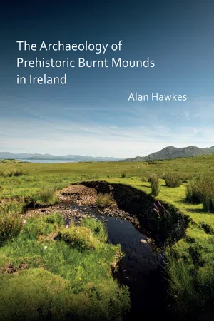
The Archaeology of Prehistoric Burnt Mounds in Ireland
About this book
Trusted by 375,005 students
Access to over 1.5 million titles for a fair monthly price.
Study more efficiently using our study tools.
Information
Table of contents
- Cover
- Title Page
- Copyright page
- Contents Page
- Preface
- Burnt mounds: an introduction
- Figure 1.1: Burnt mound at Turnaspidogy, Co. Cork (RMP CO081-044). Source: Alan Hawkes
- Figure 1.2: Distribution of recorded burnt mounds in Ireland. Source: www.archaeology.ie and www.doei.gov.uk.
- Figure 1.3: Burnt mound at Derrynafinnia, Co. Kerry (RMP KE076-085). Source: Alan Hawkes
- Figure 1.4: Excavated stone trough and hearth from Drombeg, Co. Cork. Source: Dan Breen, Cork Public Museum.
- A history of burnt mound research in Ireland
- Figure 2.1: Map compiled by Thomas Carew Hunt c. 1843 (top), along with sketch of burnt mound (bottom). source: Rockley 2008
- Figure 2.2: Plan of stone-lined hearth and ‘dug-out’ trough at Clonkerdon Co. Waterford. Source: Quinlan 1885.
- Figure 2.3: Stone-lined hearth and trough pit at Kilnaglery Co. Cork. Source: Ó Ríordáin 1937.
- Figure 2.4: Plan of sections through burnt mound at Ballygambon, Whitechurch, Co. Waterford. Source: Forsayeth 1913.
- Figure 2.5: The first cooking experiment carried out by M. J. O’Kelly at Ballyvourney, Co. Cork. Source: O’Kelly 1954. (A) Meat is wrapped in straw and placed into the trough, taking 35 minutes to bring 454 litres of water to boil. (B) It is allowed to co
- Figure 2.6: Plan of features uncovered at Ballyvourney I, Co. Cork. Source: O’Kelly 1954.
- Figure 2.7: Plan and section of features identified at mashanaglass, Co. Cork. Source: Fahy 1957.
- Figure 2.8. Excavation of burnt mound at Castleredmond, Co. Cork (Cork to Dublin gas pipeline 1982. Source: William O’Brien, UCC.
- Figure 2.9: Excavation of a burnt mound at Kilcor South, Co. Cork (Cork to Dublin gas pipeline 1982. Source: Maurice F. Hurley.
- Figure 2.10: Frequency and range of burnt mound excavations in Ireland, 1930−2010.
- Figure 2.11: Distribution of excavated burnt mounds in Ireland 1950 − 2010. Note linear trends from major road-building projec s.
- Figure 2.12: Levelled burnt mound at Ballynametagh, Co. Cork (SMR CO087-108). Source: Alan Hawkes
- Figure 2.13: Levelled burnt mound at Moneygurney, Co. Cork (SMR CO086-133). Source: Alan Hawkes
- Figure 2.14: Number of burnt mounds excavated on road and pipeline schemes per county 1950 − 2010.
- Figure 2.15: Post-abandonment history of a typical burnt mound. Drawing produced by James O’Driscoll
- Figure 2.16: Excavation in progress along the N11 road scheme at Ballyclogh North, Co. Wicklow (Source: Yvonne Whitty IAC Ltd).
- Figure 2.17: Elevated view of excavated troughs and burnt mound at Bockagh, near Ballaghaderreen, Co. Roscommon (IAC Ltd).
- Figure 2.18: burnt mound damaged by machinery at Gortnagane, Co. Kerry (SMR KE068-022012). Source: Alan Hawkes
- Figure 2.19: Early Bronze Age burnt mound damaged by machinery at Errarooey More, Co. Donegal (RMP DG025-007). Source: Alan Hawkes
- Figure 3.1: Burnt stone deposits at Les Eyzies, Dordogne, France (after Movius 1966).
- Pyrolithic technology: the international context
- Figure 3.2: Distribution of burnt mounds in Ireland and Britain (After Hedges 1974−75: 62).
- Figure 3.3: Plan of ‘heated stones’ at Buckenham Tofts Park, Norfolk (after Laynard 1922: 490).
- Figure 3.4: Burnt mound during excavation at Liddle, South Ronaldsay, Orkney (after Hedges 1975; Source RCAHMS)
- Figure 3.5: Range of burnt mounds in the Scottish Isles with internal troughs with associated stone-built structures. Source: edrawn after Hedges 1975; Moore and Wilson 1999; Hedges 1986; Toolis 2005; Moore and Wilson 2008.
- Figure 3.6: Possible sweat lodge structures at Ceann nan Clachan , North Uist (Phase 1 and 2) and Cladh hallan (bottom left). Kebister structure 1 (bottom right) is a timber-built building interpreted as a cook-house. Source: redrawn after Armit and Brab
- Figure 3.7: Plan and section of burnt mound at Cob Lane Park, Birmingham (Redrawn after Hodder 1990, 107).
- Figure 3.8: Burnt mound during excavation (Source: Thames Valley Archaeological Services UK).
- Figure 3.9: Pit with plank and withy lining at Swales Fen, Suffolk (Redrawn from Martin 1988:359)
- Figure 3.10: Burnt mound C2/3 and structure F3005, Cefn Cwmwd, Wales. Excavated along the A55 Road Scheme (Redrawn after Maynard 2012:127)
- Figure 3.11: Drombeg revetment structure surrounding boiling trough and hearth. Source: Alan Hawkes
- Figure 3.12: View of Garranes burnt mound during excavation. Phase II structure possibly associated with dry roasting. Source: William O’brien, UCC.
- Figure 3.13: A burnt mound (skӓrvstenshӧgar in Swedish) from the province of Ӧstergӧtland during excavation. Source: Larsson 990:51.
- Figure 3.14: Chatillion-sur-Glane (Posieux), France. Upper level of burnt stones and bone (left) and lower level with charcoal, charred timber and oxidized earth (right). Source: adapted from Ramseyer 1991:71.
- Figure 3.15: Indian women place rocks on a fire to heat them for use in the earth oven. Painting by Charles Shaw. Source. texasbeyondhistory.net.
- Figure 3.16: This figure outlines the operation of a typical earth oven. Phase 1 (above) invloves digging a pit and lighting a fire on a layer of stones until red hot. Phase 2 involves placing layer of moist vegetation and food produce into the pit and ba
- The archaeology of burnt mounds in Ireland
- Figure 4.1: Timber-lined trough inserted into clay platfrom at Errew, Co. Leitrim. Source: Dominic Delaney.
- Figure 4.2: Scatter chart representing burnt mound thickness at levelled and extant excavated sites in Ireland.
- Figure 4.3: Recorded shape of excavated burnt mound/spread deposits in Ireland.
- Figure 4.4: Shallow spread of burnt mound material excavatied along the Sallins Bypass, Co. Kildare. Source: IAC Ltd.
- Figure 4.5: Burnt mound during rescue excavation works at Meelin, Clashroe, Co. Cork. Source: Maurice F. Hurley.
- Figure 4.6: Stone revetment at Fahee South, Co. Clare. Source: Diarmuid Ó Drisceoil.
- Figure 4.7: Mound retaining wall with central trough and well at Drombeg, Co. Cork. Source: adapted from Fahy 1960.
- Figure 4.8: Overgrown burnt mounds at Rossnashunsoge, overlooking Glengarriff Harbour, Co. Cork (RMP CO090-026006). Source: Alan Hawkes.
- Figure 4.10: Water-boiling experiment using sandstone. Source: Irish National Heritage Park, Ferrycarrig, Co. Wexford.
- Figure 4.9: Recorded stone petrologies from excavated burnt mounds in Ireland.
- Figure 4.11: Timber-lined trough at Curraheen 5, Co. Cork, with in-situ burnt limestone from final boiling episode. Source: Ian Russell for ACS Ltd.
- Figure 4.12: Number of excavated burnt mounds in ireland with evidence of stone and timber stock-piles.
- Figure 4.15: Location of hearths at excavated burnt mounds in Ireland.
- Figure 4.16: Hearth types recorded from excavated burnt mounds in Ireland.
- Figure 4.17: Formal stone-built hearth and trough at Garranes in the Beara Pennisula, Co. Cork. Source: William O’Brien UCC.
- Figure 4.18: Stone-built hearth and associated trough at Killalough, Co. Cork. Source: Eamonn Cotter for Sheila Lane and Associates.
- Figure 4.19: Selection of excavated stone-built hearths from burnt mounds in Ireland. Radiocarbon dates calibrated at 2-sigma.
- Figure 4.20: Frequency of recorded trough shapes from excavated burnt mounds in Ireland.
- Figure 4.21: Recorded depths (M) of burnt mound troughs in Ireland.
- Figure 4.22: Recorded trough linings from excavated burnt mounds in Ireland.
- Figure 4.23: Oval stone-lined trough at Cashelduff IV, Co. Mayo. Source: Richard F. Gillespie, Mayo County Council.
- Figure 4.24: Stone-lined trough at Garranes in the Beara Peninsula, Co. Cork. Source: William O’Brien UCC.
- Figure 4.25: Roundwood-lined trough at Sonnagh I, Co. Mayo. Source: Richard F. Gillespie, Mayo County Council.
- Figure 4.26: Roundwood-lined trough at Bockagh, near Ballaghaderreen, Co. Roscommon. Source: IAC Ltd.
- Figure 4.27: Roundwood-lined trough with corner supports at Bofeenaun, Lough Moore, Co. Mayo. Source Conor McDermott.
- Figure 4.28: Surviving wattle-lined troughs excavated in ireland with associated dating evidence. Radiocarbon dates calibrated at 2-sigma.
- Figure 4.29: Preserved wattle-lined trough excavated by Siobhan McNamara (ACSU Ltd) at Deerpark East 1, Co. Mayo. Source: Richard F. Gillespie.
- Figure 4.30: Preserved wattle-lined trough excavated at Coolacork, Co. Wicklow. Source: Yvonne Whitty for IAC Ltd.
- Figure 4.31: Late Bronze Age plank-lined trough excavated at Cahiracon, Co. Clare. Source: Emer Dennehy.
- Figure 4.32: Rare, oval plank-lined trough excavated at Caheraphuca, near Crusheen, Co. Clare. Source: IAC Ltd.
- Figure 4.33 Logboat/Canoe reused as a water-boiling trough at Killalough, Co. Cork. Source: Eamonn Cotter for Sheila Lane and Associates.
- Figure 4.34: Dug-out trough excavated by Joanna Nolan at Treangarrow, Co Mayo. Not catalogued. Source: Richard F. Gillespie, Mayo County Councill.
- Figure 4.35: Dug-out trough excavated at Clashroe, near Meelin Co. Cork. Source: Maurice F. Hurley.
- Figure 4.36: List of excavated dug-out troughs with dating evidence in Ireland.
- Figure 4.37: Trough pit with stake-holes in each of the four corners at Mullenmadoge, Co. Mayo. Such evidence indicates that the pit was probably plank-lined with suporting corner posts. Source: Richard F. Gillespe, Mayo County Council.
- Figure 4.38: Stone and roundwood-lined trough at Currinah, Co. Roscommon. Source: Richard F. Gillespie Mayo County Council.
- Figure 4.39: Proposed trough development in Ireland.
- Figure 4.40: Selection of water-channels associated with excavated troughs in Ireland.
- Figure 4.41: Stakehole evidence of a possible wooden sluice system designed to release water from the trough at Carrigtohill, Co. Cork. Source: Rose M. Cleary UCC.
- Figure 4.42: Reconstruction of trough, drainage channel and reservoir pit at Ask, Co. Wexford. Source: Bower 2010.
- Figure 4.43: Recorded shape of pits from excavated burnt mounds in Ireland.
- Figure 4.44: Recorded depth of pits from excavated burnt mounds in Ireland.
- Figure 4.45: Selection of possible roasting pits at Kilbeg 4, Co. Westmeath (top left), Tinnock Lower, Co. Wexford (top right) and Mullenmadoge II, Co. Mayo (bottom). Source: Fintan Walsh IAC Ltd, Kevin Martin for VJK Ltd and Richard Gillespie Mayo County
- Figure 4.46: Stone-lined roasting pit at Ballyvourney, Co. Cork. Source: O’Kelly 1954.
- Figure 4.47: Plan and profile of well and related troughs at Kellymount 3, Co. Westmeath . Soource: adapted from Wierzbicki 202 (IAC Ltd).
- Figure 4.48: Post-excavation photograph of well and troughs at Kellymount 3, Co. Westmeath. Source: Wierzbicki for IAC Ltd).
- Figure 4.49: Plan and profile of well and related features at Clogh East, Co. Clare. Source: adapted from Grogan et al 2007.
- Figure 4.50: List of excavated burnt mounds with evidence of trackways in Ireland.
- Figure 4.51: Possible wooden platfroms identified from excavated burnt mounds in Ireland.
- Figure 4.52: pre-excavation of stone trough and associated stone kneeler/platform at Dromnea, Co. Cork. Source: Rose M. Cleary UCC.
- Figure 4.53: Roundwood-lined trough and possible platform (foreground) at Sonnagh 1, Co. Mayo. Source: Richard F. Gillespie, Mayo County Council.
- Figure 4.54: Possible timber platform at Coolacork, Co. Wicklow. Source: Yvonne Whitty for IAC Ltd.
- Figure 4.55: Selection of stone and timber trough kneelers/working surfaces from excavated burnt mounds in Ireland. Source: adapted from Sheehan 1990: Cleary 1986: Cross-May 2005: Grogan et al. 2007).
- Figure 4.56: Reconstructed hut and trough from excavations at Ballyvourney, Co. Cork. Source: O’Kelly 1954.
- Figure 4.57: Shape and dimensions of built structures recorded from burnt mounds between 1950−2010.
- Figure 4.58: Internal dimensions of build structures excavated from burnt mounds in Ireland.
- Figure 4.59: Type A burnt mound structures excavated from Ireland.
- Figure 4.60: Large trough, hearth and structure (Type A) at Scartbarry, Co. Cork (left) and Possible ‘sweat lodge’ (Type B) at Rathpatrick, Co. Kilkenny. Source: Ken Hanley (TII) and Trish Long (Rubicon Heritage Services Ltd).
- Figure 4.61: Type B burnt mound structures excavated from Ireland.
- Figure 4.62: Type C stake-and post-built structures excavated from burnt mounds in Ireland.
- Figure 4.63: Range of other stake-hole structures associated with troughs in Ireland.
- Figure 4.64: Stake-hole cluster in corners of trough pit at Scartbarry Co. Cork (Type D). Source: Eachtra Archaeological Projects Ltd.
- Figure 4.65: Type H structures and Type G structures excavated at Carrowtriela, Co. Mayo. Source Gillespie 2004.
- Figure 4.67: Distribution of Type 6 and 7 burnt mound sites in Ireland (Type A structures).
- Chronology
- Figure 5.1: Context and range of material culture from burnt mounds in Ireland.
- Figure 5.2: Sample material dated from burnt mounds in Ireland.
- Figure 5.3: Periodization of Irish prehistory. Source: amended from Waddell 2000.
- Figure 5.4: Range of radiocarbon dates from Burnt mounds in Ireland.
- Figure 5.5: Burnt mound dated securely to the chalcolithic period at Ballyclogh, near Ballynoe, Co. Cork.Source: adapted from Lehane 1988.
- * Numerous dates available **Dendrochronology date NC=not catalogued.
- Figure 5.6: Mesolithic and Neolithic radiocarbon dates from burnt stone deposits in Ireland (Radiocarbon dates calibrated at 95.4% confidence).
- Figure 5.7: Early Neolithic burnt mound at Clowanstown, Co. Meath. Source: Matt Mossop for ACS Ltd.
- Figure 5.8: Late Neolithic trough at Enniscoffey, Co. Westmeath. Source: Grogan et al. 2007
- Figure 5.9: Remains of Early Bronze Age trough at Bockagh, near Ballaghaderreen, Co. Roscommon. Source: IAC Ltd.
- Figure 5.10: Possible antler haft from a burnt mound at Correagh, Co. Westmeath. Source: IAC Ltd.
- Figure 5.11: Remains of stone-lined trough at Currinah, Co. Roscommon. Source: IAC Ltd.
- Figure 5.12: Late Bronze Age/Iron Age radiocarbon dates from burnt stone deposits in Ireland (Radiocarbon dates calibrated at 95.4% confidence.).
- Figure 5.13. Burnt spread dated to the Early Medieval Period at Cloonvane IV, Co. Mayo. Source: Agnes Kerrigan, Mayo County Council.
- Figure 5.14. Medieval radiocarbon dates and other dating evidence from burnt stone deposits in Ireland (Radiocarbon dates calibrated at 95.4% confidence). NC= not catalogued.
- Figure 5.15. Burnt mound at Errarooey More, Co. Donegal (RMP DG025-007). The mound is visible as a single deposit of burnt stone within a black sediment of charcoal-rich soil. Source: Alan Hawkes
- Figure 5.16. Burnt mound at Cahiracalla Beg, Co. Clare showing different phases of use through mound stratification. Source: Adapted from Bermingham et al. 2013.
- Figure 5.17. Calibration Chart indicating different use phases at Cahiracalla Beg, Co. Clare (Oxcal 4.2.3).
- Figure 5.18. Timber trough overlying earlier example at Ballyglass, Co. Sligo. Source: Dominic Delaney
- Figure 5.19. Two adjacent burnt mounds created 1,400 years apart at Ballyclogh, Co. Cork. Source: adapted from Lehane 1988.
- Figure 5.20. Burnt mound and separate trough phases at Killeens 2, Co. Cork. Source: adapted from O’Kelly 1954.
- Figure 5.21. Two trough phases at Athronan 1, Co. Meath. Source: CRDS Ltd.
- Figure 5.22. Two trough phases at Lisdornan 3, Co. Mayo. Source: adapted from Russell 2001.
- Figure 5.23. Burnt mound and separate trough phases at Gortaroe 1, (Area 3), Co. Mayo. Source: adapted from Gillespie 2001.
- Figure 5.24. Two trough phases at Moneycross Upper, Co. Wexford. First phase dating to the late Bronze Age highlighted in orange, Iron Age phase in blue (left). Surviving planks dating to Iron Age (right). Source: VJK Ltd.
- Figure 5.2. Plan of excavated features at Garranes, Co. Cork. two phases in this site are illustrated, including an early wate -boiling operation and its replacement by a dry-roasting operation within a roofed structure. Source: William O’Brien UCC.
- Figure 5.25. Partially excavated burnt mound at Cahirachon, Co. Clare, with three trough phases. Source: adapted from Grogan e al. 2007: 190.
- The use and social significance of burnt mounds
- Figure 6.1. Context of animal bone recovered from excavated burnt mounds in Ireland.
- Figure 6.2. Range of animal species identified from excavated burnt mounds in Ireland.
- Figure 6.3. Range of fragment assemblages recovered from excavated burnt stone deposits in Ireland.
- Figure 6.4. Fragmented animal bone assemblage recovered from burnt mound at Coolroe, Co. Mayo. Source: Richard Gillespie 2010.
- Figure 6.5. Red deer antler and some teeth fragments recovered from burnt mound at Fahee South, Co. Clare. Source: Alan Hawkes
- Figure 6.6. Fat residue on surface of water during boiling experiment by the author at Rathbarry, Co. Cork. Source: Alan Hawkes
- Figure 6.7. Fat residue on side planks of trough when emptied of water during experiments at Rathbarry, Co. Cork. Source: Alan Hawkes
- Figure 6.8. Features connected with cooking using pyrolithic technology in prehistoric Ireland. Type 4 and Type 6 examples are not represented here. Drawing produced by James O’Driscoll
- Figure 6.10. Timber-lined water trough at Sonnagh, Co. Mayo. Source: Richard Gillespie, Mayo County Council.
- Figure 6.9. Divided troughs at Dromnevane, Co. Kerry (KY21a) and Gortatroe, Co. Mayo (MO27). Source: Amended from Lynch 2006 and Gillespie 2001
- Figure 6.11. Cooking meat parcels in water-boiling trough. Source: Irish National Heritage Park, Ferrycarrig, Co. Wexford.
- Figure 6.12. Cooking meat parcels in water-boiling trough. Source: Alan Hawkes.
- Figure 6.13. Cooiking meat parcels using the pyrolithic water-boiling technique at Doolin, Co. Clare.
- Figure 6.14. Reconstruction of a Late Bronze Age burnt mound in Anglesey, north-west Wales. Source: John Hodgson
- Figure 6.15. Large trough, hearth and structure at Scartbarry, Co. Cork (left) and possible ‘sweatldoge’ at Rathpatrick Co. Kilkenny (right). Source: Ken Hanley (TII) and Trish Long (Rubicon Heritage Services Ltd).
- Figure 6.16. Range of trough lengths at excavated burnt mounds in Ireland
- Figure 6.17. Truncated trough with associated water channel , evidence for sluice gate and lower reservoir or emptying pit at Carrigtohill, Co. Cork. Source Rose M. Cleary, UCC.
- Figure 6.18. Transporting hot stones into reconstructed sweatlodge during filming of RTE’s Nationwide programme 2011. Source. Alan Hawkes
- Figure 6.19. Reconstructed sweatlodge or sauna (Type 6 sites) at Rathbarry, Co. Cork. Source: Alan Hawkes
- Figure 6.20. Artist impression of reconstructed sweatlodge at Scartbarry, Co. Cork. Source: Ken Hanley, Tranpostation Infrastructure Ireland.
- Figure 6.21. ‘Iron-rich’ deposit found in the centre of a trough at Coolroe, Co. Mayo. Source: Richard Gillespie, Mayo, County Council.
- Figure 6.22. Remains of cylindrical wooden container found within Mound A at Clowanstown Co. Meath. Source: Matt Mossop for ACS Ltd.
- Figure 6.23. Yew wood pipes thought to be part of a musical instrument (dated to 2137—1909 BC) found in the base of a plank-lined trough at Charlesland, Co. Wicklow. Source: Margaret Gowen & Co. Ltd
- Figure 6.24. Human bone recovered from excavated burnt mounds in Ireland.
- Figure 6.25. Remains of human skull found in the base of a spring at Inchagreenoge, Co. Limerick. Source: Grogan et al. 2007).
- Figure 6.26. crouched burial cut into burnt mound at Leshemstown, Co. Meath. Source: CRDS Ltd.
- Settlement Context
- Figure 7.1. distribution of excavated burnt mounds and Bronze Age settlements. Yellow dots represent burnt mounds, while blue dots represent settlements.
- Figure 7.2. Distribution of burnt mounds (RMPs-brown dots) in relation to excavated sites (yellow) and Bronze Age settlements (blue).
- Figure 7.3. Burnt mound clusters within 1km of Bronze Age habitation at Coolfin 1, Co. Laois and Cuusborough 4, Co. Laois.
- Figure 7.4. Recorded (brown) and excavated burnt mounds (red) located within 1km of prehistoric settlement (blue).
- Figure 7.5. Middle Bronze Age roundhouses at Ballynamona, Co. Cork (top) and burnt mound and ring-ditch located 400m to the north. Source: Eachtra Archaeological Projects.
- Figure 7.6. Bronze Age burnt mound and structures at Clonmore North, Co. Tipperary. Source: adapted from McQuade et al. 2009
- Figure 7.7. Types of artefacts from burnt mound contexts in Ireland.
- Figure 7.8. Beaker pottery sherds from Ballyclogh North, Co. Wicklow. Source: IAC Ltd.
- Figure 7.9. Thumbnail scraper and flint flake from Monanny 2, Co. Monaghan. Source: IAC Ltd.
- Figure 7.10 Possible hammerstones from Errarooey More, Co. Donegal. Source: Seán Sharpe
- Figure 7.11. Spindle whorl recovered from Holdenstown, Co. Kilkenny. Source: IAC Ltd.
- Figure 7.12. Selection of Bronze Age lithics from Coolroe, Co. Mayo. Source: Richard Gillespie, Mayo County Council..
- Figure 7.13. Hammerstone from Gortaroe 1, (Area 3), Co. Mayo. Source: Richard Gillespie, Mayo County Council.
- Figure 7.16. Early Bronze Age wattle trough with moss lining at Kilbegly, Co. Rosscommon. Source: Neil Jackman, for VJK Ltd.
- Figure 7.17. Burnt mound during excavation in low-lying area at Killarainy, near Moycullen, Co. Galway. Source: IAC Ltd.
- Figure 8.1. Spalled and fire-cracked stone recovered from Ferriter’s Cove, Co. Kerry (left) and burnt sandstone from shores o Lake Derravaragh, Co. Westmeath. Source: Woodman et al. 1999 and Little 2014.
- Figure 8.2. Cooking shellfish using hot-stones in ‘earth oven’ method. Source: Richard Michael Gramly (American Association for Amateur Archaeology.
- Figure 8.3. Early Neolithic burnt mound at Clowanstown, Co. Meath. Source: Matt Mossop for ACS Ltd.
- Figure 8.4. The development of pyrolithic technology in early prehistoric Ireland.
- Figure 8.5. Type 3 and Type 4 sites at Moneycross Upper, Co. Wexford (top) and Caheraphuca, Co. Clare (bottom). Source: VJK Ltd and IAC Ltd.
- Figure 8.6. Rectangular roundwood-lined trough at Ballyglass, Co. Sligo. Source: Dominic Delaney.
- Figure 8.7. Hot stones used by Native American Indians to boil soup in a buffalo stomach pouch. Source: Reginald and Gladys Laubin: 1957.
- Figure 9.1. Classification of terminology used in relation to prehistoric burnt mounds and their sub-types.
- Figure 9.2. Early Bronze Age wattle trough sampled for lipid analysis at Errarooey More, Co. Donegal. Source: Alan Hawkes
- Figure 9.3. Selection of heat-altered stone from trough (above) at Errarooey More, Co. Donegal. Source: Alan Hawkes
Frequently asked questions
Yes, you can cancel anytime from the Subscription tab in your account settings on the Perlego website. Your subscription will stay active until the end of your current billing period. Learn how to cancel your subscription
No, books cannot be downloaded as external files, such as PDFs, for use outside of Perlego. However, you can download books within the Perlego app for offline reading on mobile or tablet. Learn how to download books offline
Perlego offers two plans: Essential and Complete
- Essential is ideal for learners and professionals who enjoy exploring a wide range of subjects. Access the Essential Library with 800,000+ trusted titles and best-sellers across business, personal growth, and the humanities. Includes unlimited reading time and Standard Read Aloud voice.
- Complete: Perfect for advanced learners and researchers needing full, unrestricted access. Unlock 1.5M+ books across hundreds of subjects, including academic and specialized titles. The Complete Plan also includes advanced features like Premium Read Aloud and Research Assistant.
We are an online textbook subscription service, where you can get access to an entire online library for less than the price of a single book per month. With over 1.5 million books across 990+ topics, we’ve got you covered! Learn about our mission
Look out for the read-aloud symbol on your next book to see if you can listen to it. The read-aloud tool reads text aloud for you, highlighting the text as it is being read. You can pause it, speed it up and slow it down. Learn more about Read Aloud
Yes! You can use the Perlego app on both iOS and Android devices to read anytime, anywhere — even offline. Perfect for commutes or when you’re on the go.
Please note we cannot support devices running on iOS 13 and Android 7 or earlier. Learn more about using the app
Please note we cannot support devices running on iOS 13 and Android 7 or earlier. Learn more about using the app
Yes, you can access The Archaeology of Prehistoric Burnt Mounds in Ireland by Alan Hawkes in PDF and/or ePUB format, as well as other popular books in Social Sciences & Archaeology. We have over 1.5 million books available in our catalogue for you to explore.